The discussion around the United Boulevard Extension includes the discussion of “options”. There are diagrams of freeway loops ploughing through neighbourhoods, there is a Mayor suggesting we will only look at the “T” option, and I have made the option I prefer perfectly clear. I would like to use this post to clarify the options, and perhaps dispel a few myths about each.
This is government, and your tax dollars, so let’s do the prudent thing and start with the “lowest bidder” and work our way up:
Option C.
Cost: $151.3 Million (est. $65 million from the Feds, $65 Million from TransLink, $21.3 Million “funding gap”).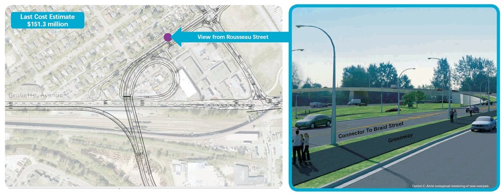
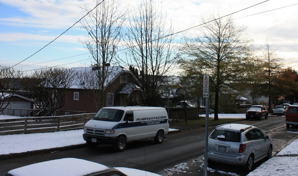
(click above to clarify, note “before” picture by me taken at same location as “after” drawing from TransLink)
This option also includes paralleling Rousseau Street with a three-lane truck route to Braid. This will involve the removal of at least 18 residential and commercial properties on the west side of Brunette, with significant “disruption” to at least a dozen more. It is a shame if your house is knocked down, but at least TransLink will have to pay you “fair market value”. For the people on the west side of Rousseau: don’t expect any compensation for your lost property values.
Option D.
Cost: $152 Million ($22 Million funding gap).
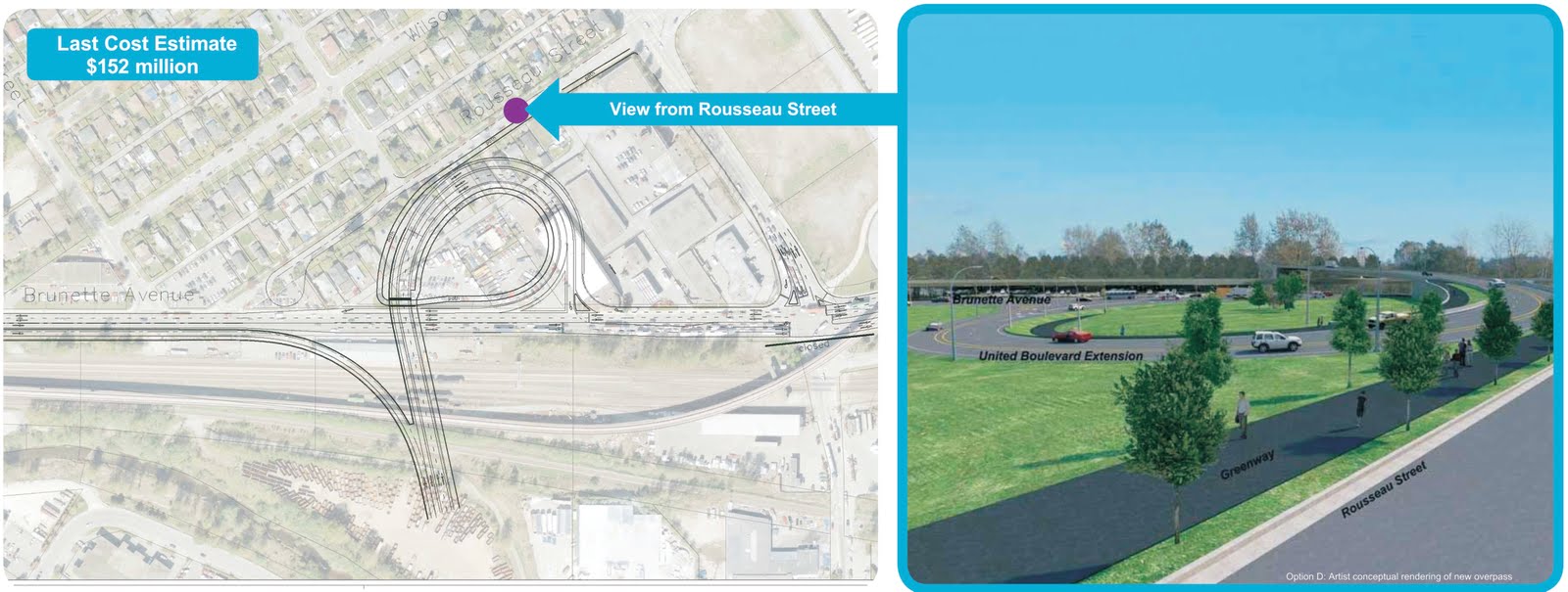
(click above to clarify, note “before” picture will be the same as Option C)
Description: a 3-lane loop, partially elevated to gain elevation over Brunette. The centre lane of the loop has about the same 45m radius as “Option C”, with the tighter downhill lanes on the inside and a single uphill lane. While reducing the impact at the northern end of Rousseau, it will still involve the removal of at least 15 residential and commercial properties on the west side of Brunette, with significant “disruption” to at least a dozen more. Not quite as bad as Option C, but clearly the $700,000 difference will not be made up in the expropriation of a few less properties.
An interesting point of this design is that it will “free up traffic” on Brunette by adding another traffic light, only 150m from the Braid intersection, to allow traffic off the loop to turn onto Brunette. If the whole idea is to end stop-and-go traffic and keep the trucks a-rollin’: this is a non-starter.
Option B
Cost: $167 Million ($37 Million funding gap).
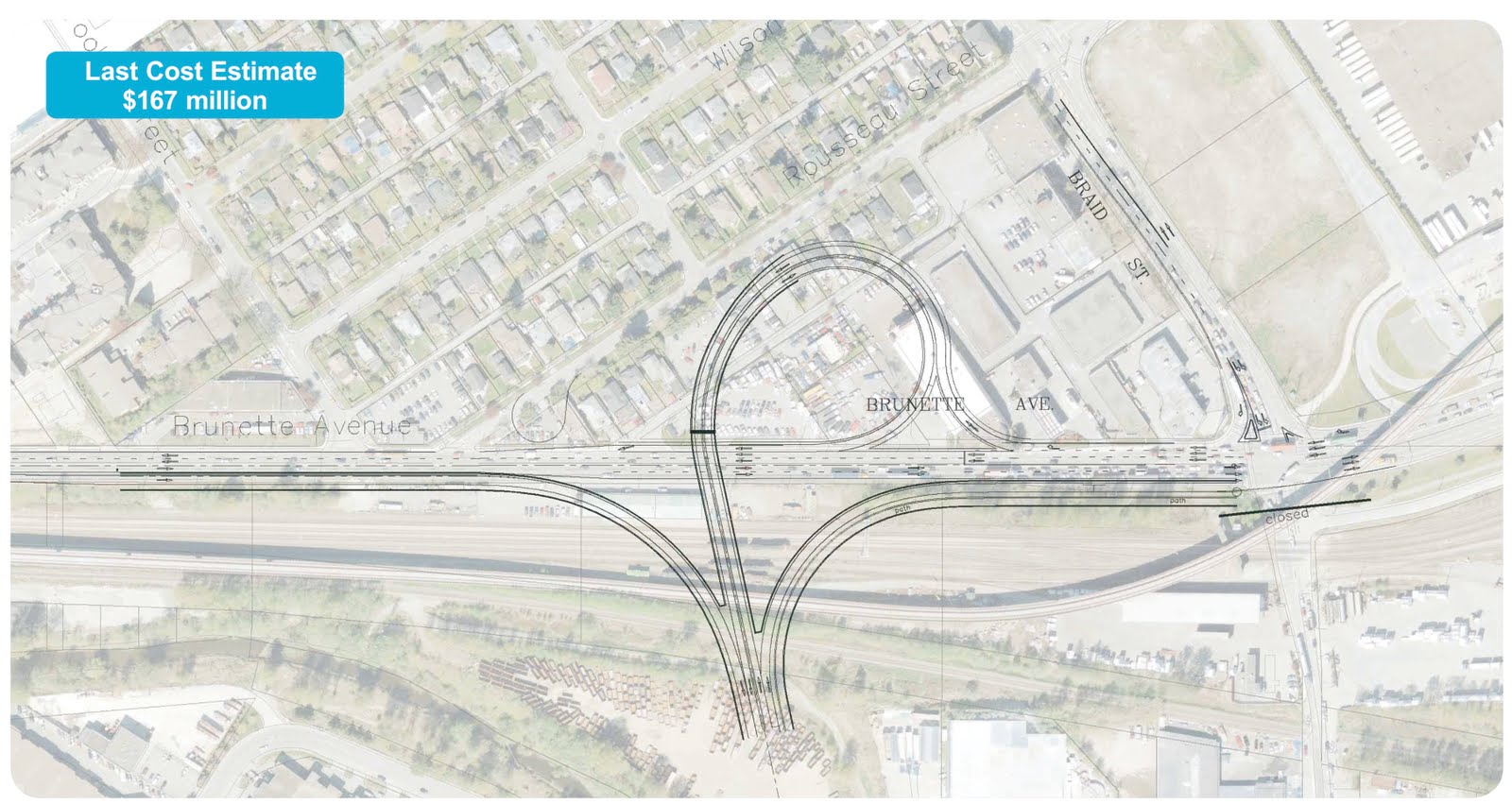
Description: This includes a 2-lane loop of similar size as the previous options, but with no less than three overpasses spanning the rails and SkyTrain. This is the one plan for which TransLink did not provide a ground-level viewscape, but it might look something like this:
It will involve the removal of about 14 properties, and significant disruption of about the same number. However, if the only goal is to “keep traffic moving” to the next bottleneck, then this is likely the best option. This plan introduces more lanes to one side of the Brunette-Braid intersection, and adds at least one potentially perilous merge zone for south-bound vehicles on Brunette, but doesn’t require new stoplights.
Notably, this is by a long shot the worst option for cyclists and pedestrians, the only one that might actually make the situation worse for them, forcing everyone in a 2-kilometre radius to manage the expanded Brunette-Braid intersection.
Option A
Cost: $175.6 Million ($45.6 Million funding gap).
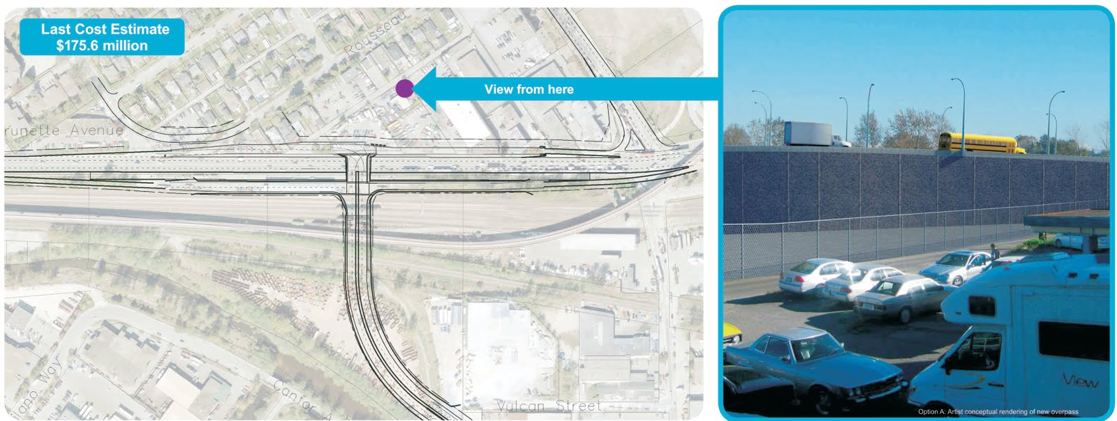
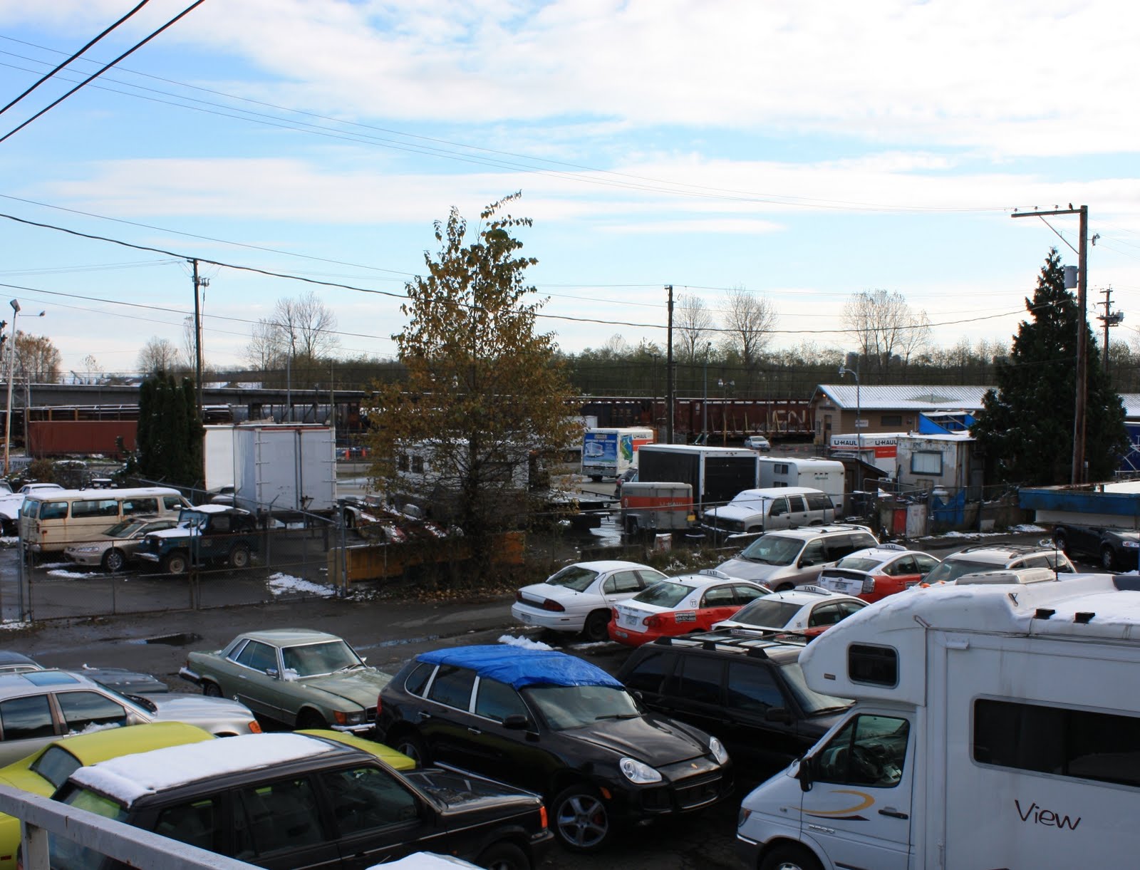
(click above to clarify, note before and after pictures)
However, the diagrams show at least 6 home or properties that will need to be removed, and significant encroachments onto another half dozen properties, including two properties further south than any other plan would disrupt. The impacts on the “preserved” properties on the south side of Rousseau from having a 20-foot high elevated intersection out their back door will be significant (but not likely compensated). The “T” option does not remove all disruptions.
You can see why neither TransLink nor Coquitlam like this option. Besides it being the most expensive option, it doesn’t solve any problems. I hate to point out the obvious (a lie, I actually love pointing out the obvious), but the top of the “T” will require a stop light, which will definitely reduce the “free flow of trucks”. The on-ramp from the north will have to start at the Braid-Brunette intersection, which means the problem of people having to dart across three poorly-defined, curved lanes on the current Brunette crossing of the rails will be made worse. Any back-up on the ramp (caused by the new stop-light on the top of the “T”) that backs up to the Braid intersection will effectively stop people from turning right onto Braid, and stop busses getting into the Braid Station loop…yikes.
This plan also has no indication of how the pedestrian and cyclist situation will be improved. There are some vaguely defined sidewalks shown on the overpass, requiring the crossing of several controlled or uncontrolled intersections: then going no-where on the top of the “T”. (a firepole maybe? None shown on the ground level perspective view…)
Analysis:
All 4 of these plans have one thing in common: none show how the Brunette River will be crossed. No matter what route you choose, there are industrial and commercial properties in the way. And it isn’t just 4 lanes of freeway, if we want these businesses to have access to this road, there will need to be offramps somewhere between the Skytrain and the Brunette River, or a stoplight-controlled intersection. They are going to take up even more space. Are we actually going to provide better truck access to industrial land by removing that industrial land?
Remember, TransLink does not pay property tax to the City, these industries and commercial businesses do. If those industries are not playing property taxes, the rest of us will have to pay more. New Westminster taxpayers paying more taxes to support poor planning choices in Coquitlam: I’m all for being a good regional partner, but how far over do we have to lean?
If we are going to take the Mayor on his word that:
Thank you for this, especially the before and after pictures. I had a lot of trouble with the Translink diagrams figuring out what was going where.
I’m stunned that Translink has managed this process so poorly and provided people with so little information.
After reading your analysis, I agree, Option 5 is the way to go.
What about all the trucks that will be sneeking up and down east 8th ave which turns into Braid St. With the addition of any new over pass or “T” on Brunett they (big trucks) will feel it`s better to cut through that strip of road way. Soon, East 8th to Braid and Mc Bride Blvd will be like the “old” 20th St, which got so bad with heavy trucks, the city had to (due to pressure from the neigborhood) had to ban those trucks. Stop this and start from one end of town to the other with a better plan other than just looking to grab some Goverment cash.