BLOC – The Bike to Work Week edition!

My place of employment had a remarkably successful Bike To Work Week – lots of people rode their bikes in, some every day, some just one day. That is the point of BTWW- for people to take a chance and see of riding a bike works for them. In the end, our organization more than tripled the number of kilometers ridden in BTWW over last year, by creating some fun inside challenges, and a significant beer-based bet between co-workers. It was fun for all, but mostly for those of us who ride in on a regular basis.

As I have written before, my ride to work is really, really good. The bike route is, for the most part, really well designed, safe, and easy to use. However, there is one ongoing issue that I keep complaining about (and I am not alone): the lack of respect for bike routes. With the vanishingly small amount of our regional transportation investment going to bike infrastructure, can we please just acknowledge that bike lanes are for bikes- the one piece of our region’s vast expanses of pavement that are not dedicated to cars and trucks?

Here is what I am talking about, in images. And yes, every single one of these photos was taken this week during my regular bike route to or from work. I wish this was not typical, but this is my daily commute, folks. Actually, this is an abridged sample of my week.

Monday:

I’m not the only one avoiding this guy.
in his defense, how could he possibly have seen the bike lane of no parking sign? 

Tuesday:

At least it is a pictogram of a bike under him, not an actual one.
Nice picture of my commuting bike, and a no stopping sign on the bike lane.

Wednesday:

This guy put a cone up, which is nice, in a way.
Note the only construction stuff blocking this bike lane is the warning sign.

Thursday:

Note both of these pics for Thursday are from the way home, as the morning ride was too rainy to photograph.
And note this guy is a jerk… 
…but not as big a jerk as this guy who honked at me (?) as I passed him.

Friday:

Yes, he was parked. Yes, a completely separated lane. 
Note no stopping sign. 

I’m not sure  what my point here is, except that I don’t think any of these people were in any kind of risk of receiving a ticket for their illegal vehicle use, while the City of Vancouver police were using BTWW to crack down on people riding bicycles on bike lanes without helmets and Bruce Allen was ranting on the radio about scofflaw bike riders and the out of control bike lane lobby. You would figure people like Bruce would love bike lanes – if only for the free parking.

A short note from the complaints department

Let’s skip the obligatory apologies for infrequent updates here; I’m busy.

On a not-unrelated note, I was on my way to the very successful RCFM fundraiser on Wednesday night when I noted that we are soon to get our sidewalk back, as the Anvil Centre nears completion.

This is great news, as the deplorable condition around the east entrance of New Westminster station and lack of connection with the rest of Columbia Street has been disruptive for a couple of years. I look forward to the opening of the Anvil, the re-activation of that important piece of real estate as a new, expanded public space. I also look forward to a return to the debate about the need for a mid-block crosswalk at the foot of 8th Street between Carnarvon and Columbia.

We have been through this debate at least twice before, once when the crosswalk was installed, and once again when it was removed a few years later. The removal was put off until the start of Anvil construction, when the sidewalk on the east side of 8th essentially ceased to exist. Now that there will be a major destination on the other side of 8th, the obvious, direct, and dry route for pedestrians connecting between Anvil and Plaza 88 will once again be up for discussion.

Much like the recent discussion about a mid-block crosswalk on Eighth Avenue by the Massey Theatre, to make safer the preferred pedestrian route between major destinations, the idea of a mid-block crossing at the foot of 8th Ave is a measure of how serious the City is about its Pedestrian Charter.

Then on Thursday night I was on my way to the NWEP meeting in Uptown, and I notice this sparkling new piece of bicycle infrastructure on Seventh Avenue, built concurrent with the redevelopment of the new drugstore at the corner with of 6th Street:

Bike lanes are important here, because Seventh is part of the Rotary Crosstown Greenway, one of the City’s primary bike routes, connecting the West End to Uptown to Glenbrook and upper Sapperton. As far as east-west travel across the upper part of the City, it is the premier bike route, as important as the Central Valley Greenway (the connections of which I was recently lamenting).

With that context, just look at this ridiculous piece of infrastructure:

A cyclist is meant to clear the signal-controlled intersection at 6th, take a sharp right turn into the dip at the curb then up onto a sidewalk, clear the pedestrians, then take another hard left before hitting the light standard to dump themselves back into traffic immediately in front of a parked car just before two (2!) driveways where the opulent 30m of bike lane abruptly stops.

Allow me to count the many ways this installation fails. The entry point creates confusion for three modes (cyclist, turning car, pedestrians), all of whom are forced to cross each other at the single crosswalk point. The cyclist is forced to share the crosswalk with pedestrians, who are unlikely to be expecting them there when they get out of the passenger side of their car, when they go to the parking meter, or when they are simply walking on the sidewalk as pictured below. The exit back onto the street is again confusing for the cyclist and the drivers who may be either passing a line of parked cars when a bike appears, or even turning right into the driveways (see picture below) when a cyclist appears “out of nowhere” from the behind the parked cars, and hops off the sidewalk. I honestly have no idea who has right of way in that collision!

For drivers pulling out of the driveways, the pole is located perfectly to block the driver’s vision, requiring them to pull a little forward, and making it more likely they will pull right in front of a cyclist who is checking his left shoulder as he is about to hop back into traffic (note this picture has no-one in the parking spots – so this is optimum visibility).

Now I can sort of see what the thinking is – it is a Greenway, we need to accommodate bikes. The developer will pay for sidewalk improvements, so let’s get it done by him. Businesses need parking, so let’s protect the 3 precious spots. With all these best intentions, the result is actually significantly worse than if they had done nothing at all. By trying to build a “bike path” where it doesn’t work, and not connecting it meaningfully to anything, they have made the situation considerably less safe for pedestrians and cyclists.

I’m not sure if I am more angry about the danger created, or the money wasted doing it!

I look at this fiasco and I wonder why? How? What was everyone thinking? Surely at some point someone – the person creating the drawing, the person approving the drawing, the person laying the concrete, the person painting the white lines – looked and said: what are we doing here? Does this make any sense at all?

We can do better. We need to do better.

RCFM FUNdraiser!

Since I wrote that last piece about the ALR, I have had a lot of chats with people in various forums on the very topic.

I have also read a bit more about the issue, including this typically-idiotic piece by Tom Fletcher where he suggests the only people against the systematic disassembly of ALR protections are the evil NDP and others who aren’t “in the real British Columbia”. I guess he didn’t talk to this guy who seems to know a bit about land development around the ALR, he being a former mayor and land developer in a place with a lot of ALR land, or this collection of people who live and work in the BC food supply chain, from the farm to the restaurant plate, or even these folks, who represent 14,000 BC Farmers. I guess none of them live “in the real British Columbia”, which by Fletcher’s opinions, I have to assume is somewhere near the Premier’s back pocket.

Many people have asked me – what can they do about it? Hopefully you have already contacted your MLA, and the Minister of Agriculture. Really, it only takes a few minutes to write an e-mail, and if you wait until election time to tell your elected officials what you think, you have failed at Democracy 101.

Here is another thing you can do to improve the Food Security in New Westminster: Come to the Royal City Farmers Market fundraiser next Wednesday!

How does that help? The RCFM gives people like Urban Digs and Glen Valley Organic Farm and the Forstbauer Family a place to market their fresh-from-the-ground actually-grown-here good-for-you food. As the good people at the Southwest BC Food System Project remind us- it isn’t just about saving the farmland, it is about assuring we have the sustainable processing, distribution and marketing systems in place to bring the local food to local tables in a way that supports local jobs and the local economy. Your local Farmers Market is part of that.

When everyone in this City is complaining about the Competition Bureau deciding that 4 grocery outlets owned by the same company is the best way to protect our town from monopolistic control of our food supply, a weekly trip to the RCFM is part of the solution – buying fresh food from people you know while enjoying the benefits of community building.

So yeah, you love the RCFM, but why go to the fundraiser? Two reasons:

First, it raises funds to keep the RCFM going. It helps pay for things like the tents, the advertising, the paperwork, the web presence, the musicians, the kids activity table, the special promotions, and it helps the RCFM employ its single staff member to herd the cats that need to be herded to make the whole travelling circus of volunteers and vendors run. It helps the RCFM do the other stuff it provides for the community, like the community table and the food coupon program and the bursary it provides for an NWSS grad. Every bit of the fundraiser money goes right back into our community, into making the RCFM the great weekly event it is!

Second, it will be the social event of the year (or at least the social event of the year that won’t require a special wardrobe). It will be at the brand new Hub Restaurant (have you seen their deck!?) with special canapé prepared by Executive Chef Michael Knowlson from food supplied by actual RCFM vendors, local craft beer and wine, a bunch of silent auction opportunities, and (this is new) a live auction for a few special items.

And yes, the rumours are true, I am going to be acting as MC, and running the live auction. So please show up, because it will be pretty weird for me to stand there auctioning things off to myself.

I personally guarantee you will laugh, you will meet new people, you will enjoy your food and drink, and you will be doing a good thing for a good cause.

Link for ticket purchase is www.rcfm2014.eventbrite.ca

The future of farming or a future without farms?

I’ve been thinking about the Agricultural Land Reserve (ALR) and the Agricultural Land Commission (ALC) a lot recently. For several reasons.

Caveat: Although dealing with ALR issues is a (very small) part of my job, nothing I write here is related to actual experiences on the job, nor do I does it relate whatsoever to the opinions of my employers.

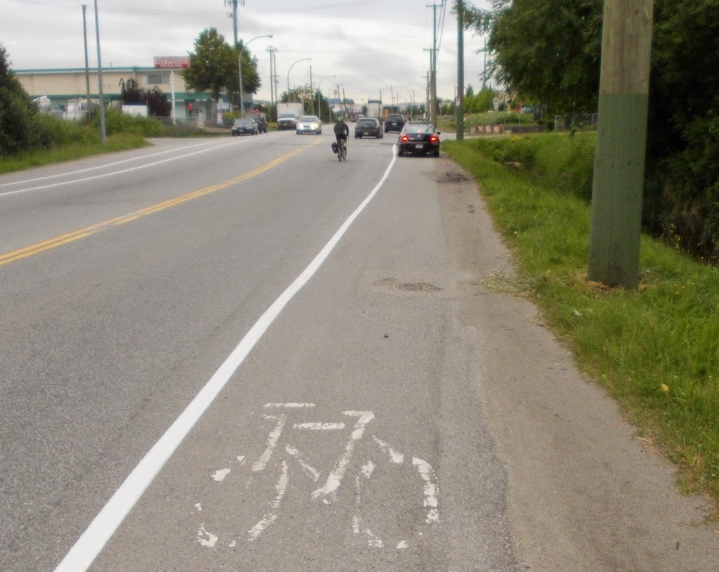
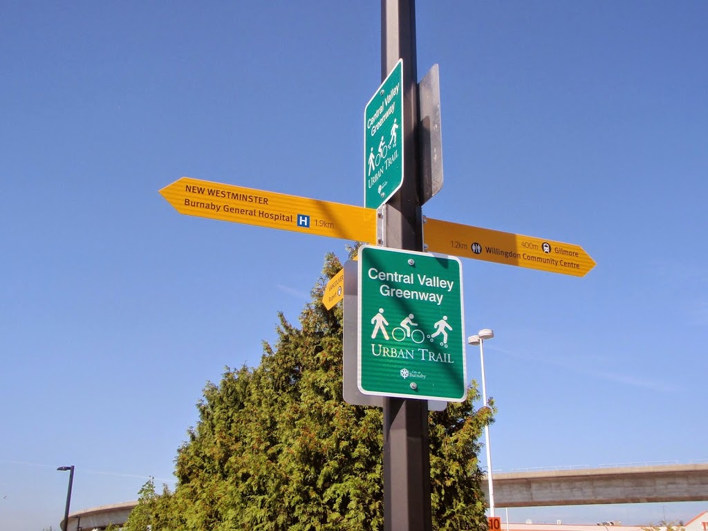
We were out on our regular every-Sunday-morning-in-a-month-without-an-“r” Fraser River Fuggitivi ride to Steveston, and a friend starting asking me about farms in Richmond. Among the topics: “wow, farmers must be rich, these huge houses!” and (in response to some signs on a farm) “is illegal dumping a really an issue?”

A second reason it has been on my mind was my recent short tour of Urban Digs Farm in Burnaby. We were there to buy some locally-grown and humanely raised pork, but got an impromptu tour and learned a lot about the realities of small farming in the Urban ALR.

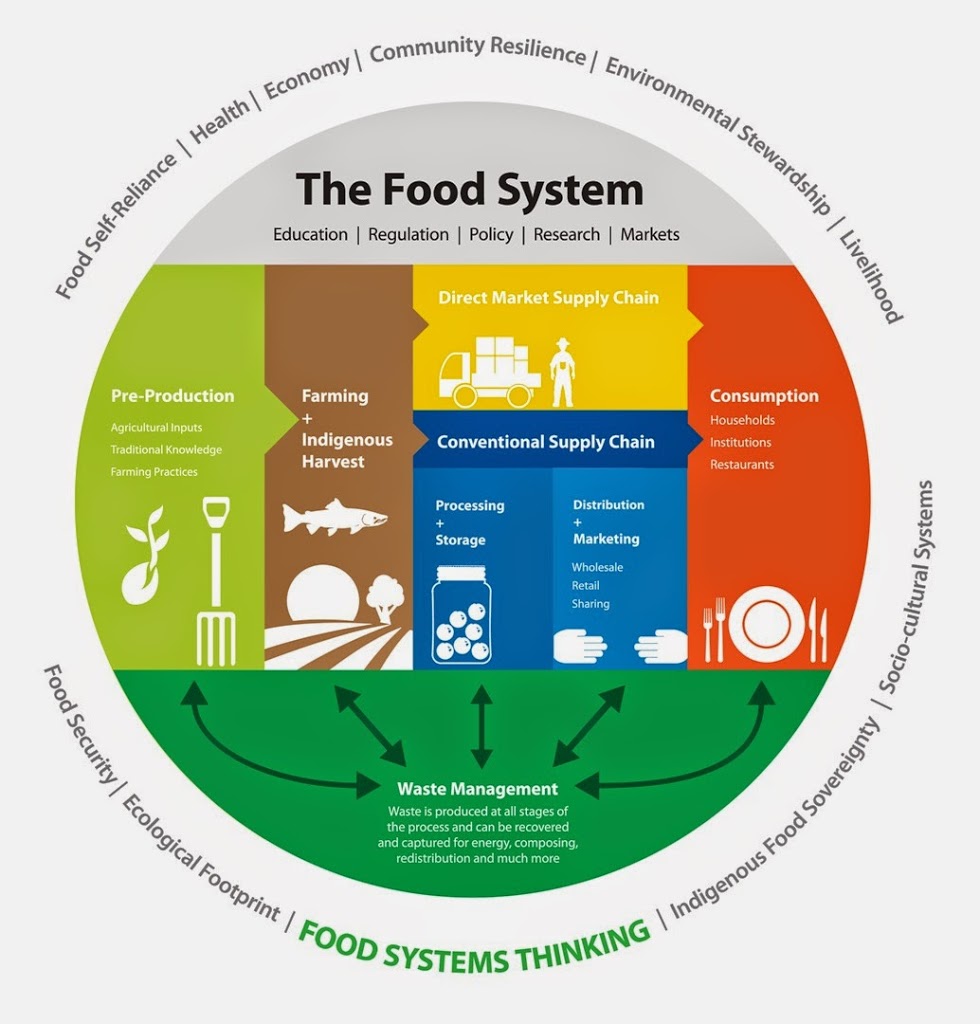
Thirdly, I recently saw a presentation by Kent Mullinix about the Southwest BC Bio-Regional Food System Design Project. This is a science-based collaborative investigation of the BC food system, with an emphasis on the sustainability of the inputs (soil, water, nutrients) and outputs (waste) of our local food supply.

All of these ideas were entering my already-addled head, because they entered in the context of the current discussion happening in Victoria about changes to the Agricultural Land Commission. The more I learn about this topic, the more concerned I am about the erosion of our ability, as a society, to feed ourselves, and the ripple effects that will have in our local and regional economy.

So let’s go back up to topic #1: The economics of farming in parts of the Lower Mainland. The reality is that some people are making money farming in the Lower Mainland, but they aren’t building mansions. Well, a few are building mansions because they are the very few large landowners and leaseholders growing cranberries or blueberries at a scale and scope that they can tie into the globalized agri-business model. Most of the mansions you see on agricultural land are not owned by the farmers of the land, but people who want to build a 20,000-sqft house, and a 10-acre piece of farmland is the most affordable way to do it. The farming that occurs on that land is not by them, but by someone else (usually the agri-business conglomerates) that lease the land, allowing the person who can afford the 20,000-sqft mansion to avoid paying too much tax.

There is also a fair amount of good farmland in the Lower Mainland that is sitting idle – not being farmed because it is owned as a long-term investment. Occasionally, someone decides the land has to be raised to grow crops (often, a dubious argument) and gets approval to bring fill onto the land from the ALC. That can be very lucrative, as it is surprisingly difficult to find somewhere to put all of the dirt you dig out of the ground when you build a high-rise tower in Burnaby or Surrey or New Westminster. Occasionally, this fill is contaminated or contains construction trash or debris. Since the ALC currently does not have an Enforcement Officer in the Lower Mainland, the chances of anyone getting in trouble for dumping this non-farm-use soil on ALR land are pretty slim. Very occasionally, unknown people dump large quantities of fill of unknown quality or origin on unoccupied farmland. See the part above about “Enforcement Officer”.

The third category of farmland use in the Lower Mainland is the small farmer trying to grow crops for local markets and maybe trying to latch onto the side of the global agri-business train. For them, the work is hard, and the economics dire.

Part one of the sketchy economics are land prices. Large tracts of ALR land in the Lower Mainland can be had for $100,000 acre, if you are buying a very large piece out in the far reaches of Langley or an unimproved piece of South Surrey. If you want to buy a smaller 5- or 10-acre ALR lot closer to urban areas, your land price can get up to $1,000,000 per acre. When the vast majority of BC Farms make less than $100,000 in annual revenue, there is simply no opportunity to support that land value.

So why is the land so valuable if it doesn’t deliver revenue? See the two examples of ALR land use above. If you want 40 acres upon which to build a 20,000-sqft mansion, $6 Million seems like a bargain, especially as you can lease 75% of the land to an agri-business and save on your taxes. Add to this the speculation that all ALR (especially the stuff near urban development) has the potential to turn into extremely valuable commercial or industrial land, if you can only convince the ALC to let it out of the ALR. The speculative value of the land is so much higher than its monetary value as farmland.

The second half of this sketchy economics discussion is the globalized agri-business industry in BC as a whole. According to Kent Mullinix, Food agriculture on BC made about $2.5 Billion in revenue last year, but the industry as a whole lost $87 Million. That is only a 3% loss on revenue – an industry can rebound from this type of temporary setback – except it is not temporary, it is systemic. The trend is downward, with no plan to recover.

The trend is going that way because the North American agriculture system is becoming less sustainable. It relies on uncertain hydrocarbon markets to fuel it, it is overtaxing the soil, in some places depleting the ground and surface water that sustains it, in other areas polluting the water running off from it. It is becoming more reliant on a few large Corporations that own all of the seeds and the pesticides that the seeds have been genetically modified to tolerate. The meat is overloaded with antibiotics that are creating a resistance problem, and grown in such concentrated conditions that the entire Fraser Valley has a “nutrient glut” – they can’t find anywhere to put all the shit they are generating. If, god forbid, there is a bumper crop, the Global Market, in all its invisible-hand wisdom, causes prices to dive and the farmer still struggles to break even. Margins are so tight that an entire industry of indentured servants temporary foreign workers had to be developed to allow the money-losing crops to get to export.

This contrasts completely with the approach the good people at Urban Digs are taking. They have leased a few acres of land in the last remnants of farm land in Burnaby, and use it to grow higher-value vegetable crops, organic free-run chickens (for eggs), ducks (for meat), and pigs. They may grow other things, but those what was on site when I visited.

I first met Julia from Urban Digs when we both presented at the same PechaKucha event at the River Market. I babbled on about rocks, but she gave a compelling talk about the farm that struck a nerve when she discussed the ethics of meat eating. She spoke of raising, nurturing, and caring for animals before you slaughter them for meat. Short of becoming an ethical vegan, this seems the least cruel way to manage our meat supply. Also, because they are not stressed, are free to roam, and have healthy balanced diets, the meat simply tastes better. Yes, this meat is a little more expensive than the foam-platter plastic-wrapped slab of flesh at Safeway… but I’ll address that issue later.

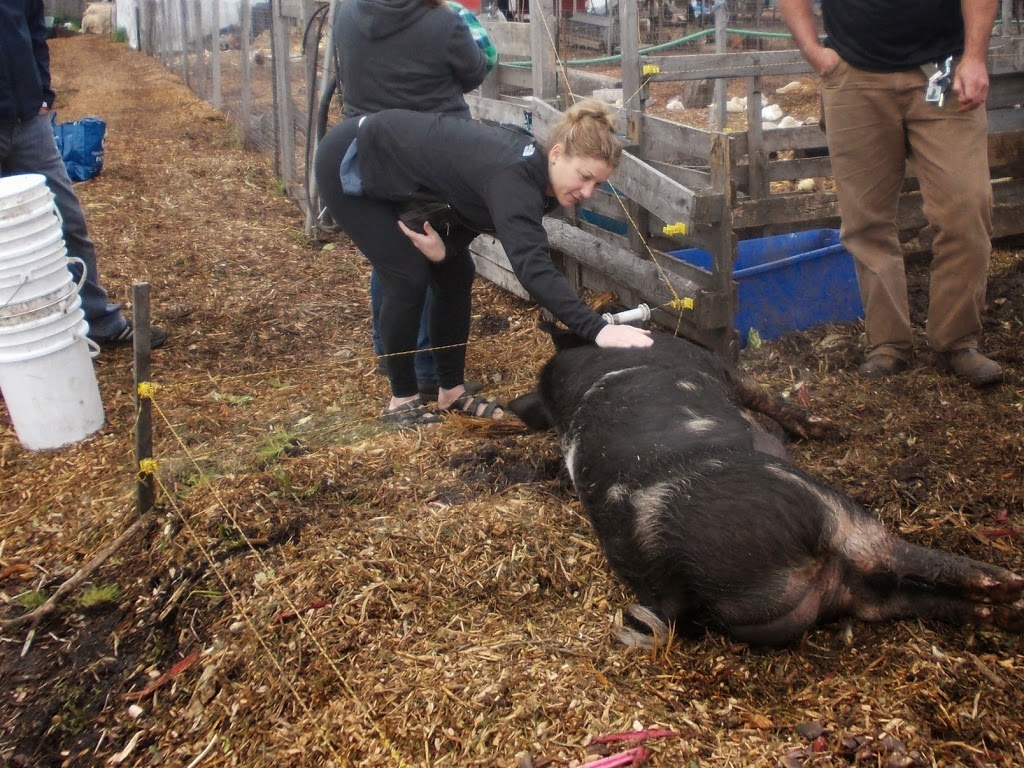
That’s MsNWimby meeting her meat at Urban Digs. 

Urban Digs are like pretty much every successful small-business owner I have met: They bust their ass every day to keep things running; They hire a local assistant when they can afford it and need arises to share in the hard work and they pay them for it; They rely on an integrated network of local supports for the bulk of their supplies; They are constantly reaching out to expand their local customer base and innovating to find new ways to serve their market. They contribute to their community, and every dollar they make is returned to the local economy. They are not getting rich, aren’t building a big house on their acreage, but they are getting by, doing good, honest work right here in our community.

This to me is the fundamental point that speaks to the real issue behind farming in BC: they can make enough revenue on a few acres of rich ALR farmland to make a (hard) living, but they can only dream of making enough to pay for the actual land they farm, hence the short-term lease.

So the big operators are scratching by, or losing money, riding the globalized agri-business  train, and the small operator is scratching by, but cannot afford to settle on a piece of land by providing better food to local people. At the same time that the majority of the food we grow, and the majority of the $2.5 Billion in annual revenue agriculture generates leaves BC, we in British Columbia spend more than $6.3 Billion on food, and watch our own farmland sit idle, or get redeveloped into tilt-up slab industrial land. Why?

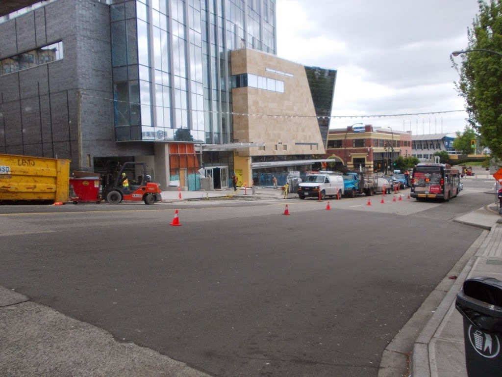
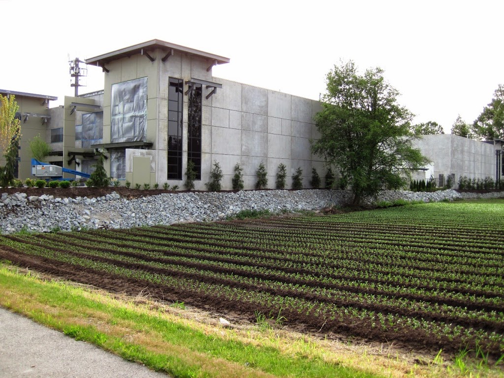
A new crop of tilt-slab light industrial buildings in Burnaby.

Because agri-business food is cheaper.

That’s it – that is the only reason anyone can give for why that slab of antibiotic-laden, nutrient-reduced, potentially-diseased, tasteless flesh wrapped in plastic at Safeway is the better way to feed ourselves. However – and this is the important point – this is a false economy.

The compromises we need to make to our food security to save that little bit of money at the check-out counter are huge, and piling up, and they don’t represent real savings, they represent offsetting costs. The reliance on increased petrochemical inputs, on overtaxed soil and contaminated water systems, on increasing livestock influenza epidemics and moving food in gigantic steel boxes across the ocean when it can be grown in our own backyard. When almost all of the money we spend on that “cheaper” food leaves the Province, and the large agri-businesses operating in BC are losing money – is this really the cheaper option? Or are we being penny wise and pound foolish.

When the California Central Valley, where most of our vegetable crops come from, is seeing its third consecutive year of critical drought; when the Ogallala Aquifer, which irrigates 1/3 of grain crops in North America, is showing signs of failure; and when the world is moving past peak phosphorous (Cripes! That’s a thing!?), there are many signs that the era of all this “cheap food” is fleeting. The system is too big, too unyielding, and relies on too many critical paths. The globalized agri-business food industry in 2012 is starting to look like a Soviet corn or cotton plan from 1960, and it is just as doomed. The economics are shifting.

If this system is breaking, what will replace it? That is what the team from the Southwest BC Bio-Regional Food System Design Project are going to try to calculate. Now this post is running very long already, so I leave it to you to go to the website and get more detail about this very interesting program (and maybe I’ll Blog more about it later). Short version: A group of researchers from Kwantlen’s Institute for Sustainable Food Systems is working with a broad group of partners including Local Governments from Hope to the Sunshine Coast and groups as diverse as the ALC, Real Estate Foundation of BC, the New Westminster Community Food Action Committee, and the Surrey Board of Trade to study the food system that nourishes our community.

Here is a quote form their website:

“The team is using a bio-regional approach to design an integrated food system that respects the boundaries and leverages the opportunities of an ecological and cultural region beyond the conventional delineations of municipal and regional boundaries. Our planning horizon is 2050. What is the potential for a revived and re-localized food system in BC; how can we respect and incorporate Indigenous harvest and hunting practices in the food system; how many jobs can we create; how much can we contribute to the regional economy; what kinds of ancillary businesses can emerge and how can this kind of food system reduce GHG emissions and address serious environmental concerns? These are some of the questions the ISFS team is trying to answer”.

This is an interesting project, in its infancy, but inside here may well be found the systems that need to be developed that will allow businesses like Urban Digs to provide food in a sustainable way to our community, and pay themselves a living wage while doing it.

Our Provincial government is also aware the ALR system is broken, but instead of fixing it, they seem intent on scattering the pieces about to prevent it’s repair. I present to you Bill 24 – Amendments to the Agricultural Land Commission Act.

The first step (and it can’t be the only one) to repair the disconnect between farm land value and its cost is to end the speculative investment in ALR land, which starts with a Government standing up and saying “This Government will not undo the ALR, and will not allow lands to be removed from the ALR”, like every other government of the last 40 years has done. Even showing the kind of commitment for the ALR that they demonstrated during the election last year would be nice. Look at their 2013 Campaign Platform, and the Agriculture section was 400 words with three strategies and 10 actions, and no mention of changes to the ALC. Actually, the platform suggests it will help with a Buy Local campaign and promote 50- and 100-mile diets, an idea that is best supported by strengthening the ALC.

This Act does quite the opposite, and opens up the door for exclusion on the whim of local politicians. The cost of farm land in the lower mainland will be going up when this bill passes, hand in hand with the pressure on local councils to open it for development.

With apologies to the most stunningly non-partisan of all Canadian scientists, this Government seems to never see a problem so bad that they can’t make worse.

Bill 24 is a potential disaster for BC food security, because it entrenches the unsustainable, failing business model that is our current globalized agri-business based food system. It not only fails to prop that business model up (as the land price equation change is going to hurt them as well!) it runs the risk of ending any hope we have of building the sustainable model that may replace it, at the very time when we are seeking to understand better what that system looks like.

Banging my head against a (heritage) wall

I’m having a hard time finding time to write blog posts these days. There is much happening on many fronts, pretty much all good stuff, so no worries.However, this story got my gander up, so I am staying up to midnight on a work night to vent, or I’ll sleep the sleep of the angry – and that’s never good.

The crosswalk situation at McBride and Columbia sucks, and it needs to be fixed. Asking staff to do “more review” at this point (as New Westminster Council did) is a dodge, and I hope to hell no-one gets hurt on that corner before something is done. The topic of this crossing even came up during last weekend’s Jane’s Walk that passed nearby, and it was happily reported that Council was finally going to address this issue on Monday. I cannot believe the ball was dropped so resoundingly. I am astonished.

To understand my disappointment, we need to step back a bit. The crosswalk at McBride and Columbia is part of the Central Valley Greenway. This is (arguably) the premier inter-regional Greenway in the Greater Vancouver region, opened with some fanfare in 2009, as a partnership between New Westminster, Burnaby, Vancouver and Translink, with significant funding provided by both the Provincial and Federal governments. It is a 24-km low-grade route that connects Downtown New Westminster to False Creek, via the Brunette River and the Grandview Cut. This route works as the new central corridor for Greenways through three Cities. It represents the single largest one-piece investment in Greenway infrastructure in the region’s history. The CVG is a Big Deal for sustainable and active transportation types. It’s not prefect, but it is well used, and a real success story.

(Image from Let’s go Biking, where there is a good description of the route).

The CVG also happens to be the lowest-grade active link between Sapperton and Downtown – a point emphasized because of the constant lament about New Westminster’s hills making it a tough town for walking and cycling. The CVG along Columbia is low-grade, easy and safe to use (for the most part), and should be celebrated more. This is probably the most important active transportation link in the City – and will be until the not-yet-built pedestrian link to Queensborough is completed, but I run the risk of serious digression there, so let’s stay on topic.

The point of this background? Of all the intersections in the City where there may be a push-pull between accommodating pedestrian/cyclist/disabled safety and managing other factors such as throughput and heritage treatments, this is one where the emphasis must be on the active transportation users. If not here, then where?

As a transportation design issue, no-one is arguing the intersection isn’t problematic. The grades are bad, the sight-lines are terrible, the traffic is thick, and includes a constant flow of large trucks that require much larger turning radii than other vehicles. To put a poorly-operating pedestrian crossing in the middle of this mess is to invite disaster. This is why we need to throw the minimum needs in the standards book out the window, and go above and beyond to make this vitally important intersection safe for all users.

First of several Google images you can click to make bigger.

Here is the problem, and fortunately, Google provides enough different views of the intersection, we can see how it has evolved in attempts over the last several years to solve the problem.

This image shows the original design (this looks like around 2006, best I can tell, prior to the construction of the CVG), with the crosswalk (paint almost worn away) going corner-to-corner as in any typical intersection. The crosswalk was at the foot of McBride, where the road is exceptionally wide due to the need to accommodate the aforementioned Big’ol Semi turning radius. The crosswalk was 26 m long (when compared to a typical urban lane width of 3.5m, the crossing was equivalent to crossing more than 7 lanes of traffic), and not particularly well marked. There was a right-turn-only lane from Columbia to McBride which operated in synch with the usual light signals.

The primary problem with this configuration was the extreme length of the crossing, which challenged some pedestrians to make the crossing on a single signal. Another issue was that the east crossing point is 10m from where the CVG proposed to dump cyclists and pedestrians onto the sidewalk. The grade on this piece of sidewalk is almost 15%, providing cyclists, people with mobility issues, and those in wheelchairs an almost insurmountable slope upwards, and a frankly dangerous one downhill, when failing to stop would launch you into heavy traffic.

The fix that was implemented a couple of years ago was to move the crosswalk half-way up the hill and mark it more clearly (note, “zebra striping” is one of those things that no longer meets the “standards”, but would no doubt assist here). This reduced the crossing length marginally, and cut the steep slope length to make the east sidewalk more useable. The right turn light was also changed to make it turn red – no right turn when a pedestrian pushed the crossing button. They also cut a slot through the mid-road island, making the crosswalk accessible.

Problem is, moving the sidewalk up the hill makes the sidewalk essentially invisible to the people making the right turn until they are well into hill-climb acceleration mode. The variety of slope and direction factors are exacerbated by the presence of the Heritage Wall. This view in Google Earth rally shows the issue with visibility of the crosswalk and the stop line:

Potentially worsening the situation, the right-turn-only light was no longer synched with the through-traffic lights, but was pedestrian-activated, creating confusion for the half-attentive driver, especially when they can’t see the crosswalk. No surprise, the half-solution to deal with the initial crosswalk design found the problem only half solved, yet spawned other issues altogether.

A once-considered proposal to remove the corner of the wall would be another half-solution. It would indeed improve the visibility, but not fully address the slope issue, or the non-compliance issue with the right-turn only light. Staff suggested it would also require a metal railing be installed to stop corner-cutting by pedestrians. All that, and more loss of the heritage structure – not a great compromise.

The long-sought solution was to create a new opening in the wall, 3m wide or so, closer to the bottom of the hill. This would allow the crosswalk to return to the corner where visibility is optimum, but would also allow a connection to the CVG via a new paved walkway with a gentle 3.5% slope that is accessible for cyclists of multiple fitness levels, people with mobility issues, and wheelchairs. For the cost of one 3 – 5m opening in a 300m-long “Heritage Wall”, we can make this important link work for all users, and markedly increase the safety of people using this regionally-important route. Combined with a more progressive approach to pavement marking (yes, this would be an appropriate place for a greenway crossing marked with green or blue paint, similar to what you see in other jurisdictions), this has a potential to be a real success story.

I need to emphasize, this is the solution suggested by the engineering staff, working on their own best data, bolstered by analysis from their external consultants and the committee that advises on pedestrian and bicycle safety issues. This issue has been ongoing since the CVG opened in 2009, and several attempts to address it have happened over the last 3 years, as outlined in the Report to Council. Even in the Google Earth images you can see the history of these attempts that are described in the report: adjusted geometry, changes in signal operation and placement, signage changes, even directed enforcement and monitoring. The best solution from a pedestrian safety standpoint is not an issue of debate at this point, every option has been explored.

So I was especially exasperated listening to a few Councilors speculating how staff should maybe think about changing pavement markings, or adding flashing lights, or report back on other approaches, as if these are novel ideas never considered by the people who have been banging their head against the problem for 5 years. With all due respect, does the Councilor seriously think that through three years of engineering staff time, committee meetings by at least three City committees (two who are dedicated to discussing accessible transportation issues), and the hours spent by the team of professional traffic consultants hired to develop and assess the best alternatives – IT NEVER OCCURRED TO THEM TO SEE IF ADDING A FREAKING FLASHING LIGHT WOULD WORK!?!

(…deep breath… count to 10….)

Ultimately, Council made a non-decision that is actually a bad decision. To be generous, some fault for this may lie in the inability of staff to transmit the information in a way that prompted action, or even on me and my fellow advocates for safe transportation for not showing up to delegate and explain the urgency of this situation to Council. I cannot believe that Council, if considering this as primarily a safety issue (it is), would not decide to take the advice of Staff, Consultants and Committees, and fix the damn thing when they have the chance.

In my mind, the only question here is how to we make this vital crossing as safe as possible for all users, recognizing limited financial resources (which precludes things like overpasses or 24-7 enforcement of the right turn light). This is one of those situations where something has to give: we cannot maintain 100% of the heritage wall, have a safe accessible pedestrian crossing, and have a road designed to accommodate Big’ol Semis turning up the hill.

I would choose safety first.

Jane’s Walk time again!

Last year, New Westminster resident, pedestrian, and rabble-rouser Mary Wilson brought Jane’s Walks to New Westminster, to great success.

This year, despite her continued reluctance to do all that Social Media stuff, she once again drew together a team of people to put on a variety of interesting walks.

As a summary, I will quote myself from last year plagiarizing the press release:

“Jane’s Walks are becoming a global event, held in hundreds of cities around the world on the first weekend in May. Around the world, neighbourhood groups organize free community walks to honour the memory of Jane Jacobs. 

Jane Jacobs is considered by many to be the Mother of modern Urbanism, in that she brought it to life, loved and supported it, and worked tirelessly to give it all the tools it needed to prosper. She rose to prominence for her activism to protect Greenwich Village from the Lower Manhattan Expressway proposal, and her ground-breaking book The Death and Life of Great American Cities. She moved to Toronto during the Vietnam War, and brought her Urban Activism with her, such that she received first Citizenship, then the Order of Canada. To put a local angle on her story, Jacobs is sometimes referred to a founder of Vancouverism for the influence her writings and research had on the development of the urban character of post-freeway Vancouver, built on the belief that density can be done without compromising liveability. 

Jane’s Walks are meant to honour Jane, but also to honour her desire: that cities and urban areas become safe, diverse, and interesting places for people to live, work, and play. We honour this by drawing urban neighbours together to take a walk through their own city, not to get from A to B, but to have a ‘walking conversation’, meet neighbours, learn something new about their own backyard, and ultimately increase citizens’ connection to their urban home.”

I hope to attend a few walks this weekend, but I want to highlight two:

On Saturday evening, I will be joining many of the NEXT New West crowd for a bit of fun, combining Jane’s Walk with the SkyTrain with a good old fashioned Pub Crawl. We will start in Sapperton and use our feet and the SkyTrain to make several stops in local food and drink establishments, at Sapperton, at both ends of Downtown, and then (in an interesting twist!) taking the Starlight Shuttle from 22nd Street Station to the Casino, where there will be live music, dancing, and general merriment.

Sunday will have a different feel, as I am walking with members of the New Westminster Environmental Partners, Get On Board BC, and a few noted local historians, tracing the route of the old BC Electric streetcar line through Queens Park and Downtown. It seem unlikely to us now, but yes, electric trains used to travel along Third Avenue and such places, through the residential heart of our City. It was part of a system that connected Downtown Vancouver to Chilliwack and Steveston (proof exists in the few spots where the old rails still emerge from the asphalt). Along the way, we will talk about what was, what was lost, and what might be possible in the future, with our regional transportation system.

Should be fun! Rain or shine! Come and meet some neighbours and learn a bit about your City! Make Jane proud!

Oh, and if trains and pubs aren’t your thing, there are at least 10 other walks going on Friday, Saturday, and Sunday – you really should get the family out for at least to one! They are free, run by volunteers, and you never know what you might learn.

All the info is here: Jane’s Walk New Westminster)