On 6th Street, Drivers and crosswalks

I noted this story in the News Leader, and as sorry as I may feel for the “rattled molars” of drivers on 6th Street, the story seems to miss the bigger concern on that stretch by the Rivers Reach: the disappearance of the crosswalks.

I live about a block from here, and I’m not afraid to admit that I spend a disproportionate amount of my food budget at the Reach. During Hockey season, The iCandy and I spend enough time at the Rivers Reach that the wait staff know our order coming in. The recent change in hamburger bun suppliers at the Reach was a cause of lengthy conversation in our house. What I am trying to say is that we are regular customers. I also cross 6th on a regular basis, walking to the Curling Rink or Queens Park, or to the Uptown Market (a damn fine small grocery, if I may say so). This area is literally my back yard.

The sewer repairs and resultant asphalt cuts are a hassle, and presented some challenges to local businesses during the works, but with the average speed of drivers cruising down 6th somewhere around 80km/h, it has been kind of nice to have some speed bumps along the way.

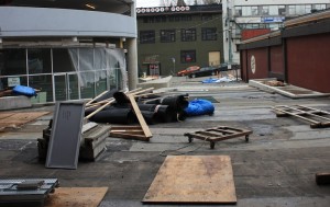
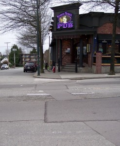
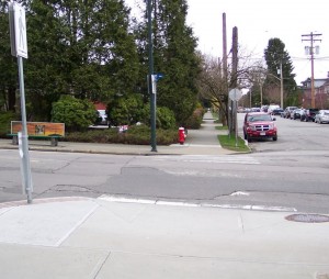
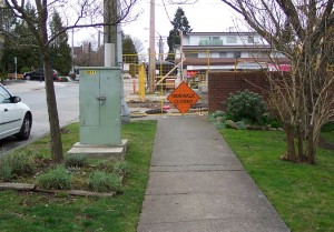
What’s not nice are the crosswalks at Blackford (right in front of the Rivers Reach) and at 3rd Ave being essentially gone for 6 months. With several stages of pavement ripping having taken place, the road markings for the cross walk are essentially eroded away. Crossing 6th between the lights at 4th and the signalized crossing at Queens has become a harrowing experience, with pedestrians not sure of the drivers recognize that there used to be a crosswalk here (or if drivers notice the signs indicating there used to be a crosswalk here), and drivers confused by people stepping onto the road against the flow of traffic, with no crosswalk to be seen.

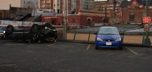
6th Street crossing at Blackford. Note great pub for scale.
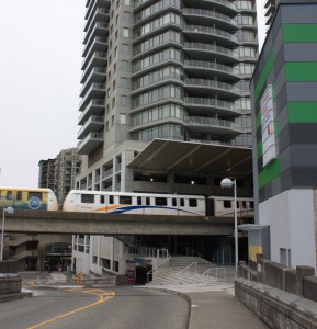
The next block down, 3rd Ave. crossing of 6th. The signs belie the lack of road markings.

This is exacerbated by the works on 3rd Ave and 6th St., where the much-touted Discount Towers development (I think that was their name) has staged their construction equipment on the sidewalk with nary an accommodation for pedestrians, except a “sidewalk closed” sign. Causing pedestrians approaching form the west to cross 3rd somewhere (as there are actually no north-south crosswalk markings in the area) or to walk in the driving lane.

Makes me wonder why they don’t close the CAR lane, and re-route the crosswalk around the construction site using the freed-up car space? Crazy? Giving up a little car space instead of a little pedestrian space? Not crazy when you put it in context of the City’s Pedestrian Charter.

Which I reprint here for your reading pleasure (emphases thiers):

New Westminster Pedestrian Charter 

Walking is the universal mode of transportation; people around the world walk to work, school and other destinations. Nearly every personal trip involves some walking, often to connect with other modes of transportation, such as bicycle, public transit and private car.

A pedestrian is a person that moves from place to place, either by foot or by using an assistive mobility device.

To ensure walking is safe, comfortable and a convenient mode of travel, the City of New Westminster respects the following principles:

Accessibility
Walking is a universally available means of reaching and using goods, services, community amenities and public transit.

Equity
Walking is the most affordable mode of transport, and allows everyone of all ages and abilities including children, youth and seniors to travel independently.

Healthy
Walking is a proven method of enhancing personal health and well-being.

Sustainability
Walking relies on human power and has negligible natural environment impact.

Safety
Walking is a safe mode of transportation. The more people out on foot, the more a community has a greater sense of safety.

Community
Walking-friendly places are people-friendly places, creating a more livable and cohesive community and contributing to community vitality, both socially and economically.

To support and encourage walking, the City of New Westminster will:

  • review practices and regulations to ensure that a high priority is placed on pedestrian needs;
  • plan, design and develop a pedestrian-friendly environment in public space to meet travel needs of pedestrians;
  • improve pedestrian safety by minimizing potential conflicts between pedestrian and other users in the public right-of-way;
  • invest in pedestrian facilities and services to encourage people to walk for commuting to work and school, exercise and recreation;
  • integrate walking with other modes of transportation.

Actions:

  • provide and maintain infrastructure that gives pedestrians safe and convenient passage while walking and crossing streets;
  • provide appropriate pedestrian access to public transit services;
  • ensure weather protection is in place for pedestrians in commercial areas and other locations where there is significant pedestrian activity; and
  • seek funding opportunities with other levels of government and agencies;
  • ensure that all sidewalks in the City have appropriate curb cuts, that surface texture is constructed to prevent persons using mobility challenged devices from losing their grip on the devices, to include adequate lighting, and
  • access to buses be accommodated at bus stops for devices used by mobility challenged persons.

The City of New Westminster works with individual citizens, community groups and agencies, businesses and other levels of government to achieve a pedestrian-friendly, walkable community.

All I’m asking for is for someone in the City to open a bucket of paint and put temporary lines down until the road is properly restored. It is, quite literally, the very least we can do to live up to the Pedestrian Charter.

Trucks on Royal

This is an issue that bubbled a bit during the last election. Most notably, Council Candidate Vladimir Krasnogor raised the issue of heavy truck traffic on Royal Avenue throughout the campaign. The issue didn’t seem to have legs, though.

I used to live on Royal Ave and 10th: a great condo in a great building. Our first experience with Condo ownership was a surprising success, mostly because the Strata Council was proactive, with a few very sharp members who were able to manage the books and keep the ship running. The only downside of the place was intersection of Royal and 10th. The pavement was pretty beaten up, with a huge volume of heavy trucks causing the asphalt to ripple dramatically. Although the route is only a “daytime” truck route, it only takes a few scofflaw drivers to give people the impression it is a 24-hour truck route. Laden trucks grinding up Royal between 10th and 8th were bad enough, but the crash bang of (seemingly empty) container trucks rattling over the rippled pavement while racing through the intersection on the downhill route can shake you filings out, and that one-in-a-hundred jake-brake user during a quiet summer night paints all drivers with a bad brush, even from 20 stories up.

I sympathized with the folks at City Hall even when I was phoning to complain, yet again, about the guy in the Celeste green wood chip truck with the wailing brakes who drove down the hill, wailing away, yet again, at 5:00am. The City Bylaw Officers did what they could with enforcement, but it was an endless game of whack-a-mole.

What are you going to do? Trucks are necessary for the operation of our society. Royal is on the Major Road Network, and therefore Metro provides money to maintain it, and they are not likely to remove this route from the MRN unless viable alternatives are provided. I hear people at the Master Transportation Plan open houses talking about how “cut and cover” is the solution to all truck traffic issues, without acknowledging the costs and other logistical issues (not to mention the tradeoffs) that come with those types of hard, expensive, engineered solutions in urban areas.

This intractable issue has come up again, as part of the discussions around the Pattullo Bridge. Like many lightly-scabbed-over intractable problems, an off-hand comment from Matt Laird peeled it open again, and got me thinking about the problem in a different way. While looking at the various off-ramp designs TransLink had offered us for their new Bridge, Matt asked why trucks had to turn right onto Royal from the bridge. I’m not sure anyone in the room got what he was talking about, but for the last couple of weeks, that question has been stuck in my head like the baseline of “The Lion Sleeps Tonight”. There. Now it’s in your head too.

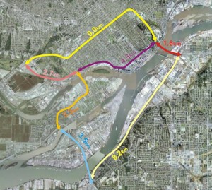
So I got thinking about the question, and came up with this handy little diagram.

This measures the distance between key points relating to truck movements around Royal Avenue. I’m assuming that the South Fraser Perimeter Road will be completed and the Pattullo Bridge (in whatever shape or format) will continue to connect to East Columbia and Royal near McBride. The numbers indicate the distances between the important node points. So the distance from 124th and King George in Surrey (the intersection of the SFPR and Highway 99A) to the north foot of the Queensborough Bridge via Royal is 1.6km + 4.5km, or 6.1km.

So let’s look at what options truck drivers have while crossing the Pattullo Bridge (for the time being, lets ignore the trucks that have specific business in New Westminster, and talk about the through-traffic only).

Arriving at the Hwy99A/SFPR intersection from any direction, any truck heading to the TriCities is pretty likely to take the Pattullo, as the asshats at MOTI have decided not to connect the two most expensive road-building projects in the Province (Port Mann 2 Hwy 1 and the SFPR) with an intersection where they cross. These trucks will therefore be forced to cross the Pattullo, take East Columbia, and get mired in the Brunette / Braid intersection and Brunette overpass hijinks. (note, the UBE would definitively NOT have solved this problem, as the trucks want to get to the 8-lane Lougheed or the 10-lane freeway, not to a driveway-laden 4-lane service road through big box retail and casino entertainment hell)

Trucks heading to the northwest will typically stay on 99A up McBride. The only trucks taking Royal would be those heading west to the Queensborough Bridge intersection: the aforementioned 6.1km trip. If their destination is along Marine to points west, the logical alternative is to continue up McBride to 10th, then go down Southridge Drive to Marine at Byrne Road: a trip of 10.6km, which is only slightly longer than the Royal route (which is 8.9 km total). If their destination is the East-West Connector, then their option is the SFPR – Alex Fraser route, which is 11.7km compared to 9.4km along Royal. Considering the SFPR route will all be separated freeway, and not involve stop-and-go traffic lights, even most destinations in Queensborough might be better serviced from the southern route.

Now what about trucks coming from the E-W Connector? The only reason for them to use the Pattullo is to access the TriCities if they choose the longer Alex Fraser – SFPR – Pattullo route, which is quite a bit longer (13.3km) than the Stewardson – Columbia route (7.8km), so not likely. More importantly, if their destination is south of the River, they might be best off to cross the Alex Fraser right away, as they will get to Surrey sooner (11.7km of freeway vs. 9.4km of City streets), so no Pattullo access needed at Royal.

Coming from Marine Drive, the only reason for trucks to use the Royal-Pattullo route is to get to Surrey, and Royal is only one of the three options (Royal is 8.9km, 10th and McBride is 10.6km, and Queesnborough is 17.7km).

So again, except for local traffic, why do trucks need to be able to access Royal from the new Pattullo? Is a 10% longer route along less-restricted roads faster than a shorter route with hills, stoplights and commuters?

I guess one point to take out of this is that we need to understand the ultimate routing of these trucks, in order to service them adequately, not just whether a truck is “local” or not. If only 5% of the trucks are using Royal Avenue because it is a significantly better routing than any alternative, but because of that 5%, we build Royal into the quickest route, then that will attract trucks off of the alternative routes that are only slightly longer. We also have to ask the hard question: is accommodating those 5% of trucks worth the cost to the livability of our City?

These questions require better data to answer. As does the “local truck question”: are there better alternatives to service the trucks whose destination is New Westminster, separate from the through-traffic? Remember, “truck routes” only apply to through traffic (trucks with local business are not limited to these routes, but can use service roads to access businesses that are not on truck routes).

Maybe Matt and Vladimir are right – maybe it is time to start talking about taking Royal off of the MRN. Could such a move be timed to coincide with the opening of the SFPR? Would such a move put the Pattullo replacement project into a new light?

Queens Park Master Planning

I love Queen’s Park. Not the neighbourhood I can’t afford (although that is very nice), but the Park itself. Sitting in the beer garden during Hyack, jogging the Centennial Trail during my occasional brief forays into fitness, walking though the hazy park after midnight on my way home from the Curling Club, even the occasional NWEP open-air meeting during the summer. Just looking at New Westminster from space (via Google), it is the square rectangle of green in the middle of Urbania that sets the geography of the City- even as it contrasts with the angry sharp finger of green that is Glenbrook Ravine.

It is the contrast with Glenbrook Ravine that speaks to the meaning of the word “Park”. The word is used to describe any generically green space in a urban environment, or otherwise protected space in other environments. There has always been a bit of dichotomy between park space being “preserved”, or set aside for nature, and park space being “programmed” for human appreciation of nature. Look at the protests about a rather innocuous walkway in Jasper, or the “No National Park” signs throughout the Similkameen Valley for examples of the conflict between how “Park Space” is valued or not by groups in our society.

Glenbrook Ravine is a pretty wild place, all trees and brush, a green sanctuary for flora and fauna (and overrun by invasive species), where few people wander off the one or two trails. In contrast, Queens Park has seen 125 years of poorly-planned development, the result a criss-cross of playing fields, paved and unpaved trails, parking lots and buildings. Even much of the Green Space is not actually plants, but painted plastic.

The City’s Parks and Recreation Department recognizes that much of the development of the park has been rather ad-hoc, with little long-term planning. So they are looking at changing that, and are launching a Queens Park Master Plan process, to make sure the park’s utilization is optimized in the future.

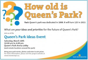
Much like the Master Transportation Plan, this process is going to take a few months and involve various steps and lots of public consultation. This first step for public input is this coming Saturday, with an “Ideas Event”.

Parks and Rec are encouraging everyone to come out an provide some ideas about the future of Queens Park – what do you like or not like about the current Park? What do you want osee happen to the park?

I have my own loves and hates with the park. I think the long-term preservation and management of the Really Big Trees is important for all sorts of reasons. I am less particular about the rest of the manicured gardens: I know the Rose Garden has a proud tradition, but I would love to see an area dedicated to the growing and preservation of important threatened species of native plants.

Upgrading the driving and parking areas to make them a little more, uh… “park like” would be a nice. Unfortunately, the area between the Stadium, the Arenex and the Arena is a pretty dismal asphalt jungle now, and that is (for many people) the first impression of the park that people get.

The Parks works areas are also a little disappointing in a setting as beautiful as Queens Park. The entire fenced-off maintenance areas both disrupt the park-like setting, and make wandering around the park less pleasant. I would add the petting zoo area to this list of strange disruptions. Again, I may be in the minority here, but I think the petting zoo concept is an idea well past it’s prime.

I like the idea of the Bandshell more than I like the actual Bandshell. Having enjoyed great concerts at the Malkin Bowl and Deer Lake Park, I can’t help but think we need a better outdoor venue in New West. Maybe the Bandshell just needs and upgrade, or maybe these types of events will move to the new Pier Park?

The picnic areas are so well used in the summer, that it is sometimes hard to find a spot unless you book well ahead. I think a few other less-structured sitting-and-meeting spaces could be integrated all around the Centennial Trail.

I think the Stadium is spectacular and under appreciated for its setting. I wish I had more reasons to go see Games at it (oohhh… imagine a Single-A baseball team?!? Line me up for season’s tickets!)

Ultimately, I don’t think Queens Park needs any radical changes, but subtle upgrades as the aging infrastructure is being replaced. As population density to the east of the park goes up, and property values to the west stay high, there will be more demand on Queens Park. At the same time, the new Pier Park may draw a lot of the picnic and other “programmed” uses away. Connecting the two via greenway trails, including the upgraded trails through Glenbrook Ravine, would make a nice connected green region of the City… but maybe I’m dreaming now.

the Dollar Store Debate.

OK, I will wade into it.
This was touched off by a minor local Twitterstorm last week, when some lamented the opening of yet another “Dollar Store” in New Westminster. Some had the temerity to suggest that miscellaneous discount crap fresh off the container from East Asia was not a product category of which New Westminster was suffering paucity.

Ever-opinionated, usually correct, and fiercely local Twitterista Jen Arbo was quoted in the Record lamenting that this was the best our local retail environment could offer. The counter argument being, I guess, all hail the free market and the entrepreneurs for which it stands. I have to count myself on the Arbo side of the discussion, but had little to say on the issue. I don’t go into Dollar Stores, because they have nothing to offer me, although they apparently offer something to others: go, go, free market!

Then I noticed the Record article quoted a New York Times article thusly:

“We are awakening to a dollar-store economy,”

…and I shuddered. I cannot think of a more damning lament for our economy, or for our society. No I gotta comment.

This “Dollar Store Economy” is one where the retail environment is dominated by bountiful cheap choice. If you cannot find the quality or the features you want, that is offset by the remarkable affordability of what you don’t want. As the times article points out, it is the “Luxury of Quantity”. Tired of crappy stuff? Here is some more crappy stuff. This is the foundation of the economy that makes Wal-Mart the largest retail business in the world, and IKEA the largest seller of home furnishings in the world. This is the philosophy that brings us 5000-square-foot plywood McMansions in neighbourhoods without sidewalks, straining the City’s ability to provide basic services, while the homeowner laments outragrous 2.5% property tax increases. This is the philosophy that makes it profitable to burn the crap we import and pay a dollar each for more when we find a more pleasing colour the next day.

This also creates the market condition where it is difficult to shop in New Westminster if you want to shop locally and support the local economy. Outside of Wal-Mart, there is no place to buy sporting goods in New Westminster. We have two very good bike shops, but not one place to get a decent selection of running shoes. We host the Canadian Lacrosse Hall of Fame and one of the greatest Lacrosse teams in the history of the sport, but you cannot buy a lacrosse stick within our 15 square kilometres. The same lament for people trying to buy office supplies, gardening equipment… the list goes on.

The big-box merchants at our periphery provide a dizzying supply of low-quality replacements for all of the above. Think about it: one sure way to tell you are not an aficionado of something, but are merely a dabbler, is when you find yourself buying supplies for that thing at Canadian Tire. People who race bicycles (or even commute seriously on them) don’t buy tires at Crappy Tire; barbecue experts are not going into Home Depot to peruse the latest offerings from Broil-King; professional Graphic Designers are not picking up art supplies at WalMart. All for the same reason: these businesses sell crap for the masses who don’t know better (which also explains why I buy car parts at Canadian Tire, I guess).

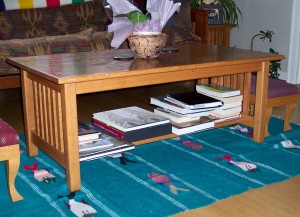
Which brings me to my favourite example of the unseen cost of cheap goods. Look at the coffee table in this picture:

It looks pretty non-descript, if boring. We bought it about 10 years ago from an Amish guy when we were living near Amish Country in the Mid-West, so it is hand-made of real locally-sourced hardwood. Real joinery, too, the thing is built like a tank. Barring housefire or natural disaster, this is probably the last coffee table I will ever own. But the wood was local, made by a local artisan, and we bought it right from him: cost us about $150. I seriously think this is the last coffee table I will ever buy in my life. In that sense, it is similar to the $80 solid wood cutting board I bought from Louie at the Royal City Farmers Market. Well built, local, durable.

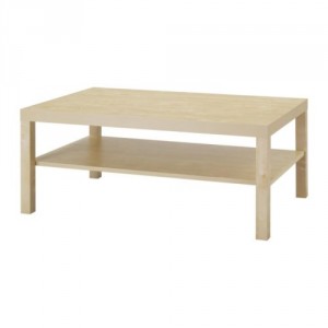
Now there is another way we could have gone. Drive down to IKEA, and see what they have to offer. They have a very similar coffee table, for about a third of the price; what a bargain. It is, of course, made from a compelling blend of particle board, fibreboard and plastic, wrapped in a provocative envelope of Melamine foil and acrylic paint. It is packed 3 inches flat in cardboard, with Styrofoam and plastic film, and comes with a little 4mm hexwrench to put it together.

But how long do we anticipate before the $50 coffee table starts to look tattered around the veneer edges? How long until those 4mm hexwrench fasteners start to wiggle loose in their particle board sockets, of the fiberboard shelf starts to sag? How long before this coffee table is headed for the landfill and another trip to the IKEA is required? 3 Years? 5 years? Then try to imagine how much of that $50 stayed in the local economy? The guy who sold it to you spent 3 minutes punching in the purchase, and gets paid $10 an hour. Your proportion of the money spent by IKEA that day in Coquitlam might total 10% of that purchase, and some of that will be eaten up by the landfill costs of the packaging…
That is the promise of the “Dollar Store Economy”: more cheap shit, sold by the lowest bidder, brought to you by mass production overseas, with no local content, and little contribution to the local economy, except what we can squeeze out in the form of taxes (with the resultant whining about how taxes are hurting “competitiveness” of business).

So thanks Jen Arbo, for running a local businesses that helps other local businesses succeed, and for all your work at the Royal City Farmers Market, bringing local goods directly to local consumers. You might not have thought about it this way, but you have been fighting against the forces of the “Dollar Store Economy” before you ever piped up in the Record.

Cluffy and the Bridge

It is not going to surprise any CBC Radio1 listener if I admit to being a firm Anti-Cluff-ite.

Rick Cluff is the morning show host in Vancouver on the Flagship Mothership, and comes to us after a long history of sportscasting in southern Ontario. This explains why the only thing he approaches with any intelligence or enthusiasm is sports. When talking to the Sports Guy in Toronto (whoever that is this week), he is in his element. And food; he seems to really be into talking about food. For pretty much any other topic, he is hopeless.

It is worst when he is interviewing someone on a topic he is less versed in, like, say, this morning’s interview with TransLink’s Sany Zein about the Pattullo Bridge. (you will be able to hear it here, February 21, just before the 8:00 news, so about 1:50 into the 2:35 program). Rick’s technique is to prepare for the interview by finding the conflict, then writing down a bunch of questions probing that conflict. That way, during the interview, he can read the questions off the page (and the cadence he uses make it clear he is reading through the bottom of his bifocals) and not have to worry about listening to or understanding the answers. It is especially funny when an interviewee provides the answer to the question before Rick asks it, and Rick just can’t break the script and have a conversation, so he boldly charges ahead and asks the question just answered…

In this morning’s conversation , the conflict narrative was New Westminster being a roadblock to replacing the aged Pattullo. Sany Zein tried to clarify and explain that New Westminster was in the middle of their Master Transportation Plan and that the two consultations would work in parallel, and together. There is no conflict there. Then he has a canned input from Wayne Wright saying the same thing, followed by Mr. Zein repeating it, but Rick kept on narrative- How can they move forward with New Westminster being so uncooperative? It was painful.

The worst part is that Rick’s blind devotion to the conflict he wrote down on his crib sheet kept him from asking questions most of his listeners wanted to have answered. How big will this bridge be? Who is going to pay for it? Will it be tolled? How can the public get involved in the consultations? You know, useful information that the news could provide, instead of trying to find a simple conflict narrative to attach sports metaphors to.

Contrast this to Stephen Quinn’s interview approach, where he carries on a conversation, responds to the previous answer, and prepares himself ahead of time so that he can follow the conversation wherever it leads. He also has a knack for fitting in that one slightly uncomfortable question that the public wants to hear answered. Quinn is clearly the best interview talent on the local CBC. Yet again, I digress.

In the case of this morning’s interview, Rick Cluff continues his trend of seeing the world through a windshield. He is of the generation that thinks you can solve traffic problems by putting more roads down, which is a frankly ridiculous approach in the year 2012. This might be because he drives in from White Rock at 4:30 am when the roads are empty, then listens to the traffic reports all day and can’t imagine the cars are the problem.

Regardless, Sany Zein is, in my experience, an approachable and thoughtful guy. So you should feel comfortable asking him questions directly during the open houses coming up this week. Starting tonight!

Discussing the Parkade- Part 1.

There was a meeting tonight hosted by the Downtown New Westminster Business Improvement Association, on the topic of… well… a few things.

The main point of discussion was the future of the Front Street Parkade. There have been reports to council talking about longer-term visions for the waterfront, most of which include the partial or complete removal of the Parkade. These are supported by some engineering reports that indicate the maintenance costs for the Parkade are likely to go up significantly in the next few years, and some decisions are going to need to be made about how much to invest. It probably doesn’t help that some uppity bloggers have been calling for the end of the Parkade for a while now…

Naturally, there is a significant number of downtown business owners who see ample, inexpensive parking as fundamental to their business success. When others (be they uppity bloggers, City Staff, or Elected types) start talking about taking away their parking, they get a little itchy.

The BIA also had some gripes about back-in angle parking on Columbia, Bike Lanes, bike lanes, and Pay Parking on Sundays, but those issues seemed to be brushed aside as the conversation centered on the past, present and future of the Parkade.

Present were about a score BIA members, and about the same number of non-BIA types (including downtown residents and uppity bloggers), a few members of the local media, and from the City: Mayor Wright, Councillors Puchmayr, Harper, and MacIntosh, and Jim Lowrie from the City Engineering Department.

The Transportation Committee of the BIA provided a PowerPoint presentation with a lot of words on it (all caps lock), and perhaps I will go through that presentation in detail in a later blog post. Now I want to more talk about the spirit of the room and the nature of the conflict, from an uppity blogger point of view.

If I’m not sure how to summarize what the BIA’s complaints are, it might be because they have not come up with a coherent message. It is clear they do not like that others are suggesting they are going to take away parking. They feel that access to parking, and more specifically, access to the entire Parkade that they (or their ancestral business owners) financed and built, is not only necessary for their businesses, but is vital to the future of the City’s business community.

Arguments that the Parkade is underutilized are countered by the BIA suggesting the Parkade is too expensive and not effectively marketed. Dan O’Hearn from the BIA went so far as to suggest that if the Parkade was put under the control of the Downtown Merchants, it would be filled to capacity providing revenue for the Merchants. This reflected a certain spirit in the room that the Parkade is just poorly managed by the City.

To me, this argument has always sounded like cognitive dissonance, to argue on one hand that every parking spot is needed and that Downtown suffers from a lack of parking, then to argue on the other that the Parkade needs to be more effectively marketed to get people to use it. Are they saying there isn’t a lack of parking Downtown, there is a perceived lack of parking? Or are they saying there are simply not enough parkers downtown? How is either an argument for investing in a mostly-empty Parkade?

Even then, whose responsibility is it to advertise the availability of parking in the Downtown Parkade? The City? The Parking Commission? Dare I say, the BIA?

However, I think the main complaint I heard was that the BIA was not in the loop about what is going on. I heard a lot of people unhappy about not being consulted, and more than a few people worried that the Parkade would be going away this year, with no plan to accommodate the people who currently use the Parkade. It may only be 30% used on most days, but that still represents more than 200 parking spots.

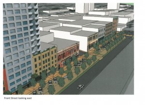
I think this is where there is agreement between the BIA and uppity bloggers like me (and other people who are looking forward to a pedestrian-friendly Front Street connecting Downtown with real human ties to the Waterfront). We agree that there needs to be a plan. I just happen to think we need to look at confirming our current and future parking needs, then planning to accommodate those needs as we develop the Downtown, with the eventual goal being the removal of the eyesore Parkade from our waterfront. The BIA just doesn’t want the Parkade removed until there is a plan in place to accommodate Downtown parking needs. Some might think we are looking for the same thing.

Jim Lowrie and the Councillors at the meeting said as much. The plans they have read regarding eventual Parkade removal have been mid- to long-term planning documents. The City has no intention of removing the Parkade until the BIA and other stakeholders have been consulted, and until there is a comprehensive plan to address the current and future parking needs of Downtown.

So the two sides are not too far apart, and the City is right in the middle. This shouldn’t be to hard, should it?

The Port Declares War

Jeff Nagel of Black Press (who is turning out to be the best Municipal Affairs reporter in the local Dead Tree Press) wrote a piece on recent proclamations by the new CEO of Port Metro Vancouver, and the reactions from various groups throughout the lower mainland.

My first reaction was – poor bastard from England has no idea what he is doing wading into ALR politics. Then I did a little research and see that CEO Robin Sylvester was party to the sell-off of part of BC Rail, so he is obviously aware of (and not afraid of) the worst of BC political morass. He knows exactly what he is wading into here, the poor bastard.

My issue with the Port Authoirty is not just their stunning disregard for the spirit of the Agricultural Land Reserve (even if, as a Federal Agency, it doesn’t apply to them), but their business model. It isn’t just farmland that the Port has declared war upon, it is our roads, our waterfronts, and the livability of our cities.

All of this discussion skips over the reason we have n ALR. It is because BC has very little high-quality farmable land, and most of it is very close toVancouver. Once farm land becomes industrial land, commercial land, or a neighbourhood, it is neigh impossible for it ever to be returned to agricutural use. none of these characterisitcs are true for Industrial Land. Industrial Land can be located anywhere, and land that was once industrial can be easily converted to other uses – and land under other use can easily be converted to industrial use. All it takes is for someone to spend the neccessary money to convert the land. So the need for an “Industrial Land Reserve” is a red herring. There is no scarcity of land to put warehouses upon, although there is currently a scarcity of people willing to spend money to deveop industrial land, and a lack of willingness for Cities to provide appropriate industrial zoning within their land base.
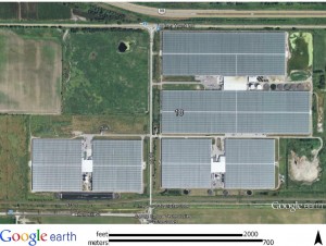
Which brings us to the Port, an organization that is exploting these issues, and is rapidly getting out of the business of taking things off of and putting things on to boats. If farmland (which is commonly located right next to the River) is sacrificed for that, they may have an argument for balancing out industry and farming. Frankly, if the current buzz-word “Food Security” is our primary concern, it is no worse than Golf Courses or cranberry bogs, or even the 100-acre greenhouses being built on ALR farmland today:

140 Acres of our best Reserved Agricutural Land in Delta

Except that the port isn’t using our prime farm land to take things on and off of boats. They are using it to take things on and off of trucks, something they can do on any land, really. No need to use ALR land. The only reason they choose to do this on ALR land is because they can buy ALR land at a fraction of the cost of non-ALR land. Since they are able to remove it from the ALR with federal fiat, they can convert it to valuable lease space for warehouses, instead of buying expensive commercial- or industrial-zoned land that municipalities have set aside for just that purpose.

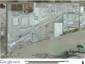
This is because the Port is no longer in the business of taking things on and off of boats, they are now a real estate development and lease business. How else can one justify the purchase of more farm land in Richmond? Look at the port land adjacent to their recent purchase in Richmond:

click to zoom it. or go to Google Earth yourself

All those warehouses (actually there are more now, this photo is a little old), a new highway overpass to connect this land to the East-West Connector, and only one thing is missing: Docks. There is a single berth there for ships, where a single business moves wood pulp onto barges from the rails. Every other business there is truck-oriented, with only a couple even having rail spurs. This is the Port Authority business plan for ALR land. Buy cheap, develop, lease for cheaper than anyone else can. That’s the free market, I guess.

So what? Notice how much of the talk about the traffic issues in New Westminster are around “goods movement”. The issue always comes up of trucks crowding our roads, or our livability being eroded by the noise and pollution of all this container traffic on our roads. When people wonder why we aren’t using the river or the rails more, why there are all these trucks on the road. They aren’t bringing laves of bread to Safeway, they are shuffling goods from the actual Port to “Port Facilities” like these, and to the vast warehouse ghettos of places like Port Mann, Port Kells, and Port Coquitlam – all locations of huge truck warehouses, and all lacking in actual Port facilities to move things on an off of boats (with the occasional exception of logs and woodchips).

How will we ever make use of the goods movement opportunities of the River, when it is against the business interests of the Port Authority – the only agency with any jurisdiction over the waterfront?

Master Transportation Plan Open House 1

Yesterday was the first Open house for the City’s new Master Transportation Plan process. Right off the bat, it looked like the turnout was great. I would put the over/under on total attendance at 90, if you include the staff and a few City Councilors (but, notably, not the Mayor). It was no donnybrook, but for a preliminary information session held on a busy night, it was good to see so many people are interested in the process. 

The Open house featured poster boards with some of the preliminary info collected by traffic counts and surveys, and a short presentation providing details on some of the posters, and giving a broader view of the process ahead. There were also some opportunities to add your comments to post-it boards, and to fill out a survey of pretty general questions. I have a few comments on a few interesting facts and ideas provided by the posters and presentation, but I’ll cover those in a later post. Here, I want to talk more about the feeling in the room. 

From listening to the conversations, most vocal concerns could be summarized into one of three broad categories: 

1) Through-traffic is a problem, but we can fix it once and for all by doing “x”; 

2) The intersection of “x” and “x” is the worst in the City! It needs to be fixed; and 

3) Why aren’t more tickets given out to bad drivers / cyclists/ rat runners/ anyone but me? 

Of these, number 3 has the least to do with the Master Transportation Plan. It speaks somewhat to a poorly functioning transportation system if systemic lawbreaking is the normalized way to operate the infrastructure, but targeted enforcement is really a complex issue involving driver education, signage, the police, and the community. The Master Transportation Plan will hopefully result in a better-integrated system that reduces the bad behavior of users, but that is rather secondary to where we are here. If traffic enforcement is really a passion of yours, why no join the City’s Neighbourhood Traffic Advisory Committee… they always need help! 

Number 2 is sort of what this is about. The solutions found might pick out a few key intersections and areas for improvement of the transportation network, but the bigger ideas will come in answering questions about how we want our intersections and other infrastructure to work, and how the various bits of the infrastructure can work better together. 

Number 1 is a big part of this. However, I bet the problems are more complex that we think, and that the solutions will not be simple ones. Unfortunately, some of the problems will not have a satisfying solution at all (Queensborough Bridge, anyone?), but that doesn’t mean this process is not useful or cannot change the way we approach these problematic areas. 

After the presentation, there was a bit of time for a few questions from the audience, the answers to which I can paraphrase here (yes, both the questions and answers below are paraphrased, any error of fact or language is mine, I tried to catch the gist of the conversation, if not the detail). I have added my comments after each Q&A point. 

Q: You say 40% of trucks are going to a destination within the City, but what about the rest of the traffic? It would be interesting to see how much of the car traffic passes right through.

A: No answer was offered, as it seemed like more of a statement than a question. 

This, more than any other point, is the big gripe New Westminster has about traffic, and the gripe our neighbouring communities have about us. I concur that it is important for us to get this number, because it seems to range depending on whom you ask: 60%? 80%? More? And so much of the conversation in New West is about it, we should start from a factual base. The strange part in this discussion is that many people who think this is our #1 problem also think the solution to too much through-traffic is to blow the bank on building infrastructure to accommodate more through-traffic (freeways through, around, or under the City). 

Q: How does this align with the proposed Pattullo Bridge project?

A: The Pattullo Bridge project is the jurisdiction of TransLink, and will include its own public consultation process, likely starting as soon a February 

However, the data collected for this plan, the impacts of the Pattullo refit/replacement, and the impacts on New Westminster when the Port Mann II comes on-line with its tolls, will all need to be considered as part of the City’s planning. I didn’t get confirmation on this, but I assume TransLink will be one of the agencies identified as a key stakeholder in the entire MTP process.

Q: This City is right next to the River- is there any consideration to using the River for transportation?

A:We don’t know of any plans to move passengers on the river that have gone past the very-high-level concept phase, but there has been discussion of this in the past. Port Metro Vancouver will be one of the Agencies invited to take part, and they have been invited to have a seat at the table here

Goods movement on the River has been a pet peeve of mine for a while, but I will save my strong opinions about how Port Metro Vancouver is screwing the entire MetroVancouver area for a later post. 

Q: What is our clout, jurisdictionally? If TransLink and Province and our neighbouring Municipalities have different plans than us, what can we do about it?

A:Some roads in the City are Provincial, some are part of the Major Road network, and are TransLink, but most are owned by the City. We work with these other agencies, and also, the UBE experience taught us that a strong, united community can have an influence. Experience has shown that a City that has a well-articulated Master Transportation Plan is in a better position to negotiate with other agencies to protect the goals of that plan

This was a great answer, and speaks to the importance of us not only putting a good plan together, but also acting on it to demonstrate that our community supports the goals outlined in the plan. 

Q: What about the UBE, are we going to address that issue as part of this?

A: If the UBE is identified as an issue during this process, then we can look at potential solutions to that issue. However, TransLink has taken the UBE off the table, and are not planning to build it anymore. That project was a TransLink one, with some Federal money. 

The UBE is dead, and the North Fraser Perimeter Road is at least in a very, very deep coma, the chances of it coming back are not nil, but are vanishingly small. But many of the problems highlighted in the UBE discussion (rail crossing safety, access for the Braid Industrial Area, the Braid and Brunette intersection) have not been addressed once TransLink’s approach to the solution was found to be unacceptable. I think there are creative solutions to these issues, and I hope having TransLink, that railways, Port Metro Vancouver, the Truckers and Coquitlam at the table will help us find some common understanding on these issues, if not a solution. 

Q: Are we working with the neighbouring communities, and have Urban Systems tracked the success rate of their previous clients for these types of Plans?

A: First question: Yes, neighbouring Municipalities will be involved in Agency Workshops. Second question: Yes. In their experience, most clients have implemented 50 – 70% of their plans 10 years after the plan is finalized. An interesting nuance is that sometimes the projects completed are not those that necessarily best suit the goals set forth in the plan.

That second part might need some clarity, I can think of an example where a City with the goal of “Improving Pedestrian Safety” may get a big grant to build a connector road in an underserviced area, but defer the sidewalk improvements to a later date, to take advantage of a short-term funding opportunity. Or someone like Rob Ford gets elected and decides to tear up an integrated cycling network, and replace street cars with subways, resulting in increased car-dedicated road space. Even the best laid plans sometimes get nuked by bad politics. 

If you missed the Open House, there will be another opportunity on the afternoon of Valentines Day at Century House. Nothing says “I love you, Honey” like skipping off work to take your date to at a community open house on transportation policy planning.

The MTP Begins

Thursday night is the first open house for New Westminster’s Master Transportation Plan. The first meeting will mostly talk about the process to come over the next 12-18 months, and there will be more public consultation, so don’t go in expecting to hear a lot of answers… but do expect to hear lots of questions, and be prepared to ask them!

The part I am looking forward to is the first bits of data coming from the City’s traffic measuring and public surveys. it will be interesting if the problems we perceive are the same as the problems shown by traffic counts and other data collected by the City and their consultants.

As for the path ahead, the new President of the NWEP, Reena Meijer-Drees does a great job getting Grant Granger at the NewsLeader updated on what the vision that group has for the future of transportation in the City. This is a great start. 

 There was also a great short article in the March Walrus Magazine (I suspect you non-subscribers will have to wait a month or so until you can read it on-line, or pick it up at the Library) talking about Luc Ferrandez, the Mayor of the Montreal’s Plateau borough. Being both a cyclist and and a believer in contemporary urbanism, he has been turning one of the most storied and historic neighbourhoods into a pedestrian-friendly paradise of wide sidewalks and green spaces.

Limited in his powers by a Metropolitan Government that oversees all major transportation infrastructure, and facing opposition from neighboring communities whose denizens want to commute through the Plateau unfettered by his neighbourhood traffic calming, Ferrandez is unapologetic. How unapologetic?

“I accept that some people think I’m the Devil. For them, the Plateau doesn’t exist. It is just a place to be driven through. I don’t give a shit about those people. They’ve abandoned the idea that humans can live together”.

Oh, to have the candor of Québécois politicians. However, when speaking about his vision for his neighbourhood, he sounds inspired:

“The Plateau is an Italian cathedral. It’s a forest. It’s something to protect, something sacred. I don’t want it to become a place where people come to live in a condo behind triple-glazed windows for a couple of years. This has to be a place where people can be comfortable walking to the bakery, walking to school, walking of the park – where they want to stay and raise a family”.

Will anyone stand up and say they want anything less for British Columbia’s most historic City?

Saving Parkades – the original

Editors note: I first posted this on December 18, 2011. but somehow (likely my ham-fisted Blogsy iPad Interface doofusness) it got lost. I posted a follow-up on the 26th of December, but with the context removed, the second post makes less sense, so here is the original post, repeated in exactitude (even though I have learned more about this subject since December 18th, I will post this as the original for posterity, then write something in the next few days to update the update of my update. Get it?  

There was apparently a Rally Thursday night to “Save the Parkade”. It was not well advertised outside of the Downtown Merchants, and I only heard of it through the blog of Adam Goss (oh, by the way, Adam Goss has a new blog – worth reading!) I am on the record about my feelings around the Parkade and the future of Front Street, so I won’t bore you here. But I was intrigued by the flyer information provided via Adam’s Blog. To a point:

“Downtown Merchants and Landlords have not seen any line of reasoning from city hall showing that removal of the Parkade or reduction in parking will improve business.”

Interesting, but I haven’t heard the City suggest it will improve business. They have said that the Parkade is underutilized, falling apart, and that repairing it will be expensive. There are however many of us who suggest that Downtown would benefit from being connected to the waterfront and from having a vibrant Front Street for commercial businesses, and removing the Parkade may facilitate those things.

“Merchants and landlords will lose over $6,000,000 in rents and personal income during the West Parkade demolition and Front Street realignment process.”

I am intrigued about where this number came from, and how it compares the “rents and personal income” that will come from having storefronts on Front Street.

“Removing 283 parking spaces and replacing them with only 36 much despised back in angle meter parking spaces will not be adequate for area prosperity.”

I guess I would return the question with asking how many empty parking spots are required in order to provide adequate prosperity? The studies on the Parkade have shown peak usage of less than 38% of the 741 spots: meaning that even after the above-mentioned changes are made, there will still be 200+ empty spots in the remaining half of the Parkade.

“Other than the East Parkade, there are no monthly or multiple hour parking spaces available for our workforce. Not everyone takes the train to work.”

As noted, there are still going to be 200+ unused spots in the East Parkade, and you can park all day for $5 at Douglas College (you don’t need to be a student), and you can park at the Quay. As to the ending non sequitor argument about trains, just how many cars is each employee planning to bring to work? And what incentives are you giving your employees to not drive to work, saving precious parking for your customers?

“The city has not implemented any long term plan to create decentralized parking spaces. In fact, most new developments have relaxed parking requirements.”

I agree with this statement. The City needs to develop a realistic plan for decentralized parking in Downtown New West before they remove the East Parkade. Clearly, the West Parkade is not needed (see empty space numbers above), but I think that knocking it down without a plan in place is bad planning. Removing it without a plan is silly, but so is dumping money into maintaining a bad piece of infrastructure that is not being used and is causing other negative effects. Will the merchants accept a plan that suggests that parking is currently adequate without the Parkade, if that is what the study finds?

“The parkade is a $20,000,000 revenue generating, downtown revitalizing, asset to save, not to destroy. Smart money would invest in its rehabilitation and enhancement.”

Where is this revenue number coming from? Surely the Downtown Parking Commission is not getting $20 Million from selling fewer than 200 parking spots a day. Clearly, the smart money is not in rehabilitation, but in planned removal.

“The parkade and Front Street are in need of a long term vision including noise abatement, safety, maintenance, beautification and enhancement.”

Agreed. A long-term vision for Front Street is needed. Part of that long-term vision will be evaluating whether last century’s parking solution makes sense over the next 20 to 50 years. Safety, maintenance, beautification and enhancement of Front Street will all be facilitated with the removal of the Parkade.

“The parkade was created by the merchants, paid by merchants and its fate and management should be controlled by merchants.”

Interesting argument. My understanding of the history of the Parkade is that it was built at the end of 1950s to coincide with the decline of Columbia Street as a destination when auto-oriented shopping centres began popping up in Coquitlam and Burnaby and other areas, and the Woodwards opened in Uptown. At the time, parking seemed to be the Bright Idea about how to develop a shopping area. Even in the 1960s, this didn’t work for Downtown, so more of a bad cure was applied, and the Parkade was expanded, and Columbia Street continued to decline. It wasn’t until SkyTrain arrived in the late 1980s that Columbia began to turn around, and the despised back in angle parking introduction of the Road Diet in the last few years has also made the street a better place to visit, walk, and shop. All along, the Parkade was underutilized, and never provided the boost to business for which it was designed.

I stand to be corrected, but I thought the Parkade was built by the City, not the merchants, although it was the merchants who lobbied the City to build it in the 50s, and lobbied to have it expanded in the 60s. It was the merchants who more recently recognized the Parkade was underutilized, and lobbied the City to advertise the Parkade as a park-and-ride destination, ironically complaining that we need more parking at the same time as trying to find ways to fill empty parking spots. Merchants are important, and addressing their needs is a fundamental duty of City Hall. However, the Downtown Merchants have no more or less right to decide the fate of a public resource than Residents or other community stakeholders do. So I hope what comes out of the Rally is a public conversation about the fate of the Parkade, not a confrontational keepit vs. killit debate that lacks rational analysis of the needs of all stakeholders.

I also think that there are other things the Downtown Merchants could direct their energy towards. While researching for this post, I ran across this interesting Masters Thesis on the topic of Columbia Street and potential for urban renewal. It is a good read, and since it is a few years old. It is good to see some of the recommendations coming out of it (changes to Hyack Square, the establishment of a Community Centre downtown) are already arriving.