Two Bridges

A presser was called in New West this week to let people know that the design-build contract for the Pattullo Bridge replacement has been awarded, complete with a first rendering of what the bridge may look like. This is design-build, so expect that early renderings may be adjusted to accommodate the many competing demands and value engineering that the contractor will have to wrestle between now and ribbon cutting.

And then there are the political demands.

This conversation has gone on for a few years, but each new news cycle will require it to be told again. Such are our times. The City of New Westminster, the City of Surrey, and the TransLink (which was the responsible agency for the Pattullo) spent years doing planning and public consultation on the very question of what to do about the Pattullo. A quick scan of this blog finds that these conversations were happening back in 2011, and before I was elected I attended numerous public meetings, open houses, and community events (even dressed for the occasion on occasion).

At the end of that work, after all of those conversations in the impacted communities, an MOU was completed between the major stakeholders agreeing that a 4-lane bridge with appropriate ped/cycling connections was the appropriate structure to replace the aging Pattullo. Not everyone agreed, some wanted the bridge closed completely or moved, some wanted a 8-lane bridge and tunnel to Burnaby. If you look closely at the costume above, you will note it features a 3-lane refurbished Pattullo with a counter-flow middle lane, so there is my bias. Clearly, not everyone was going to be happy. As is usually the result if consultations are comprehensive and honest, the most reasonable result was settled upon.

The 4-lane bridge is the project upon which the Environmental Assessment and Indigenous Consultation were framed. It is the project that was taken to Treasury Board to fund, it is the project whose impacts were negotiated with the City at each end. It is the right size for the site, and it is the project that will be built. Re-negotiating those 8 years of consultation and planning now is ridiculous because nothing has changed in the principles that underlie that MOU.

Which brings me to this little news story. It is hard to tell where this is coming from, except for a zealous local reporter in Delta trying to put a local angle on a provincial news release. There is nothing new in this story, no new questions asked or answered, but a re-hashing of staff comments from 3 years ago.

With all due respect to the staff member quoted, those comments from early 2017 are now based on bad data, since the traffic impact issues raised were from before the removal of Port Mann tolls – which everyone in New West recognizes had a profound impact on Pattullo traffic. I have some data on that coming in a future post, but for now this is my (paraphrased) retort:

Of course, the Pattullo isn’t the only bridge Delta wants money poured into right now. The patently ridiculous 10-lane boondoggle project to replace the Massey Tunnel has been effectively shelved, but the province is currently reviewing other options. Unfortunately, the currently-leading option would be as expensive and no less boondoggley, doubling freeway car capacity to a low-density sprawling community that still resists the type of density or growth that would support more sustainable urban development, while somehow framing this entrenchment of motordom as a functioning part of a Climate Emergency response. This is a 1950s solution to a 1990s problem.

This is troubling climate denial, as Delta will certainly feel the impacts of climate change more than any community in the lower mainland, but I digress yet again.

The short news here is that Delta wants New West paved over and the people who live here to breathe their exhaust and walk near their speeding boxes. They also want the people of Richmond to pave over more farmland and have their community bisected by more freeway noise and disruption. If accomplished, they will (no doubt) be calling for the people of Vancouver to expand the already-congested Oak Street Bridge and the Granville Corridor and maybe a third crossing of the north arm because their suburban lifestyle demands it. And they want everyone else to pay for it, because tolls are “unfair”.

If this ode to motordom in the face of a Climate Emergency boggles your mind as much as it does mine, you can always let the provincial government know, because they are taking public comment on the Massey Tunnel Expansion Project right now. Go there, remain anonymous, and tell them what you think. I did.

Ask Pat: Stormont redux?

CH of Burnaby asks—

Have you changed your views on the Stormont Connector now that there is an opportunity to revamp the access to the new Pattullo Bridge? You were against the connector a few years ago. Do you still want all that traffic meandering through your residential areas? 

To your first question: No. And your second question sets up a false premise.

The Stormont Connector is a really expensive solution to a poorly defined problem, as I wrote about at length six (!) years ago. Nothing has substantially changed since I wrote that, except that the plans for Pattullo replacement have shifted from a 6-lane bridge to a 4-lane bridge, and the Port Mann now provides 10 toll-free lanes shifting even more regional traffic to that bridge. If anything, we have less reason to spend billions of dollars building a freeway through the middle of our city, and asking Burnaby to do the same.

Do I want rush hour traffic meandering through New West neighbourhoods? Not really, but I also don’t want a freeway running through the centre of the City, and there is no reason to believe that adding the latter will take away the former.  It simply doesn’t work like that.

So TransLink and the Ministry of Transportation are going to replace the Pattullo with a similar-capacity bridge, and there will be some minor increases in vehicle through-put, mostly related to better designed intersections at each end of the bridge. I think the opportunities New West has through this process are to improve the east-west connections through our City. We can make it safer and easier for Victoria Hill residents to walk and cycle to Downtown or to QayQayt. We can safely connect the Central Valley Greenway across McBride (finally) with enhanced connections to the proposed Agnes Street Greenway. We can vastly improve the public realm around Albert Crescent Park. There are many potential wins here for the City of New West, I just don’t see how a Stormont connector is one of them.

This topic also gives me a chance to give props to North Vancouver MLA Bowinn Ma, whom I was able to chat with at the Pattullo press event on Friday, and who continues to impress with her straightforward smarts and ability to engage on technical topics. It is refreshing to have an MLA speak so clearly and knowledgeably about urban transportation issues as Ma did on twitter last night:

Yep, She gets it.

Pattullo EA

With all of the excitement around elections, renewed commitments to transit funding somewhat confounded by unclear priorities around the application of road tolling, it is easy to forget the Pattullo Bridge is falling down and scheduled to be replaced very soon. At this point, it is unclear how the replacement will be funded, but it is clear right now that the existing structure is unlikely to be carrying traffic in 2023, so unless they get busy planning the replacement, we will be entering uncharted territory.

Translink is continuing to get busy with that planning, and is currently involved in the Environmental Assessment (“EA”) process. I write about this now, because you have until the middle of next week to provide your first round of input to that process.

The need for an EA is mandated by the province, and the EA itself is run by the Environmental Assessment Office, not by Translink. It is a fairly tightly regulated process, with a structure and firm timelines, so if you at all care about the Pattullo (and I think most people in New West fall under this category), you might want to take your chance to comment while they are open. I thought I might outline the process a bit here, not to tell you what to comment on, but to help you understand the process so your comments have the best chance of being heard.

The first stage of any EA is the pre-application stage when the terms of the EA are determined. The primary purpose of this stage is to evaluate what impacts (positive or negative) will be created by the project, and what are the potential targets of these impacts – so “sediment in the river” is a potential impact of construction work, and “fisheries habitat” is a potential recipient of that impact. The second stage is the actual “Assessment”, where these potential impacts are assessed to determine if they are real, and then to make adequate mitigation of these impacts a condition on moving forward with the project. To have a project (any project, be it a bridge, a mine, or a pipeline) refused an EA certificate would be very unusual. The more likely process for an EA to kill a project would be to create conditions that make the cost or hassle of mitigating an impact so high that the proponent will decide not to proceed. I don’t think that will be the case here.

By necessity, an EA has to have a project to review. So the proponent has to provide a project description to hang the assessment on. It appears, from the preliminary documentation provided by TransLink to the EAO, that project is “a new four-lane bridge funded primarily by user pricing” and “located north and upstream of the existing bridge, its approaches will connect to McBride Boulevard in New Westminster and the King George Boulevard in Surrey” , which is consistent with the public consultation work TransLink has done to date and with the MOU between TransLink, Surrey, and New Westminster. This is important to recognize, because comments like “they need to build 8 lanes for future capacity” or “they should build the bridge in a different location” are not relevant to the EA. Those arguments were made, and discussions had, over the last 5 years while the project was being developed, they are not the current plan, and the EA is not the process through which a radical change of plan will come about. In essence, the question in the EA is not “how best to connect Surrey to New West by roads”, it is “what impact will this 4-lane bridge proximal to the existing one have”. Comments addressing the first question are interesting, but not relevant to this process.

So the comments the EA needs right now are pretty limited, but foundational to the EA to come. Have TransLink and the EAO appropriately identified potential impacts? How do you think the proposed project will impact your life, the livability of your neighbourhood? What concerns you about the project as proposed? If you want TransLink (or other parties, such as the Ministry of Environment) to address something as part of this project, now is the time to ask, so it can get into the EA early, and the proponent has an opportunity to properly address it.

Picking a random example, I have talked in the past about how the Pattullo is an iconic structure. It has significant heritage value for the City of New Westminster. It is hard to finds a picture or photo of the City over the last 75 years that doesn’t feature the large orange arch defining the skyline. There is a value to that for our community. I don’t know how the EAO or TransLink can address that value, or what kind of mitigation can happen, but if we don’t raise that as an issue important to our community now, it will not get into the EA review, and an opportunity to discuss that aspect of the design of the bridge will be lost.

There is another issue that I hope will become clearer as the project EA proceeds, and this might be a bit wonkish. How valid are the traffic modelling assumptions baked into the assessment?

Transportation Planners and City Planners understand that traffic is impacted by induced demand. If we build a 4-lane bridge to replace an existing 4-lane bridge, there will be no more than a marginal increase in traffic counts (perhaps induced by a wider, safer, bridge configuration). That small increase in traffic is fundamental to a bunch of other impacts that will be measured – air quality impacts, noise and vibration, economic impacts, etc. However, if the traffic numbers coming out of this model are based on false assumptions about traffic, then all of the resultant data will be similarly flawed, and mitigation will not be appropriate. With all due respect to our regional transportation planners, the last two major bridges built in this region have completely failed to reach modelled traffic volumes – let’s not three-peat that mistake here.

So if this bridge is being built to accommodate future expansion to 6 lanes, how does that increase in traffic capacity (and concomitant induced demand) change those impacts, and (more importantly at this stage) is that being assessed as part of this project?

Then we have to raise the uncomfortable subject of tolls. The MOU and Project Definition both call for a tolled bridge, and the recent election seemed to indicate the province is now cold on the idea of bridge tolls. There is some time (this bridge will not be built until 2022 at the most ambitious rate) for the region’s Mayors to work up a regional road pricing scheme as envisioned in the 10-year plan, but that is something different than specific tolls on this bridge. As we have learned from recent experience, tolls significantly decrease demand for bridge infrastructure, so if this EA is based on traffic models based on toll aversion behavior of drivers, is that base assumption still valid? This is the type of thing we need clarity on right now.

Finally, there is an area of the EA where the cumulative impacts of multiple concurrent projects can enter into the assessment. The idea here is that one project may have a small, but acceptable impact on a valued part of the environment, but 10 similar projects on the same river will have a bigger impact. However, this is a transportation project, so cumulative impacts may be thought of in a different light. What impact will the (potential) cancelling of the Massey Bridge have on regional transportation (and the resultant traffic modelling?). Perhaps more important, what impact will SkyTrain/Light Rail in Surrey have on regional transportation patterns, and the assumptions feeding the transportation plan?

So that is long way of saying, if you care about the Pattullo Bridge and the impact its replacement will have on New Westminster, do a bit of reading here, and take the time to provide some comments to the EAO before the end of business on July 26. Then hold tight and wait until early 2018 when the full EA process starts.

paint

Disgusting (updated)

At some point, a pander to one group of electors goes beyond cynical, and becomes an abdication of responsibility and an offence to the idea of governance.

The BC Liberals platform apparently includes a promise to create a “cap” on bridge tolls – where no driver pays more than $500 per year, regardless of how often they avail themselves of extremely expensive and not-yet-paid-for infrastructure. A great election promise to “put more money in the pockets of hard working British Columbians”, or some such bullshit, but I have to go bullet point to condense my anger about how bad an idea this really is.

  • It completely undermines the Mayor’s Council and the regional transportation plan that they developed. The province has put roadblock after roadblock in place of that plan, while shoveling money to vanity road projects that won’t solve the problem. Just last week they wrapped themselves in benevolent support for the plan with some commitment of financial support of a couple of it’s components. However, it has been clear all along that road pricing and Transportation Demand Management will be major components of the next phases. This cap is a pre-emptive strike against the Mayors, delivered with no warning.
  • This isn’t saving anyone any money. The tolls on the Golden Ears Bridge still need to be paid, because Golden Crossing General Partnership still needs to get paid. Similarly, the tolls on the Port Mann are still owed to TREO, and are already not bringing in anywhere near enough revenue to meet the business objectives of that White Elephant. The Province is going to have to top up these agreements from general revenue – potentially costing taxpayers hundreds of millions of dollars, because use of the bridge above the cap – the tolls taxpayers will have to cover – are actually encouraged by this scheme.
  • This undermines the business plan for the Massey Bridge. We don’t know much about the business plan for the Massey replacement, because the province redacted it to the point that none of the business risk was disclosed. However, the Ministry has been clear through the planning and the Environmental Assessment documents that the 10-lane bridge will be tolled. Tolling was not just a major component of the finances, but was fundamental to the traffic forecasts and environmental impacts for the project. This tosses all of those best-laid plans out the window.
  • It undermines the terms of the MOU for the Pattullo replacement. The stakeholders for the Pattullo have an agreement in place that underlies the ongoing project: a 4-lane tolled structure. Tolls are not just there to pay for the bridge, but to balance the traffic demand between crossings and reduce the impact on residential neighbourhoods of Surrey and New Westminster. A commuter cap on tolls shifts this balance, and sets back a decade worth of progress and partnership on this project, just as we were crossing the goal line.
  • It is counter to basic economics. We are taking a scarce and valuable resource, road capacity, and encouraging its increased use to save money. Simply put – the more you use the bridges, the less you pay. It is insane, and contrary to all Transportation Demand Management best practice across the industrialized world. It is separated from reality. It is deranged. Do I need to get out a thesaurus to make my point here?
  • It is not being offered for any alternatives. It will now, once again, be cheaper to drive a car across the Port Mann Bridge than to take transit across it. Just as the province has been dragged reluctantly into bringing expanded light rail to South of Fraser , they are creating a quick incentive to discourage its use, and undermine the entire model, shifting growth patterns in Surrey for a generation, at the most critical point of its growth.

Now, I am writing this about an hour after this information leaked out, so there may be devil-in-details I am not aware of here that will arrive with the official announcement, but that speaks to the point that there has been no consultation with the Mayors of communities affected, no public engagement over a plan that will re-shape the region and undermine so much of what the region is trying to achieve in livability, sustainable development, greenhouse gas reduction, and transportation. How do you recognize electioneering replacing governance? It is a surprise announcement completely disconnected from any other policy, program, long-term planning, or previous action by the government.

This is a flip of the bird to the regional plan (to the very idea of regional planning!) and to every resident of the Burrard Peninsula. It is a cynical pandering to a few ridings South of Fraser, and low-information voters across the province who likely won’t realize they are going to have to now pay through their taxes for infrastructure built on the promise that users would finance it. Not surprisingly, Jordan Bateman is taking a pass on criticizing this specific tax increase, being the original champion for the Port Mann fiasco.

And people will fall for it, of course. Congratulations, BC Liberals. You have raised the art of disgusting panders to a new level.

UPDATE: I was in the room when John Horgan announced out of nowhere that he would end all tolls on the Golden Ears and Port Mann bridges if elected. The closest thing I have to a response was what James Gemmill made succinct on Twitter:  holdmybeer

Toll comment

I received this comment to my previous post about $1 tolls:

Another big problem, amongst others in this plan, is that it does not fairly distribute the burden on all Lower Mainland residents. I notice that nobody seems to think that the Burrard, Granville, Cambie, No. 2 Road, Dinsmore or either of the Moray Channel Bridges should be tolled. Therefore, if your objective is downtown Vancouver, all residents of Vancouver, Burnaby, Port Moody, New Westminster and Coquitlam are exempt from tolls. Ditto for any Richmond resident working at YVR. And yet, their cars place as much stress on the infrastructure and contribute to congestion/GHG emissions as a car coming from across the Fraser or Burrard Inlet.

There is a lot packed inside this succinct comment, and it deserves a fuller response that I can fit in a comment. If we decide to toll all/most bridges, which bridges do we toll?

The Mayor of Delta provided an analysis of tolling all crossings of the Fraser River and Burrard Inlet within the general TransLink area. I pointed out a problem with including the Laing bridge, as it is Federal, and YVR isn’t going to want someone else collecting tolls on their infrastructure that they built for their customers to use.

There are also (as noted in the comment) three more crossings of the middle arm of the Fraser (the No 2 Road, Dinsmore and Moray bridges) that all belong to the City of Richmond. There are also three bridges crossing False Creek (the Burrard, Granville and Cambie) that belong to the City of Vancouver. Should we expect those two cities to turn the infrastructure that they paid to build and still pay to maintain, over to regional tolling?

Should we expect their respective Mayors to take any different an opinion about this than the Mayors of the North Shore do when it is suggested their residents and businesses start paying tolls without a concomitant return in infrastructure investment for their residents and businesses?

Perhaps we are asking this question the wrong way. Instead of asking where we can toll, we should be asking what we want to achieve with a regional tolling strategy.

Although many appeal to “fairness”, that discussion usually devolves to getting someone else to pay more and the commenter to pay less. There is little fair in transportation funding. Pedestrians and cyclists subsidize drivers, transit users pay to cross rivers, drivers don’t. We all pay for TransLink whether we use buses ourselves or not. People in Vancouver are paying to build transit infrastructure in Prince George, but Prince George residents are not expected to pay for TransLink infrastructure, BC Ferries that run on tidewater are expensive, those that run on fresh water are free. It isn’t fair. Let’s put fair aside.

One thing we may try to do is manage the infrastructure we have more efficiently. The toll on the Port Mann has caused a decline in the use of that brand new and woefully underutilized crossing, and an offsetting increase in use of the aged, decrepit and congested Pattullo. When (if?) the Massey and the Pattullo are replaced with tolled crossings, the Alex Fraser is going to be a gong show. The idea of balancing tolls across the region is one way to address this issue.

Of course, flat tolls on all bridges is a pretty inelegant and inefficient way to do this. Dynamic tolling where off-peak crossing costs are lower than peak times, and even (gasp!) temporary reductions on some alternates when an incident or construction is causing one crossing to be jammed, are possibilities that could make our existing infrastructure carry loads better, and make road use more predictable. Of course, this is effectively the same thing as increasing capacity, and induced demand will result in the same net congestion within a few years anyway. Which brings us to the third (and best) reason to toll crossings.

Transportation Demand Management (TDM) is the only thing (emphasis needed here: *The. Only.Thing.*) that has ever been effective at reducing traffic congestion in urban areas. When we talk of “road pricing” or “congestion pricing”, we really mean using the forces of the market to adjust traveller’s behaviour. Airlines do it (it costs more to fly on Friday and at Christmas), Ski Hills do it (it costs more to take a lift on a Saturday in December than a Tuesday in March), Ships, Trains, Busses, Car Rental companies, hotels – they all do it. Charge more at peak times and less in slow times to encourage some percentage of riders to take the off-peak trip and save your need to build more capacity.

Except when we talk about an integrated regional transportation system, we can also incentivise different uses altogether. And herein lies some of the answer of which bridges we should toll.

If your objective is downtown” is a compelling part of the comment. Translink constantly reminds us, the living in the burbs – working downtown model does not apply to Greater Vancouver (reason #437 why the PMH! Project was a silly approach). Look at this compelling diagram from BTAworks  that shows where commuters travel. Most people from Surrey don’t commute to Vancouver, nor do most people in most communities.

JtW2011
Source: http://www.btaworks.com/wp-content/uploads/2014/07/JtW2011.jpg

However, there is no doubt the region has “zones” for the most part defined by water bodies, and just like we use those zones to determine transit use, we can use them to determine tolling policy.

The model suggested by the Mayor of Delta would divide the lower mainland into the following zones: the Mainland, South of the Fraser, Lulu Island, the North Shore and the North Valley.
map1

Although I admire the simplicity, this does seem to create significant inconsistencies, and as the commentor noted, if I want to drive the 45km from Anmore to UBC, I pay no toll, while I would pay two tolls to go the 12km from New West to my favourite Indian Restaurant in North Delta (and this is, like most things, all about me).

This also creates as bit of a strange zone-in-the-middle out of Lulu island, which I suspect would be of concern to the City of Richmond. Or not. Their residents may hate the idea that every time they wish to go somewhere more than 3m above sea level (and bring their car along) they need to pay a toll. Alternately, they may like the idea that toll-in and toll-out will reduce through traffic and make their City streets work better for the residents that live there. I frankly don’t understand the politics of Richmond enough to predict where that discussion would go, but I would wager less tolls would be favoured.

A perhaps more logical model I once saw suggested was to consider the Burrard Peninsula as the “central zone”, and create three other zones: South of the Fraser, the Northeast, and the North Shore:map2

This creates the slightly complicated (but not insurmountable) challenge of tolling crossings of North Road (or some imaginary line that runs roughly parallel to it). This arguably distributes the burden better. The problem is what to do with Lulu Island. Does it belong North or South of the Fraser?

The answer in that probably lies in one of the fundamental assumptions of using road pricing as a TDM measure: You need to provide alternatives. Simply tolling a crossing where people have no choice but to drive will do little to disincentivize people from adding to the traffic, but will do much to anger people who used to get a crossing for “free”. Looking at Lulu Island, the transit options to the south through the tunnel and Alex Fraser are not great. However, the Knight, Oak, and Laird currently parallel one of the nicest, shiniest, newest transit lines to ever grace the Lower Mainland. The pedestrian and bike alternatives are also there. So from a TDM perspective, it makes sense to toll the four north arm crossings, not the two main arm crossings.

map3

I agree, true distance-based road pricing is a better solution, but we are a decade or more from that being implemented, and we need to deal with a funding situation that is killing the regional transportation vision right now. Meanwhile we are bringing a bunch of new asphalt infrastructure into the equation within the next decade. I see a more regional tolling introduction as a good stop-gap measure, and we can no longer allow the perfect to be the enemy of the good. We need to get moving.

And yeah, $1 still isn’t enough.

Ask Pat: Tipperary U-turns

Chad asks—

I’m a Brow of the Hill resident who walks home from the Skytrain at Columbia St up 4th St every day. I’m wondering about the deal with Royal Ave and 4th St. Every day I see dozens of cars getting around the no right turn restriction on to Royal Ave by driving into the Tipperary Park parking lot and doing a u-turn. (Where I frequently feel I’m at risk of being run over). I’m especially concerned about this as the days get warmer and longer and more people will be making use of that great park, while those using New West as their highway between home and work zip around in the parking lot to try to bypass part of the Royal Ave traffic parade. I can see that there is a no u-turn sign in the parking lot but no one’s paying attention to it – makes me wonder why they even bother obeying the no right turn sign…anyway, would love to see this area made safer for pedestrians and park goers alike, and would greatly appreciate your thoughts on this!

It has taken me more than a month to answer this question, mostly because I don’t have an answer.

It isn’t only the “no right turn from 4th to Royal” folks who do this. It is also the “no left turn from 3rd to Royal” who turn right instead, go the block and pull a u-turn. Mix these with the people who drive through the City Hall parking lot and access 4th from there instead of waiting a light cycle on 6th

It is a mess. We have (according to some counts, although the source of this oft-cited number is somewhat obscured by urban legend) 400,000 vehicles a day passing through New Westminster, and for an hour or two a day, the legal accesses to the Pattullo Bridge are constricted, and those through-commuters do whatever they can to take a few minutes off their commutes. Except pay a toll on the Port Mann, of course.

It has been measured, this increase in 20,000 vehicles a day crossing the Pattullo (about 30%) since the tolls were applied at the Port Mann. There is a coincident 20,000-vehicle drop in daily crossings of the Port Mann. This is a huge part of the reason why this City has been working so hard to assure that any replacement for the Pattullo Bridge will result in a tolled crossing – to level that playing field. We are also lobbying to assure the bridge is not higher-capacity, as induced demand will assuredly result in congestion on the feeder routes increasing as capacity does. Finally, we worked to encourage people to vote YES for the funding of the Mayor’s Plan to bring better transit service South of the Fraser so those 10,000 extra people had viable alternatives to sitting in traffic in New Westminster and getting frustrated enough to pull a u-turn in a parking lot to shave a few minutes off their trip.

We can target enforcement in places like you mention, and the NWPD does have a traffic division who do this. Their priorities are not necessarily to catch “rat runners”, but to target the most dangerous road users at the most dangerous intersections. With a few thousand intersections in the City and a million road signs, they can’t be everywhere enforcing everything (and enforcement costs money!), but they are doing what they can against the tide.

So no easy answers, and yes I share your concern, but I don’t know the solution. I’d love to hear if you have any ideas to make the situation safer.

$1 Tolls: still not enough

I’m going to avoid being critical of Mayor Jackson, because I think her accepting the idea of road pricing as a Transportation Demand Management method (even in this watered down and ineffective format) is a sign of progress regionally.

I am going to be critical of the regional media for their lack of analysis in reporting this story. It is almost as if the story wasn’t “reported” at all, but instead the press release was repeated, sometimes with a few clauses moved around, with the most minimal amount of background (“the tunnel needs replacing!”) and no actual analysis. I cannot find a single report where a member of the esteemed press even checked the math.

Here is the math the Mayor provided in her press release:

That argument in the Mayor’s release was that $1 tolls would raise close to $300 Million (not the “$348 Million” reported by one local print media source) to pay for the local government portion of the Mayor’s Plan. Aside from a few of the questionable statements in that release (an increase of 20,000 cars a day does not suggest people are “avoiding” the Pattullo Bridge), you would think reporters would check the base premise. Is spending an hour with Google and a spreadsheet really too much to ask before the story is filed?

Lucky, I had an hour in the evening to sit down and compare this report to my earlier analysis that did get a little notice a couple of years ago, the last time this idea came up. So here’s the kind of analysis I would want to read in the media, if I felt it was doing its job.

The screenline numbers from 2011 used by Delta for traffic count simply do not reflect the reality of bridge use in 2015. I was able to throw this table together based on a bit of Google searching, and note every number is a hyperlink that connects you with the actual official traffic count source of data (for the crossings where such a thing exists).

Delta data: 2015 January 2015 September 2014 Annual
“2011” MAWD MADT MAWD MADT AADT
Laing 79000 79000 79000 79000 79000 79000
Oak 88000 69166 65069 75043 71779 67376
Knight 96000 96000 96000 96000 96000 96000
GMT 89000 77306 71633 87037 82531 79105
Qboro 88000 79724 73739 87113 82706 80108
Fraser 117000 113496 103281 121079 113984 107785
Pattullo 68000 72985 78043 83598 79633 68000
Port Mann 112000 96098 87905 106378 100608 94986
Pitt 79000 79000 79000 79000 79000 79000
GEB 30000 34520 34520 34520 34520 32054
Lions Gate 63000 58857 56918 63137 61357 60757
IWMSNC 127000 120600 112697 129971 125220 117854
Total daily crosings: 1,036,000 976,752 937,805 1,041,876 1,006,338 962,025
x 365 days: 378 357 342 380 367 351

The Golden Ears Bridge data is less certain, as it comes from TransLink financial documents, and is not collected with the rigour of the Ministry of Transportation data. The Pattullo data is horribly complicated in its reporting, but available as a daily number, not as an annual average. For the Knight, the Laing, and the Pitt River, I could find no useful data. Anything I found lacked a link to who collected the data, and was too old to be reliable. For those bridges, I projected the TransLink screenline data that the Mayor of Delta used.

How much traffic you count depends on when you count it (no surprise!). The biggest number (378 Million crossings annually) is a made-up number that projected the annual weekday traffic (AWD = average week day) over the entire week. As weekend traffic is generally 20-25% lower than weekday, that automatically gives you an inflated number, so for the purposes of projecting toll revenue, you are better to use ADT – average daily traffic. It also depends if you pick a winter, summer or fall day (with fall being the busiest urban travel season). That is why I listed both January and September data for 2015.

The last year for which the MoTI provides Annual Average Daily Traffic data is 2014. This number best balances out weekdays, holidays, seasons, and other shifts. It is important to note that every bridge with good traffic count data from MOTI has a significantly lower amount of traffic than the 2011 data used by Delta to make their case. I’m amazed that this point was not noticed by any media).

Regardless, using the concise MOTI data as the best regional and pan-seasonal effort where available, and the likely inflated Delta/TransLink numbers where it isn’t, the actual number is somewhere less than 1 million trips per day, and less than $350 Million with perfect across-the-board $1 tolling.

That hefty chunk of change looks good if it ignores the issue of what to do with the existing tolls on the Port Mann and Golden Ears. If they are reduced to $1 and included in this analysis, then we have to account for the $164 Million (2014 estimate) collected from those bridges in the current regime. This problem is exacerbated by the fact that neither bridge is collecting enough toll revenue right now to cover their financing costs, and the concessionaires want to keep getting paid.

There would be many things nibbling away at the remaining $186 Million, including the cost of setting up the tolling system and the cost of administering the tolls. Based on the TREO model, and their most recent Financial Reporting, they spend about $16Million collecting $120Million, so we will be conservative and call that 12% overhead not including the capital cost of setting up the system. Giving a generous benefit of doubt, I’m going to assume they can collect a $1 toll three times more efficiently than a $3 toll, but still getting us down to about $160Million.

There will also need to be some discussion with the owners of several bridges, as the Pattullo (see below) and Knight belong to TransLink, and the Laing belongs to the Federal Government through the Airport Authority. With all due respect to the Airport’s sense of charity, they are not likely to let someone else collect revenue from their customers on a piece of their infrastructure without some form of compensation.

And finally, it raises the uncomfortable question of how much of this revenue goes towards replacement of the Pattullo Bridge and Massey Tunnel. The Pattullo is part of the Mayor’s Plan, and was slated to be funded by a toll that is similar to the one on the Port Mann. With that idea now replaced by regional $1 tolls, the revenue required to cover the financing for that >$1 Billion project will need to be drawn from an ever-dwindling revenue stream.

The proposed $3.5Billion replacement for the Massey Tunnel, a project the Mayor of Delta is almost single-handedly in support of, would surely eat up more than the remaining revenue from the regional $1 toll. It is not part of the Mayor’s Plan, and it is hard to see the Mayors of the region agreeing to divert all of the regional tolling revenue to that one project when it does nothing to address the rapid transit and bus service improvements the region desperately needs. Not to mention any improvements to the North Shore…

So $1 a crossing is far from a panacea, but this discussion may lead us in the right direction. Tolling many crossings and sharing the revenue as part of a truly integrated regional transportation infrastructure investment plan (which is what the Mayor’s Plan is) is not in itself a bad idea. Once the infrastructure is in place, then time-of-day tolling shifts and other TDM measures can be put in to better manage demand, and even take away the imagined “need” for 10 more lanes of car traffic crossing the Fraser River.

My 1500-word case.

I started writing a note to a group I was hoping would support the YES side of the upcoming Metro Vancouver Transportation and Transit Plebiscite, and it turned into a bit of an extended rant. Actually, after re-reading, it appeared to be very un-ranty for me, which first disappointed me, then made me a little proud. So I thought I would share it here (edited slightly for audience). So here is my 1,500ish-word case for the Yes vote.

I’ll list some facts for clarity, then give you my opinions. See if you can tell where it shifts.

The Plebiscite

The Plebiscite asks for a 0.5% increase on the PST to fund a package of transportation and transit capital projects across the Lower Mainland. This money is specifically earmarked for the projects listed in the Mayor’s Plan released last year, and there will be annual independent audits to assure the money is spent as promised.

The Plebiscite will be my mail-in ballot. Elections BC has not released all of the election details yet, however indications are that ballots will be mailed to every person on the Elections BC voters list. To vote you need to be 18, a resident of the area served by TransLink, a Canadian Citizen, a resident of BC for the last 6 months, and you must be registered to vote at your current address. The ballot will be mailed in March, and you will have until the middle of May to return it.

The “Congestion Improvement Tax”

The regional CIT is a 0.5% sales tax that will raise something in the order of $250 Million per year for the next 10 years. The province has committed to matching funds, and suggest the Feds would as well; when these three sources are combined it equals $7.5 Billion over 10 years.

The CIT will cost the “average household” something in the order of $100 per year. The number is hard to parse exactly, because it depends on how much you spend. The average household income for the lower mainland is about $60,000, and if you spend all of this on PST-taxable items (i.e. didn’t buy food, pay rent or purchase haircuts) then your burden would be $300.

To put the tax rate in transit-oriented perspective, if you buy a $1000 television, you will pay $5 in CIT, which is less than the cost of a single 3-zone ride. If you purchase a $34,000 car, the CIT will cost you $170, which is equivalent to a single month 3-zone bus pass.

The Mayors Plan:

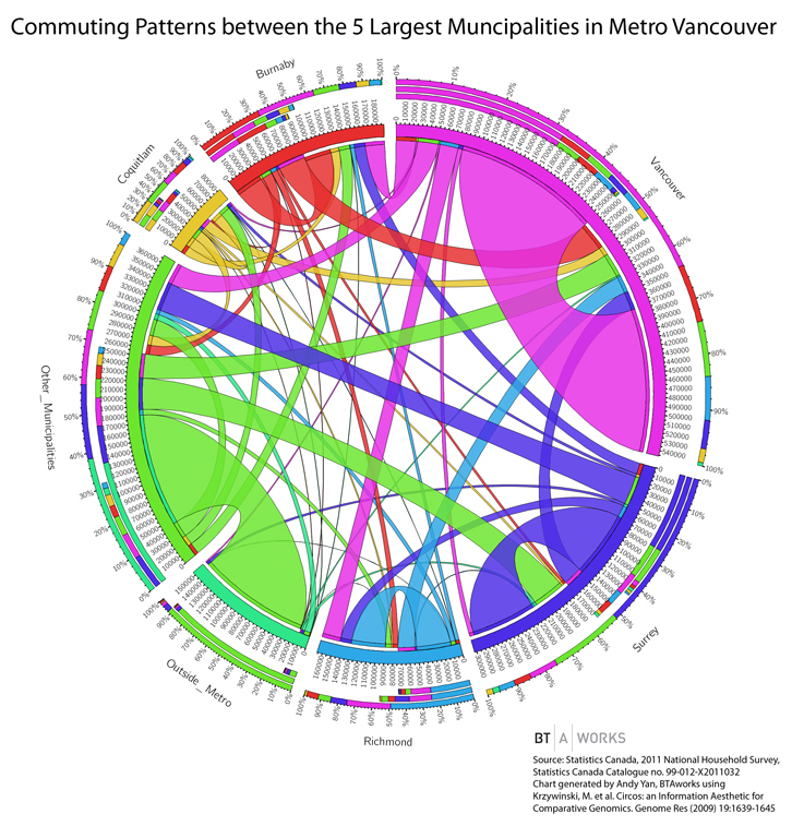
After almost two years of discussion, negotiation, and finagling, the Mayors of Metro Vancouver agreed almost unanimously on a planned package of improvements (the Mayor of Burnaby was the only dissenting voice):

3 light rail lines in Surrey, which will connect the King George SkyTrain station to a line along 104th to Guildford Town Centre, a second along King George Highway to Newton, and a third to Langley Town Centre along the Fraser Highway;

1 Broadway Corridor extension of the Millennium Line all the way to Arbutus;

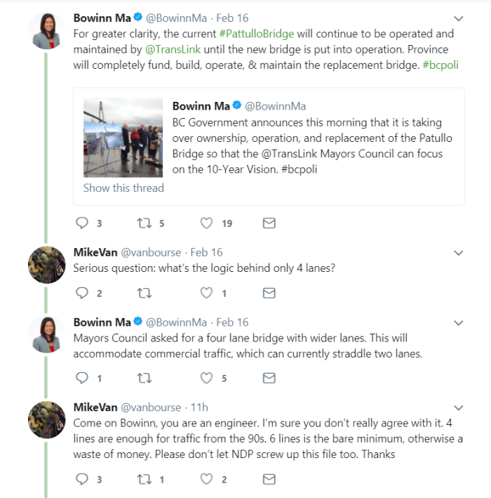
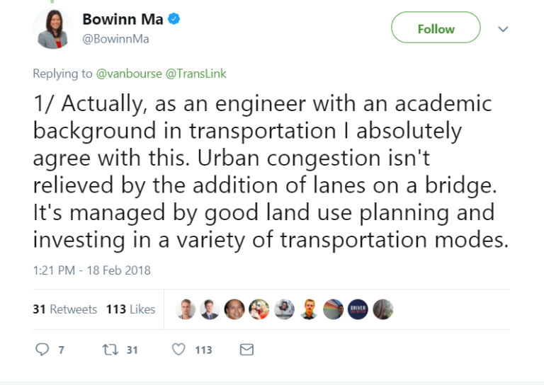
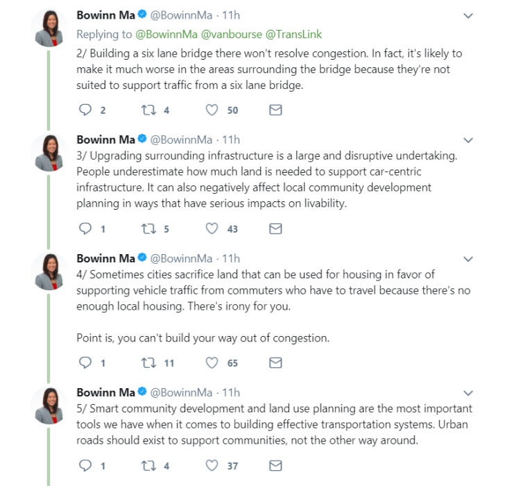
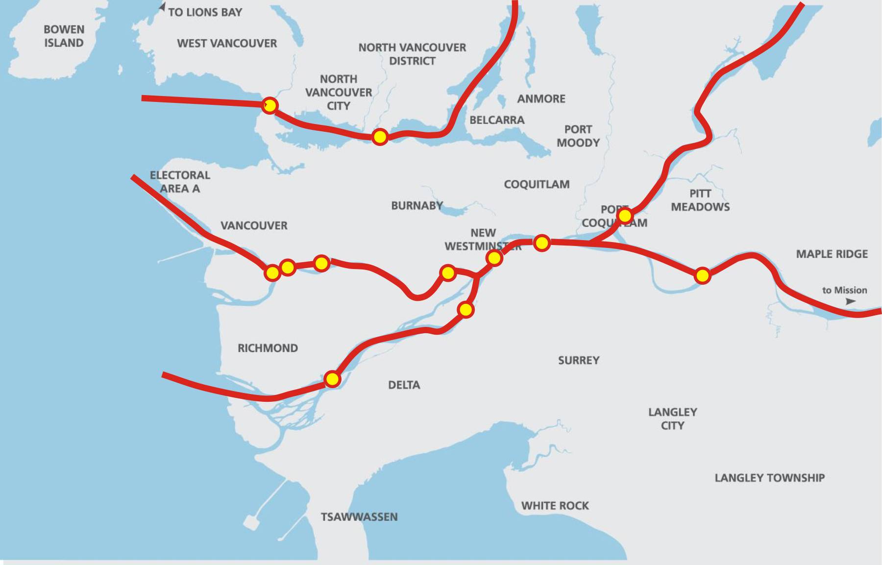
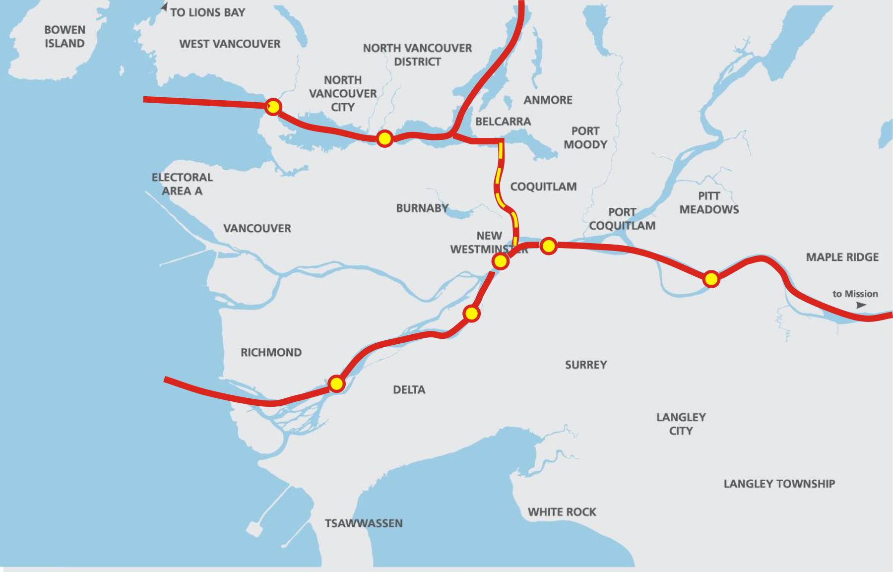
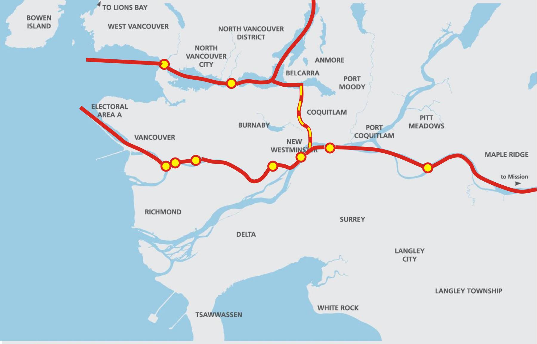
1 replacement Pattullo Bridge. The Plan will provide an important portion of the capital funding to build a new 4-lane bridge, with the balance of the capital coming from tolls;

11 new B-line routes, adding up to 200km of much more frequent service. 3 of these lines are in Surrey, 2 are in the North-east section, the rest are in Burnaby-Vancouver, or connect Burnaby-Vancouver to target destinations (Richmond, UBC, SFU, North Vancouver);

400 new buses, which means more frequent service, extended hours, and higher reliability for everyone who uses busses;

50% increase in Seabus service – more frequency, longer operation al hours;

80% more night bus service;

30% more HandyDart services;

129 additional Skytrain/Canada Line fleet vehicles on existing lines, providing more frequent,
reliable, and comfortable service;

2,700 km of bikeway improvements.

Impact on New Westminster:

The City is in support of this plan because it provides valuable tools for us to achieve the goals of our Master Transportation Plan, and helps meet many of the City’s objectives towards building a more sustainable, inclusive, affordable and livable community.

The Pattullo Bridge plan is a good one for New Westminster. The bridge will be 4 lanes, and will be tolled. Both of these are issues the City has pressed hard and negotiated towards. The bridge will be built to accommodate future expansion to 6 Lanes (and this is the exact language of the agreement) “if need arises, to meet demand increases beyond current forecasts”. The plan does not include funding for this expansion to 6 lanes, and tolling the bridge and providing the alternatives (light rail and B-line expansion South of the Fraser) is our best assurance that the demand increase that would drive future expansion to 6 lanes will not occur.

More frequent SkyTrain and bus service will of course have a huge impact on New Westminster, which has one of the highest per capita transit use rates in the lower mainland. These new buses will turn the tide on “service rationalization” that has seen two bus routes reduced in New Westminster in the last two years. Larger, more frequent SkyTrain cars mean you are more likely to fit in the first train that arrives at 8:00 in the morning at New West Station, instead of trying to decide if the next train might be a little less packed. Increased Night Bus service will have a huge impact on shift workers (think RCH – our largest employer) and night owls. Increased HandyDart service will help keep our community connected and accessible for more people.

However, providing improved transit service to South of the Fraser and the Northeast Sector is also a major “win” for New Westminster, as it provides viable alternatives to people so they do not have to drive through New West on their daily commute. This is not the solution to New Westminster’s traffic problems, but it is a huge step in the right direction.

Plan B:

We cannot talk about the YES side without acknowledging the NO side. What will be the result of a NO vote? Frankly, no-one knows for sure, but we can make some educated guesses.

We can be fairly sure that the scale and pace of expansion offered by the Mayors Plan will not occur. No provincial government interested in staying in government is going to reply to a NO vote from the public by introducing a new taxation scheme to replace what was just voted down. The Mayors could, in theory, decide to fund this plan with property taxes, however if you read the history of how we got to where we are now, the chances of a plurality of Mayors agreeing to that in short order are very slim, especially as they will be under the same pressure as the provincial government to not approve a tax that the people just voted down. (I will ignore for now the public policy argument that property taxes are a terrible way to pay for transit infrastructure).

Note that almost every other alternative to funding proposed by the Mayors (carbon tax recovery, vehicle levy, gas tax increase, comprehensive road pricing program, funding from general revenue) has been nixed by consecutive Ministers of Transportation. It is not as if there wasn’t a Plan B considered, it is that no proposed Plans B have received consensus support.

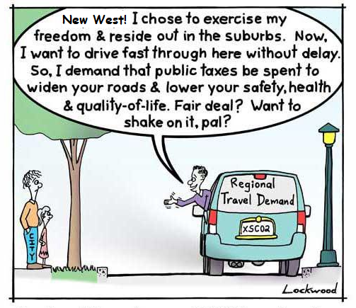
In New Westminster, a NO vote almost certainly means continued “rationalization” of bus services. The delay at getting rapid transit built in Surrey will put more pressure on the Pattullo and provide incentive for a 6-lane option. The delay in other transit expansion projects mean more people will be forced (note – I didn’t say “choose”) to include driving through New Westminster’s neighbourhoods on their daily commute to Surrey or the Northeast sector. Congestion will increase the cost of moving goods, will erode the livability of our community, and will empower the government to build yet more lanes of unsustainable transportation infrastructure – with your tax money, and without a referendum.

TransLink:

It is important to remember that TransLink is the agency created by the provincial government to operate Greater Vancouver’s regional transportation system. It exists at the pleasure of the provincial government, and is governed by them. The province could disband, re-regulate, or replace TransLink tomorrow, but the region would still require a public transit operator who would operate the expanded capital assets the Mayors Plan will provide.

There may be significant governance issues with TransLink, however those governance issues are not part of this Plebiscite, nor has the province suggested that governance changes at TransLink will result from a YES or NO result. To suggest so is pure speculation with no basis in the public record. TransLink is not running the Plebiscite, nor are they particularly in favour of it. Every indication is that TransLink has the same position as the Mayors (if I may paraphrase: “we wish we didn’t have to go through this exercise to get adequate funding, but if this is the only path provided to us to build our service level, let’s get going).

This Plebiscite will raise funds to build capital projects, and the funds raised are specifically earmarked for the projects proposed. The province and Mayors have agreed to annual external audits and reporting on how the funds are spent, providing a level of transparency and accountability unparalleled in the history of transportation capital budgeting in the province. This money is not going into a TransLink black hole, but into tangible assets we can see operating. If you want to see more accountability in how TransLink spends, this provides it.

In summary

I am very much on the record in my support for limiting the lanes on the Pattullo to 4 lanes, and tolling the bridge; I have advocated for better public transit in New Westminster; I have supported the mode shift goals of the Master Transportation Plan; and I have supported working with our regional partners to build a more sustainable transportation network;

All of these goals are supported by a YES vote on the Plebiscite,
None of them are supported by a NO vote.
So I’m voting YES.

Truck Routes – Disappointing, not surprising.

I suppose the refusal by TransLink to remove various New Westminster streets from the designated truck route network is not surprising, but the wholesale dismissal of the concerns with a paucity of supporting arguments is definitely a disappointment. I hope this is not the end of this discussion, but the beginning of a conversation about the specific routes, and just a small setback to eventual progress*.

I don’t think anyone really thought Royal Ave would be removed from the designated routes at this time, not at least until there is a significant change in how the Pattullo Bridge connects on the north side of the River. However, there is no reason for keeping East Columbia through the Sapperton business area as a truck route, and a re-evaluation of the East 8th Ave connections are definitely in order.

Part of the frustration is the TransLink news release itself. Apparently released to a few news outlets, there is nothing on the TransLink media page, and the reasoning behind the decision is not made clear. The City of New Westminster provided rationale, alternate routing proposals, and justifications, and TransLink essentially said “no” without addressing the specific points.

Of course, they “took feedback from… Port Metro Vancouver, BC Trucking Association, and the Greater Vancouver Gateway Council” – that last agency essentially being the marriage of Port Metro Vancouver and the BC Trucking Association. It is unclear of they consulted with any of the residents being impacted by these trucks, by the PACs of the impacted schools, or by the businesses in Sapperton or elsewhere in the City that are meant to be serviced by these trucks. Nor are they reporting out on the feedback they received.

They basically asked kids if they want ice cream or Brussels sprouts, and got the predictable answer.

On the positive side, there is language in the news story about working with the impacted neighbourhoods to find solutions, so let’s hope this dismissing the proposed solution out of hand doesn’t set the City back too far, and we can start an expanded conversation about accommodating goods movement while protecting the livability of our City.

“No” isn’t an answer I want from any level of Government. I would rather hear: “That solution doesn’t work, but lets find one that does”.

There is an ongoing Facebook conversation about this topic in the Group “Rattled About Traffic In New West” with a variety of voices piping in, some more rational than others. The voice I find most interesting is that of Dave Tate, who is both a trucker, and cognizant of the impacts truckers have on neighbourhoods. He has been promoting the idea that a weight restriction on the Pattullo would increase safety, prolong the life of the bridge, and would remove much of the heaviest cohort of the truck traffic from Royal- those triple-axle container trucks that are typically the ones that rattle and bang down Royal, have the biggest impact on road wear and traffic, are typically the worst performers in the random roadside safety inspections, and are most likely to be using the Pattullo as the “toll free alternative” between two points that could easily be connected by an alternate route.

It is good to hear from a balanced group of people on this issue, as it is refreshing compared to the comments one might hear on the AM radio call-in shows. Yes, I’m looking at you Simi Sara.

If you listen to CKNW and (I cannot believe I am suggesting this) listen to the comments, you hear little but ill-informed people complaining that New Westminster is a progress-hating problem child, and has always been. There are a few major themes that are constantly repeated, so I thought I would touch on them as a point of retort:

“If New West keeps putting up barriers, I will avoid it, and will not shop there!”
If a significant proportion of the several hundred thousand cars that pass through New Westminster every day actually stopped to shop here, this would indeed be a strong argument to use, but unfortunately, this is just not the case. In actuality, it is the massive number of through-commuters and heavy truck traffic that makes it harder for people from around the region (and our own residents!) to access our business storefronts. It also makes our retail areas less attractive to spend time wandering around in. Removing trucks from East Columbia would improve, not worsen, conditions for businesses in Sapperton.

“Without all these trucks, your store shelves will be empty!”
Admittedly, New West does have a resounding number of Save-on-Foods outlets, but I doubt they require the 3,500 trucks a day crossing the Pattullo, with similar numbers coming in from Brunette and across the Queensborough to keep the lettuce shelves stocked. Besides, these truck route changes would not impact at all local delivery or pick-up of goods, because trucks are permitted on non-truck-route roads when actually having business on that road.These closures would only effect through-traffic trucks with no business in New Westminster, the ones that we just spent $5 Billion on new bridges and highways to accommodate.

“New Westminster needs to get with the program and build roads around the perimeter!”
Problem is, there is no perimeter, unless you define perimeter as “where someone else lives”. The roads at the perimeter of our City run right through the heart (and other vital organs) of our community, and right past people’s homes. 10th Ave is residential west of Kingsway, and residential and way too steep for trucks east of McBride. 8th Ave is residential most of it’s length. Columbia is both residential and home to a lot of ground-based retail, and is the heart of two of our most historic neighbourhoods. One can argue Brunette is a perimeter, but it only connects to non-perimeter roads to the west. Front Street cuts through our resurgent waterfront area – downtown will only succeed if Front Street succeeds as human space that connects downtown to the River. McBride, Royal, 12th Street, 8th Street – these are urban streets in the middle of bustling neighbourhoods surrounded with parks, residences, and commercial districts. Where is this mythical “perimeter” where you want to put all the trucks?

“How many of those New West people commute through surrounding Cities – they’re just being selfish!”
The short answer to the rhetorical question: fewer than any neighbouring community. New Westminstergenerates fewer car trips per capita than any Municipality in Metro Vancouver excepting Vancouverproper. Our “alternative mode share” (people who use their feet or transit for their daily commute instead of their car) is the second highest in the region. If the Northeast Sector (~82% of trips in a car) and South of Fraser region (~82% of trips by car) [data available here] had New Westminster’s mode share (~65% of trips by car) or took steps towards reaching the goal New Westminster is reaching for in the new Master Transportation Plan (~50% of trips by car), that would be a huge step towards addressing the traffic problems in New West, and a huge step forward for the region and the Province.


This all brings me to the real point here: New Westminster is not the selfish, parochial, progress-impeding “speed bump” in the regional transportation system and we need desperately to get past that narrative. New Westminster is a leader in moving towards meeting its regional commitments to a more sustainable transportation network. It has lead by building a more compact City, investing in mixed-use developments near transit hubs, but taking a SkyTrain station that Coquitlam refused, and by holding the line on mega-freeway development while suggesting increased transit investment might be preferable if the region hopes to meet its Sustainable Region goals. New Westminster has been demonstrating transportation leadership, both in words and in action, and we should not be shy talking about it.

*Since someone asked:  Progress, by my definition, is moving towards an efficient transportation system that serves the community, not a community that serves the least efficient transportation systems. “Building more lanes” has not represented progress in traffic management circles since the late 1970s; where providing affordable, efficient alternatives is how the 21st Century sees progress in Transportation planning.

The Mayors have a Plan

The Mayors of the region have done what no-one (and I include the Minister of Transportation in this group) thought they could: they came to a consensus around a 10+ year transportation plan. For a moment in time Thursday morning, people around the region started to dream about a rational transportation future… then the Minister reminded us that he wasn’t interested in solving the transportation problem, he wanted to perpetuate the contrived impasse. Alas…

First the good news: the plan looks good. The major components show a significant amount of compromise by many of the Mayors, as a few big dreams have been scaled back somewhat. However the route charted is clear: Rapid transit in the form of underground Skytrain on the Broadway corridor and two light rail lines in Surrey. A whole swack of B-line routes for everyone else. Investment in the SeaBus, a few shekels tossed to pedestrian and cycling infrastructure, and yes- a tolled 4-lane Pattullo Bridge.

Surrey LRT: Three lines total, 104 Ave and King George Boulevard running within 7 years, and the Fraser Highway line in service by year 12.

Broadway Corridor: Continuation of the Millennium Line to Arbutus within 10 years.

Skytrain: improvements to the system to increase frequency of Skytrain by 2016.

Burnaby Mountain Gondola: They are calling it a “connection” to avoid discussing technology, but the business case for the gondola is solid: it can move many more people for much less money with much more reliability than buses. There is no timeline provided for this investment.

SeaBus: An increase in SeaBus service by 50% will bring it close to a “Frequent Transit Service” standard, meaning waits for the next SeaBus will be reduced to the point where “Over Town” commuters don’t have the schedule your life around catching the next boat.

Pattullo Replacement: A tolled, 4-lane Pattullo is now the plan – although no date is provided for completion. The bridge will be “expandable” to 6 lanes, so the devil will clearly be in the details (for those who remember the Alex Fraser was built with two “spare” lanes that were opened about a year after opening). The language sounds to me like they are NOT trying to sneak in a 6-lane bridge:

“This possible expansion may be considered if need arises, if demand increases beyond forecasts and/or the surrounding network changes. Future consideration of expansion would require all-party agreement and Mayors’ Council approval.”

I read from that that New Westminster, being one of the parties, would need to agree, and with the toll in place, the odds of demand requiring more lanes any time soon are pretty small. I call this a win for the “Reasonable Approach” work that New Westminster Council has been doing for the last year. This was the part of the Mayor’s Plan I was most concerned about before it was unveiled, and I’m glad to see it is something I can vote for as part of the greater plan.

Roads: “…having benefited from many decades of high and consistent investment… no major road capacity increases are needed” -BOOM!

Pedestrians and Cycling: The Mayors support and call upon TransLink to strengthen the regional cycling network, and to invest in making the pedestrian connections to transit stronger. There are few specifics here, but the next time you hear about the great Bicycle Conspiracy/Agenda, note that only 3% of TransLink’s current budget will go to all of the cycling, pedestrian , road and bridge maintenance (yes, even truck and car roads), and the plan will bring that proportion up to… 3% (which is an increase, as it will be the same percentage of a slightly larger budget).

B-lines: 11 New B-line bus routes. These almost-express buses bridge the gap between light rail and old-style buses, by being frequent enough with limited stops to get a lot of people across medium-distances fairly efficiently. The advantages are that 200km of these lines can be installed with very little capital investment on the part of TransLink, but their effectiveness is tied to their being as fast as, or faster than, a car on the same route, which requires the individual Cities investing in supporting infrastructure (priority lanes, queue-jumper lights, etc.). More devil-in-detail stuff here.

Buses: More and newer buses will mean a better quality of service, and lower operating costs. The plan includes more than half a million more service hours per year, between the B-lines, peak load service, and off-peak service. This would support getting more people to the “core services” of rapid transit which will increase revenue. The plan proposes that by 2030, more than 60% of front doors in Greater Vancouver will be within walking distance of the Frequent Transit Network (the service that is frequent and reliable enough that you don’t need a schedule to depend on it, you can just walk to the stop and a bus will arrive within a few minutes). That gives pretty much the entire region a level of service approaching Burnaby levels, if not quite New Westminster levels. This is good, and will provide huge revenue increases through tickets.

There is a bunch of other stuff in there about transportation demand management, better integrated information and payment systems, upgrading the Goods Movement system, etc. This is a 45-page document full of good details; a well-referenced and integrated Regional Transportation Plan. It is simply amazing that TransLink and the Mayors were able to put it together so quickly, and find enough consensus on it to get it (almost) unanimously passed.

Reading it through, you can see how this happened. Overall, there are signs of compromise – a little of everything, not too much of any one thing – note the SkyTrain to UBC is not included, and the LRT access for Surrey is coming online slower than ideal. Make no mistake: this is actually a very modest plan compared to what our region should build if we want to be “world class”… but at least we are, for the first time in almost a decade, moving forward instead of backwards.

Well, we were, until Minister Stone killed it shortly after birth. This, once again, confuses exactly what his goal is. The Minister told the mayors to make a plan, they did it. He told them to set up a payment plan, and that (this is the important part) the populace would be able to vote on whether that plan was acceptable. No money unless the people agree. That was the deal.

Of course, he didn’t really want the people to vote, he wanted the Mayors to be forced to supplicate themselves in front of the public asking for more money…ideally during local elections. The tax plan the Mayor’s have proposed has suggested a re-jig of the Carbon Tax, which puts a load on general revenue , which the people are apparently not allowed to vote on.

This type of cynical politicking is why we can’t have nice things.

The hanging question, after a year of this discussion, is this: What is the BC Liberal Plan? So far they have offered nothing- no vision, no funding, no ideas, not even any creative criticism – they just say “No”. Leadership is not asking other people to come to you with proposals, then responding by saying “I think not, try again”. It is instead about finding the way to say “yes” to a better future – something the herd-of-cats Mayors’ Council have been able to do, but Todd Stone simply cannot abide.

Put this lack of leadership in contrast with Kathleen Wynne’s bold leadership on sustainable transportation in Ontario. Both of these unexpectedly-re-elected premiers call themselves “Liberals”, but they clearly have very different visions of what liberalism is, and different views of leadership.