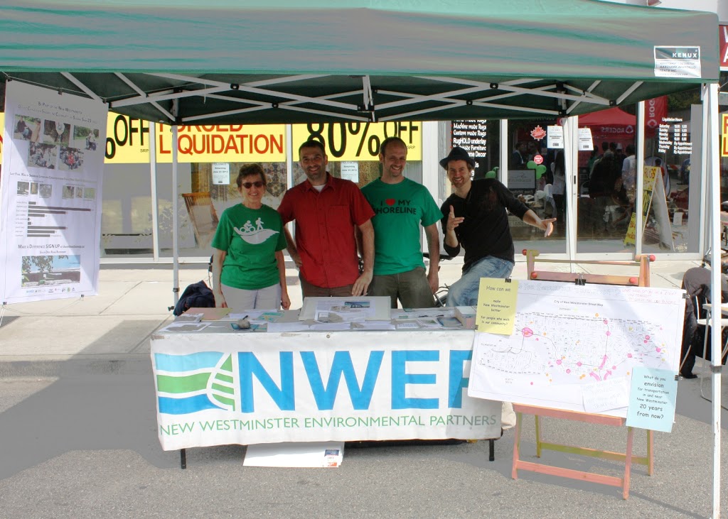
As I mentioned, I was invited to give a talk this week to N.E.X.T.NewWest, a group of young entrepreneurs, business leaders and community builders in New Westminster.
Not sure why they asked me, but I took the opportunity. As I had previously whinged, we need to hear from this community on important issues like the Pattullo Bridge. New Westminster’s business community is not just the Bricks and Mortars on 6th Street, or Columbia, or 12th Street. They are fundamental to our City, and well represented by the Chamber of Commerce and various BIAs, but I chatted at the N.E.X.T.NewWest event with people running bricks-and-mortars, and with a bunch of people running home-based business, most with home-based employees, or using services like the Network Hub –examples of what the business community of the future is going to look like.
I gave them a speech full of facts and opinions (challenging them to call me on the difference). I really had no idea what kind of reception I was going to get from the 60+ people in the crowd, and I can only characterise it as “mixed”. They mostly laughed at my lame jokes, and some folks really engaged (i.e. nodded their heads at the right time), while others were clearly not buying my bunk (i.e. rolling their eyes at the opportune time). I even got cornered after and into a long discussion with a couple of guys who strongly disagreed with me about how traffic and road building interact. Actually, it was those conversations that were the most fun, because I learned from those guys, and I hope they learned a bit from me as well.
As an afterthought, I had no reason to be as nervous as I was, they were a receptive and informal group, and fun to hang with. I perhaps should have been more depressed that I was the oldest guy in the room, considering the accomplishment and contributions of the folks in attendance. My only other mistake was assuming that everyone was already engaged in the discussion around the Pattullo, and know what the “NFPR” and “SFPR” are, or even what I was referring to when I used the term “Puchmayr Express” in reference to connecting the SFPR to the new Mega Mann Bridge.
Anyway, I drifted off script a bit, but here was my prepared summary of my talk. If you have read this blog a lot, you have heard all of this before. If not, then hopefully this is a good summary of the Pattullo Bridge issue, as I see it, with references to some documents I mentioned in my talk – so you can verify my facts and separate them from my opinion. The photos are all mine, I had them running behind me on the mother of all flatscreens at the ReMax Office.
 |
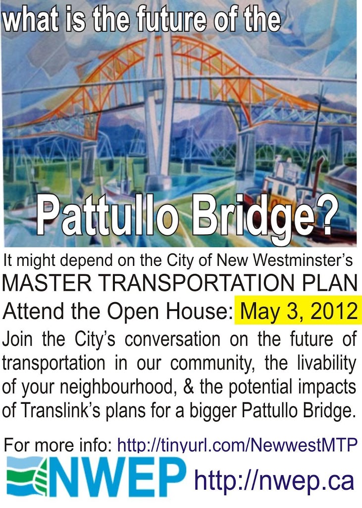
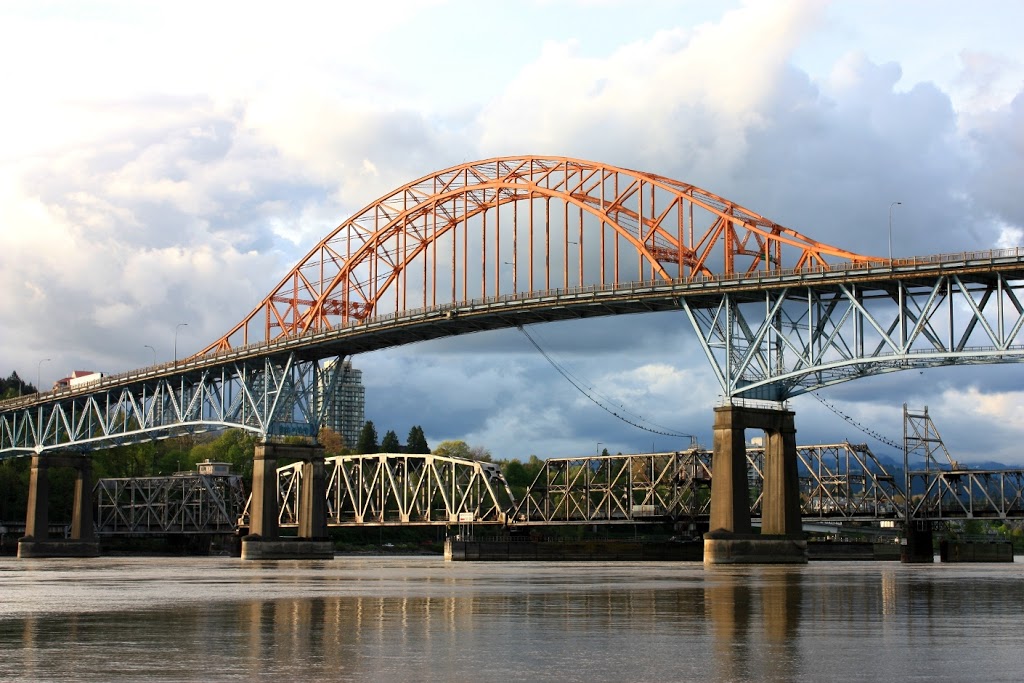
| This is the only image here not my own creation. Well, I took the photo, but the image is of a painting by one of my favourite artists, Jack Campbell. He was a long-time New Westminster resident, and captured many remarkable images of New West during his time here. Coincidentally, he is also my neighbour on Saturna Island, where he is now catching remarkable images of the arbutus trees and sandstone shorelines of that jewel of a Gulf Island. When I think of the Pattullo as being an iconic structure in New Westminster, an important part of the heritage, I think of this image, there it is between the futuristic SkyBridge and the guys doing the historic work of booming logs on the Fraser River |
What’s N.E.X.T. for the Pattullo Bridge?
I’m here to talk to you guys about the Pattullo Bridge, where it came from, where it is going, and why I think you should care. I have been following this issue for a while, have written a bunch about it on my blog, have been to several community meetings, and have read a lot of reports on the Pattullo, so I am going to start off by supplying you a bunch of facts, then will work my way into a whole bunch of opinions. I will try to make it clear which is which – and I want you to call me on it, if you think I have confused the two!
First the Facts.
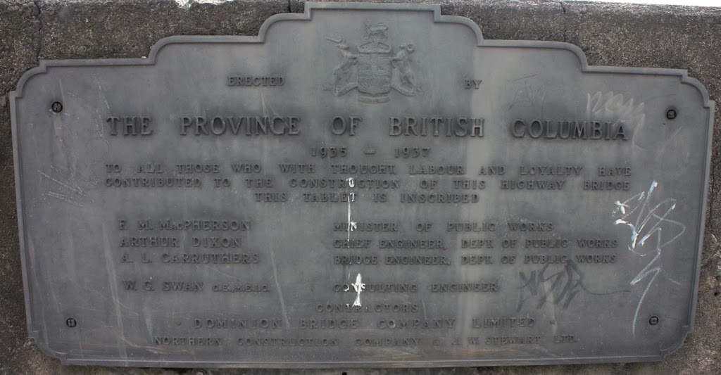
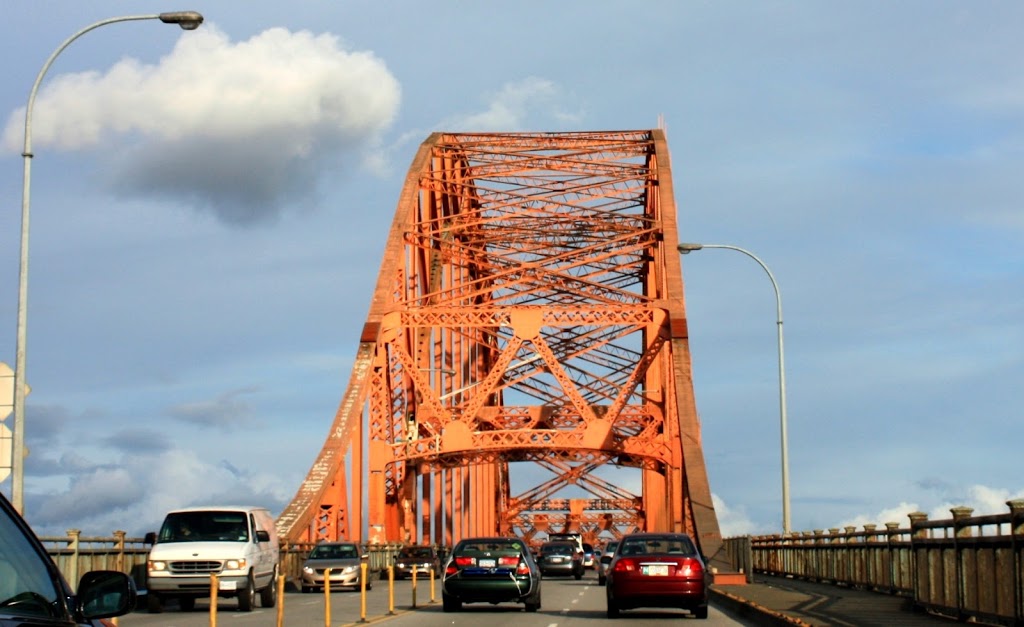
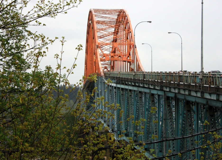
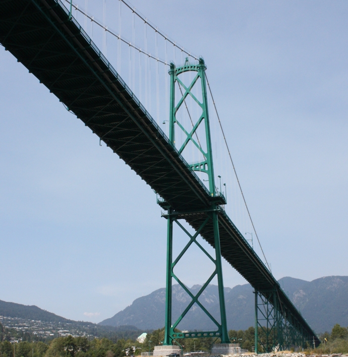
The Pattullo Bridge opened in 1937, a year before the Lions Gate Bridge and a year before Superman was published in Action Comics #1.
The bridge belongs to TransLink, which is kind of unique. TransLink only owns and operates three bridges: Pattullo, Knight, and Westham Island. They also own Golden Ears, but it is financed and operated by a concessionaire through the PPP process, so that is best left for another conversation. The rest of the bridges you cross every day either belong to the Province through the Ministry of Transportation and Infrastructure (Port Mann, Lions Gate) or to a City (Burrard Street, Cambie Street).
The Pattullo, for 75 years old, is really showing its age. Worse than the Lions Gate or Superman.
According to TransLink stats, about 60,000 cars and 3,500 big trucks cross the bridge on the average day. This is about the same car count as the Lions Gate, but there are no big trucks permitted on the Lions Gate.
However, the number of cars and trucks crossing the bridge is NOT the reason Translink wants to replace the bridge.
Instead, TransLink has provided an alliterative list of Replacement Factors: Safety, Scour, Seismic, Structure.
The safety issue is probably the one most people can relate to. The Pattullo has narrow lanes, curves at both end, and has a reputation for being accident-prone. For those prone to anthropomorphise, the term “Killer Bridge” has been used. I just want to note that there has not been a fatality on the Pattullo since 2005, when the nightime centre-lane closures were implemented. There are also fewer accidents and injuries per year on the Pattullo than on TransLink’s other bridge- the Knight Street.
The bigger concern is that the bridge is currently faslling apart.
TransLink says it is past the end of its service life, and costs them $3 Million/year to maintain. It will not last much longer without a major re-fit, which will cost about $200 Million. This will bring the bridge up to modern structural code, and get us another 50 years of life out of it, but will not bring it up to the highest current seismic codes.
So TransLink has a plan.
Actually, these plans have been brewing for some time. A commonly cited report from 2001 talks about the federal government paying $1Billion to replace the rail bridge with a tunnel, and attaching some car lanes to it (although it is unclear if this would be parallel to the existing Pattullo or replace is). It wasn’t until late fall of 2010 that TransLink announced the start of public consultation on the project. Then those consultations were abruptly cancelled.
This was unfortunate, partly because that would have given us the opportunity to discuss the future of the Pattullo and the plans that TransLink had in the context of a Municipal Election. That would have led to interesting dialogue on both sides of the River, and in the region.
Instead, the consultations were re-announces a couple of weeks after last November’s elections were over. But it wasn’t until after the Christmas Break that TransLink brought their planto the public:
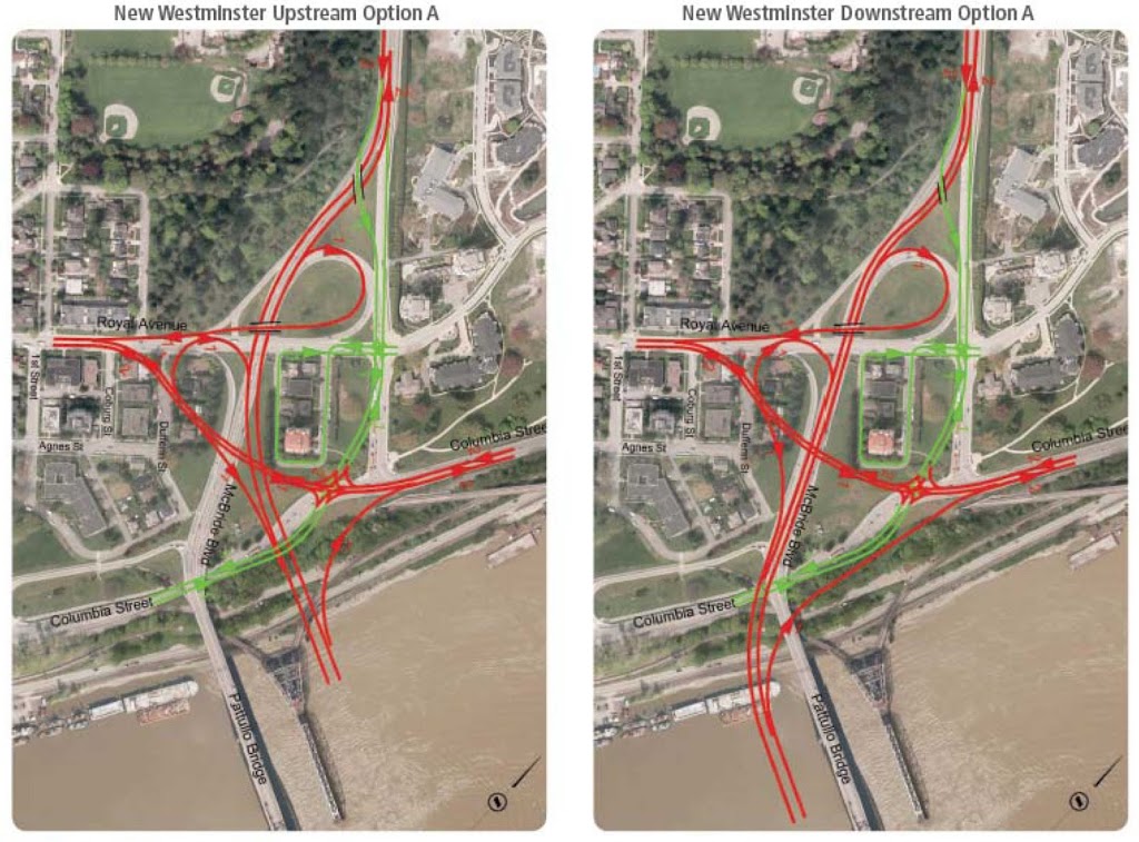
There were a series of open houses this spring run by TransLink showing us a bunch of options to consider: did we want a new 6-lane Pattullo bridge just to the left of the old one, or just to the right of the old one?
They also included a few different off-ramp configurations, but did not (as was humourously reported by many) ask us what colour we wanted the off-ramps painted. I would rather re-characterise it as offering us a few different bowl-of-spaghetti off-ramp drawings, and asking us which offended us less. Primavera or Alfredo?
It was also during this consultation that the alliterative reasoning for replacement was provided:
Scour, Safety, Structure, Seismic.
The 60,000 cars a day were not (and remain not) a replacement factor for the bridge. The two extra lanes were instead justified for “goods movement” – and were referred to as “truck priority” lanes. The definition of “truck priority” lanes was not supplied, and is hard to calculate, as no such thing exists in TransLink’s jurisdiction, anywhere else in the province, or in the Motor Vehicle Act.
There were a few other ideas that fundamental to the public discussions, but came out through the question and answer parts of the consultations.
1: the bridge will be tolled;
2: TransLink projects traffic to increase on the new bridge to 94,000 cars a day, and 7500 trucks a day.
Remember those numbers, if nothing else: 50% more cars. 100% more trucks.
Now I cannot speak for the City of New Westminster, I am not an employee of the City of New Westminster – it is not my job to speak for the City. But I do serve on the City’s Master Transportation Plan committee, and have attended a lot of public meetings on this issue. So what you are about to hear is my take on the situation, and I stand to be corrected by the City if I misquote their position.
This plan and the consultation are both – to be generous – less than optimal.
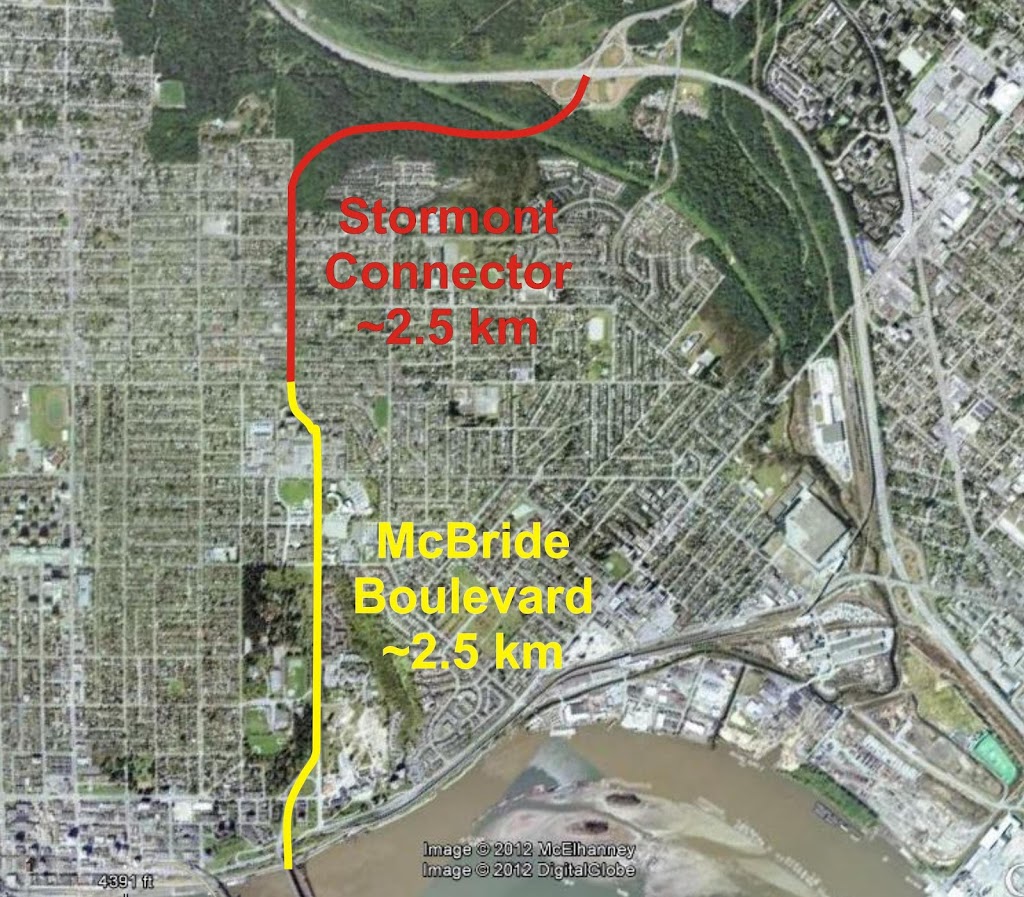
First off, the timing is terrible. The City had already begun its Master Transportation Plan process. This is a master planning document that will outline the shape and form of the City’s transportation network (roads, sidewalks, bike lanes, trails, transit facilities) over the next decade or longer. A major component of the MTP is multi-stage public consultation to determine what the visions and goals of New Westminster are for their transportation network. Here have already been two rounds of public consultations and stakeholders engagement.
So part way through this process, TransLink drops a 6-lane bridge, effectively shuffling the deck.
The City decided to not provide a formal response to the consultation at that time, but to wait until the MTP process got to the point where the goals and visions are reported out, and those goals and visions would constitute the information that TransLink wanted from the City. TransLink recognized this as a valid approach, and agreed.
And that is where we are now.
Secondly, there were some obvious problems with the plan itself, expressed by the public at the public consultations and informally by many of the elected types in New West. Primarily:
Why 6 Lanes? How does 6 lanes address the problem TransLink has with the Pattullo?
Remember what the problem was? Not cars, not trucks, it was:
…an old bridge.
At the public consultations, TransLink claimed the maintenance costs for the Pattullo are $3 Million per year. I have refuted this claim, based on both opinion and fact:
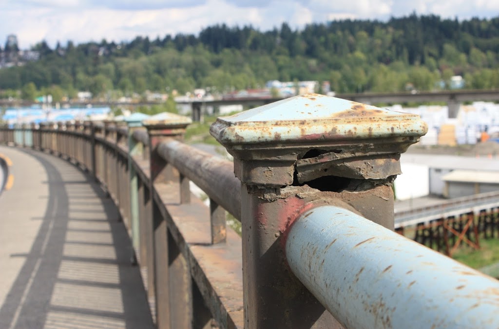
The opinion part is when you walk along that bridge and try to find evidence anyone had opened a bucket of paint anywhere near the bridge in the last three years. The storm grates are plugged with sand, there are birds nesting and plants growing in the steel superstructure.
The fact part is going back through TransLinks public financial documents and trying to identify the $3Million. It just isn’t there. The total costs for bridge operations and maintenance last year was under $300,000, and that is combined for all three bridges. The average over the last couple of years has been $1.2Million a year. I don’t know what they spend, but it is not $3 Million.
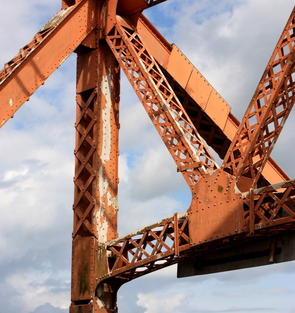
And this is an important point. The Pattullo Bridge is an old steel structure. Like other old steel structures: the Lions Gate Bridge (75 years); the Golden Gate Bridge (75 years); the Empire State Building (80 years); the Eiffel Tower (122 years); my Honda Civic (15 years), old steel structures require maintenance to be reliable. They can last forever if appropriately cared for, but will turn to dust in an instant if neglected.
But instead of addressing the issues with the existing bridge, TransLink has decided instead to build a new bridge, and a bigger one.
Now a bigger bridge is an easy sell to people on both sides of the river caught in traffic:
“Whoo hoo! New lanes! The end of congestion! No more mention of the Pattullo in the traffic report- freedom!”
But remember those numbers? 50% more cars. 100% more trucks.
Now, I’m a geologist, which is science code for “I failed Calculus”, but this is not difficult math. 50% more lanes with more than 50% more traffic is not less congestion. It is the same number of cars per lane, the same number of cars per hour in each lane. Just more lanes and more cars.
So what happens when those 50% more cars and 100% more trucks get dropped on New Westminster’s old streets, already stressed by 400,000+ through-drivers every day?
How will 50% more cars and 100% more trucks fix the situation at Front and Columbia? At Columbia and Brunette? On Royal Avenue? On Stewardson?
I’d like to stand here and tell you we need a bigger vision – a longer term plan. But I can’t say we need these things, because we already have them!
The City has its existing Master Transportation Plan, and is updating it currently. TransLink has a long-term regional transportation plan called Transport 2040. MetroVancouver has a Regional Growth Strategy, built on the old Liveable Region Strategy.
All of these documents say the same thing:
The future is in compact urban centres, in smart density, in transit-oriented development, in moving living and work spaces nearer together, in providing people options to use transit, to bike, to walk. The future relies on us ending the dependence on automobiles. Not ending cars, ending the dependency on cars, through an integrated transportation network that supports all users and provides choice. A sustainable region will be the one where sustainable transportation choices are available and supported through sustainable development practices.
And we are building this future today. Look at Downtown New Westminster. Look at Sapperton. These strategies are being built into New Westminster.
You may not realize, New Westminster is second only to the City of Vancouver for our “Alternative Mode Share” – the proportion of our population who use transit, bikes, or walking for their commuting and shopping trips. We are approaching Transport 2040 goals faster than any other City. We will be the densest City in MetroVancouver by 2041- we are leading the way on the regional planning goals. New Westminster is the target other Cities are striving towards, even as we move forward.
So why jab a 6-Lane Freeway-style bridge into the middle of that progress?
How does that serve our long term plan, or the regional long term plans?
Whose long term plan does it serve?
I have an alternative approach (warning: lots of opinion ahead).
First- to TransLink. Please give the City and the region a real consultation on this. Don’t come to the first community open house with a bowl of spaghetti and ask us what flavour of sauce we prefer. Even Anton’s lets you choose the noodle first.
Let’s discuss the local and regional impacts of a 6-lane bridge; of a 4-lane bridge; or of no bridge at all.
Some have suggested the solution is to move the bridge, upstream to Sapperton Bar and Coquitlam, or downstream to Tree Island and Burnaby. I’m not personally a big fan of this argument, as it stinks of nimbyism, and if this bridge is a bad idea for New West, it is probably just as bad an idea for Coquitlam. But hey, show me the business case, and I’m ready to be convinced.
How about an evaluation of this approach: what I like to call the Lions Gate Solution.
The Lions Gate Bridge is an interesting parallel. The bridge is the same age, and had the same problem. In the late 90’s, the old steel structure was falling apart and it needed replacement.
The public consultation process started with a public call for proposals, and evaluated a suite of solutions- replacement, twinning, refurbishment, tunnels…
Here is the first lesson for TransLink, the public consultation process lasted 3 years. They even opened an office on Denman Street that operated for two years, so people could come down, look at the proposals, learn about the strengths and weaknesses.
It is a long story, and a great thesis was written at SFU on the topic, but the short version is that the West End of Vancouver and West Van would not accept increased traffic. No-one wanted a major shift in the Stanley Park Causeway. North Shore commuters would not agree to tolls. No PPP partner could be found to expand the bridge to 4 lanes (the preferred approach) so the Provincial government spent $80 Million refitting the bridge, starting in 2001.
$80 million, replaced structural components to increase the load capacity, seismic upgrade, replaced the entire deck, and kept the same number of lanes.
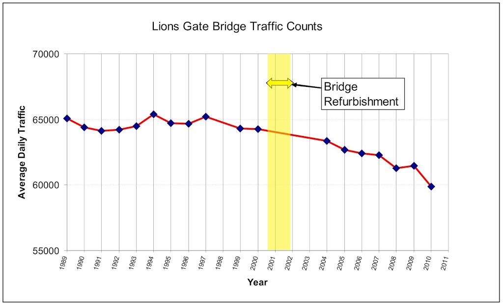
This is the only graph I will show, because I want you to know this is not my opinion, these are real numbers from the Ministry of Transportation (from Here, Here, and Here.)
During the consultations for the Lions gate, they looked at tunnels, twinning replacement, because they were certain they needed more lanes. The argument looks pretty familiar: “Traffic is coming, it will grow, it always does, so we need to build a bigger bridge, here is our chance”.
They got three lanes, and this graph shows what happened to the traffic.
Over the same period, 22% population Growth in Vancouver (more on the downtown peninsula), 125 growth on the North Shore, Combined jobs growth over 18%. Housing prices are up, employment is up, every indication is robust economic growth, even through an earth-shattering recession. Where did the inevitable traffic go?
Maybe it is magic. Or maybe it is the Plan.
OK, Back to opinion:
Good enough for Lions Gate its good enough for Pattullo.
Good enough for West Vancouver, good enough for New Westminster.
So I am suggesting we fix it. Let’s spend the $200 Million fixing the Pattullo Bridge, and the $3 Million needed to maintain an old steel structure. We will still be $800 million ahead. That money TransLink can use to give Diane Watts and Surrey the transit system they want and need. I don’t care if it is light rail, heavy rail, SkyTrain, street cars, fast busses, or jetpacks. Let them build the transit sytem of their dreams with an $800 million blank cheque.
Because every person South of the Fraser who is on transit is one less car driving through New West.
Let’s fix the historic, iconic, non-killer, repairable, and affordable Pattullo.