Ask Pat: Encapsulation

TJ Sport asks—

Hi Pat, great blog.

From researching the OCP and Downtown Community Plan it looks like Front Street generates a lot of noise pollution and significantly reduces the air quality for residents due to the freight trains and trucks that use it. There have been talks of eventually encapsulating the train tracks and Front Street and even the zoning bylaws or OCP states the buildings should be compatible with encapsulation. Toronto looks to be doing something similar and placing a park on top.

I realize that encapsulating tracks and Front Street will be very expensive and is likely decades away (Frankly I’m skeptical that it’ll happen in the next 25 years) Any idea what the City has in terms of timeline, vision and potential land use on top of the structure? If the idea is dead in the water/a pipe dream/no longer part of the City’s vision what are the City’s plans to address the safety, noise, and pollution in the downtown area?

Short answer is the idea is no longer part of the City’s vision for the waterfront.

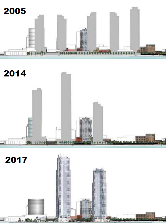
Over many decades, there were various vague plans to build over the rail lines on the waterfront and/or Front Street. I’m not sure when this idea was first floated, but with the de-industrialization of the port and re-imagining of the entire downtown waterfront and Quayside starting in the 1980s, a lot of visions came and were either realized or went away when a new vision came along. Looking through old City planning documents from the last half of the Twentieth Century, you can see some of the encapsulation schemes that were sketched up. Some frankly fanciful.

It was never (to my knowledge) costed, and it was not clear who would pay the monumental cost. Its also not clear if the railways would agree to encapsulation or if the Ministry of Transportation would agree to a regional truck route that did not permit hazardous materials (because they are not allowed in tunnels). I don’t think anyone was concerned about what happened to the businesses and historic buildings that face Front Street. The vision seemed to rely on the entire waterfront, from the River Market to the Pattullo Bridge, being converted to residential towers, at least a dozen of them. These were pencil-sketch concepts, and I’m not sure there was ever a real understanding how to get there.

As recently as 2010, the conceptual idea was still bouncing around, as it worked its way into the Downtown Neighbourhood Plan – the planning document that serves as the Official Community Plan for the area below Royal Ave. When the new OCP was adopted in 2017, the Downtown Community Plan was included as an Appendix – as placeholder until a new Downtown Plan was developed. And it included this:

Since then, events have unfolded, and these became the proverbial best laid plans. I would suggest the one event that was more significant than any other was the demise of the North Fraser Perimeter Road (NFPR).

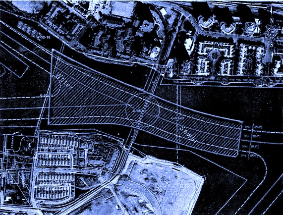
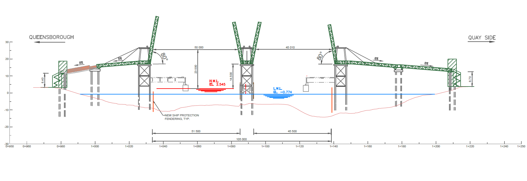
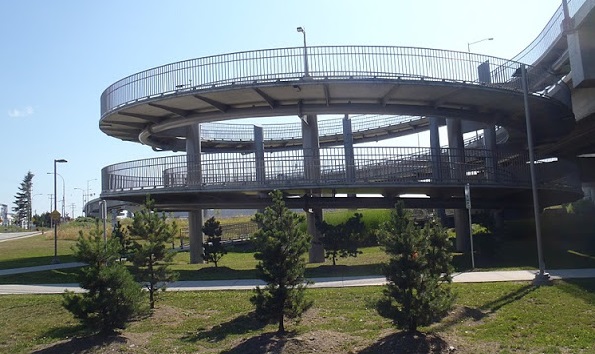
To understand the encapsulation idea, we need to understand the NFPR. There was a vision around the Turn of the Century (can you believe that phrase applies to 20 years ago!?) to shift more of the riverfront landscape of the Lower Mainland to “goods movement”. The so-called Gateway Program  required the building of two limited-access high speed freeways, presumably to service trucks, but open to all traffic on either shore of the river. The South Fraser Perimeter Road was built, the NFPR was not. Primarily because of the horrifying impact on New Westminster.

The vision for the NFPR was 4 lanes, limited access, from a new expanded Brunette Interchange to the Queensborough Bridge connecting east and west to (not really clear). This may not sound so bad if the road is encapsulated from Elliot Street to Third Ave as suggested in the clip above (requiring, I note, the longest road tunnel in Canada), but what about east and west of there? There also existed the not-insignificant problem of pinch points like the historic Station building (Kelly O’Bryan’s) and interface with the SkyTrain guideway. Between the (federally regulated and not going anywhere) rail lines and other not-easy-to-move infrastructure, there simply wasn’t room for four lanes of traffic, buried or otherwise.

And there was the wider context of what it means to our community. If encapsulation addresses noise and fumes downtown, the NFPR only increases noise and fumes in Sapperton, in Fraserview, in the West End. And as more lanes always induce traffic, the knock-off traffic impacts on our surface roads would, if every other example in the history of building roads in cities has demonstrated anything, destroy the livability of many parts of the community within the noise-and-exhaust shed of the NFPR itself. Don’t get me talking about the Braess Paradox and Induced Demand.

The NFPR was a bad idea, and needed to be killed. It was killed in 2011 when TransLink proposed spending a couple of hundred million dollars on a key eastern connection to United Boulevard, and the community recognized it for the community-destroying freeway plan it was. I am really proud of the community who stood up to stop it, and the Council of the time (long before I was elected) that made it clear to senior governments that this was not on. We literally saved the City back in 2011, and TransLink went on to fund better things, like MOAR SKYTRAIN.

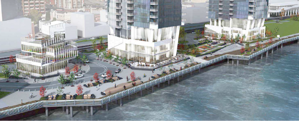
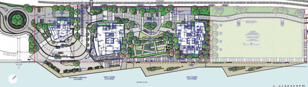
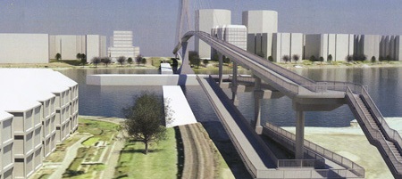
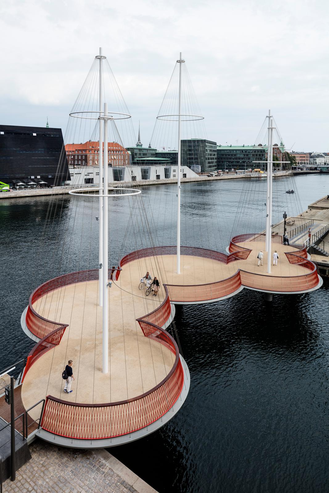
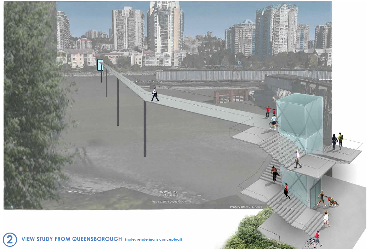
So without the NFPR, a different set of decisions had to be made. When it came time to invest in maintenance and upgrades to the Front Street Parkade, the lack of an NFPR meant we were able to right-size the structure by removing the older half of it, daylight some business fronts, and create a new public space. When the design for the Larco Parking Lot (now Pier West by Bosa) was being re-evaluated, we no longer wanted or needed an elevated podium cutting people off from the River, and were able to leverage another couple of acres of public park space for the Downtown. As we adopted whistle cessation downtown, as we design a new accessible pedestrian overpass to Pier Park, as we look at upgrades to the McInnis Overpass, as we plan greenway improvements along Stewardson, etc. etc., it is about planning for something that fits our community needs and connects our community better, not accommodating 4 lanes of high-speed truck traffic to slice our community in half, using an unbudgeted, difficult-to-realize, and half baked encapsulation idea to soften the blow.

The language in the Downtown Neighbourhood Plan has not been updated to reflect this change, but the planning we are doing around downtown certainly has. For the better.

Ask Pat: Ferry & Fixed Link

John asked—

Hi, Pat. I have read everything on your blog over the years, and support all of your ideas for a more equitable/human distribution of public spaces. Now that the pandemic has shown how fragile the Q2Q link is, I must ask if the idea of a fixed pedestrian bridge has been re-opened. I know that there were legal concerns regarding use of the existing rail link as an affordable solution, but, is it just possible that there may be a change of heart in that direction?

It’s not really a change in heart, because it wasn’t heart that prevented the bridge from being built.

I agree that the COVID situation caused us reflect over what the QtoQ ferry is meant to be, and how we value its operation. This conversation was a frequent one during the use restrictions, and is an ongoing source of angst in the Queensborough community. Recently, I was part of a Queensborough Residents association meeting with MP Julian, MLA Singh and School Board Chair Dhaliwal where this discussion came up again, and I thought to myself “Self, you have that Ask Pat just sitting there, you ever going to write an answer?”
Sorry it took so long.

The story of the fixed pedestrian bridge has not changed much since I wrote this long explanation of the pitfalls of the project, and the same problems remain. There is still some unspent DAC funding (although the Casino being closed for two years may impact that), but nowhere near enough to build the project. The engineering challenge of building it high enough for the Port Authority to permit it, yet keeping it accessible (i.e. less than 5% grades) remain problematic. The use of a swing or bascule bridge significantly increases build and operational cost (including, most likely, full time staffing).

The issues with using the existing train bridge are not just legal. Naturally, the Houston-based owner of the railway is reluctant to take on the liability of having a large piece of pedestrian infrastructure they don’t own attached to their bridge, but that could be overcome with insurance and agreements. There is a question of how to attach a pedestrian sidewalk to a 105-year-old bridge, but I think engineers could come up with something that works. The real problem is that the existing train bridge, with only a few metres of clearance over the river, has a default setting of “open” for boats to pass through, and only “closed” when a train passes, which is on the order of once a day. This would not work for a pedestrian link, for obvious reasons. The Port will not permit the change of operation of the bridge to default “closed” (permitting pedestrian crossings) with limited “openings” when a boat passes, for a number of reasons, including the increased collision risk on the river.

A pedestrian bridge can’t work like the existing train bridge – it must be much higher above the river, unless the Port and Marine Carriers can be convinced to change their regulatory requirements. There is nothing in it for the federally-regulated Port or Marine Carriers to agree to this. Our problems are not their problems, and they have authority.

That said, this still needs to be our medium- or long-term vision. Increasingly, our communities (not just New West, but every community on the River and marine coast) is seeing the waterfront as a place for people, not just a place for industrial activity. And as I have lamented in the past, too much of this prime riverfront industrial land us being used for industrial activities that in no way connect to the river. So building a fixed crossing is going to take more than money and vision, it is going to take partnerships across the region to help pay for it, and to shift the mindset about the River as a transportation challenge.

So, in the meantime we have the QtoQ Ferry.

Which brought us to the conversation through COVID times about how far the City was willing to go to support this service. The early response was to suspend the service for two reasons. Much like the Library, we did not know if we could operate safely and within unclear provincial health restrictions. And much like the Canada Games Pool, we simply couldn’t justify spending money on running it with the very low number of people who were going to show up to use it, as other transportation modes (transit and cars) shut down suddenly. Eventually, the health restriction issues were worked out (with protocols and reduced capacity), but the ridership was slow to come back, which led to, what I think, was a really healthy discussion at Council.

The essence of the discussion was (to me, at least, I shouldn’t talk for all of Council) whether the QtoQ was a vital transportation link or a nice to have community amenity. In my mind, if it was the latter, then I was not interested in us funding it at a time when our finances were so uncertain and the priorities were piling up in COVID response. However, as I was convinced we needed to see it as the former, it only became a discussion of how much we can afford to fund. A few adjustments of schedule were made, as people’s commuting patterns were shifted by the pandemic, and the service that worked best before was probably not the service we needed after.

The QtoQ is never going to pay for itself in its current format. The small ($2) fee to ride it does recover some money, but much like the Canada Games Pool or the Queens Park Arena (or Public Transit, for a regional comparator), the QtoQ is a community benefit we have decided to invest in, and we spend some of your property taxes running it.

If you value it, the second best thing you can do is let Council know. The best thing you can do is take the Ferry as often as you can and put your $2 down to show this transportation link is valuable. Demonstrating to partners (TransLink, Metro Vancouver, Port of Vancouver, senior Governments) that a link here is valued by the residents and helps with regional active transport network is the best way to build on the service to make it more financially secure, and to demonstrate that the fixed link deserves to be built.

Ask Pat: 660 Quayside

Back from vacation, refreshed and ready to rock 2019, and no better start than banging off a couple of Ask Pats!

Jeff asks—

How long will the Waterfront detour at 660 Quayside be in place? For the entire duration of the build or are they getting the Waterfront walkway done before the full project gets underway? More importantly, where could I find this information? I see a lot of info online regarding the 660 Quayside project, but nothing about the required closures / detours.

The project at 660 Quayside, known as Pier West, is going to be a big, disruptive construction project. There is no way around that. Everything I write below is based on my current understanding of the project plan, but need to add the caveat that any construction project at this scale will no doubt see some changes and adjustments as they go along. The reality is that there will be a variety of factors (ground conditions, the regional building market, unknown unknowns, etc.) that will impact any timelines being proposed so early in the process. And quite often a lone City Councillor is the last to find out about things like this.

What I do know is that the developer agreed to delay the start of the project and adjust their construction staging to better accommodate the needs of the community, both by delaying the closing of their existing parking lot until the River Sky project has an operating public parking lot, and by adjusting how they do their major dig so that the inevitable closure of the railway crossing at Begbie Street is as short as possible.

There is some good news here. When this project is complete, it is going to be transformative for our Riverfront. What is now a pretty scrubby parking lot will become a newly-designed and better working Quayside Drive, two residential buildings and a daycare/commercial building, a completed waterfront boardwalk/esplanade connecting Pier Park to the River Market, 2 acres of new public greenspace expanding Pier Park to the west, and a new accessible pedestrian/cyclist overpass from the Parkade at 6th Street over to the expanded park. There will be a few surface parking spots around the base of the new buildings, but the bulk of the parking will be below grade (including something like 80 public parking spots), assuring that views of the Riverfront from Front Street and the intersections at Columbia are improved over now – we have avoided a big above-ground parking pedestal that can overwhelm public spaces. I think the project is going to be a great addition to the City’s Riverfront.

Between then and now, however, the entire 3.5 acre site is going to need to be excavated. Dug up, fill and contaminated soil removed, shored and sealed, and underground parking and mechanical spaces built. There is no way around the need to build a “bathtub” to accommodate the new landscape and underground parking. To make the situation worse, a big section of Quayside Drive that connect the River Market area to Begbie Street does not belong to the City (it has belonged to the owners of 660 Quayside for as long as anyone can remember, with the City has operated the road on a right-of-way). That area is going to be dug up to re-align the streets and build access to underground public parking. There no way to do this that isn’t disruptive, but the disruption will result in a great Riverfront improvement.

With that background, we can get to the essence of your question. The agreement the City has with the developer is that access to the west end of the existing Pier Park needs to be maintained. Until the Sixth Street overpass is built, that means that some form of pedestrian walkway needs to be maintained from Begbie Street. As installing sheet piles secant piles along the waterfront is an early part of the project, the access is not likely to be along the waterfront, but through the parking lot as it is now. Once the overpass is built and the bigger dig begins, you will need to cross at the Begbie intersection, go along Front or Columbia Street to access the Pier Park via the new overpass. How long this type of diversion will be in place is not an answer I have for you right now, but expect it to be for more than a year.

Secant piles being installed today. These are going to keep the underground garage and the river from interacting.

I suspect as the project moves along I will be able to give some better answers to some of these questions. Right now, the buildings are approved as far as zoning, and they have a partial building permit for the shoring and piling work currently happening (you can track this kind of stuff on the City’s “Projects on the Go” page) but a lot of the other details around the construction are still being worked out. Any kind of work like this that includes the River will trigger a bunch of Federal and Provincial environmental hoops for the builders to get over, work on the overpass and intersection means the Railways are going to be involved, and of course there will be legal agreements around rights of way and access relating to the redesign of the Begbie Street and Quayside Drive intersection. The developer has, up to now, shown a great deal of patience and willingness to work with the community (including the River Market, who are being impacted the most here), and I think that, in recognition of the high level of disruption this project may cause, Council will have reason to be kept more aware of progress than with a typical building project.

I don’t have a site contact yet, but once the project begins in earnest, I expect that there will be a person at the construction company who will be able to answer inquiries from the public. In the meantime, best to send specific requests to our planning department at the City (follow this link for the contact info)

Ask Pat: Q2Q Ferry

I am a little behind on my Ask Pats, I apologize. there are a few in the queue, but work, life, and an amazing array of community events have kept me away from the computer keyboard. I’ll try to catch up.

BoatRidesAreFun asks—

Hi Pat,

Any updates on the Q2Q ferry that was supposed to open July 1? I haven’t seen anything happening at either of the docks.

The ferry has been a challenge. This is one of those times I am glad I am an Elected Type setting unreasonable expectations for staff, and not City Staff trying to meet the unreasonable expectations of the elected types!

The good news is the the trial is ready to go, and will be starting this weekend. The Ferry will run on weekends and holiday Mondays in August and September from 9:00am to 7:00pm, and from 5:00pm to 9:00pm every Friday in August. It will run every 20 minutes, and will cost a Loonie or a Twoonie. The route will be from the Quay (near the Inn) to the public dock on the south side of Port Royal. The bad news is that the limitations of the project as a “pilot” will mean it falls short of some expectations, and that could benefit from some background explanation, so I am glad you asked.

Running a passenger ferry turns out to be a much more complicated process than you may think. You need a boat and operator, you need (at least) two places for it to dock, and you need permission from several different agencies responsible for keeping people from drowning as a result of poor planning.

The first issue was surprisingly hard to solve. The Fraser River is a dynamic, working waterway. There are tides reaching 9 feet in range, and tidal and river currents that flow in different directions up to 10 knots. These currents shift lots of hazardous debris like large logs. There are also tugs, barges, and large ships moving around the river. The little tubs used to shuffle tourists around the relatively safe tidewater of False Creek were not going to work on the Fraser. Something more skookum (to use the nautical term) was required. The more requirements the City put on a boat (number of passengers, weather protection, accessibility, room for bicycles, operating cost), the more limited the number of available boats just sitting round BC waiting for hire.

Then we need two places to dock the boat. Installing a new dock facility in tidewater in Canada is not a simple process, as it activates everyone from the local Port Authority to the Marine Carriers and environmental agencies including the Department of Fisheries and Oceans. For a short-term trial, the City really needed to find already-existing docks.

Ferry_Map(1)

The public dock at Port Royal was there and available, but designed for small pleasure craft, not to accommodate a passenger ferry. Significant changes would intrude into water lots owned by Port Metro Vancouver, who were helpful and accommodating, but had their own safety and operational concerns that had to be addressed. On the Quay side, the only functional docks are operated by the Inn at the Quay (where the paddlewheeler tours launch from) and the industrial dock operated my Smit. Again, both had challenges with accommodating their established operations with a new every-20-minutes group of passengers, many of whom are not that accustomed to walking around industrial marine operations, and who will create no end of hassles if they fall into the drink and get dragged downstream. Again, a deal was worked out and operational concerns managed.

At this point, City Staff need to be acknowledged for managing a significant number of potential game-stoppers here, but in the compromises required to make this work are the inherent flaws in the final plan. During this summer, we are going to have the trial ferry service that was possible, not necessarily the one we want.

When I think about connecting the Quay to Queensborough, I am not thinking of it as a tourist draw or a piece of recreation programming, I am thinking of it as a vital transportation link. To be such a link, it need to be reliable, available for daily users, and fully accessible. The trial ferry is going to fall short of this. The high tide range and reliance on existing dock infrastructure means it will not be fully accessible to those with some mobility challenges at all tide stages. Running the ferry only on weekends with limited hours means it will not be useful for work commuters wanting to get from Port Royal to Downtown or Skytrain. The limited hours will further cause people crossing the river for diner and a drink to look closely at their watches while waiting for the bill to arrive. The City recognizes these limitations, but also recognizes the value of getting this project running to see how the public reacts.

In the end, I hope people will appreciate this is a test-of-concept trial, and not the ultimate solution to connecting Queensborough to the Quay. Its successes may be limited, but there has already been a lot learned by the City just in setting up the service, and there will be much learned during its limited run, both in it’s success and where it falls short of expectations. I hope that people on both sides of the North Arm will come out to support this pilot, and provide your constructive feedback to the City, so that we have useful info to inform planning for a more permanent solution.

53 Stories.

What is arguably the highest-profile development proposal in my time on Council was given a development variance by Council last week. Bosa Development (not to be confused with Bosa Properties who are building the nearby River Sky. These are two separate companies) plans to fill the parking lot between the Fraser River Discovery Centre and Westminster Pier Park with two residential towers and a 3-story commercial building, while dedicating a bunch of the space to expansion of public park space on the waterfront. The big news seems to be the 53-story height of the tallest building, but there is (as always) much more to the story. As there is a bit of uninformed chatter in the community about this development, it is worth me going through my impressions about this variance, and how I made my decision on which way to vote.

The background for this development pre-dates my time on Council. Back in the early 2000s , this site was zoned for 5 towers and 1,000 residential units to be built upon a multi-story parking pedestal. As the Downtown Community Plan changed and North Fraser Perimeter Road was shelved, this model of an elevated parking pedestal no longer met the vision of the City to connect the waterfront to Downtown and keep it public space. The previous Council worked with the owner of the time (Larco Properties) to re-imagine the space so that parking could be placed below grade, the number of towers could be reduced to three, and the number of residential units reduced to 820. After a Public Hearing on September 29, 2014, that rezoning was adopted by the City in November, 2014, just before the last Municipal elections.

The process that occurred over the last year was not a rezoning. The owner of the land has the right under existing zoning to build that 3-tower 820-unit development. However, for reasons that no doubt result from serious number-crunching at Bosa, they requested to change this project footprint from three towers to two, and to reduce the number of residential units to 665. They still committed to giving the City about two acres of public park and to build the full allotment of parking (mostly under grade except for 20 surface spots). They are now committed to meet and exceed the City’s Family Friendly Housing Policy by building mostly 2- and 3-bedroom units. To do this, they want to make the two towers larger than those proposed in 2014, and they re-designed the landscaping to move the towers out of direct line of existing towers on Columbia Street, and to better accommodate rail setbacks and traffic flow through the site, and to build a 9m-wide boardwalk across the riverfront. These changes did not require rezoning (the FSR has not increased, and the number of units has gone down), but variances of the development permits.

bosa4

It is important to emphasize that: the decision Council had before it was to grant the variances or not, we were not deciding whether buildings could be built on the site or not. The developer had their zoning in hand, and could have proceeded with the 2014 plan; Council had to decide if the 2017 plan was a better one for the City.

The public consultation and delegations to Council brought forward a few concerns, which create a good framework to answer that question:

Too much density: This general concern was that this project brought too many people or too much traffic to downtown. As previously described, the variance actually reduces the number of units in the development by 20%. If density is your concern, the variances are your friend. Building density within a 5-miunte walk of two SkyTrain stations is completely consistent with our City’s pending OCP, with the Regional Growth Strategy, and with our larger regional desire to manage automobile traffic by providing people better access to alternatives – the opportunity to live, work, play and learn within a short walk of major transit infrastructure.

What about our views?: Every building in downtown blocks someone else’s view of the river, and this is simply the easternmost development of a line of buildings stretching along the Quayside. However, this variance shifts from 3 towers 34m apart to two towers 50m apart, which opens up more view corridors and reduces the blockage of river views from existing buildings.

53 Stories is just too big: Indeed, this will be the tallest building in New Westminster (although similar-sized buildings are currently being planned or built in Burnaby, Vancouver, Coquitlam – essentially anywhere SkyTrain exists), however the variance only increases the height of the tallest building by 6 stories, from 47 to 53 stories. I have consistently said that the real impact of new buildings in the City is felt in the bottom three stories – how the building footprint improves the streetscape – and not at the elevation of the penthouse. One need look no further than Plaza 88 to see that the streetscape impacts are much more important than the ultimate height

bosa3

The FSR of this development is not increasing, and the buildings have relatively small footprints. By shifting the locations of these buildings on the lot (as done on the variance), there is better flow-through of the site and the vehicle access to the buildings is separated from the boardwalk. In my opinion, we get a better layout of the site for the public, in exchange for a relatively modest increase in height.

bosa1

What can the city get out of this?: We get two residential buildings bringing residents, customers for the local businesses, and a financially viable development on a piece of land that has sat empty for more than 20 years. The City will get 2 acres of public park space, a re-aligned Begbie Street intersection built to maintain whistle cessation, a second access to Pier Park spanning the rail tracks at the foot of 6th street, a 40-child day care space in the third commercial building, 80 public parking spaces underground, new restaurant spaces, and a re-aligned 9m-wide boardwalk along the waterfront. This will be a phenomenal addition to our Riverfront once it is built.

However, there is something else that came out of the public consultations around this variance that speaks positively towards the development. The construction was originally envisioned to start this fall and result in a closure of the Begbie St rail crossing for up to 18 months. This shocked and concerned local businesses, especially at the River Market, as they are already feeling the pressure of the River Sky construction. After meeting with River Market owners and the Downtown BIA, Bosa agreed to delay the start of construction until after the RiverSky development makes its public parking available to guests of the River Market and adjacent businesses. They also adjusted the construction plan so that the (absolutely necessary) closure of Begbie would only be for a few weeks. The willingness of the developer to delay and adjust their construction schedule like this cannot be emphasized enough – these are real costs the developer is bearing for the benefit of the businesses and citizens of downtown New West.

The use of secant piles instead of steel pile walls and a commitment to using vibratory hammer driving of building piles will reduce construction noise and vibration by about 50% compared to RiverSky. This is also an increased cost the developer is bearing to the benefit of the community.

In summary? Yes, 53 stories is tall, but the density is within the existing plan, and the ground level amenities (and demonstrated will of the developer to be a good neighbour to existing residents and businesses) made this variance easy for me to approve. In my opinion, the changes that made the variances necessary make this a better development overall.

Ask Pat: The Sub

Eric asks—

Ahoy Capt. Re: Das Sub

Great the Quayside playground is up for a needed rebuild. Has “what do we do with the submarine” come up?

After all this item has quietly slipped into historic artefact/ community heritage resource status.

We all know it came from Expo ’86. What might not be as well known: it was from a West Edmonton Mall attraction (at the time the mall had more working subs than the Cdn. navy); at Expo it was part of the brilliant public art piece Highway ’86 by James Wise of SITE, a cutting edge design firm all us young architects were in awe of.

The sub was the largest of dozens of transportation, including a tricycle and an aeroplane, all painted matte grey and set on an undulating grey asphalt “road”.

How about we hand the sub over to the Public Art Cttee. to reprise/resurface it in a new location? Our local transpo crowd – including a certain councillor- might get right into it.

Yes, the topic of saving or moving the semi-Sub has come up. Staff have even spent a bit of time looking at potential options. However, at the risk of sounding like a boo-bird, I need to point out some of the significant technical challenges staff have related to me about trying to save and/or move the Sub.

The Sub can’t stay where it is. The storm drainage pipe under it needs to be excavated and replaced, that is not an optional thing, but something the City needs to get done before compete failure of the pipe and related flooding. Try trying to remove the sub in one piece presents several challenges (not to mention the unknown unknowns, to borrow a phrase). It will need to be separated from the foundation built to support it, and the entire concrete-over-steel structure would have to be lifted and moved, which if not done with great care (read: expense) may end the entire “in one piece” part of the discussion.

20170308_112210(0)

The Submarine itself would need extensive restoration if it was to be made a permanent art installation, as the steel is not in great shape based on the concrete delamination and spalling – the piece was built for a 6-month installation 30 years ago. The modifications of it to install it in the park (removal of the wings, installation of the railing) probably didn’t help, nor did the various coats of paint that are now peeling off of, regardless is whether the concrete overcoast comes with it or not. We currently have no budget for, and have not even had evaluated, the form of this restoration, however safe to say it will be significant.

We have nowhere to put the submarine. If we remove it, we would need to find a place to store it where it can be protected from the elements, and where restoration work can happen. Unless a generous benefactor with spare warehouse space was to come along, I’m not sure where we can do this.

Finally, and this is, unfortunately, the biggest issue with all of the above – we have very little time to get the pipe replacement work done. As much of the drainage involves an excavation within the wetted area of the river, the work needs to be done within a “fisheries window” – a short period of time when Fisheries and Oceans Canada have given us permission to do the work in order to minimize the disruption of fisheries habitat and the injury of fish. Again, this is not something we have any control over, and that is creating a very, very tight timeline for the work, and it will be starting very soon. An extra week or two to design, coordinate and execute a potentially delicate removal plan for a piece we have no long-term plans for would be perilous. Never mind trying to find the (estimated – with significant contingency) tens of thousands of dollars to do the removal work.

As for the Heritage value, there already was a preliminary assessment of the Sub. The value is considered very limited and “sentimental”, but not representing a significant heritage artifact. Its provenance is not New Westminster, and it is separated from its context. Although there are legends about a connection to West Edmonton Mall, in reality the submarine was the only machine of the 200 that made up the Highway 86 installation that wasn’t a real, operating machine before it was installed. It is a semi-sub; half of a fake boat. The “U” in this U-boat stands for “Unecht”. You get the message.

That said, on kitsch value alone I’m not opposed to the idea, and wish we had more time to allow someone passionate about such a plan to cook up a solution to the above concerns. Problem is, this project has been discussed and on the books for many months (including a few public consultation rounds and public meetings), and the topic of saving the submarine has not been put forward as an important component of the engineering work or playground replacement. I also touched bases with a few people in the Publci Art realm, and they were… underwhelmed. Unfortunately, we are now well past the eleventh hour, and jeopardizing the timeline and budget of the planned work for the site at this point would be irresponsible.

So in sumary, I’m going to suggest this is an interesting idea, likely impractical, definitely costly, and probably undoable considering the pressures on the City to get the engineering work at the Quayside done. I would suggest the submarine is finally heasded off towards the sunny horizon it has pointed at for more than a generaiton: the metal recycling and junkyards south of the Fraser.

20170308_112433

Ask Pat: Whistle cessation update.

I’ve been a little behind on my “Ask Pat” responses. There are a few questions on different aspects of the Whistle Cessation theme, so I’ll cover them all with my answer to this one:

J.S. asked—

RE: new westminster train whistle cessation

I do not understand this project. There is a law saying train has to sound its horn at every crossing. Is there a law require it to be so loud that the entire town can hear it? Instead of throwing money on all these cessation projects which seem to be going nowhere, can’t train horn simply be modified so it is less aloud like a car horn or even a bell? Canadian train travels slower than a car. And I believe the law meant for it to be heard at that intersection only.

Yes, that would make total sense, but the answer to your first question is a completely absurd “yes”.

Train horns are designed to call attention to a train approaching a lonely rural road on the Canadian Shield at 80km/h, and therefore blow at something exceeding 100db for a regulatory more-than-20-seconds-for-every-crossing. That might make sense on a snowy rural crossing 100 miles east of Thunder Bay, but in the middle of a busy urban area the volume of the horns is clearly absurd. Especially then the crossing already has gates, bells, flashing lights, and the train is rolling along at 20km/h with a gigantic diesel engine chugging away at the front of it.

But the Railway Safety Act has a tendency to err on the side of caution, probably for good historic reasons. So we are stuck with this absurdity.

I would normally say “call your MP”, except that I know your MP has been working on rail interface issues for years, and has been stonewalled by successive governments and the simple intractability of trying to get the rail industry to behave as a good neighbour in urban areas. There is a bunch of long history here, related to the railways that built the Nation thinking and such, which was at one time, when railways were part of the National Enterprise, compelling, but now seem so much hollower now that the rail companies are just another multinational corporation charged with the holy duty of returning shareholder value… but I digress.

The City is, as you may have heard, working on bringing “Whistle Cessation” to our level crossings. This requires a significant amount of safety engineering, most of it patently absurd, to provide redundant safety measures enough that the Act and the railway operators are satisfied that absent-minded pedestrians and drivers won’t physically be able to wander into the path of a train. The City needs to pay for these works, and the rail companies that own the crossings both have to approve them, then decide (after the work is done, natch) if it now constitutes adequate protection to no longer require every person in a 5km radius to be alerted of the trains’ presence.

The works in New West have been painfully slow. There were a few engineering challenges, including the need to order some special equipment that could only be provided by a supplier approved by a railway. The multiple steps of design, pre-approval, engineering drawings, waiting for clearance, approvals to work in the right of way, waiting for the rail company to do the bits only they are authorized to do, getting authorization to do the bits we are authorized to do… it was painful.

However, I am happy to announce that the City has officially notified all of the stakeholders who need to be informed* that the City will officially request that Whistle Cessation be brought into effect for the two Front Street crossings through a resolution at Council scheduled for February 6th, 2017.

There are also three level crossings in Sapperton, and I have no idea when whistle cessation will be brought to those. The engineering requirements as far as sight lines and approach angles for cars under the Skytrain pillars are such that it appears simply impossible to meet any existing regular whistle-free standard. We will try, and new road infrastructure along that corridor will be viewed through a lens of whistle cessation, but barring radical ideas, I’m not making any promises about when that will actually occur.

*The list of Stakeholders who were officially served letters informing them of the City’ intentions for the February 7th meeting included the four rail companies that regularly operate on that line, plus PLM Railcar Management Services (Canada) Ltd.; PROCOR Ltd.; General Electric Railcar Services Corporation; the Canadian Fertilizer Institute; the Canadian Chemical Producers Association; the United Transportation Union; the Transportation Communications International Union Systems Board; UNIFOR; Teamsters Canada Rail Conference; Travailleurs Unis Transport (1843); the Brotherhood of Locomotive Engineers and Trainmen; the United Steel, Paper and Forestry, Rubber, Manufacturing, Energy, Allied Industrial and Service Workers International Union; GATX Rail Canada; Amalgamated Transit Union, Local 279; International Association of Machinists and Aerospace Workers; International Brotherhood of Electrical Workers; and the Propane Gas Association of Canada Inc. Dear God I hope we haven’t missed anyone. It’s absurd.

The Q2Q quandary

No doubt the biggest let-down last Council meeting, indeed the biggest disappointment of my time on Council, was the releasing of the updated projected cost numbers for the Q2Q bridge preferred concept.

A short version of this project is that the City will receive “DAC” funding from casino revenues to spend on a fixed pedestrian link between the Quayside and Queensborough, based on a 2007 agreement between the City and the Province. Based on some very preliminary cost estimating, the project was put in the $10 Million range, so Council placed that amount in the budget to support the project. The idea has seen several rounds of public consultation, with several design concepts sketched out and debated. Ultimately, a design that would be acceptable to the regulatory authority that controls river crossings (i.e. a design that allows safe and unfettered barge traffic) and still allows reliable pedestrian use was developed to the point of doing detailed cost estimating. That cost came back at a little over $39 Million. The City doesn’t have $39 Million, and it is hard, with so many competing capital priorities, to see how we can get $39 Million to make this project work. I’m frustrated and disappointed.

However, regular readers (Hi Mom!) know I rarely stick with the short version, so I thought I would go into a bit more detail about how we got here, and where we may go from here, because I want to slay some of the social-media-derived myths about the project.

This project was not killed by NIMBYs. Over the last 10 years or so, the Q2Q project has gone through several iterations. The DAC agreement was in 2007, but it was always anticipated that the Queensborough Community Centre update, other park improvements in Q’Boro, and the MUCF (now called Anvil Centre) would be the completed before the Q2Q project began. The DAC funding did not arrive as one big cheque in 2007, but is allocated as projects come along, and as casino revenues come in. Q2Q was a little further down the timeline.

During those 10 years, preliminary planning work was done on a few concepts for a “fixed link”. At several times, early concepts with very preliminary sketches were bounced off of Quayside and Queensborough residents. For lack of a better term, these concepts were “focus grouped” to test public reaction and determine what potential concerns residents on either side and other important stakeholders may have. They were also run past pedestrians and cycling advocates (like me) to see if their needs were being met.

Three different “high level” crossings were evaluated about 8 years ago. These would completely span the navigable channel at a height that met regulatory requirements (and therefore be about the same height as the Queensborough Bridge). There were some concerned neighbours about the mass of the structure, and some were concerned about the fate of the “Submarine Park”, but there were also some functional and cost concerns with this early concept.

Cable stayed bridge Option 1, estimated cost $19 million.

At the advice of the Council of the time, staff stepped back a bit to take a look at options that didn’t go so high as to span the navigation channel, and would require a lift, swing, or bascule section to open and allow boat passage. This opened up a large number of potential options, including new alignments. For a variety of technical reasons, a bascule was determined to be the best option for a lightweight span with a limited footprint. This evolved, through a type of value engineering, into a couple of models of twin bascules – one at a moderate height (but requiring elevators to be accessible) and one at a low enough height that grades were accessible (but requiring more opening/closing cycles, due to reduced boat clearance).

These also saw some limited public consultation, and some neighbours expressed some concerns about the location of one of the “elevator” options. However, Council felt we had enough information to do a more detailed cost analysis of the most practical alternative. That alternative is the one that came back to Council with the $39 Million price tag. The concerns of neighbours were part of the considerations, but the $39 Million was the deciding factor.

Cost estimates are necessarily iterative.
Someone asked me how this project ballooned from $6 million to $39 Million? The simple answer is it didn’t.

The original DAC funding formula envisioned a ~$10.5 Million crossing. I can’t speak to how that number was arrived at (I wasn’t even a local blogger in 2007!) but I can guess it was a simple bit of math: pedestrian bridge, 200m span, look at a couple of recent examples around the country, don’t worry too much about details (the City can always make up a shortfall if needed from their capital budget), and since we aren’t building it for another decade, any estimate we make now is likely to be off anyway. The point wasn’t to plan a bridge at that time, but to earmark parts of this one-time funding source towards worthy projects.

The City then went to work on some of the other DAC projects: the Anvil Centre, the Queensborough Community Centre, and other waterfront improvements in Queensborough. To better make the financing work without having to enter too much long-term debt, they re-allocated some funding between DAC project areas. Consequently, the DAC funds for the Q2Q are now only a little over $6 Million, but another $5 Million in capital reserve funds was earmarked to cover the difference, meaning we still have the ~$11 Million originally earmarked.

As far back as 2009, order-of-magnitude cost estimates for the high-level crossing were in the $15 – $22 Million range. This is when the City went back to the drawing board to see if there were more affordable options, and also started to look around for sponsorship and senior government grant opportunities to see how much of a funding gap could be filled. By 2013, preliminary estimates for the first bascule concept were given as cost of $10.4 Million.

Fast forward to 2016, after Council asked staff to spend a little money on getting some detailed cost estimates on the more refined design, where $11 to $15 Million was still the general thinking, as we became aware of some of the significant engineering challenges. These included the need to install pillars in the river (not just on shore), the barge collision at Queensborough back in 2011 which definitely triggered a closer look at the safety factor for large vessels through the north arm, and the mechanical and operator costs for a bascule bridge. It seemed likely these would offset cost savings that might be realized by not going 22m high and building 1km of ramps. Add a few shifting project priorities as the public consultation and interest in the project increase (Strong enough to carry an ambulance? Wider than 2m for greater pedestrian comfort? Offset to reduce impact on vulnerable riparian habitat on the Q’Boro side?) and things start to add up.

That said, cost estimating for engineering projects is a complicated business, and like most engineering, you get what you pay for. Early estimates were preliminary, in that a lot of the project definition we not yet completed. After working to refine a project enough that we could confidently define important parts of it, Council recently directed staff to get a Class ‘C’ cost estimate, which is considered to be accurate to about 30% variance (i.e., costs are unlikely to be 30% higher or lower than the estimate). We could spend a lot more money to get that estimate down to Class A level, but when the estimate we have is well outside of our affordability range, we need to decide whether the extra design work required would represent money well spent.

I can’t speak too much about the decisions and work done before I was elected, but this webpage has links  to the reports that have come to Council since 2013, where you can (if you care) walk through the public process planning for the Q2Q has been.

q2q5

This project only appears simple
I wrote a blog post a little while ago that talked about some of the complications and compromises required to make this project work, then followed up to answer a few questions, so I don’t want to go through all of that again. This is not a simple project to build, for a variety of reasons, and it is very different than a simple pedestrian overpass. Strapping a sidewalk onto the side of the existing train bridge raised other issues that seemed insurmountable. Many other proposals I have heard (a bridge to Poplar Island then a second to Queensborough, for example – why build one expensive bridge when you can build two at twice the cost?) have also been similarly evaluated, and either didn’t make sense at the time, or had significant issues that seemed to prevent it happening. If it was easy, we would have done it already.

Q2Q is still a good idea!
This is a serious setback, but I want to make it clear that I am still a big supporter of this project concept. A fixed pedestrian link between Quayside and Queensborough makes so much sense at so many levels. It has a certain tourist appeal (especially if you can build something aesthetically pleasing), but it isn’t for tourists. It is to connect people and businesses on both sides of the North Arm better, it is to connect the great pedestrian and bike routes on both sides of the North Arm, it is a vital piece of transportation infrastructure for the people of New Westminster, and for the region.

Is a passenger ferry a good substitute?
No. I do not think a passenger ferry service is a substitute for a fixed link. As a vital piece of transportation infrastructure, a fixed link provides certainty and reliability that a ferry service can’t. I think of it like a bus route (which can always be cut at the whim of a government) compared to a light rail line (which is a fixed asset difficult to remove). There is reason the bus lines running down Hastings have not resulted in the kind of development that the Skytrain running down Lougheed has – the latter is something people can count on still being there and reliable 20 or 30 years down the road – certainty is an incentive to investment. There is also the strange psychology of having to schedule/wait for a ride, vs. just being able to hop on a bike and spin across at the drop of a hat. The former “feels” like a tourist attraction, the latter more like a transportation link.

However, in the meantime, I think it is worth trialing a ferry service to determine the interest, and perhaps to argue the need for a more permanent link. Or maybe (I sincerely hope) the trial will prove my skepticism wrong. These cannot be the little aquabuses that run to Granville Island – currents and logs and heavy industrial traffic mean the Fraser needs a somewhat more robust design. We will need to invest in some dock upgrades and look for a partner to run the show. It is highly unlikely that a ferry can be made accessible for people with mobility issues. However, with luck we can have something running in the late spring.

What now?
To me, the fixed link dream is not dead, but it is definitely suffering a bit. I am hoping for a miracle some really creative thinking to come along that makes the transportation link more accessible and permanent. I am interested in looking at a more stable and reliable ferry option (like a fixed cable ferry), and wouldn’t turn my nose up at urban tramway ideas (could we connect to New West station?), or a pedestrian tunnel as is common in England, and would get us out of our 22m clearance issue. There may even be more efficient and elegant bridge designs that haven’t seen complete costing analysis but may thread the needle between what is acceptable to the river users and what works as urban transportation infrastructure.

It breaks my heart that we don’t have an immediate path forward on a bridge. I think it is a really important idea for the City, I just wish I could responsibly say the cost as presented made sense for the City.

Q2Q, again.

This Post is actually an extended response to the comment by Ken, a Quayside resident and community builder, to my previous post about the Q2Q bridge. I thought his comments raised enough issues that I couldn’t do it justice just replying in a comment field!

Thanks Ken,

I will try to address your questions, but recognize that much of what you talk about occurred before my time on Council (so I was not involved in the discussions) and I respect that you have a much more intimate knowledge of the conversation on the Quayside over the last decade than I do.

The project has indeed gone through various iterations in its history, and the initial plans ( here is a link to a report from the time) were to reach 22m of clearance to develop a fixed link that would get adequate clearance that we would not need Navigable Waters permission (read- not specifically need Marine Carriers permission) which required essentially the same height as the Queensborough Bridge. Conceptual drawings were developed based on the site conditions and some baseline engineering, and very preliminary cost estimates prepared. That concept was indeed reviewed by the Port (at that time, the Vancouver Fraser Port Authority) and note they even at the time preferred an upstream (east of the train bridge) location (see page 12 of that report I just linked to). Note also: that report suggests elevators at each end to improve accessibility. This is the concept that first went to public consultation, and concerns were heard about the need for long ramps that would have nonetheless been very steep, the overall height, the fate of the Submarine Park, etc.

The only alternative to all of that height was a swing/bascule bridge. To explore this option, the City asked some engineers to sketch and (very preliminarily) price some alternative concepts, including a bascule and a sidewalk attached to the rail bridge. The City again took these preliminary concepts to public consultation, and the bascule design clearly came up as the preferred approach, even recognizing it was potentially more expensive.

Now that a preferred concept was (hopefully) found, and the Q2Q crossing once again received endorsement from the new Council, it was time to actually pay a little more money to engineers to further develop the preferred concept to a level of detail that would allow screening for Port review. Not enough development for a full review, mind you (that will likely take several hundred thousand more dollars in engineering and environmental consultant fees and will no doubt also result in adjustments of the concept), but enough that it is worth the Port’s time to look at our concept and provide a detailed regulatory screening and provide us a pathway to approval.

That is pretty much where we are right now, and for the third time, this concept is coming to the public for review. The only thing I can guarantee you at this point is that if (and it is still an “if”, despite general Council and public support) this project is completed, it will not look exactly like the drawings you see on the page today. There is much engineering to do, environmental review to perform, and more public discussion to be had. Satisfying the Port’s environmental review will be months once we get to that point, and we can guarantee it will require some design adjustments.

There are also other adjustments I think we need to see based on public feedback this time around. Although I have held my cards close to my chest because I don’t want to prejudice the public consultation, I will admit up front that there are two things in particular I cannot tolerate in the plans as presented at the open house: the 8% ramps simply do not meet modern standards of accessibility; and the closing of the bridge at night is not an acceptable way to treat a piece of public active transportation infrastructure. I’m prepared to accept that we cannot have the Copenhagen-style transportation amenity I would prefer, but I am still hopeful we can find a compromise that provides an accessible, reliable, and attractive transportation connection. We are not there yet. (And please remember, I am only one member of a Council of seven, and I cannot speak for them).

To answer what seems to be your main concern, I don’t know when the Marine Carriers were first consulted on this project, but the Port (who provides the Marine Carriers their authority) were clearly involved from day 1. They preferred an upstream location (now prefer a downstream one) and created the 22m by 100m “window” that led to the original 22m-high bridge concept, and have now led to evaluation of several swing/bascule concepts. Clearly, the City and our engineers have been searching for a creative solution to make what the politicians and public want mesh with the rather strict requirements of those who regulate the river and transportation. But serving those two/three masters is why the City is taking this iterative, slow approach, and why “plans that keep changing” are a sign of progress, not failure.

One thing to think about is that every step of this process costs more than the previous step, and moving backwards costs most of all. As engineering analysis and design gets more detailed, it gets more expensive, so we don’t want to do the detailed work twice. We could have asked for a ready-to-build concept a decade ago, and done enough detailed design that we just needed to pull the trigger and we could have it built within a year, and then taken it to public consultation. But if things are found that don’t work (i.e. the initial 22m height), we have spent a lot on a concept we now need to spend more on to change. Instead, we do feasibility studies, take it to stakeholders, the public, the regulators, and are given feedback. We then develop the concept to get more engineering done, and again have a look at the result and either move forward or change track depending on feedback.

This is a responsible way to plan, design, and pay for a public amenity. It is an iterative process, because as a government, we need to do our best to meet the needs of residents, of taxpayers who are footing the bill, of the regulations at 4 levels of government that have a thousand ways to limit our excesses, and of people who may be impacted by every decision we make.

If a government claims to do three years of stakeholder and public engagement, detailed engineering analysis and business case development, then turn around and deliver to you the exact same proposal they managed to render in a 3D model three years ago when the analysis started, then you know their consultation was bunk.

And I guarantee you, for every person who complains “this project has changed since the public consultation”, there are two who will say “public consultation never changes anything, they are going to ram their idea through regardless of what we say”. Actually, the same person will often say both, completely unaware of the irony. And that is why I appreciate your honest comments Ken, it sounds to me like you are trying to understand, not just complaining. So please provide your comments to the Engineering department and to Mayor and Council, and you will be heard!

Q2Q Compromises

The Q2Q bridge is an important project for New Westminster, and one I support. It is, however, a project with major challenges, and I am glad we are at a stage where the next phase of public consultation is taking place, so we can talk about some of those challenges, and what they mean to the City.

First off, I need to put my comments on the Q2Q into context, in relation to my position on Council.

The Q2Q concept was developed long before I was elected, even before I started to rabble-rouse in the community on transportation topics. However, I have expressed strong support for the project for years, even piping up to challenge some of the past opponents of the concept. I have always believed, and continue to believe, that the Queensborough community needs to have a reliable, safe, and accessible connection to the “mainland” of New Westminster, and that connecting the beautiful waterfront greenways of Queensborough to the Quayside boardwalk will have huge benefits for both communities. When the topic came up during the election, I was quick to say I supported the project and wanted to see it built as soon as possible.

Now that I am on Council, and am (in part) responsible for getting this project done, the brutal reality of the project has set in. The bridge some of us may dream of may not be possible in this location, and the development of palatable compromises is daunting and frustrating at times. It is becoming a lesson for me about the reality of planning for community infrastructure when a local government’s power is so limited.

If someone were to ask me what I wanted to see in a Q2Q bridge, it would look something like this:

Click
(typical, ask an urbanist geek about a design, he takes you to Copenhagen)

The bridge would be approximately the elevation of the boardwalks on either side, fully accessible, would be at least 3m wide, and would have an interesting design aesthetic that creates some regional buzz when it is built. As marine traffic would need to cross, it would have an innovative swing style that was integrated in to the design, and was an eye-catcher such that the 5-minute wait for the boat to cross was not something that irritated you, but intrigued you. It would even have areas over the water where you could sit, have a picnic, drop a fish line in the water, or take photos of crossing trains, passing boats, or overhead eagles. It would also represent an easy connection for people commuting by bikes, people out for a stroll, people pushing kids in a stroller – a seamless connection across the river.

But that ain’t going to happen, because the City doesn’t own the river. Although the North Arm of the Fraser at that location is a significant industrial transportation corridor regulated by the Navigation Protection Act and Port Metro Vancouver. I cannot emphasize enough that the people who make a living moving things up and down the river would much prefer no bridge there at all, and due to the nature of the regulations, the people working the river get the say about what goes in, on, or over the river. If they don’t agree, nothing gets built.

The “they” in the case of the North Arm of the Fraser River are the Council of Marine Carriers. They use the North Arm of the Fraser to move barges, boats, booms, and all sorts of floating things. There are no alternate routes, and their business relies on it, so they are pretty motivated to keep the North Arm accessible.

If you haven’t noticed, the train bridge connecting the Quayside to Queensborough is open most of the time to marine transport, and only swings closed when a train needs to cross the river. This would not be a great situation for the Q2Q bridge if we want it to be a reliable transportation connection that pedestrians and cyclists can rely upon. We need a bridge where the default position is closed (to boats), that only swings open when the boats go by, with a cycle quick enough that it won’t cause major inconvenience for either user group.

For the bridge to operate like this, the Marine Carriers have determined a clearance of 14.5m over the water is required. This would permit enough boats to pass under without opening the bridge that a default-closed position is acceptable to the folks who work on the river. This 14.5m makes for a pretty challenging crossing for cyclists or pedestrians with mobility problems. Hence, we can’t have the bridge we want.

q2qdrawThe question then becomes – how do we get people up to 14.5m? A ramp that meets typical mobility-access standards (i.e. no more than 5% grade – and yes, I am aware and frightened that 8% grades are shown on the rendering) would need to be about 250m long, even longer if we add standard landings at set distances. This would be expensive, and create a long visual intrusion for the Quayside residents next to the bridge. Stairs wrapped around an elevator column would have a much smaller visual impact, and if we can avoid the design mistake that led to a completely unacceptable delay on the Pier Park elevator (yes, we can), the size and scale of that structure is a good estimate of what the bridge landings would look like.

This image is *very* conceptual

I would love to see some creative alternate approaches, and we may see some coming from the engineers we hire to build the bridge. The corkscrew ramps at the southern foot of the Golden Ears Bridge seem very effective to me, and are of the same scale vertically, although I’m not sure we have the footprint area to take the same approach:

geb
…and I have my doubts whether Port Metro Vancouver would allow us to build such a structure over top of the water. It has already been suggested that the structure as proposed would require the highest level of environmental review (“Type D”) which makes it sound like a pedestrian and cyclist bridge will somehow have a bigger environmental risk than a coal terminal or LNG export facility.

You may also have noticed the plans for the bridge shifted from being slightly upstream of the train bridge to slightly below. The upstream side as a little better for the City, as both landings work better, but the downstream was deemed safer for boat traffic. Unfortunately, this means the landing on the Queensborough side is going to be much more complicated (read: expensive) to build.

Alas, we are stuck with what we have. I can complain about an industry group having more power than an elected local government about how our river is used, but as we learned in the Fraser Surrey Docks coal terminal discussions, the Port does not answer to local governments, but to their own mandate, and Sunny Ways are not likely to shift their business model any time soon.

So we will do what we can to build the most accessible, most convenient, and most user friendly bridge within the constraints given us, even if it isn’t as elegant as one we might see in a place like Copenhagen.