Tunnel to Nowhere

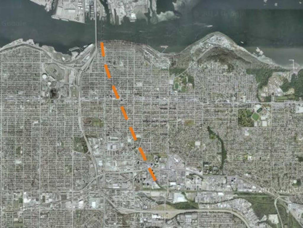
Last week a few friends and I dropped by the Ministry of Transportation’s open house on the future of the Massey Tunnel.

MoT is currently doing “public consultations” on which flavour of tunnel fix/replacement the people like best, following the announcement by soon-to-no-longer-be-Minister-of-Transportation Mary Polak announcement that the tunnel replacement is the next critical piece of transportation infrastructure that needs to be built. Or, to translate roughly: screw you Surrey and UBC/Broadway, we are doubling down on dumb road building ideas from the last century.

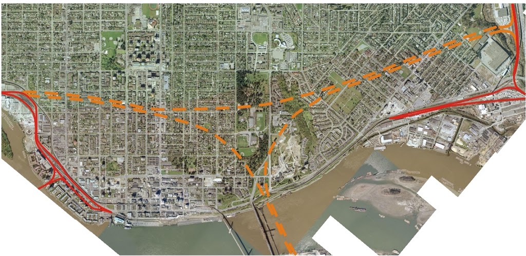
At the consultation meetings we were told there would be 5 options for the future of the tunnel:

Option 1:

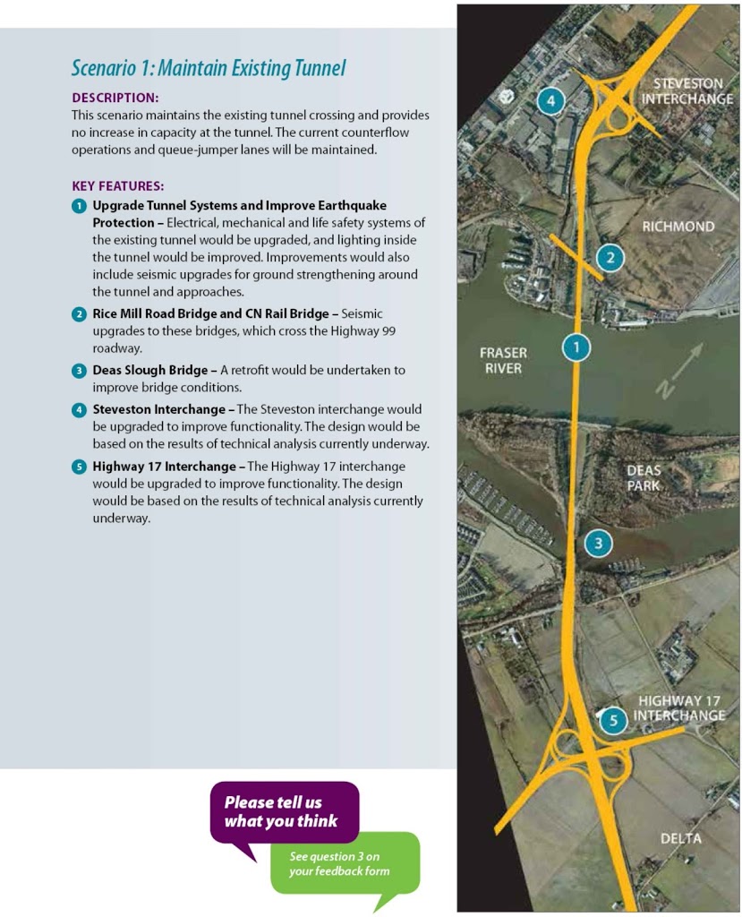
 Fix the Tunnel we have: Upgrade the lights, air-moving, emergency, and other mechanical systems (which are archaic, being built at about the same time as Sputnik, and hardly upgraded since). This would also involve a seismic upgrade of the tunnel to modern standards (and a young engineer in the room assured me this was very feasible, but would not provide a cost), and upgrades to the adjacent intersections at Steveston Hwy and Highway 17.

Option 2:

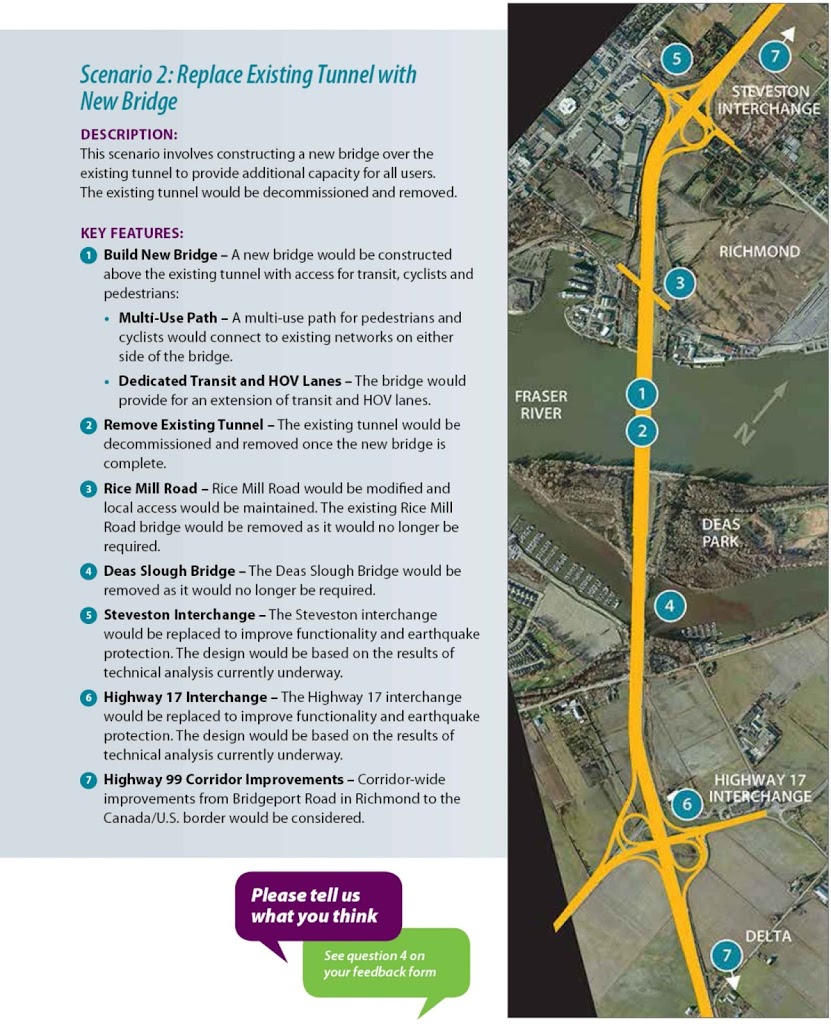
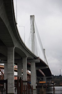
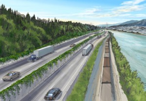
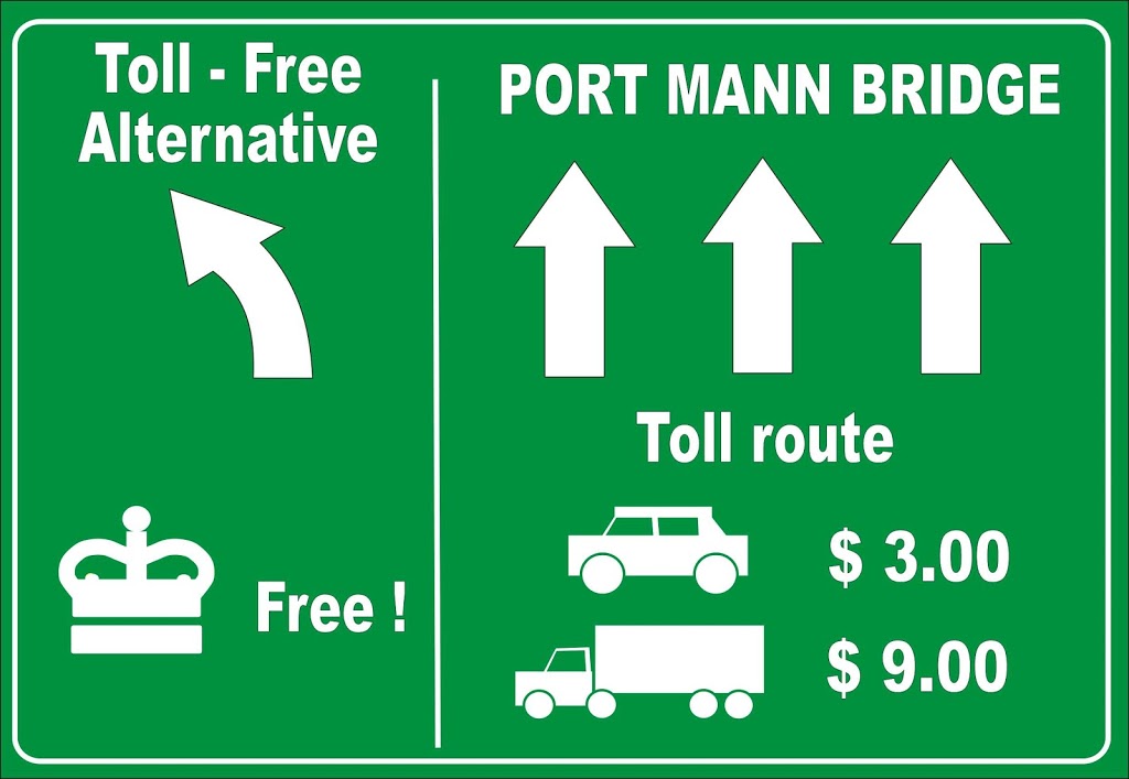
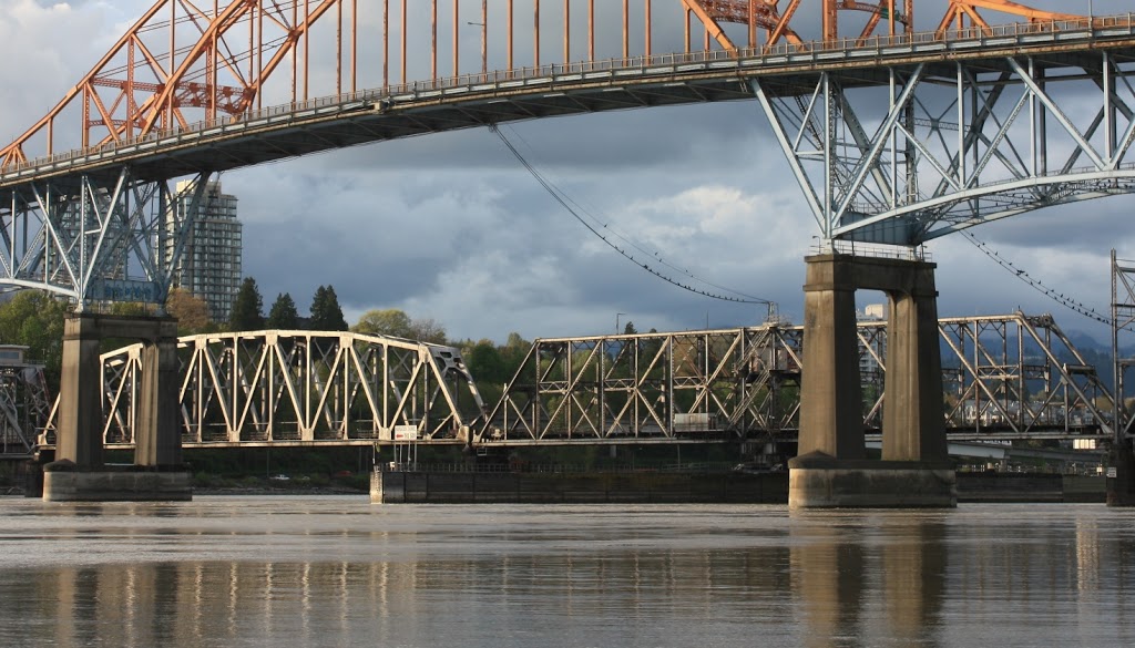
Replace with a Bridge: This would involve placing a bridge essentially on top of the existing tunnel footprint (again, I was assured they could do this, and who am I to doubt Engineers?). The suggestion was a cable-stayed bridge of similar design to the Port Mann 2, and make no mistake: this bridge will “provide increased capacity for all users”, although no specific lane count was provided.

Option 3:

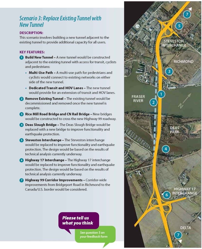
Replace with a new Tunnel: This would presumably mean digging a new tube adjacent to the exiting one, and one again no lane counts were provided, but “increased capacity” is offered. Tunnels are generally considered to be much more expensive to engineer than a bridge, especially in loose substrates (and this substrate is as loose as they get), so I’m going to go ahead and say this idea is dead in the water (excuse the pun).

Option 4:

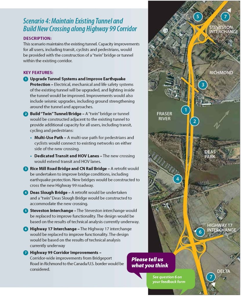
Twin it: This would involve doing both Option 1 upgrades to the existing tube, and building another bridge or tunnel next to it to achieve “capacity increase” goals. This is the literal lipstick on the pig option that will not satisfy anyone, as the cost savings in building a 4-lane bridge over an 8-lane (note- my numbers, not theirs! They won’t talk about lane counts!) cannot possibly be more than the cost saved by upgrading the existing tunnel. If they are feeling flush, they will take Option 2, if they are frugal, they will take Option 1, this compromise is unlikely to be Goldilocks’ choice. Dead in the water.

Option 5:

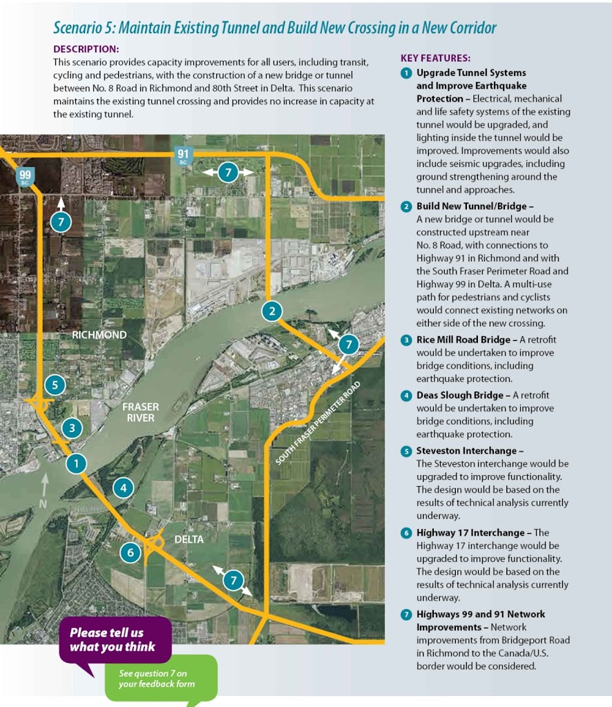
Far-off Sibling: As opposed to twinning in the same spot, this option would keep the tunnel and build another crossing elsewhere: not twins, just siblings. No way Richmond is going to go for this, and the same cost argument for Option 4 exists. Dead in the water.

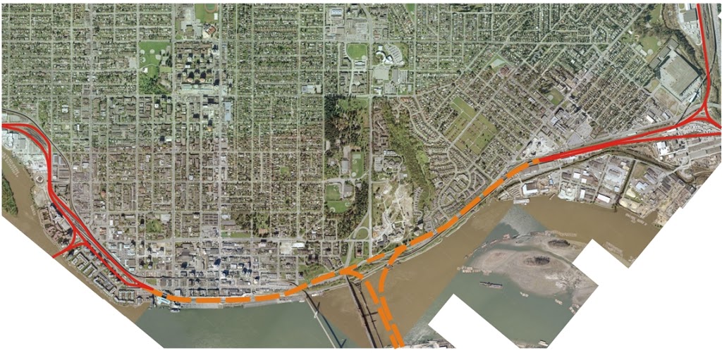
The other argument for the bridge is, of course, removing a perceived impediment to harbour travel in the Lower Fraser River. Currently, the River is dredged to 11.5m depth (at considerable expense) to allow Panamax ships to pass during most river/tide stages. This won’t be quite enough for fully laden liquid bulk carriers that want to bring Jet Fuel to South Richmond (they will need to be only 80% laden to pass safely).

Suggestions that the River will soon be dredged to “New Panamax” depth of 18m are foolishly optimistic, considering the cost, engineering and environmental challenges that would face anyone attempting to modify the Fraser River that way. Six extra metres of sand for a 250-m-wide path over 30km is what is technically called one hell of a shitload of sand. It would move the saline wedge of the river tens of kilometres upstream, well past where Delta and Richmond farmers draw water to irrigate and harvest crops. I can’t thin of what it would do to fragile salmon stocks or endangered sturgeon. This is a crazy pipe dream. Besides, the Port’s business model is no longer taking things on and off of ships, it is developing real estate for truck warehouses. Why would the Port be interested in spending their own money in dredging rivers when they can enjoy the subsidy of asphalt roads.

The missing point during these consultations was raised several times during the Q&A session: there were no costs mentioned. Not even order-of-magnitude estimates were provided, or “high-medium-low” scaling of costs related to each alternative. Which makes the whole consultation thing a little premature. How can we (the taxpaying road-using public) meaningfully respond to which is best if we don’t have the price?

“Would you rather eat Kobe Beef or a Stouffers Salisbury Steak? Don’t worry about the price, we’ll tell you later which you chose.”

I’m sure the people of Tsawwassen (especially those planning monumental but short-sighted car-oriented retail development) want the biggest, widest bridge they can get (and no tolls, of course), but if you ask the average British Columbian Taxpayer if they want to spend $250 Million fixing the tunnel or $2.5Billion replacing it, you might get a very different answer! (That said, letter writers to the Delta Newspaper are more nuanced in their positions that a smug North-of-Fraser know-it-all like me might have expected)

A final problem with the entire rush-to-consultation before election production is that they are not being straight-up about the “need”. If the tunnel is old and needs repairs: fix the damn thing. If the river draft is a problem: tell us that and make the Port pay for replacement. However, MoT is suggesting that growing congestion is the real driver, but this is not only untrue, they are using the wrong tool to fix it.

First off, Massey Tunnel traffic is going down, and has been for a while. Part of this is less people are driving and more are moving to the alternatives, another part is that the tunnel only avails you to traffic chaos further north. Traffic can only get so congested before the traffic stops arriving. Before anyone replies with “stunting economic growth” argument – this drop in traffic has happened during a time of unprecedented growth in population, industry, and land value on both sides of the tunnel! I’m not sure Delta or Richmond could have tolerated growth faster than it has arrived in the last decade or two.

Secondly, as was pointed out at the consultation meetings by MoT representatives themselves, the real congestion problem at the tunnel is that the vast majority of the vehicles in it are not moving “goods”, or even more than one person. Single Occupant Vehicles represent 77% of the traffic. By comparison, transit represents 1% of the traffic, but moves 26% of the people going through the tunnel:

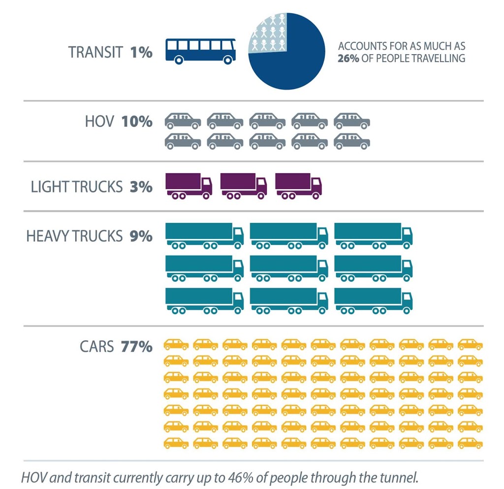
…all images courtesy Ministry of Transportation’s glossy
consultation materials, which  I didn’t ask permission to use,
but hey, I’m a taxpayer, so I paid for them. 

The MoT representative even shared the “surprising” point that of people travelling though the tunnel to get to Vancouver proper, more than 50% were on Transit, not driving. I was only surprised that he was surprised. To anyone who pays any attention to transportation trends in the Lower Mainland, this seems obvious. And it isn’t the result of some fluke of statistics, because This is what Vancouver planned! This is the model set out in the Regional Growth Strategy, in TransLink’s long–term planning documents, in the Livable Region Strategy: this is the model for the region! I find it shocking that an MoT representative would be surprised to find alternative transportation planning works in the Province, and there is data to demonstrate that.

Or maybe I shouldn’t, as we still have a Ministry of Transportation that sees the world through the windshield of their car (or their yellow trucks), and the only transportation plan they understand if roadbuilding. This is why the Minister is sitting in her office off of the Langley Bypass (“best idea for a road ever”), making the Mayors of Surrey and Vancouver fight for the few transit crumbs she may feint to toss their way, while boldly announcing billions for roads to nowhere. This is how she feels no shame in proudly declaring the 10-year-delayed Evergreen Line as “on track”, while making up glossy consultation brochures for the next freeway and while failing to provide basic operating expenses to keep TransLink running busses at the level of service they provided 5 years ago…

So go to the MOT site and fill out the survey they have running until April 2.

Tell them to build the alternatives (light rail or other transit South of Fraser, restoring funding to TransLink, replacing the real goods movement choke point in Greater Vancouver: The 104-year old one-lane Westminster Train Bridge) and they might see the need for this tunnel replacement go away.

Let’s fix the tube we have, and move on to solving real problems.

Damn

UPDATE: I was just informed there will be a brief memorial at 2:00pm on Tuesday at the Queens Park bandshell, moving to the Rose Garden. My work commitments keep me from attending, but I do hope some New Westminster folks who care babout pedestrian safety will show up. It’s not about politics, or blame, it is about showing Gemma’s family that we as a community recognize the tragedy and want to do better…

This sucks.

I hate reading about this kind of thing. It makes me sad, it makes me angry, it frustrates me.

Putting a face to the name, recognizing Gemma Snowball as a young Australian woman who worked for a couple of local businesses makes it a little more personal. It’s not like I knew her name or shared any relationship more than being two people living in the same community, but just having interacted with her, recognizing her as a human being, and not just another nameless accident victim, it hits you a little harder.

It shouldn’t, though. Every person killed in what Newz Radio euphemistically calls an “incident involving a pedestrian” is a person, they were humans with families and jobs and futures and stories. Even if we didn’t have a chance to know them. Instincts deeply rooted in our evolution as tribal animals make deaths in our community more important than ones farther away, deaths of people we share a language and skin colour with more important than those whose cultures we don’t understand, people we have met more important than those we haven’t. One of those vestigial bits of human nature we would be best to get past.

My connection to this also comes from another direction, though. Serving on the City’s Advisory Committee on Transit, Bicycles and Pedestrians and the Master Transportation Committee, and being an outspoken advocate for improving pedestrian safety in New Westminster, I spend a lot of time talking with other (better informed and more effective) advocates for safe pedestrian environments, like Mary Wilson and Marion Orser and Bruce Warren. When we discuss the need for better traffic control, reduced speed limits, better lighting and pedestrian protection, better crosswalks, we often feel we are in our little bubble speaking to the wall.

We aren’t speaking to the wall, though. The City is making positive changes. We have a Pedestrian Charter, although fulfilling its vision seems a glacially slow process at times. Small changes are happening all the time: improved lighting or signals here, a new crosswalk there. Planning at every level in the City is doing a better job acknowledging the needs of pedestrians instead of just suffering their existence. The movement is slow, but those of us who spend our free time working on this stuff can see that we moving in the right direction, otherwise, why would we bother?.

Then something like this happens, and you shake your head and wonder if we are moving fast enough. In the priorities of “needs” a City strapped for resources has: firefighters and keeping the sewers running, plugging potholes and aiding the homeless, maintaining a vibrant community spirit and protecting people from crime, where do we stick “Pedestrian Safety” on the list?

The good news is that the pedestrian space in New Westminster is relatively safe. For a City with 400,000+ cars and trucks a day driving through, pedestrian deaths are uncommon: one in each of 2009 and 2010, none at all in 2011 or 2012. Maybe we have been lucky, dodging bullets, as MetroVancouver averages just under 20 pedestrian deaths a year. Even more depressing, the majority of automobile-related deaths in Vancouver are pedestrians – not cyclists, not drivers or passengers, certainly not Transit users, but people on foot.

The reality is that accidents happen. We don’t yet know the details of this incident. We know it was dark and rainy and the media reported the driver was making a left turn, which is clearly illegal at that intersection. Maybe it was an honest mistake by the driver; maybe it was intentional… a “victimless crime” if there was no cross traffic. But this time there was cross traffic. Maybe Gemma wasn’t as cautious as she could have been crossing the street at night, rushing to catch the bus on a rainy night after a long shift at work.

We may never know the combination of bad decisions made in a split second that resulted in one dead woman, and a driver whose life has now been tragically altered.

We don’t know the details, and I don’t know the solution. Maybe the built infrastructure had nothing to do with it – a freak combination of events that could not be avoided. But like many others, I can’t see an event like this and ignore it. Gemma was too close to my tribe and died in my back yard, I can’t let it pass unnoticed. Some have set up a vigil at 6th and 6th, and that is good for a time. Some others are holding an event on this upcoming Tuesday at the Dublin Castle to remember Gemma and raise a little support for her family. I am going to plan to go and help out in that little way.

More important, I am going to continue to advocate for pedestrian safety, to make our streets safe to cross. Gemma (and Christian Mesa) will stick in my mind, even if they were not friends. They are the reason we are working to make our urban areas better by making our streets safer for humans; so a momentary lack of attention doesn’t result in the tragically premature end of a life full of promise and hope.

If you are an advocate for pedestrians, a person who has felt that more needs to be done to make our crosswalks and sidewalks safe for the people of our City, maybe you might want to show up on Tuesday at the Dublin Castle and show some support. This isn’t a political issue (I don’t know any politician who wants streets to be less safe!), just a reminder of why we should be listening to advocates like Mary Wilson and keep fighting the good fight.

Digging Deeper

I love it when I agree with the people I am disagreeing with.

Chris Bryan, the Editor of the New West News Leader, is building a reputation for some compelling opinion pieces. This week, he definitely hit that mark with his column entitled “New Westminster’s traffic discussion must dig deeper” .  It is compelling because I can agree and disagree with almost every idea in the column.

The essential question (if Bryan will afford me the benefit of paraphrasing) is: “How long can New Westminster resist the paving over of our neighbourhoods to service the cities on our borders?”

My simple answer is as long as we are here. Because what is the alternative?

Yes, Surrey (pop 468,000) and Coquitlam (pop 126,000) would love it if New Westminster (pop 68,000) would get the hell out of the way and allow their residents to get from house to work or shops quicker. I would argue that is firmly in the category of “not our problem”.

Douglas Adams, in my second favorite piece of absurdist writing, The Hitchhiker’s Guide to the Galaxy discussed the idea of building freeways through people’s homes:

“Bypasses are devices that allow some people to dash from point A to point B very fast while other people dash from point B to point A very fast. People living at point C, being a point directly in between, are often given to wonder what’s so great about point A that so many people from point B are so keen to get there, and what’s so great about point B that so many people from point A are so keen to get there. They often wish that people would just once and for all work out where the hell they wanted to be.”

This was just as relevant to Arthur Dent’s house and his planet, which were (spoiler alert) both destroyed to make way for bypasses, as it was to Jane Jacobs in Washington Square Park (spoiler alert) which she helped save along with the soul of Greenwich Village and New Westminster in 2013.

I’m not sure why we, in New Westminster, the first City in British Columbia, the former Capital of the Colony, and the original heart of the region, should give a rat’s ass what upstart suburbs like Coquitlam and Surrey need, now that they have built huge communities of sprawling auto-oriented neighbourhoods whose very economic survival relies on their expanding populace having an unfettered ability to drive through the New Westminster community – through our very neighbourhoods.

It isn’t our intractable resistance to plowing over our City that got them into this mess, it is their continued choice to develop on the assumption that we would eventually plow our City down to accommodate their needs.

Yes, The Strange Case of the Bailey Bridge is a great example of how New Westminster concerns itself with preserving its character and historic neighbourhoods instead of sacrificing everything we are to allow Coquitlam to build (to quote Chris Bryan) “a rapidly growing big-box retail area, and… the redevelopment of Fraser Mills into a residential community housing thousands of new drivers poorly served by transit.”

Perhaps a better example is the history of Braid Skytrain Station. Coquitlam was given the opportunity, back in the 1990s to have SkyTrain service to Maillardville. Fears of the “CrimeTrain” and density caused Coquitlam to resist rapid transit in their most historic neighbourhood, and the line and station were moved to more forward-thinking (and more historic) New Westminster.

By their own preference, Coquitlam instead got 8 lanes of Highway 1, and 6 horribly congested lanes of Lougheed Highway in Maillardville. They are now afraid that 7,500 people living in Fraser Mills will be the gigantic strawpile that breaks the back of their community. It may dump too many cars across their shiny new overpass into the traffic quagmire of their own (terrible) planning. A 4-lane Bailey Bridge and overpass looming over Sapperton will surely afford them some temporary relief, but only by pushing the traffic pinch point, idling pissed-off drivers and livability impacts a few hundred metres into New Westminster neighbourhoods.

These bad planning decisions were not made by New Westminster- in fact we were not even consulted on them. Why should we suddenly acquiesce to their unanticipated “needs”?

So Coquitlam is willing to finance the slow destruction of our 150-year-old City? Thanks, but no thanks. Their generous offer only makes us enablers.

Instead, New Westminster is taking the principled, responsible stand. We are leading the region in building a compact, transit-friendly, sustainable community. We are developing a Master Transportation Plan that builds on our current strength as the Municipality with the second-highest alternative transportation mode share in the Province (excuse the emphasis, but this is a pretty big point!). We are making it easier for people to live, work and shop in the same community. We are building mixed commercial-residential developments on SkyTrain lines. We are increasing density, and are taking risks building office space and investing in community amenities.

For those who must move across the region, we are making it easier to do so through transit, through cycling, through car-sharing. We are making genuine efforts to reduce our community’s load on Coquitlam and Surrey roads. The results are demonstrated in our region-leading alternative mode share, and we are aiming to do better!

So do we need to “dig deeper”? Hell yes. We all do. We are facing major growth, climate, and economic challenges. In New Westminster, that means we need to have cojones to say to our neighbours that their car-driving problems are a result of their poor planning, and we are terribly sorry, but you are not going to fill our community with pavement to solve them.

If Coquitlam wants to put 7,500 residents in Fraser Mills, they had better figure out a way to move them around that doesn’t include cars passing through Braid and Brunette.

If Surrey needs a billion dollars to expand rapid transit to serve their growing population, we will be the first to step up and advocate to senior governments on their behalf to get them the transit system of their dreams. But if they want to spend that billion dollars to expand a freeway bridge into the heart of our City, they will have a hell of a fight on their hands.

We are ready, Chris. We are ready to help the region move forward and fulfill its Regional Growth Strategy, its Regional Transportation Plans, its Sustainability Plans.

It may look to them like we are “dug in”, but we in New Westminster are actually leading. Maybe it is they who need to dig deeper.

Bike Ride

I went for a bike ride the other day.

I go for bike rides lots of days, but what made this unique was I decided (against all experience and reason) to go for a bike ride in Coquitlam. Mostly, I wanted to check out progress of cycling connections around the new Port Mann Bridge.

Remember, bicycle and pedestrian access is a “a key goal of the PMH1 Project”, and the plan is to have a bike and pedestrian path crossing at Port Mann for the first time since… well, since anyone remembers. And with all the breathless excitement of the opening of the new bridge (tempered somewhat by the bridge’s sudden violent temper), the introduction of tolls, and New West suffering under the weight of the toll-free alternative, I thought I would pop over to Coquitlam and see what the new bike path looks like.

Except, of course, the new bike path isn’t done yet. And there is no mention anywhere on the PMH1, Gateway, or Ministry of Transportation websites suggesting when or if it will be done. I sent an e-mail to the Gateway people and got this in reply:

A key goal of the PMH1 Project is to improve cycling connections throughout Metro Vancouver, and when the project is complete, cyclists and pedestrians will be able to cross the Port Mann Bridge for the first time.
When the bridge opens in its final design, it will have 10 lanes and one multi-use path on the east side of the new bridge. The multi-use path will have a barrier-separated, three metre-wide cycling and pedestrian path. A portion of the existing bridge must be dismantled to complete the final two lanes on the south approach. Given this, the multi-use path will be complete when the final two lanes are opened. We are in the process of finalizing a schedule, but we anticipate this will occur by the end of 2013.

So cyclists and pedestrians will have to wait another year or so before they get to use the bridge, but it is still a “Key Goal”.

Until then, I can speculate about how useful the bike path will be, considering its connections on the Coquitlam side, and I can lament the abhorrent situation created by the construction of the bridge in the first place. Hence, my little bike ride.

Riding through New Westminster on the Central Valley Greenway is a relatively painless experience. The CVG is not perfect, but it is a pretty good second-generation bike route. Even with a few strange connections on the New West side, it is easy to follow, and at no time is it really unsafe. Trying to connect to Coquitlam, that is when you enter the danger zone.

Dropping down behind Hume Park on the bike path to the Braid Station, the Coquitlam-bound have two options: The Baily Bridge to United Boulevard, or the Brunette Overpass to Lougheed. The second isn’t really an option: it is a confusing jumble of lane-changing highway traffic with no shoulder and an uneven and intermittent sidewalks, leading you to nowhere but more killer intersections. Meanwhile drivers are jockyeying for the hole-shot of the on-ramp merging just before exit or the gap in traffic on Brunette to make the suicide turn off the off-ramp (both definitively not looking for cyclists). I’m an aggressively hyper-aware and experienced bicycle commuter (I worked as a bicycle courier in downtown Vancouver in the late 1980s!), I can move a bike through urban traffic like few people. The Brunette overpass area is too scary for me.

So that leaves us the Bailey Bridge to United Boulevard option. The bridge is ok, wait your turn in the line of traffic and occupy the entire lane so the irate guy behind you cannot pass. United past the Golf Course is currently pretty good, because it was built as a 4-lane but currently has two lanes, so lots of room. It was noted by cycling advocates during the UBE discussions that it is certainly not wide enough for four lanes and a reasonable bike path. TransLink’s inability to commit to widening United to make it a safe bike route was one reason regional cycling advocates lined up against the UBE, even with a bike path on the UBE being a “key goal”.

things get much worse once you get past the new King Edward Overpass (with its luxurious pedestrian and bicycle lanes). United Boulevard is narrow and curvy, just barely wide enough for its four driving lanes. No sidewalks, and certainly no shoulder. Add to this numerous poorly-marked driveway entrances and exits to the commercial and industrial sites and a completely disregarded speed limit, and this is one of the least safe roads for cycling in the region. Yet, there are no alternatives. There are no connecting roads at all to the south. Lougheed is a high-speed high-volume freeway with double-lane turnoffs. Brunette Ave through Maillairdville is only better than United in that there are enough traffic lights to slow traffic a bit. The simple message is that Coquitlam doesn’t want people riding bicycles.

The City of Coquitlam does produce a Bicycle Route map, you can see it here. It is pretty much what you expect, disconnected lines with a few routes, featuring more gaps than actual connections. So once the new bike route accross the Port Mann is built, where is it going to go? Who the hell would ever use it?

According to Gateway plans, it will connect to Lougheed Highway on the north side. This should, at long last, provide the people of Surrey the safe cycling access to Mackin Park they have so long awaited. Or perhaps, they can ride to the King Edward Overpass, and watch 10 lanes of cars vroom by below. Fun for the whole family.

What Coquitlam does have is those kind of bike paths preferred by people who don’t really ride bikes for their utility, but as an alternative to playing tennis or bocce. The short multi-use bike path through the park, where one can drive to and park easily, take the Canadian Tire bikes off the rack, spin around for a half an hour. A great example is the path connecting Maquabeak Park under the old Port Mann to Colony Farm Park (as you can see on the Coquitlam Cycling map). It is not really suited for cycling, is guaranteed to produce user conflict, and doesn’t really go anywhere.

Even this sub-optimal trail has been wrecked by two years of Port Mann construction. With construction staging on top of the old trail, there are signs indicating some sort of detour:

But no actual map or diagram or even arrow to tell you where these detours are. I looked on the City of Coquitlam website, the Gateway one, the MOT and transLink sites after I got home, and I’ll be damned if I can find a map of the purported detour anywhere. so I cannot even blame my complete lack of preparedness for this adventure.

So it was back on United, still bereft of sidewalks or shoulders, but now enhanced by highway on-ramp and off -ramp traffic. Until I was greeted by this:

And this:

I had apparently found the detour. It went right by this spot:

At first, I assumed he sign in the middle was not meant to be ironic. then I thought about it some more, and realized that it was only through the lens of irony or pure David Lynch surrealism that any of the signs made any sense whatsoever.

So what’s the point? When it comes to bicycle access, Coquitlam is a disaster. Combine their incompetence/disinterest with the Ministry of Transportation/Gateway™ aggressive dislike for non-automobile users, and the result is a horror show of pissed away taxpayer money.

The $5 Billion Gateway™ program will, they triumphantly declare, provide “an estimated $50 million in pedestrian and cycling improvements.” Which is, apparently, “the largest single investment in cycling infrastructure in the region”. I would love to be excited about this “investment” in sustainable transportation that represents 1% of the budget, except for two things: It is a sham, and the results will be useless.

The MoT/Gateway™ plan for that $50 million can be read in this report (at least that is the most recent information we have). Aside from including a bike path on the new Port Mann Bridge that won’t connect to anything useful, (at maybe a marginal cost of a couple of million dollars?) it isn’t about building bicycle or pedestrian infrastructure at all. It is about “accommodating” bicycles and pedestrians on the expanded overpasses they have to build to span their shiny new megahighway. Essentially, replacing the current sidewalks and leaving enough shoulder room to paint a white line.

It actually gets worse on the South Fraser Perimeter Road, where the “cycling infrastructure” investment is going to be painted bike symbols on the hard shoulder of a limited-access 80km/h 4-lane truck route. Look at these pictures from the official SFPR website:

See that space between the semi truck going >80km/h and the concrete wall? That’s “bicycle infrastructure” in which they are investing your tax dollars. Looks like a fun place to take the kids for a spin, eh? Why not just call it what it is (pull-off space so stalled vehicles don’t slow the rush of progress traffic), and quit with this shell game accommodation-as-infrastructure bullshit.

If MoT / Gateway™ was really interested in improving cycling infrastructure, they would hand that $50 Million to TransLink or the municipalities to invest in real, useable bicycle infrastructure where it is needed and where it will be used.

In the meantime, I suggest everyone avoid taking bike rides to Coquitlam.

Our New Motto?

There has been a little recent on-line and print chatter about the “Royal City” moniker. It seems to stem from an off-hand comment by noted New Westminster philanthropist and style maven Bob Rennie, who suggested if we want to sell more condominiums, we should update our image. Lose the “Royal City” and the Crown motif, and start fresh.

Our Mayor, never one to lack vision, suggested off-the-cuff that to some people in New Westminster, the idea of losing the “Royal City” might be considered blasphemy. And we are off to the races.

There have been letters to the editor, lots of on-line chatter, both sides of the issue have been discussed. The subsequent announcement of the Anvil Centre naming, a name that nods deeply to traditions, mixed with its appropriately-modern NFL-Helmet-ready swoopy logo only added fuel to the low smoulder. Fanned again by Councillor Cote’s recent post on a much better local blog than this one admitting to mixed feelings about the return of “swag lights” to Downtown New Westminster. Do these lights demonstrate an excitement and sense of place, or do they just evoke a historic time that ain’t coming back, and perhaps the money could be invested better elsewhere?

I was, up to now, a little ambivalent about these ideas. I like the “Royal City” moniker, although I am anything but a royalist. There is a tradition there worth preserving, and there are (to quote myself) ways that a clever marketer can bring excitement to the Royal City motto without evoking paisley wallpaper and tea sets. I don’t think it looks like Snoop Dog’s jewel-encrusted crown or Kate’s foetus, but I honestly don’t know what it looks like. Hey, I’m a scientist, not a marketing guy.

However, it occurred to me reading this week’s paper that our solution may be at hand. Our good friends at the Ministry of Transportation and Infrastructure have already provided us a handy new motto, and they are already splattering the new logo all over the roads South of the Fraser:

Artist’s rendition – I haven’t seen the actual signs.

Goodbye “Royal City”. Hello “Toll-Free Alternative”.

That’s right, we think of New Westminster as a community where we live, work and play, where we raise our kids, do our shopping, go to the park, and spend our idle time polishing our crown motifs and complaining about the Socialists. The Ministry of Transportation sees New Westminster as a place where drivers who don’t wish to pay for use of the $3.3 Billion bridge they were all clamoring for can instead zoom along surface streets, past our residential driveways and through our school zones! We have arrived! .

Think of all the tag lines opportunities:

“400,000 drivers a day can’t be wrong!”
“Stay for the stop lights – then please move along”
“Our pedestrians may be slow, but at least they’re soft!”
“Don’t have $3 for a toll? We have dollar stores!”
“If you lived here, you’d enjoy this traffic all day!”
“We put the ‘rough’ in Thoroughfare!”

Again… maybe I just don’t get marketing.

UPDATE: Astute reader and man-about-town Jeremy pointed out to me that “Royal City” isn’t really a motto, it is more of a nickname. You should take all of those times above where I misuse “motto” and stick in “moniker” or “nickname” or some such word. I would do it, but I’m lazy, and busy, and tired from a hard curling weekend.  

This is vitally important because the City already has an official big-M Motto right there on its Wikipedia page: “In God we Trust”. And there’s nothing dated or old fashioned about that!  

Tunnels as problem solvers.

It’s inevitable, whenever discussion of traffic issues in New Westminster carry on for long enough, the topic of tunnels come up. Makes sense, as we are overloaded with traffic and there is no undeveloped space upon which we can build more lanes. So there is a portion of New Westminster population who figure tunnels are the solution to all of the City’s through-traffic woes.

During the last Municipal Election, one mayoral candidate evoked the McBride Tunnel as the solution to the increased traffic that would be caused by expansion of the Pattullo Bridge. Captain Johansen told of a grander plan for tunneling the entire stretch of McBride to the legendary Stormont Connector. John Ashdown doubled-down on this idea by dreaming of a tunneled McBride, Stormont, and entrenched Royal Avenue.

There are two criticisms common to all of these plans: they will cost a fortune, and they don’t solve any actual problems.

Road tunnels in urban areas are notoriously expensive to build and connect to the existing road network, and what is being proposed would be the long road tunnels for Canada. McBride alone would be 2km, Stormont to the Gaglardi interchange another 2km. Add a trenched Royal Ave, and that’s 2 more kilometres. Each of these individually would be much longer than any existing road tunnel in Canada (the Massey Tunnel is just under 700m long, slightly shorter than the 730m Cassiar tunnel).

Length isn’t the only problem. Tunnels in urban areas have to deal with decades worth of utilities under urban roads: sewers (storm and sanitary), water and gas pipes, electrical and communication ducts. Varying fill materials, shoring foundations, contamination, archeology: it’s a mess down there. Moving all of those things out of the way to push a trenched road through is expensive and difficult. Not to mention the disruption at the surface during construction. For this reason, shallow cut-and-cover road tunnels are often no cheaper than deeper bored tunnels, which can avoid these entanglements. You can ask the folks in Boston about these complications and how they can result in runaway costs. Transportation Engineers I have talked to have estimated $4 Billion for a McBride Tunnel and surface Stormont connection. I cannot imagine anyone at any level of government coming up with that order of cash to solve New Westminster’s little traffic inconvenience.

Especially as these expensive tunnels are not likely to be an effective solution, but will only push the traffic pinch points a few hundred metres up the road to inconvenience another neighbourhood, or fill up our underground space with cars to go with our car-filled above-ground spaces. Anyone who thinks a bypass tunnel solves traffic problems has not spent enough time trying to drive through Seattle at rush hour.

If cost -recovery programs are included, then the tunnels will simply be avoided, as the Brisbane experience is showing. There, a tunnel under an urban area built to bypass traffic lights and allow “free flow” is failing: going bankrupt only two years after completion. As we have learned with the Golden Ears Bridge and will soon learn with the Port Mann, people will tolerate a lot of inconvenience to avoid even a nominal toll. Car commuters are not rational in their choices regarding cost and time management. If they were, they would not be in cars, commuting. It’s a tautology.

That aside, there is a place for tunnels in a developed urban environment, and maybe part of New Westminster’s traffic woes can be helped with judicious application of tunneling as long as we put trains, not cars, into those tunnels.

Hear me out here.

Many of the costs and troubles related to road tunnels do not apply to rail tunnels. A 2-track rail tunnel can be as narrow as 10m, but for practical purposes, must be over 6m tall. A road tunnel can be slightly shorter, but would be significantly wider (the Massey tunnel is about 4.8m high, but more than 23 m wide). With trains running through them, not individual trucks and cars with flat tires, finicky engines, erratic drivers and “Baby on Board” stickers, train tunnels require less air-moving capacity, groundwater and seep control, fewer “safety features” like escape tunnels, buffer zones, lighting or climate control than car tunnels. Train tunnels, for all these reasons, are an order of magnitude less expensive to build than road tunnels (presuming, of course, that they can be bored deeper than the majority of existing utilities).

The difference in cost is enough that it was rationally decided that if you want to take your car through the Chunnel, you need to park it on a train first.

It is no secret in regional transportation planning circles that the biggest “pinch point” for goods movement is not New Westminster’s road network- it is the New Westminster Bridge. The 108-year-old steel swing bridge is the only rail crossing of the Fraser River this side of Mission. Even the regional transportation study back in 2003 that established the need for a “Gateway Program” identified the New Westminster Bridge as a high priority – the highest priority for all rail upgrades. Along with the Port Mann, expanding Highway 1, the SFPR (all funded and being built) and long before the NFPR, the Massey Tunnel or Pattullo – the New Westminster Bridge was the critical almost-missing link.

New Westminster Rail Bridge: still solid after 108 years. Please
ignore the big, showy, youthful, orange bridge next to it! 

Yet the Gateway Program has been silent about this imperative issue. Nothing has been done for several reasons; at least part being the difficulty of building an adequate replacement (read: two tracks, and not a swing or lift bridge that impacts rail schedules) in the spot where the bridge currently resides. Trains hate hills and the Navigable Waters Act requires minimum clearance over the River for fixed bridges: the Pattullo has 45m, the New Port Mann about 42m. The ground on the Bridgeview Side has an elevation of about 3m above the River, meaning the bridge would have to lose something like 40m between midspan and Surrey. That isn’t a problem if you are driving a car – a 6% slope is almost invisible to a car, and would require a 650m-long ramp, not unlike the current Pattullo approach. However, to a freight train, that is an insurmountable slope. Trains require a slope closer to 2%, and consequently the offramp on the Surrey Side would need to be 2km long!

For this reason, the idea of a tunnel under the Fraser at that point was considered in that same 2003 report on regional transportation needs. The navigable channel under the bridge is maintained to 10m depth through the dredging program (to accommodate 11m draft ships at least two hours a day – tides and freshets really mess with elevations when you use the top of an estuarine river as a datum – good thing we have geographers!). So the bottom of the tunnel would need to be something like 20m down, requiring a km-long slope from mid-stream to the surface at Bridgeview. Long, but not unmanageable considering most of it will be underground.

The New Westminster side gets more interesting, though. The current train bridge hits the land at about 5m above the river, just above Front Street. From the north pillar of the bridge, McBride would only be about 200m distant. A new 40m-high rail span could therefore only slope down to about 35 m elevation over that distance, which would put the rails on the green grass slope above Columbia Street. I cannot imagine how to connect those rails to the existing rail network without some sort of aircraft carrier-style elevator.

Bring an under-river tunnel in 20m below grade, and you can similarly forget connecting to the existing east-west rail line under the Pattullo Bridge. A new east-west connection would be required, and this is where things start to get exciting for New Westminster, as the only logical connection is a tunnel under New Westminster. A tunnel that connects the rails yards at Sapperton to the rail yards at Quayside. I can think of two ways these tunnels can go. But first, look at the current layout of rail lines in New Westminster.

Existing rail lines in New Westminster, click to see bigger version.

A dreamer would envision three tunnels, each of them about the same length as the existing rail tunnel under North Burnaby. These tunnels would generally be deep-bored tunnels, not cut-and-cover, so there would be few issues with utilities, archaeological sites, or contaminated sites. Luckily, the materials that make up New Westminster hills are pretty competent and easy to drill (mostly sedimentary rocks of the Eocene Huntington Formation, if you care to know).

For the most part, this new infrastructure would be similar in size and scope to the existing Burnaby rail tunnel that connects the current Second Narrows Lift Bridge to the former rail yards around Still Creek. Not many people know about this 3.5km long rail-only tunnel dug in 1969. You may even have ridden your bike along the Frances-Adanac Bike Route and passed the building at Frances and Ingleton, thinking it is some sort of well-armoured house or Hydro substation, when it is actually a ventilation building for the train tunnel about 40m below:

Tunnel Ventilation Structure at Frances and Ingleton in North Burnaby. 
Approximate route of existing 3.5-km Burnaby Rail Tunnel connecting the
Still Creek area to the Second Narrows – the only Rail Crossing of Burrard Inlet.  

So envision this tunneling scheme (obviously diagrammatic – concept, not details) and think about the realized synergies!

Proposed Tunnel Option 1: Dashed orange lines are bored underground tunnels,
well below City infrastructure. Red lines are retained surface rail. Click to enlarge.

We remove the bottleneck at the New Westminster Bridge by exapnding it to two rails and removing the swing bridge schedule hassles (remember, the #1 priority for goods movement in the region). This also opens up numerous possibilities for commuter rail, improved Via/Amtrak service, and opens up valuable industrial land in Surrey that now has long rail ramps on it.

There is no longer a reason to connect the Sapperton rail yard to the Quayside rail yard via east Columbia and Front Street. Those two yards can be connected via the east-west tunnel connecting the Hume Park area to the west foot of 4th street. The rail companies will no longer have to deal with the level crossings between the two, along with the speed limits, traffic and pedestrian issues they present. We have just achieved whistle secession between Braid and Stewardson.

The unnecessarily-complex level crossing at the foot of Braid would see a fraction of the rail traffic it sees now, as it would only see use as access to the small BNSF yard at Sapperton and spurs into the Braid Industrial Area. It would effectively dead-end at Sapperton Landing Park. The through-trains would be in the tunnel, resulting in fewer trains across these routes and increased safety and predictability for drivers.

At the other end, a tunnel dropping two lines below Stewardson near 4th would allow access to the Quayside yard, the SRY bridge to Annacis, and all points west. A re-configuring of the yard would allow the dead-ending of rails in front of the River Market. Your access problems to the Pier Park are solved, your whistle problems are solved, and Front Street becomes more viable human space again. (note this will not address the other rail-related noise issue in the City- the shunting and idling issues at the Quayside yard, but I’m sure James Crosty and Friends will have that situation managed soon enough.)

An alternate, and potentially cheaper, solution would look something more like this:

Proposed Tunnel Option 2: Dashed orange lines are bored underground tunnels,
mostly below City infrastructure. Red lines are retained surface rail. Click to enlarge.

We lose some of the benefits of simplification of the Braid intersection, but perhaps gain a consistency with the existing rail operations, although many of those operations in areas impactful on the City will be moved underground, just to allow acceptable grades between the sub-river tunnel and the existing rails at Sapperton and the Quayside. The total tunnel length is reduced (one 3.2km tunnel instead of three tunnels totalling almost 7.2km), but the interaction with existing utility, road and rail infrastructure is greater, and therefore the construction costs may not be much lower. There are people much better trained than I to advise on which actual tunnel configuration is optimum!

Another argument for these tunnels is that they help solve some of our actual traffic congestion problems. Every container that is on a train is a container that is not on the road. This project improves the competitiveness of the train system for moving goods from Vancouver Harbour and the DeltaPort to points east (including the intermodal yards in the northeast sector and the industrial areas on Annacis), and it moves all of these containers without trying to share space with other trucks, cars, buses  bikes, and the livebility of our city.

Yes, it is up to 7.2 km of tunnelling, but compared to a cut-and-cover McBride tunnel which would be the longest road tunnel in Canada, none of these rail tunnels would be longer than the existing Burnaby tunnel, and combined length they would be much shorter than the longest rail tunnels in Canada- actually a combined length similar to the combined bored and cut-and-cover tunnel for the Canada Line, except without all the expensive underground station costs!

So to summarize: we make the Port and rail companies happy by removing the big bottleneck at the New Westminster Bridge, we remove a significant number of level crossings, open up our waterfront, re-claim valuable downtown land for non-rail use, achieve our whistle cessation goals, and improve the Braid crossing safety issues, while improving rail connectivity and freeing up community streets. All for a cost that would likely be much less than that for an imagined cut-and cover tunnel solution for cars.

Here is a tunnel idea I could support.

Thrifty Pedestrians

I think I love Thrifty Foods.

All of the sudden there are a lot of grocery options in New Westminster. No less than three Safeways, all of them of the recent-design mega-big variety; a Save-On-Foods of the slightly-too-compact urban style, an IGA that is seemingly a little crowded out and increasingly out of the way, along with Donald’s at the River Market and other smaller boutique-type options. Notably, Thrifty’s is the only Grocery spot in Sapperton (7-11 excepted, of course). The only grocery deadzone appears to be Queensborough (although, someone might tell me they have groceries in Wal-Mart: I’ll never know).

I have nothing against Safeway, and think their willingness to put a storefront on a Transit mall is a bold move worthy of praise, but I generally find their prices a little high, and their approach a little too “corporate”. I am “personally” thanked by checkers, with few of them taking to time to look at my actual name before saying, blankly, “Thank You Mr. Moose” (A Safeway Card under the name Space Moose was a bit of culture-jamming I engaged in a few years back. Note, if William Jefferson Clinton wins a big prize in one of those Save-on-More Card contests, I’m not sure how hard it will be to collect. But it makes my junk mail more interesting).

Alas, we tend to buy our groceries within walking distance, which means the Save-on-Foods with its less-than-optimal aisle widths, it’s strange practice of labelling all of its fruit as multi-origin (“Apples: USA/Canada”), and its distinct paucity of humans working the checkouts.

Aside: Look, the automatic checkout is never faster or more convenient for the shopper than having a person check your food, unless there are not enough checkout staff. If you think I can enter the code for apples (fuji or ambrosia? ) or lettuce (green leaf or romaine?), operate a bar-code scanner, and fill a grocery bag faster or more efficiently than someone who does it 8 hours a day, you are crazy. Essentially, Jimmy Pattison is getting me to do the work of his staff – because he doesn’t have to pay me. . –end rant

I would be remiss to also point out that Ms.NWimby does most of the grocery shopping for the household. This is mostly because of her advanced ability to shop ahead a week (instead of my tendency to buy for today and tomorrow), but also because she found me no fun to shop with, as I am generally an ornery retail customer (having grown up working in retail and having high customer-service expectations) and not much fun to be around when assaulted by bad retail decisions.

For smaller “just-pick-up-a-few-things” trips, I tend to run up to the Uptown Market on 6th – a small shop that always impresses me with their variety, quality, and customer service. In the summer, the drive to buy local often leads us to Hop-On Farms on Marine Drive- for garden-fresh produce. Weekly trips to the Royal City Farmers Market just about rounds out or grocery experience.

So I have only been in Thrifty’s a few times, but I might need to start about making it the usual – maybe I’ll buy a cargo bike, and take some of the load off of Ms.NWimby. The thing about Thrifty’s is that it is everything I like: they have a good mix of basic groceries and higher-end fancy stuff. They have a nice produce section, and I know what is being grown domestically. The space itself is expansive and comfortable, the lighting is soft and organic. I’m not assaulted by offers to save more by buying more than I need. And when I am done shopping, an actual human being helps ring up my purchase. In fact, there are actual human beings working throughout the store – unobtrusive but helpful. I just wish it was walking distance.

I hope (and expect) that Thrifty’s will prosper in Sapperton, even though it is currently neigh-impossible for many Sapperton folks to walk there. And here is where my second rant of the blog post begins:

The City of New Westminster has, as I have noted many times before, a Pedestrian Charter. The Charter says that the City puts a high value on pedestrian safety and access, and that walking will be prioritized over other forms of transportation within the community.

Meanwhile, for the entire time Thrifty’s has been open, the sidewalk leading north from Thrifty’s up Columbia Street has been closed to pedestrians, with no accommodation made for safe passage of those on foot. People walking down Columbia from Royal Columbian Hospital or any other business in Sapperton (not to mention about 70% of the residences in Sapperton), need to cross Columbia for a block, then cross back at Simpson Street to get to Thrifty’s.

This might be a minor nuisance, except there is no safe crosswalk at Simpson Street! Right where Thrifty’s entrance/exit abuts the “closed” sidewalk, there is nary a street sign, paint on the ground, pedestrian sign, flashing light on anything to facilitate the safe crossing of the street. I stood there on a recent Sunday afternoon, and watched as people (young, old, single, groups, adults and children) walked out of the store, and made the choice between weaving through the “no pedestrian zone” barriers and tape (there was no active construction happening) or braving an unmarked crossing of a busy street while laden with groceries. Never did I see a car stop to let people cross. Even with light Sunday traffic, it was a terrible situation.

Problem is, it has been like this for months – has no-one in the City recognized this problem? I know I brought it to the attention to someone on staff two months ago, but nothing seems to have been done. Of course, I shouldn’t have to bring it to the attention of staff: when the sidewalk closure was approved to facilitate ongoing construction on the Brewery District site, was no though paid to how people were going to get past the site, to the one significant pedestrian destination south of the site? That is what a community with a Pedestrian Charter should look like. A crosswalk would take $100 worth of paint, the contractor building the new building should have to pay for it.

Or, for an example of what should have been done, walk up to Uptown Property Group’s development on 6th Ave and 5th Street and look at the hoarding arrangement there. There are concrete blocks and scaffolding cover to protect pedestrians from construction and from passing cars during construction. The point is, pedestrians are accommodated as important road users, and are not forced to cross the road unsafely (although, I note, there are marked crosswalks at every intersection near there to improve safety there as well). What’s good for Uptown should be good for Sapperton.

I just wish there was a Thrifty’s Uptown.

The Coffee Crossing and bigger problems

New Westminster is a pretty pedestrian-friendly city, despite the hills. Our high urban density means services are always nearby, we have exceptional access to rapid transit, and our infrastructure is pretty good. Our City-wide “Walkability Index” is among the best in the Lower Mainland and Canada, and the City’s transportation plan emphasizes the importance of walking as a form of transportation, through the City’s ACTBiPed, and a Pedestrian Charter.

This is not to say everything is perfect. We still have too many pedestrians hit by cars, too few marked crossings, and accessibility challenges in some areas (including a general paucity of sidewalks in Queensborough). Overall, the City is doing a pretty good job, and the Staff and Council generally understand the issue, but there is always room for improvement.

Last week we had two news stories that demonstrate both the good and the bad.

There is talk that plans to “improve” the Coffee Crossing in uptown are on hold, and in this case, not fixing a problem that isn’t actually a problem is a good thing.

That pedestrian crossing is, actually, a very effective one for pedestrians, as Bart Slotman suggests in the article above. It is short, the cars are travelling slowly and they tend to yield to pedestrians more than most crossings. If there was any improvement needed, it might be as simple as getting rid of one or two parking spots (like where the gold Chevy truck is in the story above), to increase visibility for both driver and pedestrian. However, there is no need to spend tens or hundreds of thousands of dollars to install signals to “fix” a pedestrian crossing that basically works and is not demonstrably unsafe.

If there is any perceived problem with this crossing, it is that it emphasizes pedestrians over drivers. It is occasionally inconvenient for the minority of users because drivers may, on some occasion, need to wait for 10 or 15 seconds for a line of pedestrians to cross. In extreme events, this may stretch to 30 seconds (the horror). This “problem” is built on the assumption that roads are for cars, with pedestrians a temporary inconvenience. The alternative point of view (supported by the Pedestrian Charter) is that roads are for moving people, and people moving using their feet have as much right to the road space as people carrying 1500kg of metal and plastic along with them.

This intersection is in one of the busiest pedestrian-use places in the City – the businesses and residents of Uptown rely on a safe pedestrian environment to go about their daily lives. If the busiest pedestrian location in the City is inconvenient for drivers, they can move a block over. This crosswalk is an important part of that safe pedestrian environment. If it delays the occasional through-driver by a few seconds, then so be it.

The second story provides a great suggestion for what to do with the money saved by not installing lights at the Coffee Crossing. The residents of Massey Heights have been concerned for years about the safety of 8th Avenue through their neighbourhood, both for drivers and pedestrians.

The problems on the Heights part of 8th Ave are pretty standard, from a traffic-management view. The road is a major arterial carrying a lot of traffic through residential neighbourhoods. With the slope, the sightlines are often challenging, and it is easy to underestimate your stopping distances as the hills gradually steepen. An engineering response to this is to make the road very wide to improve sightlines, but this invariably encourages drivers to go faster, especially as there are no speed controls between Cumberland and East Columbia – it is a 1.5km long, 12m-wide speedway that bypasses narrower, more speed-controlled alternatives (6th Ave, 10th Ave, etc.). This rather sucks if you live in the neighbourhood or try to walk across 8th Ave.

The old-school solution to the pedestrian problem was to build a narrow, dank pedestrian tunnel under 8th around Richmond Street, to keep pedestrians from causing traffic to slow down. As unappealing as the tunnel is for most people, for most of that stretch of 8th, crossing the road has been a daunting enterprise. It is almost impossible at rush hour, as a line of a couple of dozen cars approach from the west, then as they come to an end, a line of several dozen cars arrive from the east. Better road marking and signs will not cause that line of cars to break just because someone is at the crosswalk – they are all trying to make the next light. This is the place for pedestrian-activated flashers.

The ACTBiPed and the Victory-Massey Heights residents have been complaining about this for years. It looks now like the City is going to put some resources towards fixing the problem, and they are looking for your input.

My suggestions? First, forget the tunnel at Richmond Street, and do the job as recommended:.

This should be a fully-signalized intersection, one with full crosswalks painted on both sides. Richmond Street is a major north-south connection, close enough to the Crosstown Greenway that it is a major pedestrian and bike route to the Hume Park area and to Burnaby. Given the nature of the intersection and traffic, and slope of the hill there, full stop lights are overdue.

As for Sherbrooke Street, I frankly don’t care if they close off Sherbrooke and Devoy (best ask the local drivers), and the sidewalk bumps help pedestrians (although they make things slightly less comfortable for cyclists). However, this is the place where a pedestrian-controlled flasher is needed. Traffic regularly hits 80km/h along here (despite the 50km/h limit), with long lines of cars between light signals at the distant intersections.

The same is the case for where Williams and McKay intersect 8th Ave, 300m to the west. This is another major pedestrian cross-street, where it is neigh impossible to cross safely as a pedestrian during rush hour. I suggest we need a second pedestrian-controlled crossing here. There is mention of “improvements” at that intersection, but no details provided. Clearly, all of the safety issues that exist at Sherbrooke also apply at Williams, and similar treatments are appropriate.

There is an on-line survey at the City’s website on the topic of 8th Ave improvements. You might want to fill it out right away, as it closes this Thursday. Please take 5 minutes and ask them to assure that pedestrian safety be the #1 priority in this residential neighbourhood. Accommodating through-traffic is important, but a distant second to the safety and livability of our neighbourhoods. We need a fully-singnalized intersection at Richmond, and pedestrian-activated flashers at both Sherbrooke and Williams.

TransLink – countdown to 2013

(some edits made, factual and grammatical)

As I mentioned last post, I got to spend another exciting evening last week with TransLink consultation staff.

For a change, I wasn’t giving them the gears about the Pattullo Bridge. They have bigger problems these days, and (surprisingly not for the first time) I am 100% on their side of this argument.

They were in town meeting with New Westminster transportation and community advocates to talk about the 2013 Base Plan – their economic outlook for fiscal 2013. I wish it was full of good news.

Short version: TransLink is out of money, and cannot hope to expand their service to the level that demand dictates. If the Mayors don’t agree next week to provide the extra $30 Million annually from Property Tax that came out of the last stand-off, then TransLink will need to start cutting services.

Yes, in 2013, our regional transit system will need to take busses off the road and reduce SkyTrain service in a City that is still growing at double-digit levels, with transit use growing at a fast rate than population. Boggles. The. F-ing. Mind.

The long version is very long, as is the list of politicians soaked in the stink of failure here. TransLink’s economic failure is not a story of a system gone off the rails, of a system that has squandered their good fortune or taxpayer’s money, or of a system that isn’t well used and desired by the community. It is a story of our political structures being wholly unable to provide solutions that everyone can see, while (in many cases) taking active measures that worsen the very problems they are meant to solve.

How big a failure is TransLink? Between 2000 and 2011, the number of MetroVancouver trips taken on transit has gone from 130 Million/year to 233 Million/year. That is an 80% increase in ridership over 11 years, in a region where population has increased just under 20%. Say what you want about TransLink- they have done their job. Just since 2008, MetroVancouver has seen a 6% rise in population, and TransLink ridership went up 17%. Compare this to the increase in car use (4%, notably only 2/3 of population growth), and a 26% increase in bicycle use. These numbers become important as the discussion of how TransLink manages their current economic morass.

Few are arguing TransLink’s problem is anything but a revenue problem. Here, for the sake of discussion, are where the revenues come from that fund TransLink:

But this pie doesn’t talk about the revenue problem, which is something to behold. The organization moves something like $1.4 Billion a year, but will be almost $500Million short between 2013 and 2015 unless something dramatic happens. The shortfall seems to be hitting TransLink from every direction.

$38 Million shortfall from the Golden Ears Bridge tolls: this is the gap between the number of cars the Province dreamed would cross the Golden Ears Bridge, and the number that actually do. Since the bridge was built by a PPP, the concessionaire is guaranteed to make the profit they are entitled to, and the regional transportation authority has to make up the gap. SNC-Lavalin (correction: The GEB is operated by something called “Golden Crossing Group”, a partnership of Engineering firms CH2M Hill and Bilfinger Berger – Thanks for the reminder Bart) gets the profit, the taxpayer gets the risk. Keep this in mind when the Port Mann 2 opens, and when people tell you the Port Mann tolls are “guaranteed” to cover the capital cost of the bridge.

$108 Million shortfall on transit fares. Never mind the alleged “fare evasion” problem (which is less that 5% of this amount), this is the lost opportunity costs due to TransLink being unable to expand their system as intended. These are the fares lost because the rapid bus on Highway 1 will either not happen or will be cut back, because we still have no B-line on King George, because Evergreen is years behind schedule, because the increase in bus service hours has been scaled way back. This number is a count of potential customers lost.

$152 Million is the shortfall on asset sales. TransLink is going to sell off real estate around stations, and the Oakridge Bus Terminal. Lack of ability to move capital projects forward has exacerbated this problem, because the real estate is not currently surplus.

144 Million is the shortage from the gas tax. Simply put: people are driving less, and are driving more fuel-efficient cars. Although a small proportion of this represents people buying gas outside of MetroVancouver to avoid the tax, the vast majority simply reflects what happens when you have an effective transportation system and $1.50/l gas: people make the more rational choice. Ironically, TransLink’s funding woes will work to cause this revenue source to improve in the near future, as Provincial policies seem directed at forcing people to buy more gas.

Then there is the $30 Million that is the current cause of so much consternation with the Mayors. TransLink has prepared their 2013 Base Plan on the assumption that the Mayors will provide that $30 Million next week. This is far from a certainty, but TransLink is legally required to plan assuming that this funding is in place.

Just for perspective, here is how that $30 Million fits into the original graph of TransLink revenue. That sliver is what all the fighting is about, what is causing this silly brinksmanship between the Mayors Council and our completely rudderless Provincial Government.

Alas, this is all (recent) history. How is Translink moving forward with this revenue problem? They have already cut 90 professional positions (remember what I said about not being able to get their capital programs moving forward?), they are reducing SkyTrain frequency, “rightsizing” their bus fleet (meaning fewer busses or trains that aren’t bursting-at-their-seams overcrowded), and they are “optimizing” the bus schedule (meaning fewer busses on the less-popular routes, more on the more-popular routes).

Upgrades to stations have been put on hold (except the FalconGate installations, of course), and there will be cuts to both the road upgrade program and the bicycle infrastructure program. TransLink has already cut almost $100Million a year in expenditures through these measures.

Unfortunately, all of these will fail to solve the problem. As they all make the real problem (revenue) worse.

TransLink acknowledges what the results of these measures will be. Busses will be less frequent, some “less busy” service (read: the suburban service) will be cancelled. Skytrains will be more crowded, and there will be less flexibility built into the entire system, meaning that any small disturbance (a bus break-down, traffic congestion, etc.) will impact more people, more often. In summary: a more crowded, less reliable system servicing fewer areas. Does that sound like a recipe for revenue growth?

Instead, these cuts seem to be directed at specifically cutting off future revenue opportunities.

Making service in the “less busy” areas less reliable will do nothing to increase ridership in the rapidly-growing suburbs, where all the revenue growth potential exists. People crowding onto the 99 B-line at Commercial Station are already Transit users: they buy monthly passes or U-passes: TransLink cannot possibly increase revenue by providing better service on Broadway. Ditto the hundreds queued up every morning waiting for a 145 at Production Station. Cutting funding to bicycle programs – the programs that get people out of cars and into transit stations – and to pedestrian and bicycle accessibility at SkyTrain stations, again throws disincentives in front of potential multi-modal travelers.

Any opportunity to increase revenue in the one place TransLink has some revenue-control (fares) is being cut off, as the service will become less reliable, less useable, less attractive compared to the shiny new $5 Billion freeways criss-crossing the suburbs.

There is very little (except for creating a policy to charge for Park-and-ride spaces – wait, we didn’t already havethat!?!) in this plan to address the revenue side of the system. The Mayors keep saying that increased property tax is a no-go, and seeing the level that they fund the system now relative to senior government contributions, I tend to be on their side. However, there is no-one in senior government willing to put more than their paltry 6% into improved transit service in the Lower Mainland, as they have already decided that the $5 Billion in roads and bridges they have spent in the last decade needs to be increased by another $1- $2 Billion in the next 10 years. Mary Polak continued to talk about road expansion today: Announcing another $60 Million for roads. I’m not sure she even knows there is such a thing as TransLink. The Gas tax is a declining factor. The only real hope for revenue growth is in putting asses in seats.

TransLink cannot afford to shrink right now, as the region is growing so rapidly. They cannot even afford to “hold fast” at their current size. TransLink needs to grow now. We need rapid bus to Langley, we need Rapid Bus (not just B-line) to WhiteRock, we need increased SkyTrain or light rail in Surrey, in Richmond, to the Northeast, and along Broadway (mostly to free up the Broadway busses to service other routes). The only way for this organization to increase revenue that is within their power is to make it easier for customers to use their service. To do that, they need to make it more useful, more predictable, more reliable. Not the opposite.

The only good news is that we know an election is coming. We know that in May, 2013, things will change for TransLink. Their governance will change, and their funding will likely change. All signs indicate it will be a change to the better. It simply cannot be any worse.

As much as I disagree with the model, I hope the Mayors can find a way to fill the $30 Million gap through Property Tax next week, so TransLink is able to tread water for one more year until the rescue boat arrives. Before they do that, though, I hope they get some confirmation from the party that will form government next year that the Province will provide adequate support in the coming years to build the transit system we need.