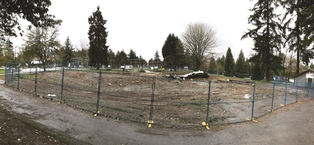
The existing Skate Park at Mercer Stadium is now closed, as the school district is busy building a high school on that spot. Recognizing this was coming, the City put some money in to the capital budget to build a replacement. The replacement will be bigger and more modern than the old skool bowl at Mercer, and it took more than year to work with the skate community and other stakeholders to figure out the best compromise between various potential locations. The best solution found was the old Arenex location at Queens Park, in an area of the park designated for “active recreation” in the Queens Park Master Plan.
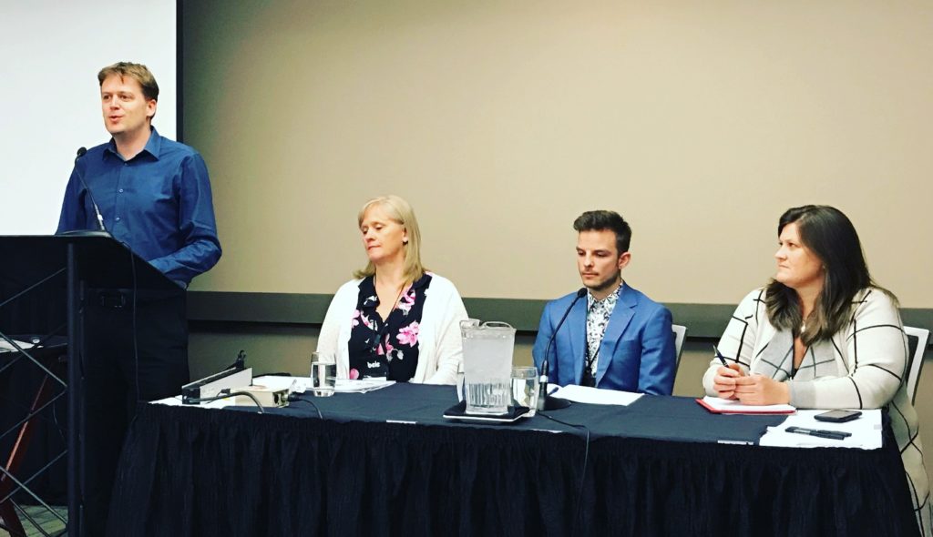
As there was some community concern related to this location during the community and stakeholder consultation, staff did extra outreach, design and engineering work to specifically address the concerns raised by some existing park users. With this work done, they came to Council in Monday last to ask for the go-ahead to procure the works, in the hopes we can get the new facility in the ground this summer.
I received a lot of correspondence on this proposal. At least 60 e-mails, some in favour; most opposed. An online petition was circulated and apparently collected hundreds of signatures in opposition to the proposal though I have to note that I haven’t seen or been provided any such list. Frankly, I was dismayed by much of what I read in that correspondence. I’m not going to call anyone out by name here, but the quotes speak for themselves:
“I am concerned about cadet safety and potential conflict that could arise between the cadets and skateboard park users”
“It will just lead to conflict between young people and theatre goers.”
“The theatre building will be a prime target for graffiti.”
“With the legalization of marijuana, the theatre faces the possible smell of skunk to the west”
“I believe having a skate park within Queens Park anywhere would be a detriment to the Park. It is a beautiful quiet family park and not suited to a skate park at all.”
“There are many (most) residents in new Westminster who would have it (the skateboard park) done away with if they could, so please do not create more ill will between your mature, working, VOTING citizens and youth.”
To quote the staff report on the last round of Public Consultation “In summary the stakeholder’s concerns include personal safety for other park users, risk of vandalism, potential for bullying of youth aged members of some organizations, perceptions of noise generated at the site, potential for vandalism/ graffiti”
I’ll talk about the noise concern further down, but before I get there, I have to admit that just reading this correspondence completely took me aback, and made it hard for me to remain objective. The narrative presented offers an archaic and uninformed attitude about roller sports. Skating (along with bmx/trials, scooting, blading) is a healthy, creative athletic activity enjoyed by youth and adults. Characterizing an entire group of recreation users as troublemakers not deserving of sharing in our parks use because they are vaguely threatening is, in short, offensive to my definition of community. So, to be really honest here, I probably went into Monday’s meeting with a frame of mind shaped by this, and that no doubt influenced my decision making. But let’s step back a bit.
When planning for a facility like this, or any facility in a City Park, there is a lot of work done before we get to a meeting like last Monday. Staff, user groups, stakeholders, consultants, and Council have been working on this for more than a year. I appreciate people wanting to get engaged in a decision like this, but people joining at the 11th hour need to recognize that your new idea has most likely already been evaluated. The City evaluated every piece of available City-owned land between Grimston and Hume Parks, between (to borrow a phrase) 10th and the Fraser, for this facility, and none were perfect. However, I can confidently say, having been involved in this discussion for more than year, that all other options had more net negatives than the final proposed location. The proposed place was not the perfect place, it was the least non-perfect place. That is the reality of how a consultative City works – every decision is a compromise of least-perfect solutions.
That said, the proposed location was a good one, worthy of support.
In speaking to the Skate community, it was clear that by putting a roller sport facility (like any other facility primarily directed at youth) at front and centre in a public place, you not only show you are inviting that activity into your community, but you generate interest, curiosity, and engagement, and build the sport. We hear too much these days that youth have limited opportunity or interest in unstructured outdoor activity (or “getting off their screens”, in the parlance of the day). Roller sport are exactly the kind of creative, athletic, unstructured, knee-scabbing and dexterity-building activity we lament youth not doing enough of, yet we have adults here trying to marginalize the activity by wanting it put “somewhere else” where they don’t have to see, walk or even park near it. Sorry, that argument doesn’t work for me.
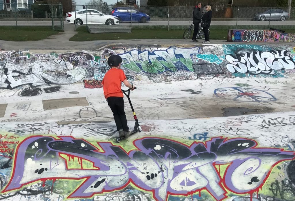
Knowing this issue was emerging, I have spent some time in the last little while dropping by the old Mercer skate bowl and the All-Wheel Park at the Queensborough Community Centre. Every time I went by there, there were users of a variety of ages, from 4 year olds on scooters to adults teaching their kids how to board. There were parents watching their kids be active and creative in the outdoors. None of them felt this was an unsafe place. I think all of them would be offended to hear they (and their kids) were being dismissed as threatening to other parks users. The New West Police and the staff at the Queensborough Community Centre were both consulted on conflict issues that we may need to mitigate if we move the facility to Queens Park, and both said, plain and simple, there are none. The City’s skate parks are not havens of hooliganism and trouble.
There is a reason for that. Rolling sports are not a fringe activity like it may have been 25 years ago. This is a mainstream sport. Its culture has evolved to one of creativity, community support, and partnership. When I found out that roller sports are going to be in the Olympics in 2020, and tried to square this with the non-competitive/cooperative nature of the community, it reminded me of something I noticed at the Winter Olympics this year. In the new Snowboard/Slopestyle/Cross type sports, there was a noticeably strong comradery in these sports. The person finishing fourth in the Skicross ran up to hug the gold medalist from another country; every slick run was rewarded by high-fives from competitors, every sick crash with a pat on the back or a hug. The kids today are different than us; dare I say better.
This was manifest in the correspondence I received in favour of putting the park in Queens Park. Again, no names:
“Placing the new skate park in the centre of Queens Park would profoundly and positively impact the New West community and increase acceptance and diversity for youth in New West. I believe it is the responsibility of our Mayor and Council to practice inclusivity towards more unique recreational activities that are popular among our youth.”
“I believe that placing the skate park in Queens Park would demonstrate the city’s celebration of diversity as well as honouring positive activities. It would set an example for all of our youth to see adults value the well-being, health, and enjoyment of young people. Skate Parks are a beautiful place that may invite people across many different socioeconomic backgrounds in New West to enjoy being outside, and foster belonging within our community”
“Given the wide range of existing facilities and user groups within Queens’ Park, our community has demonstrated it’s belief in the importance of public spaces being fully inclusive of different expressions of arts, culture, leisure and recreation. This is an opportunity to welcome a new user group and demographic to Queen’s Park and enrich its uniqueness, while contributing to its cultural legacy”
Now that I have disclosed by biases (and how they were developed as we went through this process), we can talk about the decision made on Monday.
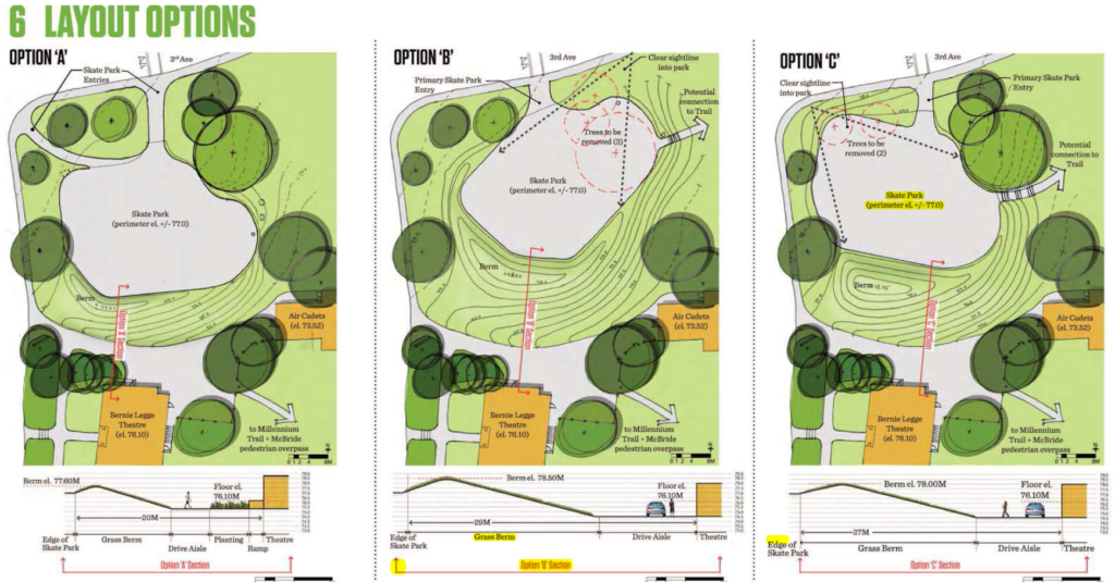
There were some legitimate concerns raised about this site: most notably the potential for noise impacts on the Bernie Legge Theatre. Recognizing these concerns when raised by stakeholders, the City paused the process and hired an acoustical engineer to evaluate the impacts. The report acknowledged that the skate park would create noise, measured it, and evaluated two ways to mitigate it. If the skate bowl was oriented towards the north, and a berm were built on the south side, the noise of the park (and other significant ambient sounds such as whistles on the soccer pitch and traffic on McBride) would be abated, making the theatre actually quieter than it is now. Alternately, the City could invest a little money in providing some improvements to the theatre including weather stripping and solid-core doors, which would effectively reduce ambient noises and the skate park form impacting theatre operations. The report from staff recommended the City do both of these, to double the sound baffling effect to give the theatre patrons an extra measure of confidence. This proposal would have resulted in a quieter Bernie Legge Theatre experience than there is now.
There were also some concerns about parking and pedestrian circulation around the Theatre. Again, the report proposed designating parking spots adjacent to the skate park, and improving pedestrian flow and surfaces between the parking lot, the theatre and the Cadets building. The proposal would have actually improved the very things the stakeholders were concerned about.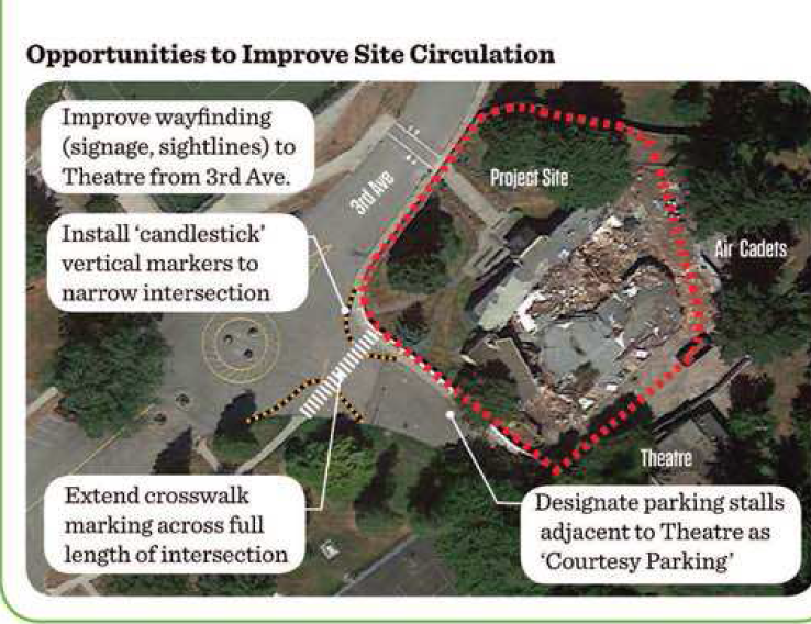
So the location was good for the user group, the legitimate concerns raised by the stakeholders could be and would be mitigated at the cost of the City, actually resulting in a quieter theatre with better parking access and pedestrian amenities. I don’t know why I would vote against this proposal.
After hearing a dozen delegations at Council, however, a “compromise” location was proposed. I could not support it. Here is why.
After more than a year of work, and a concerted effort to evaluate all positive and negative impacts of different locations, finding a design that fits the space and takes advantage of a current unused and unprogrammed part of the park, and after delaying to hire professional engineers to develop scientifically-defensible mitigation measures to address legitimate concerns, Council came up with a knee-jerk “compromise location” 30-40m to the west where there is a grove of trees and old tennis courts (the actual location is a little vague), which we have asked Staff to move ahead with “if technically feasible”. To be clear – no-one in that meeting knew exactly what footprint we are talking about, and no-one has any idea what “technically feasible” means, or what compromises will need to be made to accommodate this plan.
This “compromise location” is clearly an ill-informed compromise. It is not (as it was touted at the meeting) a “win-win”. It was, in my opinion, a result of treating the wants and needs of one user group with lesser regard than the wants and needs of another group, even after significant efforts to address the concerns of that second group resulted in a well-developed strategy to address their valid concerns and then some. Make no mistake, there is a lot potential loss in this “win-win”.
We don’t know what the skate community lost yet. Best case scenario, only a couple more months of being without a facility to practice their recreation. Potentially, this may be a much longer time if engineering or other concerns pop up. The “if technically feasible” caveat is a vague and compromising one in the world of engineering, and a terrible piece of guidance for professional staff (technically feasible at any cost? Regardless of other impacts?). After more than a year of work, the vision developed will be unnecessarily delayed and potentially compromised because of a last-minute knee jerk reaction that received far, far less technical scrutiny or input from stakeholders and user groups. That is a terrible way to make decisions.
Even worse: The potential impact on non-skaters has now not been fairly assessed. What of the users of the tennis courts and picnic area that will now be removed? Honestly, we don’t even know if moving the Skate Park to this “compromise location” will make the noise impacts on the theatre better or worse. It is entirely possible (and quite likely) that an earthen berm would have deadened sound much better than an extra 30m in distance. We do not have any evaluation of the opportunity cost of the “compromise location”. Basically, we cannot demonstrate any actual benefit of this location to anyone, other than salving a vague feeling that “they” need to be kept further away from “us”.
Best case scenario, staff will not run into any problems shoehorning a well-developed plan into a “compromise location”, and after only a couple of months delay, we will get a fully functional park up and running. Best case scenario, the new location will not create unanticipated impacts on other users of the park that require further mitigation. I am an optimist, and I sincerely hope this best case is realized. But in the decision we made on Monday, and the way we made it, Council did nothing to assure this happens.