Pedestrians matter

The City has been doing a lot under the new Master Transportation Plan to re-prioritize our transportation system. As New Westminster is increasingly a compact, mixed-use urban centre, our public spaces become more important to the comfort and safety of residents, to the attractiveness and accessibility of our businesses, and to the building of community. That means our public spaces have to be safe places for people; that safety cannot be compromised in the interest of “getting traffic flowing”. Freeways are for flowing traffic, streets are for people.

I’m proud of the work that the City’s Advisory Committee for Transit, Bicycles and Pedestrians (ACTBiPed) has done, and the collaborative attitude that City staff has adopted when discussion transportation issues, be they local traffic improvements or large regional projects like the Pattullo Bridge. However one piece of the political puzzle around transportation has been notably absent, not just in New Westminster, but regionally, and that is an independent advocacy organization to support the rights of pedestrians, and assure their voice is heard.

We have had various regional “straphangers” organizations over the years, and greater Vancouver has not one, but two separate cycling advocacy groups: The BC Cycling Coalition and HUB. The cycling groups have demonstrated that adding political voices together multiplies the volume, but also shows that advocacy can be constructive and collaborative. Their hard work over the last decades has resulted in millions of dollars in work making cycling a safer and easier alternative to driving in our region, and their work goes on.

There hasn’t been any such organization regionally working on protecting pedestrian space, or helping governments make better decisions regarding pedestrian rights. Perhaps this is because pedestrians are not seen as an under-represented minority. When you think about it, we are all pedestrians. Even if the only walking you do is to get from your car to a parking space, you need outcross a sidewalk to get there, and want that space to be safe (To expand out to truly everyone – the definition of “pedestrian” in modern transportation planning includes those who need mobility aids like walkers of chairs to help them get around). But politically, pedestrians are almost silent.

When the Ministry of Transportation, TransLink, or a Local Government design a new bridge or overpass, they seek input from the BC Trucking Association and the Gateway Council, organizations like BCAA and HUB use their political influence and the voices of their membership to assure that the interests of their member groups are added to the discussion. But pedestrians, for some reason, are absent. Because of this, sidewalks, crosswalks, and other aspects of the pedestrian realm are too often tacked on afterward, not integrated into the primary design thinking. The first thought is “how do we move cars”, then followed by “ok, let’s fit in some sidewalks”. Imagine how we would design our transportation system differently if we started with “how will a pedestrian use this space”, then decide what spaces we can allow for cars? Shouldn’t that be the default mode in a dense urban area like New West? Where is the organization to advocate for this shift?

The good news is that some local people are starting just this type of organization. They are calling themselves New Westminster Walker’s Caucus. They are a small group started by a few people familiar to the ACTBiPed as strong advocates for pedestrian rights, and for walking as a transportation mode. They have had a couple of meetings, and would love a little support from other walkers in New West and the region – show up at a meeting, lend them your skills, share the conversation.

We are all pedestrians, it’s time we stopped being so damn quiet about it.

Ask Pat: Whistle cessation update.

I’ve been a little behind on my “Ask Pat” responses. There are a few questions on different aspects of the Whistle Cessation theme, so I’ll cover them all with my answer to this one:

J.S. asked—

RE: new westminster train whistle cessation

I do not understand this project. There is a law saying train has to sound its horn at every crossing. Is there a law require it to be so loud that the entire town can hear it? Instead of throwing money on all these cessation projects which seem to be going nowhere, can’t train horn simply be modified so it is less aloud like a car horn or even a bell? Canadian train travels slower than a car. And I believe the law meant for it to be heard at that intersection only.

Yes, that would make total sense, but the answer to your first question is a completely absurd “yes”.

Train horns are designed to call attention to a train approaching a lonely rural road on the Canadian Shield at 80km/h, and therefore blow at something exceeding 100db for a regulatory more-than-20-seconds-for-every-crossing. That might make sense on a snowy rural crossing 100 miles east of Thunder Bay, but in the middle of a busy urban area the volume of the horns is clearly absurd. Especially then the crossing already has gates, bells, flashing lights, and the train is rolling along at 20km/h with a gigantic diesel engine chugging away at the front of it.

But the Railway Safety Act has a tendency to err on the side of caution, probably for good historic reasons. So we are stuck with this absurdity.

I would normally say “call your MP”, except that I know your MP has been working on rail interface issues for years, and has been stonewalled by successive governments and the simple intractability of trying to get the rail industry to behave as a good neighbour in urban areas. There is a bunch of long history here, related to the railways that built the Nation thinking and such, which was at one time, when railways were part of the National Enterprise, compelling, but now seem so much hollower now that the rail companies are just another multinational corporation charged with the holy duty of returning shareholder value… but I digress.

The City is, as you may have heard, working on bringing “Whistle Cessation” to our level crossings. This requires a significant amount of safety engineering, most of it patently absurd, to provide redundant safety measures enough that the Act and the railway operators are satisfied that absent-minded pedestrians and drivers won’t physically be able to wander into the path of a train. The City needs to pay for these works, and the rail companies that own the crossings both have to approve them, then decide (after the work is done, natch) if it now constitutes adequate protection to no longer require every person in a 5km radius to be alerted of the trains’ presence.

The works in New West have been painfully slow. There were a few engineering challenges, including the need to order some special equipment that could only be provided by a supplier approved by a railway. The multiple steps of design, pre-approval, engineering drawings, waiting for clearance, approvals to work in the right of way, waiting for the rail company to do the bits only they are authorized to do, getting authorization to do the bits we are authorized to do… it was painful.

However, I am happy to announce that the City has officially notified all of the stakeholders who need to be informed* that the City will officially request that Whistle Cessation be brought into effect for the two Front Street crossings through a resolution at Council scheduled for February 6th, 2017.

There are also three level crossings in Sapperton, and I have no idea when whistle cessation will be brought to those. The engineering requirements as far as sight lines and approach angles for cars under the Skytrain pillars are such that it appears simply impossible to meet any existing regular whistle-free standard. We will try, and new road infrastructure along that corridor will be viewed through a lens of whistle cessation, but barring radical ideas, I’m not making any promises about when that will actually occur.

*The list of Stakeholders who were officially served letters informing them of the City’ intentions for the February 7th meeting included the four rail companies that regularly operate on that line, plus PLM Railcar Management Services (Canada) Ltd.; PROCOR Ltd.; General Electric Railcar Services Corporation; the Canadian Fertilizer Institute; the Canadian Chemical Producers Association; the United Transportation Union; the Transportation Communications International Union Systems Board; UNIFOR; Teamsters Canada Rail Conference; Travailleurs Unis Transport (1843); the Brotherhood of Locomotive Engineers and Trainmen; the United Steel, Paper and Forestry, Rubber, Manufacturing, Energy, Allied Industrial and Service Workers International Union; GATX Rail Canada; Amalgamated Transit Union, Local 279; International Association of Machinists and Aerospace Workers; International Brotherhood of Electrical Workers; and the Propane Gas Association of Canada Inc. Dear God I hope we haven’t missed anyone. It’s absurd.

Tax time – 2017 edition

Assessments are out, everybody lucky enough to have entered the housing market lottery prior to about 2008 is discovering how much their nest egg has expanded in the last year, and even to the lucky winners, this is at times disconcerting. Strangely enough, people who have just discovered that have an extra couple of hundred thousand dollars in tax-protected equity they didn’t know about are concerned about the impact on their Property Tax. People are funny that way.

I wrote a piece several years ago about how property tax relates to your assessment increase, and last year provided a handy graph showing how your assessment increase vs. the average city-wide assessment increase results in different increases in your taxes.

This year, the Mayor of Coquitlam used Facebook to send essentially the same message, and New West blogger and noted Hawaiian star-coder Canspice wrote another piece with a slightly more updated example of how the system works compared my older one. So I won’t tread over all that again, but short version is your Municipal taxes won’t go up nearly as much as your assessment.

My incredibly average house’s value went up 30% this year, and the average for New Westminster was 28.5%, so my property tax bill will go up 2.5% plus whatever increase Council decides is required to pay the bills in 2017 (now looking to be just under 3%, but not yet confirmed). If your home went up 25.5% in value, your taxes would be exactly the same as last year. If your home went up less than 25%, your taxes are going down.

However (and here is another important point people often miss), this only relates to your Municipal taxes. When Council decides it needs to collect 3% more tax revenue to balance the budget, we adjust the mill rate to increase our revenue by 3%. However, Municipal taxes are only a little more than half of your Property Tax bill. You may remember these line items from last time you paid your taxes:tabletax

In New West (and this varies between Cities for reasons that will soon become obvious), about 60% of your Property Tax goes to the City, the other 40% goes to other agencies, and the City has no control over what the rates are for those taxes.

Your 2016 property tax in New West broke down into these categories, with the Mil rates shown. Only about 60% goes to the City
Your 2016 property tax in New West broke down into these categories, with the Mil rates shown. Only about 60% (the blue bit) goes to the City.

The School Taxes (for a New West residential property, this is about 30% of the total you pay) are set by the Provincial government. They are based on a Mil rate, like your Municipal taxes, and like them, the rate is different in every City. Generally cities with higher land values have lower mil rates (West Vancouver is 1.026, Quesnel is 3.698), and the rates are adjusted every year. After that, I honestly have no idea what formula they use or what their goals are towards equity across the Province. According to the Ministry, they are raised every year “based on the previous year’s provincial inflation rate”, but I am not really able to confirm or refute that idea. I have never seen a letter written to the newspaper complaining to the province that School Taxes are going up.

There are also two regional charges attached to your Property Tax bill, again not directly controlled by the Municipality: those to support the operation of Metro Vancouver (GVRD) and TransLink (GVTA).

The Metro tax (Mil rate 0.0563) is solely for regional government operation, and is separate from the utility charges that makes up most of Metro Vancouver’s revenue. The Metro Vancouver board (which is every mayor in the region) negotiates that rate every year based on needs, and it is the same Mil rate across the region, so people in West Vancouver pay much more per household than people in New West, as their property values are higher.

The TransLink Mil rate (currently 0.2834) is determined by the TransLink board, with approval from the provincial government and within the confines of the provincial regulation that governs them. This rate is , again, flat across the region, meaning West Vancouver and Vancouver pay more than New West and Langley per household. This provides about 20% of TransLink’s revenue, and this is the heart of the long battle between the provincial government and the mayors of the region – the Province would prefer that new TransLink revenue to come from increases here, the Mayors have a long list of alternate sources they would prefer, from sales taxes to road pricing to carbon tax. But let’s not go down that rabbit hole just now.

There are also two small charges controlled by the provincial government for the benefit of local governments. The BC Assessment Authority (BCAA), who determines your land value, is funded wholly through Property taxes, and the Municipal Finance Authority (MFA) gains some operational funds through a very small Property Tax charge (20 cents for a $1,000,000 house). Both of these are collected with Mil rates flat across the province, so the average West Vancouver resident pays much more than the average Quesnel resident, with New West somewhere in the middle.

Finally, the City’s new Property Tax Estimator gives you an idea of what your actual assessment means to your tax bill, assuming that Council approves a 2.98% tax increase. It also provides an interesting break-down of how the City’s revenues are distributed between departments, giving you an idea of what you are buying with your Property Tax, and how much you are paying for each.

Open letter on the OCP

I receive quite a bit of correspondence as a City Councillor, and I try to reply to as much of it as I can. Sometimes the time just isn’t available, and sometimes the writer doesn’t really leave a space for response (like the racist tirades I receive from “Immigration Watch” every week. Ugh, those guys are relentless).

I rarely make my responses public, as people writing may not like the idea of me writing in a public forum about their ideas, concerns, or opinions. However, recently a letter I received was also sent to and published by the local newspaper. In this case, I thought it appropriate to make my response public. There has already been a bit of social media push-back about this letter, some of it not very respectful to the writer, so I avoided responding via the Record for fear of “piling on” and making that conversation space less comfortable for anyone else interested in expressing an opinion.

We need an open discussion about things as important as the Official Community Plan. however, we also need to make sure the discussion is factual. So with that in mind, and with respect to the letter writer (whom I have met and is a very nice woman with honest and strongly felt convictions), here is my response as sent to her through e-mail a few days ago.

Mrs. Dextras.

Thank you for taking the time to write a letter to Mayor and Council regarding the OCP process. I know you are passionate about your neighbourhood, and am happy to see more voices from Glenbrook North take part on the public engagement.

However, I would like to correct a few misconceptions that I read in the letter as published in the Record, which were also manifest in your presentation to the GNRA when I was there.

The land use designations indicated in the draft land use map during the latest round of public consultation were not “arbitrarily” designated by planning staff. They were the product of more than two years of background data collection, public engagement, workshops, surveys, planning analysis, and conversation around the Council Table. Some earlier drafts presented at public meetings included more or less density in that area of Glenbrook North, and indeed in every neighbourhood in the City. The draft map you now see was developed through lengthy discussions of planning principles, and significant public feedback. There is nothing “arbitrary” about it.

Land Use Designation is not zoning. I know we have heard this more than once, and you have changed your language slightly to reflect this point, but it appears you are still conflating the two principles. The OCP is not a tool to change the zoning of your property, and there is nothing in the OCP that would force a person to sell or redevelop their home. There are currently no rezoning plans for your street, and your “property rights” are in no way reduced by the land use designation

The OCP update process was not initiated by this Mayor or Council, but began in early 2014 under the previous Mayor and before I or my colleague Councillor Trentadue were elected. The current OCP was developed in the 1990s, and though thoroughly amended over the years, was no longer reflective of the reality of New Westminster in 2016. As the Development Permit process to control development relies on an effective OCP, an update was necessary, and I vocally supported it while running for Council, however, I did not initiate it.

You also appear to have a mistaken understanding of the relationship between an OCP and the Regional Growth Strategy. The latter is required for regions experiencing growth (as we are) and s.850 of the Local Government Act (LGA) sets out its requirements. A Local Government OCP is required by law (LGA s.868) to include a Regional Context Statement that outlines how the OCP addresses the RGS, and how they will be made consistent. As such, local governments are required to follow the guidelines of the RGS, although they have considerable flexibility in how they meet those guidelines. In fact, the ruling you cite (Greater Vancouver Regional District v. Langley Township) found that the decision to add density to a protected area by Langley did not constitute a violation of the context statement, but was within that flexibility allowed to the City. Our Council is, indeed, legally bound to adopt an OCP that meets the RGS guidelines.

Your repeated assertion that 450 townhomes will be built on 5th Street in the next 20 years is difficult to reconcile with the draft OCP and guidelines. The west side of 5th street in Glenbrook North (outside of the part already converted to multi-family and commercial use near 6th Ave) is approximately 7 acres (not 15), perhaps 2300 linear feet of block face. With the guidelines proposed in the OCP, this would hardly accommodate a quarter of the townhouses you imagine. With a large number of residents (such as yourself) dedicated to stay in your homes, and not interested in exercising the expanded property rights an OCP amendment may afford, then it is safe to say many, many fewer than this will be built.

Where you are not incorrect (as it is an opinion) but where I strongly disagree with you, is in the assertion that young families like the one profiled in the Record should not be welcomed into our community, and we should not be developing housing policies to accommodate their needs. For a City, indeed for a neighbourhood, to be a livable and vibrant, it must remain accessible for people at different stages of life. I believe in the modern urban planning concepts that a community needs to include places where people can live, work, play and learn in close proximity, as the alternatives are ultimately unsustainable for the environment, for the economy, and for our social systems.

Nonetheless, I am disappointed to hear that your experience at one of the OCP Open Houses was not welcoming, or that you did not feel that your concerns were addressed. I attended several of these events, and never got the sense that staff were hostile to ideas that challenged the draft plans presented (although I occasionally heard participants passionately disagree on matters of principle or specific details). If you did not feel welcome to participate fully, that was indeed a lost opportunity, and I apologise. That said, the correspondence received from you and your neighbours has not been ignored, but has been read, included in the official record, and will be considered by Council as the final OCP is presented in the spring. I have listened to your concerns, have read your correspondence, and very much appreciated your hosting me for coffee in your home on Thanksgiving weekend to discuss your concerns with the process. I am, however, chagrinned that you continue to harbour false ideas about the meaning of the OCP update, and make oft-rebuked assumptions about the impact on your neighbourhood. Perhaps a more fulsome discussion may have provided some clarity to the points above (for example, I cannot stop emphasizing this is not about rezoning).

You are (of course) welcome to continue that correspondence, and to take an active role in the Public Hearing that will be required prior to Council adopting a new OCP.

Thank you again for taking the time to get involved in your community!

Patrick Johnstone

ASK PAT: Q’Boro watercourses.

Someone asked—

Hi Pat,
My partner and I live in Queensborough. We are both plant lovers and native plant specialists, and have come to love our little place by the river – such a magical mix of water, plants, and living things… We often take walks along the waterfront and up and down the tattered side roads with their open ditches filled with teeming plant and animal life. We are constantly enjoying the native plant life that has been cultivated and also occurs natively in the area, but have a number of concerns.

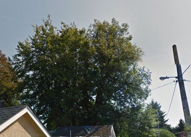
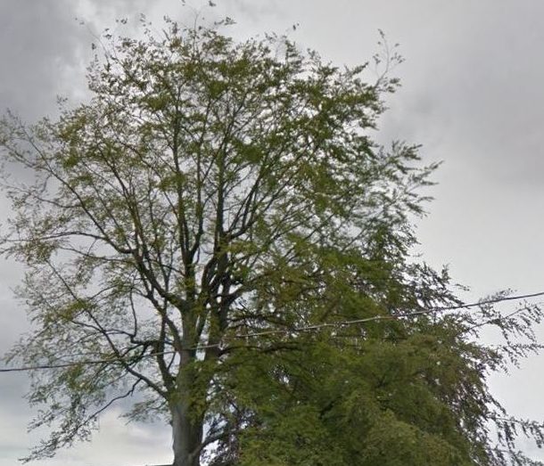
First and foremost, we recently noticed that in the last month or so, a large number of big trees and shrubs were removed from the riverfront with no notice. This is the side that faces Annicis Island, and I believe a lot of the trees were deciduous. Willows, Mountain Ash, and other trees were chopped down as well as the other herbaceous and woody plants. This is something we notice happening on a small scale along the ditches as well. Most importantly, we’d love to know why these large trees were cut down, most likely because of disease or pests, but absolutely no signage was placed on the path in the Aragon where all the cutting happened, and we are very curious about the city’s policy on controlling these wild areas, if any. Could you send some information our way please in terms of this? We’d also love to know what the plan is for the large biodiversity of plant and animal species that are consistently being eaten up by the growing development and if these open ditches and waterways will somehow remain untouched. We are looking forward to new development, the Q2Q bridge more than anything and additional retail, but it worries us to see so much changing too. We would also like to know what to do when we see ditches and waterways which are being clearly polluted by the nearby industrial?

Thanks so much for fighting for a better city for us all. We look forward to your responses, and finding a way to make Queensborough more of an example of environmental stewardship. There are few places like this left – water, plants, and living things together – that have the potential for so much life and health, and unfortunately there is much work to do still, and remediation to be completed on what was done long ago.

This is going to be one of those good-news bad-news answers, depending on how you feel about ditches/watercourses. I’m likely to go on at length here, as there are actually several questions here, and I’m going to try to hit them all systematically.

I also love the Queensborough waterfront, especially the south and east sides where the City and developers have invested in the restoration of the waterfront, and have effectively made it a comfortable human space and an ecologically productive space. We just had the 4th (5th?) annual shoreline cleanup along South Dike Road, and the impressive recovery of native species and ecology along the river is always inspiring.

qb4

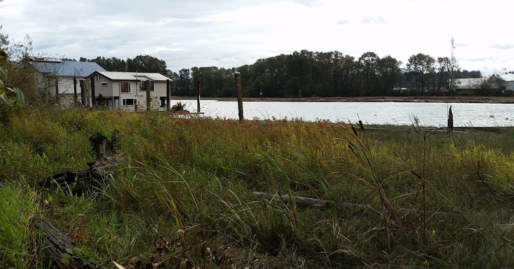
The fate of inland ditches in Q’Boro is, however, one of those political hot-button issues, where someone is going to be unsatisfied whatever the City does. For all the people in Q’Boro who love the frogs, the dragonflies, the ducks and even the occasional stickleback, there is at least another who hates the murky water, garbage accumulation, loss of parking, and general untidiness of having an open ditch in their front yard. I’m not going to opine whether you are outnumbered or not, but you are definitely outvolumed by people demanding that the City get rid of the ditches and install “proper” sewers as soon as possible.

From an ecology point of view, some of the watercourses in Q’Boro are protected by the Riparian Areas Regulation (RAR), a provincial regulation that is, quixotically, managed completely by local governments. Not all “constructed watercourses” are protected, however, as ephemeral and isolated watercourses and those already severely impacted are not determined to have high enough ecological value to receive full protection of their riparian areas. Further, the riparian protection need on some of the larger ones plays second fiddle to the need for maintenance to keep the water flowing and houses from flooding.

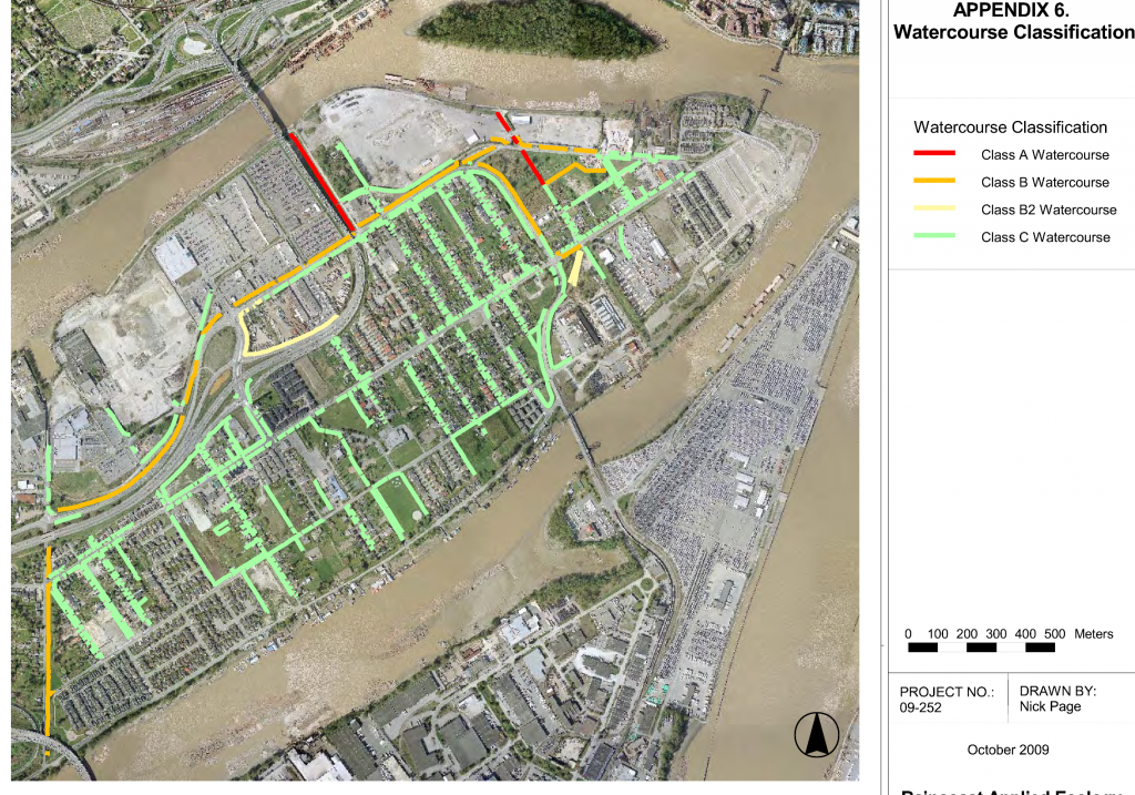
The City performed an ecological mapping exercise back in 2010 that, amongst other things, showed the classifications of the watercourses in Q’Boro. Several of the larger ones (Class A and Class B) are protected, and are not likely to be filled in the long-term. There are provisions on in the RAR for preserving and improving the quality of the habitat around them, including trees and shrubs, which can curtail development and prevent them from being filled. When you balance the need to maintain these watercourses as conveyances with the need to protect the ecology, I wouldn’t say they will remain “untouched”, but more that our engineering folks will try to protect the native species and habitats as best they can while keeping people’s houses dry.

Filling in even the smaller, unprotected ditches creates yet another problem, this one purely engineering. An open watercourse can store and transport a lot more water than if a pipe was dropped into that watercourse and it was covered up. To replace the storm water management and flood protection capacity of all of the open watercourses in Q’Boro would require huge pipe infrastructure, and all of the associated catch basins, inspection chambers, and pump infrastructure. To make matters worse, the soils in Q’boro need just as much engineering and densification to hold up a sewer pipe as they do to hold up a housing complex, which significantly increases the cost. Don’t get me started on the shallow water table and the construction/maintenance problems it causes.

Therefore the City has developed a longer-term strategy to plan for, and pay for, drainage infrastructure improvements whee they are appropriate, and addressing the eventual filling of the smaller, disconnected ditches that are not protected by the RAR. New developments in Q’Boro pay into a special DCC earmarked for drainage improvements, separate from the mainland and dedicated to works in Q’Boro. When a developer builds in Q’Boro, we take advantage of the soil densification and drainage planning they are doing to make it more affordable to install new infrastructure.

Residents in the Single Family House neighbourhoods who wish to have the drainage closed on their block can do it through a “Local Area Service Plan”, where they get the work done in a cost-sharing with the City (and pay for it over time through their taxes), as long as it isn’t a watercourse protected by the Riparian Areas Regulation (i.e. Class C or worse). We received a report to council in September 2014 (see page 88 of this lengthy Council agenda if you are curious).

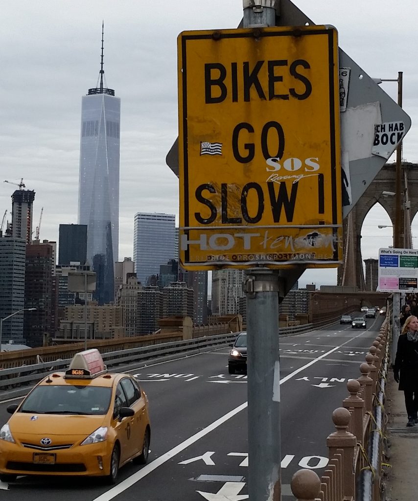
Now onto the trees. We do have a recently-adopted Tree Protection Bylaw that applies to new development, City lands and private lands. I don’t know the details of the tree removal you are talking about, but if it happened after the Tree Bylaw was adopted (January 13, 2016) and didn’t occur on Port-owned land, then there should have been a posted permit. If the trees were hazardous or dangerous (as determined by a professional Arborist) then they will be replaced on a one-for-one basis. If they were simply removed to facilitate development, they will be replaced on a two-for-one basis. It isn’t perfect (two young trees don’t necessarily provide the ecological benefit of one mature tree), but it balances the limits of power a local government can do when approving development on treed lots with our desire to have more trees in our community. When planning for trees, one must have a 20+ year vision.

What to do when you see industrial pollution in ditches? First off, you need to know if it is really “pollution”. The groundwater in Q’Boro is similar to adjacent Richmond, in that it is a product of being a former peat bog. The lack of gradient and boggy soils result in stagnant groundwater that, for a bunch of biochemistry and geochemistry reasons I won’t get into here (did I mention I’m an Environmental Geoscientist working in soil and groundwater protection?) has very low dissolved oxygen, low pH and lots of dissolved metals like iron and manganese. When that groundwater hits our ditches, it is exposed to atmospheric oxygen, causing those metals to precipitate out in to metal oxides (making it murky and rust-coloured), and in the presence of biology, more complex metalliferous organic compounds. What sometimes looks like and oil slick in the water may actually be a natural “metalliferous sheen

That said, all the ditches in Q’Boro connect directly to the Fraser River without any kind of water treatment, so real polluting substances going into the ditches will more than likely find their way into the river. Section 36 of the federal Fisheries Act says you can’t do that, and enforcement of that law falls on Environment Canada. However, response to smaller spills in to fish habitat is a multi-level cooperative effort between EC, the provincial Ministry of Environment, the Coast Guard (if it hits the river) and local governments. In that sense, who you should call first probably depends on the situation.

If you see something curious, but you are not too sure, either use SeeClickFix or contact the City’s Engineering folks, and they will check it out.

If you see what is clearly a spill, and are worried about fish or see potential impacts to ducks or any such concern for wildlife, you should contact the provincial spill reporting phone / app, and they will triage and determine the proper level of response and response agencies.

If you see a dangerous spill, such as an overturned gasoline truck or a dump of dangerous substances where there may be human health or property damage implications, you should call 911 and ask for the fire department. They will be able to determine a safe response strategy, can arrange for evacuations or road closures, and can coordinate with the City’s engineering folks and senior governments whose job it is to stop the spread and coordinate the clean-up in a way that keeps people from getting hurt.

Finally, what can you do to see more ecological protection of Queensborough, and New Westminster in general? You might want to make contact with the New Westminster Environmental Partners. They organize the Q’Boro Shoreline Cleanup every year, and are always looking for interested and knowledgeable people to help with environmental protection advocacy and works. You can also consider joining the City’s Environment Advisory Committee, which advises Council on topics environmental. The application period for 2017 is open right now, and we don’t generally get a lot of applications from Q’Boro for City Committees. Bringing your voice to the table may help the City make better decisions regarding ecological protection of your neighbourhood.

Whoo Hoo! Two ASK PATs in a row that end with plugs for joining City Advisory Committees! People should really apply!

Ask Pat: Whither bike lanes?

It’s been a while since I answered an Ask Pat question, and there are a bunch of them in the queue, so I’m sorry if I haven’t gotten to yours! I’m a little over programmed right now. All good stuff, just too much! So here we go with an Ask Pat from a guy with a suspicious name:

Patrick P. asks—

Hi Pat. I find it totally bizarre that while we allow new apartment towers to be built with hundreds of new parking spots for cars, it seems no thought has been given to mitigating all the extra traffic on the road, or to giving people a cycling alternative — or to the impact on our environment. We have no dedicated (separated) bike lanes, and my bicycle commute to central Burnaby has been a challenge as there are no signs indicating a safe route. Moreover I am very worried for the safety of children like mine who want to get around town by bicycle.
Are there any plans to make our city more cycling friendly, particularly around shopping areas? What can I do to help?

I hear you. As a person who rides a bike for recreation and for daily chores, and tries to commute by bike as much as I can, with a partner who commutes to Burnaby every day on a bike, I know we aren’t yet where we should be as far as cycling infrastructure. Short answer to Question 1 is yes, answer to Question 2 is way down below at the bottom of this post, so fix a cup of tea, sit back and enjoy (or just scroll past all the fluff to the bottom couple of paragraphs)

There is a strange thing about traffic in New West: it mostly isn’t us. Two great statistics that tell you about our traffic problem is that the City has the highest percentage of its land dedicated to roads of any municipality in BC, and that New Westies drive less and own fewer cars per capita than the residents of any municipality in BC (with the exception of the City of Vancouver). Yet traffic is our #1 problem, because people like driving through New West. Presumably, they like it because they don’t have better options, not because of the nice views or the friendly demeanor of our residents.

So in that sense, if we have a car traffic problem, it isn’t the people living in towers on top of SkyTrain nodes. The extra 300 residents with (following our demographic trends) 200 more cars, used only 50% of the time, are a drop in the bucket of the 400,000 cars a day (a number I do NOT have a source for, but a number used anecdotally to describe our through-traffic for rhetorical purposes by virtually everyone) that ply our streets. There is an entire political conversation about whether parking minimums for new developments are good public policy, but I don’t think that is where you are going with your question.

Arguably, providing more housing alternatives in New Westminster (including those towers on SkyTrain nodes, and “missing middle” family-friendly housing forms) will act as a disincentive to people commuting through our City, by providing people better options that living to the east of us when they work to the west of us (you can change either of those directions to point to the same problem). The entire model for the Regional Growth Strategy and Regional Transportation Plan is based on that idea – compact, transit-friendly, mixed-use development as opposed to car-centric sprawled single-use development. New Westminster is (IMHO) leading the way for this development model regionally, and is, unfortunately, still straddled with the traffic impacts of neighbouring communities not talking as active a role in changing how they develop to suit the regional vision.

But you live in New West, work in nearby Burnaby, and want to be more comfortable riding your bike to work and to shop. Even better you want to feel safe sending your kids off to school riding their bikes. You (and I’m not just saying this because of your great given name) are part of the solution, and are fortunate to have the opportunities in your work/life/health/etc. to make that choice. The City should be making it easier for you.

I think we are, but perhaps not as quickly as either of us would like, through implementation of our new Master Transportation Plan. Passed before I was elected (although I served on the advisory committee), this plan represents a monumental shift in how we, as a City, are going to look at investing in our transportation system.

First off, it places active modes at the top of the priority list:

heirarchy

To me, that means we are going to spend less on making the asphalt smooth, and more on making the sidewalks, bike routes, and transit system operate better for all users. To you and me, that may seem obvious; to enshrine it in a master planning document means we are charged (us elected types and staff of the City) to do it, and put our budget where out mouth is.

What does this look like on the ground? For the first time, New Westminster is investing in green paint. It has taken a bit of time, and in the first year of MTP implementation we really invested more in primary pedestrian and transit accessibility (we are aiming for 100% accessible sidewalk curb cuts by 2018, and 96% accessible bus stops, which leads the region on both counts). We have also staffed up a bit in our transportation department to expand our ability to plan and deliver these projects. This next phase does include some significant cycling improvements.

We have already identified some “quick wins” for cyclists, where a bit of engineering can make a few key links on our established greenways work better. You will see things at 20th and London Street, 7th Ave between Moody Park and 5th Street, under the Queensborough Bridge in Queensborough, and between Braid Station and United Boulevard (for a few examples) right away. A few other slightly more challenging issues (a hill-friendly bike route connecting Downtown to Uptown) are being worked on, as are designs for the Agnes Greenway, and an extended greenway from Braid Station to Sapperton Landing Park. Safe Routes to School and Safe cycling to school are also high on the priority list.

As an aside, you probably have no idea how much that green paint costs. On a square-foot basis, it would be cheaper to do engineered hardwood. But we will probably save long-term on maintenance.

The best I can offer you is small relief in the immediate future, with a long-term vision towards a properly developed integrated and complete bike network. It is going to take a few years, but the MTP gives us the vision, and I think Council has the political drive to make it happen. When compared to Vancouver, we are a small municipality with a limited budget, so multiple separated bike lanes and the assorted infrastructure (lights, signs, paint, paving) to make them really work ideally, are an expensive prospect. I can’t guarantee they will arrive tomorrow, only that this is the direction we are headed, and I’ll be advocating for our budget allocations to suit the priorities we have set through our MTP.

If you think you have good ideas about cycling infrastructure needs in New West, there are two ways you can help.

You can apply to join the advisory committee in the City that works to make New West a better place for cyclists, pedestrians and transit users: ACTBiPed. I happen to chair that committee, and served on it for a couple of years before I was elected. I think we have managed to make it an effective group where staff and community members work together on “big picture” strategies, and also take time to dig into the detailed design elements of new infrastructure to assure they work for active transportation users. The City is receiving applications right now for 2017 Committee appointments, and you can get all the info you need to apply right here.

If working within the system doesn’t satisfy your needs, you can also get involved with the local HUB Chapter, who advocate for better cycling infrastructure and funding, locally and at the regional level. New West hosted their AGM a couple of weeks ago, and it was great to hear about the work being done in the local chapters across the region. The local group is also instrumental in getting elementary school kids trained to ride their bikes safely, running cycling safety and skills courses with the School District. They are also a very helpful voice at the table when we are making decisions about cycling infrastructure in the City. You should become a member, and then decide if you can give them your time, donate them some money, or whatever combination of the two fits your lifestyle the best!

Finally, you can ride your bike, and use SeeClickFix when you run into problems, to let City staff know that good cycling infrastructure is wanted, and bad cycling infrastructure is noticed, by residents of the City.

We are working on the MTP, on making this a better place to ride a bike, but we could always use more motivation from our residents!

ASK PAT: Electrical utility

Chelsea asks—

Why does New Westminster have its own electrical utility? What benefits does it deliver to residents and businesses? Seeing as every time Hydro raises its rates to pay for new infrastructure or repairs we have to raise ours too.

Reason I ask is that as a single homeowner living in an apartment, I pay a flat rate that is higher than BC Hydro’s step 1 rates, and I never use enough electricity to move me into step 2 if we were on BC Hydro. So basically…families and people who use a lot of power over a two-month billing period are getting a discount compared to BCH, and I’m paying more.

We also don’t get the benefits of online access to our electricity consumption or basic things like e-bills. It’s nice that I could still pay my bill in person at City Hall if I chose…but I think I’d take being able to see my usage online, just like my cellphone bill or my cable/Internet.

I could have sworn I already wrote this blog post and drawn the graph below, but I can’t find anything in my archives, so I guess I just dreamed about it, or half-wrote it then moved on. So thanks for the reminder!

First off, we have our own electrical utility because we have always had our own electrical utility. It started in 1891, which makes it 70 years older than BC Hydro, and even 7 years older than Hydro’s grandfather, BC Electric Railway Company. Though most local municipal power systems across BC were amalgamated into BC Hydro (or West Kootenay Power, now FortisBC, or other entities), a few still remain independent.

The most obvious benefit is that the City makes money selling electricity. We purchase it at wholesale rates from BC Hydro, and we sell it at retail rates similar to what BC Hydro charges users in adjacent communities (more on this below). The difference between the two is about $8 Million a year. Some of that goes to pay for the operation of the utility (maintaining all those poles and wires, and the staff to do so) and contingency funds to pay for asset replacement as the system ages, but a significant portion of it goes into the City’s coffers, where it effectively offsets property taxes.

There are a few other benefits as well. We generally have more reliable power service and faster response during storm events, because we have dedicated crews and contractors who concentrate on dealing with New West issues while BC Hydro is sometimes stretched a little thin during large storm events. We also, by owning so much of our own utility assets, can leverage that for things like installing a fibre network (happening now) and district energy utilities (coming soon, I hope).

Historically, our Electrical Utility has emphasized reliable service and economy, and has (how can I put this politely…) lagged behind a bit on customer service innovation like on-line billing. They don’t have much of a web presence, and mostly operate out of a non-descript building adjacent to our works yard. Even finding out how our rates work can be a bit of a challenge with the City’s website, as most customers would not think to search for Schedule A of the Electrical Utility Bylaw to get answers. Really, in 2016, they shouldn’t have to. This is a place where a little Community Engagement effort would go a long way.

Now onto the rates issue. The City’s policy has been to maintain retail rates similar to BC Hydro retail rates, and overall when all of our different residential, commercial, industrial, and other rates are combined together, you find this is the case. However, the actual structure of how we charge is slightly different, and ultimately, some people pay a little more than they would on BC Hydro, some pay a little less.

As you have discovered, our base rate for residential users (the amount you pay to have an account, regardless of electrical use) works out to be a few cents higher per 2-month billing period (New West charges $11.92 per 2-month period, BC Hydro charges $0.1835 per day). We then charge a flat $0.0993/ kWh of use, where BC Hydro charges $0.0829 for the first 1350kWh per billing period (2 months) and $0.1243 for any above 1350kWh. So, although collectively, we pay about the same rate, residential users (like you and I ) who use less electricity probably pay more per unit relative to BC Hydro rates, that people who use a lot. To graph it out, it looks like this:

graph1

According to BC Hydro, the average BC household uses about 900kWh of electricity every month. If this average holds true for New West, then the average household is paying about $5.80 per month more than they would in a BC Hydro service area, or almost $70 more per year. Strangely, if you are an efficient apartment dweller and use half that amount of electricity, your monthly New West premium is even higher – at $93 per year.

If you use about 1130kWh per month, then your rates are the same as BC Hydro, and the more you use, the more your savings go up. At twice the average, 1800kWh/month, you would get about a $200 per year discount off BC Hydro rates by living in New West.

As our rate structure is flat, you are not subsidizing larger users – we all pay the same for each unit of electricity in New West. However, comparison to BC Hydro’s stepped rate structure gives the impression that we are encouraging consumption, but not doing enough to actively discourage it. If you add the base and metered values together, here is the true cost of what you pay for every kWh of electricity, based on your usage:

graph2

For context, my (admittedly back-of-the envelope) estimate is that the average New West household saves about $160 a year in Property Taxes (or, depending on your viewpoint, receives $160 worth of extra services from the City they don’t need to pay for through taxes) because we have an electrical utility and the profit it earns for the City. That might make you feel better, except that property taxes index with the value of your home, so again, the big-house-owner probably gets more benefit than the apartment dweller.

In summary, I don’t think this is good. I support the concept of City using the Electrical Utility to provide a financial benefit to the residents that own the utility, and offset their taxes. I support using “similar to BC Hydro” as the benchmark for our retail rates. However, I think the impression of benefitting larger users that is created by our flat rate structure sends the wrong message. I remember asking some questions about this back when I was still pretty new to the job, and I seem to remember getting a report that more of less confirmed what the graph above shows.

I’m not on the Electrical Commission, and I’m not sure when the next rate review will occur, but I’ll see what I can do.

Tree loss & protection

A few years back when I was still complaining about the City’s lack of action on a Tree Bylaw, I pointed out the presence of a great beech trees on my street. This was one of three, gigantic, more than 100 years old, trunks more than a metre across. They provide so many benefits to the neighbourhood and the community: shade, noise abatement, wildlife habitat, storm water detention, cooling the air.

These three had “heritage” protection, so they were unlikely to be capriciously removed, but that limited protection was not afforded to most trees in the City. The vast majority were afforded almost no protection – if the landowner chose to remove them, she was good to go. A Bylaw was needed, and through the lengthy development of an Urban Forest Management Strategy, these newly-monikered “specimen trees” are protected from removal by short-term thinking.

I was shocked last week when a neighbour came over to complain to me that the City had allowed one of the three grand beech trees to be removed. “I thought there was a Bylaw!”

Alas, I wandered over to the property in question, and indeed one of the three is no more. No more than pile of alarmingly large slices of wood, as the arbourists were working on site clean-up. I noticed a Tree Removal Permit attached to the house, so clearly they got permission, but I felt the loss as much as my concerned neighbour. So I called up staff and we have had some discussions about this tree.

*I am trying to be careful here, because the homeowner who owned the tree did not do anything wrong, and I don’t want to cause them embarrassment or any kind of trouble, but a few people have asked me about the loss of this tree, and now there is a story in the Paper, so I felt like I needed to comment about it here. It will be difficult to tell the story without providing clues about the location, and I think people need to know the story of the loss of a community asset like this. So please, be respectful of the homeowner who – I’ll say it again – did nothing wrong here. If you feel the need to act out or speak up or react negatively, do it to me and Council, not them. Thanks.*

The story of this tree is that it was suffering from senescence, which is the technical way of saying it was dying of old age. I don’t want to get into the detailed description given by the arbourist, partly because I’m not an arbourist and may not clearly translate their terminology, and partly because there are probably FOIPPA issues in releasing a report provided to the City without passing it through the privacy protection filter.

The now-gone tree in 2011, looking pretty happy. (ripped from Google Street View, no permission requested)

Our efforts to look back are, fortunately, assisted by technology. Google Street View has photos both from 2011 and from 2016 on adjacent streets. The visible decline of the tree is obvious. It looked (again, to my untrained eye) healthy in 2011, but by 2016, the leaves are sparse and diminutive, many branches looking bare. There was quite a bit more evidence of decline in the arborist report, but there is no doubt this tree was not very happy.

The same tree in June, 2016, looking sparse and lob-sided at a time of year when it should be in fill bloom. (also ripped from Google Street View)

The contributing factors to a tree like this entering full-plant senescence are usually multiple. Sometimes there is an attack by a pest, and the drought-like conditions we have experienced for a couple of summers probably hurt the resiliency of the tree. It is possible (I’m just speculating here) that poor pruning practice or damage to the roots for home improvements may have also been a factor, further reducing the ability of the tree to cope with declining productivity.

In the end, the things that made the tree so majestic – its great size and hulking branches – are the things that made it a “hazardous tree” once that decline began. The arbourist did not think this was a temporary setback, and that recovery was unlikely. what was more likely was continued decline until the branches started to collapse, potentially onto a building or person. The homeowner got a permit, had a tree health assessment done, and received permission to cut the tree down.

As this is a “specimen” size tree, and a hazardous one, Schedule A of the Bylaw indicates that the homeowner is required to replace the tree, and the City collects security to assure that replacement takes place. Of course, putting a new dogwood or birch sapling in the place does not really “replace” a 100+ year old giant like what was lost. It will be decades until the replacement starts to provide the mass of benefits that the old tree did. But even this replacement policy did not exist before the Bylaw.

Which bring me to the point – the Tree Protection Bylaw does not mean no trees will ever be removed again. What it means is that the City has applied measures (call it Red Tape if you are so inclined) to act as disincentives to the removal of trees, and to provide compensation to the community for trees lost. When it comes to private property, that is about as far as we can go as a City. It has proven to work in other jurisdictions, though.

The Bylaw is only one part of our Urban Forest Management Strategy, but it is an important part, and this fall Council will be taking a closer look at the Bylaw application to see where it can be strengthened, and where it needs to be relaxed to make it more functional for residents. If you have opinions one way or another, please send Mayor and Council an e-mail or letter.

on the commute.

The Ides of August was hellish for people trying to get home from work. It was a hot day by Vancouver standards, without much of a breeze, but the sweat on the brows was more caused by a series of incidents where cars unsuccessfully tried to share space with one another.helltraffic1

However, on a hot day like this, one incident causing delay often cascades into a series of other incidents as people become less patient, less rational, and the natural dehumanizing effects of being in a car get people treating everyone around them, the people they share a community with, like their mortal enemies for having the gall of trying to do the same thing they themselves are doing because aaaAAAARRGGH!

helltraffic2

I commute by car, by transit, and by bike, depending on day, weather, schedule, and lifestyle factors. Yesterday, I was fortunate to have taken my bike into work, so my commute home was relatively stress free. I have to admit a bit of smugness enters the mind when you are relaxed on a bike, enjoying the weather, and pedaling softly by a long line of single-occupant cars, which almost offsets the self-hatred I suffer every time I am in the car, stuck in a line, and see some much happier person riding their bike past me. However, having been that person stuck in a car, stuck in traffic that I am also a part of, it never occurred to me to blame the person on the bike for my physical predicament, or my mental state.

So yesterday, I am riding east along Westminster Highway near the Nature Park during this traffic chaos when I see something new to me. I am exposed to Richmond Drivers on a daily basis, but this was a little over the top. There was a line of about six or seven cars just rolling down the bike lane. It is almost as if the drivers had decided that two lanes were not enough, and had, en masse, decided this is a three lane road, passing the vehicles stuck to their left. At some point, a group of about 4 were stopped at a light, and I rolled past them. This might have been a little untoward, but after all, it is a bike lane – no sharrows or bus stop or shared parking space or right turn lane ambiguity here, and I was on a bicycle.

This was too much for a guy in a 4th generation Camaro Convertible with the ginormous Polska Pride flag decal covering the the hood. He took the opportunity to suggest to me in no uncertain terms, that I should not be riding my bicycle “on the road”. I saw this as a great time to remind him that I was, in fact in a bike lane, as evidenced by the nearby signage, and that he, in fact was also in the bike lane, without a bike, so I may have been in the right here.

At this point, he started into a lengthy screed, which was about 40% profanity and about 60% Bruce Allen “reality check”, neither of which were probably appropriate for the 8 year old in the passenger seat to witness. The short version was that bicycle riders don’t buy insurance, they should not be on the road, and that I, although obviously homosexual, engage in unwholesome acts with my mother.

I rode away from him and his impotent rage, and generally enjoyed the rest of my ride home. I did so, however, once again wondering what it is about driving a car that dehumanizes us. Why do we behave in a line of cars like we never would in a line at a bank? Why do we feel a car allows us the threaten and intimidate other people, be they children or senior citizens, and yell racial and homohpbic epithets that we would never do at a public park, on the beach, at work or in a mall? Outside of actual war, is there any other group activity we volunteer to engage in where we so publicly and unabashedly hate the people we are surrounded by? Why do we even do it?

Also, what is this strange fascination with attempting to license bicycles like they are some sort of parallel with cars? As His Snobbiness (slightly profanely) reminds us: you don’t need a commercial pilot’s license to operate a car. Bicycles present pretty nearly no risk whatsoever to drivers, passengers, or public property, except for some risk of scuffing the paint on their car, for which ICBC will make the person at fault pay. Even if I did buy insurance attendant to the risk I present to third parties (which would surely cost a few dollars a year relative to the risk I pose when I shuffle down the road at 100km/h in 2,000lbs of steel), do I think Mr. Polska Camaro is suddenly going to see me as a legitimate sharer of road space and afford me respect?

Yet for some reason, otherwise seemingly rational public servants from Toronto to Vancouver suggest there is some problem with adults riding bicycles that licensing can somehow cure. They aren’t too sure what the problem is, and have a hard time tying this solution to it, but they need to be seen to be doing something about the bicycles, because people in bicycles are not angry enough.

Let’s all try to get along, folks. Autumn is nearly here.

Mobi

The long-anticipated and irrationally-political Mobi bikeshare program has finally launched in Vancouver. I hope it works, but have my doubts.

Regular readers (hi Mom!) will remember that I went to New York City around Christmas time last year, and had a chance to try out their massively successful bikeshare program, product-placemently named “Citi Bikes”. The experience not only made me a fan of bikeshare- but changed a lot of my misconceptions about what bikeshare is. As I see many of my own misconceptions being repeated in the Vancouver media (social and otherwise) around Mobi, it is worth discussion.

Citi Bikes operate on short-term rental system. You can pick up a bike while walking by a station, and ride for up to 30 minutes (or 45 minutes if you have an annual pass) before you need to check the bike in again at any station. You can buy a day pass for $12, which gives you unlimited rides within 24 hours, or you can buy an annual pass for $150 and use it whenever you feel the need.

Now, 30 minutes seems a pretty short period of time to rent a bike, but that is the entire point of the system. If you want to rent a bike for a couple of hours to noodle around Stanley Park, or for a few days to add biking adventures to your vacation, then a private bike rental company is still the best option for you. Bikeshare is not about replacing other bikes, it is about expanding your walking distance and facilitating multi-modal trips.

I can probably explain better by talking about the day we spent in Brooklyn and Manhattan using Citi Bikes:

  • We walk the block from our place in residential Bedford-Sty to our nearest Citi Bike Station. After about 5 minutes of paying for a day pass and checking the bikes out, we were on our way east along brownstone-lined streets.
  • About 20 minutes later, we were at Barclay’s Centre where another Citi Bike station was awaiting. We dock the bikes and hang out a bit at the sprawling plaza. The dock also has a digital map kiosk, so we orient ourselves and plan the best route to the Brooklyn Bridge before we check out a couple of new bikes.

Barclay

  • Near the foot of the Brooklyn Bridge, we dock the bikes. We grab a coffee, then wander over to the bridge. The pedestrian/bike walkway is packed with tourists, so we slowly walk across enjoying the sites, the crowd, the experience, without abandoning bikes at one end we need to retrieve later, or feeling like we needed to drag them along.

brook

  • We spend an hour or two wandering around China Town and Little Italy, then hop on a Citi Bike to loop around the Bowery to the Village. Some places were better for walking, some better for riding, and we made the choice. village2
  • After some more meandering, we check out another set of bikes and cross the Williamsburg Bridge. Back on the Brooklyn side, we quickly swap bikes to get ourselves an extra few minutes, then head through Williamsburg to find a brewery.

bridge

  • After a tasting and a meal and some wandering about loving the vibe of Williamsburg, we found a nearby station and mapped out the best route home to Bed Sty as the sun was setting. Probably being a 40-minute ride at an easy pace, we figured we would need to swap out bikes half way. We didn’t know about the “Citi Bike Dead Zone” in the Hasidic part of south Williamsburg, but managed to find a station with 5 minutes to spare. If we had downloaded the Citi Bike App, we could have avoided this peril.

wilmsbg2

  • Back at our base station as it was getting dark (the Citi Bike has built-in front and rear lights run by a generator in the front hub), we checked in and walked the block home with time enough to catch a great Sousaphone-Accordion trio.

sousa

A nice 8-hour day, about 7 bike station stops, we probably covered 20 kilometres on bikes, just to connect up our fun walking spots. We never fussed with a bike lock (or a helmet – more on that later) or worried about bike storage or security, and were left with nothing but a pocket full of access codes.

slips2

That is just a tourist experience. If you live and work in the service area, the Citi Bike can change the decision you make every day when you walk out the door to run an errand or meet a friend. Walk for 15 minutes? Bike for 5minutes? Wait for 5 minutes for the bus? Screw it, I’ll just drive? The magic of bikeshare is that you don’t have to worry about the hassles inherent in the “Bike for 5 minutes” choice: you don’t need special clothes, you don’t have to fuss with locks or worry about bringing the bike back with you if you have a multi-stop trip planned. Bikeshare, when working properly, is like having a bunch of moving sidewalks around that can cut your walking time in a third, with no more hassle than walking.

The ease and functionality of Citi Bike relies on several things, though, and New York gets them right.

Stations need to be ubiquitous. Within the service area of Citi Bike, you are never more than a 5-miunte ride to the nearest station. They also manage the bikes well, in that I think there was only one occasion when we arrived at a station and found it empty of bikes. Fortunately, the on-line app and maps in the station kiosks have real-time measures of how full the stations are, allowing you to plan at the beginning of your rental. How ubiquitous? Look at the map of Manhattan and Brooklyn:

Citi

Bikes need to be Euro. By this, they need to be durable, friendly, simple, and built for casual use. Citi Bike rides are bomb-proof and a little heavy, but run like a Swiss watch. The transmission is internally-geared with a twist-shifter, the chain is in a case, so no grease or oil splatter problems. The wheels have full and deep fenders to keep the spray off, and to keep toes, cuffs, or scarfs out of the spokes. The pedals and seat are wide, flat and grippy so no special clothes are needed. There is a unique-sounding bell, a big basket for groceries, and front and rear lights are always on thanks to the nifty generator in the front wheel. They aren’t specifically elegant, and won’t win any criterium races, but they are the right tool for the job.

slow2

The payment has to be simple. Similarly, the kiosks for Citi Bike are simple to use, but have a ton of utility. It takes only a few minutes to buy a day pass using a credit card, and once you are in the system, it takes literally seconds to check a bike out (check in is as easy as park-it-and-walk-away). I could see how an annual passholder would be walking down the street, see a kiosk, and, on a whim, check out a bike to get 6 blocks down the street faster. As a bonus, there are digital maps to show you your location that allow you to zoom out to other station locations, which (as a super-double-bonus) serve as wayfinding tools for all tourists who happen by, not just Citi Bike users.

You can’t have a helmet law. Everything above about the need for the system to be easy, fuss-free, and comfortable is tossed by the wayside when you add helmets. Citi Bike is successful because it accommodates street clothes and on-a-whim decision making. Aside from the (not insignificant) yuck-factor, helmets significantly increase the hassle factor, and change the math on that walk-for-15/ ride-for-5/ wait-for-bus math. The kludged Vancouver solution (ugly, uncomfortable, dirty helmets that are likely more of a choking hazard than actual brain protector) stands in contrast to everything that makes Citi Bike work.

street2

The most significant stat about Citi Bike is that they have, since summer of 2013, had more than 25 million rides, with no fatalities and no major injuries. Manhattan and Brooklyn are not famous for their excellent roads or courteous drivers – the roads are crowded, potholed, and at times chaotic, and Citi Bike users are (reportedly) every bit as chaotic as other users. Many are novice riders, and very few wear helmets. Bikeshare is safer than driving, and Manhattan, it is safer than walking. The statistics are the same for bikeshare systems across North America. Part of this is intrinsic to the bikes: upright, slow, stable, comfortable, and visible. Part of it is the demonstrated phenomenon that the best way to make cycling safe is to put more bikes on the road – areas with bikeshare systems have been found to be safer for those cyclists not using bikeshare systems. Helmets Laws are not only a deterrent to use, they are demonstrably unnecessary for the inherent risk.

So I wish the best for Mobi. I’m not sure there is a sufficiently saturated market outside of downtown and the Commercial-to-Kitsilano corridor to provide the effective station saturation you need to make the system work, but within that area all of the pieces for success are in place. However, until we grow up and have a rational re-evaluation of the province’s silly anti-cyclist helmet law, I am afraid the system will suffer from lack of appeal. And that would be a shame.