Bikes on the SFPR

Bike lanes are in the news a bit again, here in New West, and out in one of our higher-profile western suburbs. It got me thinking about good and bad cycling infrastructure, and I haven’t gone off on a rant on this blog for a while, so make a cup of tea, because I am going to launch off on the Worst Piece of Cycling Infrastructure Ever®, known around these parts as the South Fraser Perimeter Road (“SFPR” or Highway 17). As this will most surely be tl;dr, you can skip down to the important part here.

When some previous Minister of Transportation (Falcon? Lekstrom? meh, it doesn’t matter) was hyping the region’s biggest-at-the-time motordom project, loosely defined as “the Gateway”, they were quick to point out the benefits to cyclists. The SFPR was announced as part of the largest MoT investment in cycling infrastructure of all time. This hyperbole was supported by the entire ~40km length of this glorious new road having cycling lanes affixed.

At the time, a few skeptics suggested that the shoulders of a high-speed truck route through farms and industrial areas may not be the ideal place to ride a bike, and by the time the new highway was opened, the previously-promised cyclist benefits were being seriously downplayed (hence all the dead links in that 4-year-old post above). But a Bike Route it is, to this day. There is a sign every 500m telling you so:

One of these green signs is found every 500 m for 40 km of great cycling infrastructure like this.

A couple of years on, the disaster of this poorly-placed, terribly-designed, and wholly-disingenuous cycling investment is pretty clear to anyone brave enough to venture onto this designated cycling route. No point dancing around the point: for cyclists of all skill levels, the SFPR is so unfriendly and dangerous that those “Bike Route” signs represent a reckless disregard for public safety.

That is a strong statement, so before I committed to it, I headed out to the SFPR with my bike to experience the length of the route in its harrowing glory, just to build up the temper necessary to commit that charge to hypertext. I went into it nervous, spent the ride terrified, and left enraged. Mission accomplished.

Funny I never ran into any other cyclists on this sunny fall day.

For the majority of the SFPR, the “Bike Route” is a 2.5 metre wide paved shoulder adjacent to industrial traffic moving at highway speeds. Nowhere is there a barrier protecting the shoulder from intrusions by trucks, not even rumble strips to warn drivers who may vary from their lane. The traffic is mixed, but the route was ostensibly built for and dominated by large trucks. The speed limit is allegedly 80 km/h, but speeds vary incredibly, from closer to 60 km/h around intersections (trucks accelerate slowly, after all, creating great rage moments for commuters!) to well over 100 km/h in the more open stretches.

Seriously?

In places where there is a soft shoulder or a low jersey barrier, having 80 km/h truck traffic blow by 2 metres from your left shoulder is unsettling. Where you are between those trucks and a 4 metre-high sound barrier wall (marked by the occasional gouge from vehicle swipes) or a 10-m concrete buttress, it is nerve-rattling.

shudder…

The knowledge that a momentary lack of attention by one of those drivers, or an impromptu swerve or technical problem with your bike means certain death provides a certain… clarity of thought. That thought is not “sure am glad I wore my helmet!”

The rational move (other than to avoid the SFPR altogether, which I will get to later) is to squeeze as far over to the right and put as much space between your body and the trucks. The problem with this strategy is that the SFPR “Bike Routes” are dotted with particularly deep and treacherous rainwater catch basins, and the further you get from the traffic-swept white line, the thicker and more challenging the road shoulder debris becomes:

Rocks and a hard place.

The road debris on this route is not surprising for an industrial truck route, unless you are surprised by the raw number of rusty and broken bolts and other important-looking parts that are ejected from trucks. Debris encountered on my ride included rocks large and small, glass, plastic vehicle parts, kitty-littered oil slicks, random lumber, nails, tire carcasses, tie-downs and bungie cords, and the occasional dead animal. These only serve to heighten the chances of one of those life-limiting impromptu swerves or technical failures. Once you realize the “swept clear” parts of the bike lanes are only done so by vehicles crossing the line at speed that you start to wonder if the route is designed specifically to kill you.

I hope that speeding truck didn’t need those parts…

Or just designed to confuse you…

Seriously, what are they trying to do to us here?

To add another layer of frustration to this alleged “bike route” is its isolation. Choose the SFPR and you are stuck with the SFPR, because it largely fails to connect to an established regional network and actively prevents you from getting on or off the SFPR where these types of connections may be obvious.

There are two locations on either side of the Alex Fraser Bridge, where a perfectly safe, low-traffic road is separated from the SFPR (one by a tall sound barrier wall) in such a way that getting out of danger’s way is impossible. For lack of a connection here, crossing this 5 foot barrier requires a multi-kilometre detour.

That over there on the left is NOT a designated bike route.

This lack of connection to regional cycling infrastructure is most obvious at the three regionally-important bridges under which the SFPR passes. The quality of the cycling paths on those three bridges is (east-to-west) really good, terrible, and not too bad, but they are all nonetheless important links. Again, either no connection has been contemplated for the bike route, or actual multi-layer physical barriers have been installed to prevent an SFPR cyclist from getting to the bridge where connections would be natural.

You can’t get there from here.

To get on the Alex Fraser Bridge from the SFPR requires a 3-km detour through two hairy multi-lane intersections. The Pattullo requires 1.5km and riding right past a pedestrian overpass, which would make for a great connection if it wasn’t barriered from access from the bike lane. The connection to the great bike infrastructure on the Port Mann is so far that is it actually a shorter distance just to ride to the terrible cycling infrastructure on the Pattullo.

Multi-layer protection – keeping cyclists from entering or leaving the SFPR at the Pattullo.

So the SFPR fails at every aspect of effective cycling infrastructure: it lacks the most basic safety and comfort considerations, it lacks connections, it lacks any form of appeal. It is not surprising that during my ride of the entire 40km length of the SFPR, both ways (done over two sunny mid-week days early in the fall), I never saw a single other person on a bicycle on the entire route. However, every 500m there is one of those little green signs. Or something like this:

Share the Road!

So it is time for the cycling community to wake up and recognize we got played. Of course, this is the Ministry of Transportation’s standard playbook, so we could have seen it coming: This “bike route” is a safety pull-off area for trucks.

One of these signs improves safety.

We were sold “cycling benefits” of a Billion-plus-dollar piece of transportation infrastructure, and got something else: bike signs placed on paved shoulder really intended to keep trucks in the other two lanes moving if the occasional vehicle needs to pull over, or of someone just needs to park a trailer for a few hours. Aside from that, it is a gutter for gravel and trash and carcasses and truck parts to prevent them from accumulating where they may impede truck travel. This “Bike Route” is just a part of the truck route, nothing else.

This is why this shoulder exists, signage be damned.

(I need to super-emphasize this) The SFPR it was never meant to be a Bike Route. 


So what to do? I’d like first to call upon the new Minister of Transportation to take down those “Bike Route” signs.

It isn’t her fault, she didn’t create this mess, but she adopted it by getting elected, so it is on her to do the right thing. The MoTI must stop threatening the lives of cyclists. Removing the signs and anything else that may incite otherwise-unaware bicycle users from mistakenly entering this cycling abattoir. Put an end to the ruse that this is any place for bicycles.

I could ask her for many more things – investment in cycling infrastructure for Surrey and Delta to make up for the funding-securing lies told by her predecessors, a commitment to policy changes to prevent her staff from ever doing this kind of bait-and-switch again – but those are opportunities for the future, and will require budget and policy decisions and such. She is a busy person with a huge mandate and new to the job; there will be time for those niceties later. First we must undo this mistake made intentionally by the previous government.

In the short term, someone in Minister Trevena’s office needs to call up the road maintenance contractor that bought the rights to not clean the shoulders here, and ask them to send a crew out to remove those signs. It shouldn’t take more than a day, it won’t cost any money, and it’s the right thing to do.

Where the SFPR meets another truck freeway, cooler heads prevail.

ASK PAT: the Missing Link

Tom asks—

Any news on the BC Parkway’s “missing link” between 5th Ave. and 14th St.? I understand that Southern Railways has given up its lease on the old Central Park Line, and so it’s reverted to BC Hydro and the tracks have been pulled up. Will TransLink be giving this stretch a proper surface any time soon? Can New West nudge them to do it? Or should we hold another “Worst Roads in BC” poll?

The answer to this one is short, but probably unsatisfying, so I’ll do that politics trick of shifting it to something I want to talk about and leave it with asking you another question that somehow makes you forget I didn’t answer your question. Hey, election time is coming up soon, I need practice!

But first, the answer is that it is a work in progress. The City has expressed its interest in making this connection better than it is, and the right of way on the other side of the SkyTrain pillars makes sense. However, complications arise in that the City doesn’t own that land, nor do we own the BC Parkway Trail. I’m not completely up on the details here, so don’t hold me to all of these interactions, but my understanding is that the land belongs to Southern Railway (or BC Hydro), and there are rights of way for TransLink and either Southern Railway or BC Hydro (whichever isn’t the owner). The BC Parkway is a TransLink asset, supported by surface Rights-of-Way, so I think their right-of-way is only for the SkyTrain guideway through that portion, which is why the BC Parkway was not completed through here more than as a sidewalk in the first case back in the 1980’s.

So as far as the rights to build things, including a paved cycling or multi-use path, there is some legal work to do on the part of the City and TransLink. It is in the City’s work plan, but I don’t know when all of the stars will align. I am pretty certain it won’t be this year, possibly next, but I’m not promising yet.

There is another work-in-progress in the same area also in the having-conversations-between-TransLink-and-the-City stage. When Stewardson Ave was re-aligned to build the Queensborough Bridge interchange, a link in the BC Parkway across Stewardson below Grimston Park was lost. There is a route across involving the ramps to the Queensborough Bridge, but it is quite a lengthy detour for West End residents interested in walking down to the Riverfront or Quayside. At one point, a pedestrian overpass below Grimston was proposed, but I’m not sure we should build one, which is where I turn this around and ask you a question.

When is a pedestrian overpass a pedestrian amenity, and when is it an automobile amenity?

This is not an academic question. Our City’s Master Transportation Plan puts a priority on pedestrians, with other active transportation forms and transit next, with automobiles at the bottom of the priority for new infrastructure investment. We still spend an order of magnitude more on maintaining automobile infrastructure than other forms, but when investing in new stuff, our budgets are shifting towards supporting MTP priorities.

So when asked to partner with TransLink to build a new overpass, we need to ask the question: are we building this to serve pedestrians, or are we building this to move car traffic?

The easiest and least expensive way to move pedestrians across a street is a stoplight and crosswalk. This is especially true if we want to assure the infrastructure is as accessible as possible, as any grade separation inevitably results in a compromise between slope and distance, making a simple walk across a road either impossible for those with mobility challenges or unnecessary long and complicated for everyone else. The engineering required to put active transportation users 5m in the air so cars have unfettered free passage below is always counted in the millions.

However, if we build a level crosswalk with lights and buttons and paint, that means cars need to, occasionally, stop and let pedestrians by. It also means that we need to design a crossing to reduce the chances that a driver will fail to stop and kill a pedestrian, which may mean improving sight lines and reducing vehicle speeds in general. When we consider building a pedestrian crossing on this part of Stewardson, will it be the couple-of-hundred-thousand dollar signalized crossing, or the couple-of-million-dollar overpass? If the latter, should we pay for it out of the pedestrian amenity budget, or out of the car amenity budget?

The question may be academic, because it is highly unlikely the City’s engineers or TransLink will sign off on a crosswalk on a City Street that is part of the Major Road Network (as this part of Stewardson is) where the traffic typically moves at 80km/h, despite the 50km/h speed limit. This speed issue is also part of the reason why the existing cycling connection you originally asked about feels unsafe for all users.

And this, multiplied by dozens of places throughout the City, is how we still, for all the best efforts and good intentions, lose our pedestrian spaces to motordom. It is frustratingly slow making this change, it represents a cultural shift in three levels of government and society in general, but that’s our goal.

on Data

This isn’t exactly an Ask Pat, but I was asked a question on Facebook comments thread discussing the new Crosstown Greenway changes along 7th Ave, and I needed more than a Facebook post to answer:

I read two questions here, tied up into one. Paraphrased, the first is “How many cyclist injuries or deaths are there in the City to justify all of this money spent on bike lanes?”, and the second, perhaps more nuanced, is “What data justifies spending money on all these new bike lanes”.

I didn’t answer the first question, because I think it is a terrible question, but never got around to explaining why I feel that way. If we have a spike in deaths or injuries, it may be an indication that we have a problem that needs immediate attention, but we don’t wait for those spike if we can anticipate and prevent incidents. A raw count of deaths or injuries as the sole driver of infrastructure investment is not responsible governance.

The actual data being asked for is hard to come by. Local governments do not (to the best of my knowledge) collect these stats in any kind of comprehensive way for public consumption. ICBC presumably still collects stats, but their reporting out has become pretty inconsistent, and their crash maps for New Westminster have not been updated since 2013 (for Pedestrians and cyclists) or 2015 (for cars) and cannot be filtered by injury/death/property damage: 

Anecdotally (and off the top of my head) I can think of two cyclist and three pedestrian deaths in New Westminster in the last few years (there have surely been more). One of them I am comfortable in calling an “accident”, a second was clearly an act of negligence on the part of a pedestrian. The rest were just as clearly acts of negligence on the part of the drivers of a vehicles, resulting in the death of 3 innocent road users. I have also spent the last year watching a good friend struggle through recovery from a near-fatal cycling crash where he was clearly a victim of a negligent driver. New West is not unique here, as across the region, there is news every day of cyclist endangered by the negligence of drivers.

Of course, I acknowledge the obvious point that cyclists and pedestrians also sometimes act negligently, and cause accidents. However studies have shown that accidents causing injury or death of pedestrians and cyclist are in the vast majority, caused by the actions of drivers, most notably not yielding right-of way while making turns.

That said, we are talking about infrastructure, and part of designing and investing in transportation infrastructure is in making it harder for people (drivers or vulnerable users) to be negligent, and to reduce the potential impacts of any negligence on vulnerable road users. We can do this through design that reduces conflict points, improves visibility, slows cars, or puts barriers between vulnerable users and the vehicles that endanger them. At some level, this should be the primary goal of all transportation engineering. But perhaps I am already digressing too far from the point, so let me answer more succinctly:

We don’t measure the need for a bridge by counting the number of people drowning in a river.

The second question seems to be more relevant to how governance works: What kind of data do we use to make transportation investment decisions?

The City passed a Master Transportation Plan back in early 2014, and it sets out priorities for the City’s transportation investments. It was developed in context of a bunch of other planning documents, including larger regional plans like the Metro Vancouver Regional Growth Strategy and the TransLink Transport 2040 regional transportation plan, both of which the City participated in. Internally, we have our own Official Community Plan (currently being updated), a relatively recent Sustainability Plan, and a variety of other strategies to make the City more equitable, safer, livable, and sustainable.

These plans all point to making active transportation modes (pedestrians, cycling, and transit) easier to access, safer, and more comfortable, as an important strategy towards the larger regional and local community development goals. This was reflected in our Master Transportation Plan with an established hierarchy for our transportation system:

In an ideal world, our transportation spending would reflect that hierarchy, but we are not there yet. This year, we will spend something like $4 Million* on asphalt, mostly to make roads smoother for drivers. At the same time, we will spend about $500,000* on sidewalk improvements and maintenance (which represents a pretty significant proportional increase over previous years), and the Crosstown Greenway improvements that started this entire conversation will cost us less than $125,000*. By any measure, the hierarchy in the MTP is aspirational, as travelling by car is still the preferred mode for a little more than 60% of residents.

(* all budget estimates, very close to reality, but not exact numbers) 

So the City has a well established and regionally-supported goal to encourage active modes, mostly by making them safer and more comfortable for all users. The only question left is what evidence do we have to suggest making active modes safer and more comfortable encourages their use, or provides the livability, sustainability, and inclusion goals the City is after?

I could start with Montreal, or Copenhagen, or Medellin, or even Vancouver. I can refer you to books by Jeanette Sadik-Khan or Charles Montgomery. We are not inventing a new wheel here (we are too small and too fiscally conservative a City to do that), but we are taking the best of what other jurisdictions have already demonstrated to work, and are warned by failures in other jurisdictions.

If you want to dig in to the academic underpinnings here, I can link you to resources about how protected bike lanes save lives and reduce injuries, and studies showing that communities where people are encouraged and supported in choosing active modes are happier, healthier, and more inclusive ones. Perhaps most importantly, I can show you the data that building proper infrastructure increases the number of cyclists, which actually correlates with cyclist safety much more than does helmet use (for example):

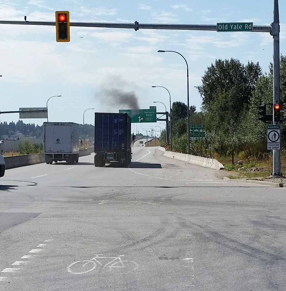
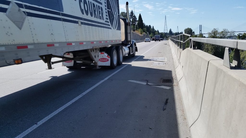
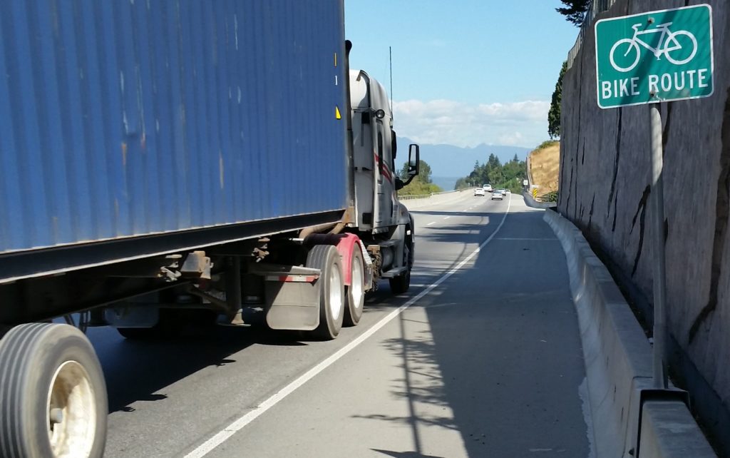
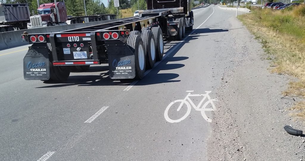
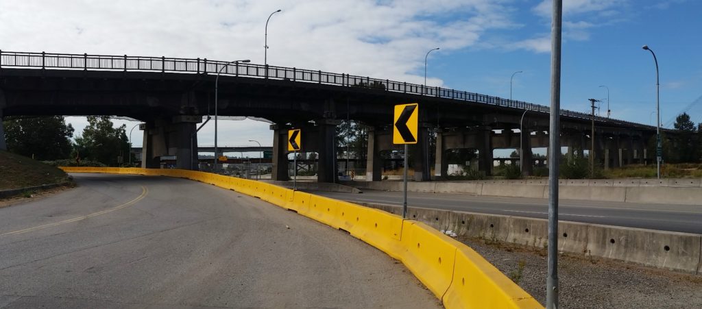
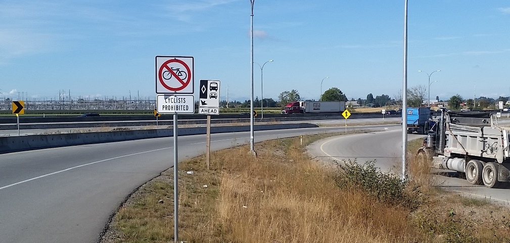
The Crosstown Greenway improvements are very small part of our transportation budget (less than 3% of this year’s budget for road improvements), and has numerous potential benefits to the community at large. As the City’s first foray into modern separated bikeway design, it may have a few kinks to work out, and it may take a bit of time for drivers to get their head around the new layout, but it is based on well-established design principles, and is a big step towards creating a safe, effective, and all-ages cycling network in the City.

That said, they were done as a bit of a trial, and I encourage everyone to let the City know what you like and don’t about the design – and provide suggestions about how the City could improve upon the design.

POST SCRIPT: I swear I did not read the New West Record that came out today before writing this post… 

The Grand Prix

The New West Grand Prix happened last week. Our City joined Vancouver, White Rock, Delta, Port Coquitlam, and Burnaby in hosting a BC Superweek professional bike race. And what a show it was. You can read the good news stories here, here, and (especially) here. But this is my Blog, so I’m going to take my time to (space?) to thank the many people who need to be thanked for making this project work. At least, I will try to thank as many of them as I can think of. An event like this is a partnership between many groups, and I’m going to risk missing a few important people here…

1

First and foremost, we had an army of volunteers making this happen, some who gave a few hours on the day, some who spent month ahead of time putting vital pieces in place. Community member Ron Cann provided great leadership and savvy guidance as the Chair of our organizing committee, Diane Perry organized the kids’ races and events, Bill DeGroot shook the bushes of the community for volunteers, and he and Jennifer Wolowic made sure the volunteer efforts were as organized as could be. Jennifer was also a star on Race Day, bringing her knowledge of high-level cycle racing to do any of a thousand small tasks that needed to be done. Mario Bartel helped put the Grand Prix on the social- and traditional-media map, and did what he does best by capturing stories through his camera lens. Ross “Mr. Jen” Arbo helped find a bunch of places for visiting racers to billet here in New West. This was the command structure of a volunteer army.

Add to this core group more than 100 volunteers who did everything from set up and tear down fences to standing at crosswalks for hours keeping people safe and many other tasks you didn’t even see being done. Here is where the greater New West community stepped up. We had teams from the local HUB Cycling chapter, The Queens Park Running Club, and from the Fraser River Fuggitivi road riding group. We had corporate teams, Youth Ambassadors, and a team from Last Door who were particularly adept at large-fence-panel moving, and scores f individuals who just wanted to help out. I don’t know where Bill found all of these people, but the first time I felt confident about this event working was the day of the Volunteer Dinner, a week before the event, when more than 100 people showed up eager to help make race day work. Thank you to everyone!

I want to thank some City staff who really stood up, but I don’t want to name them (I am, in some weird sense, their employer, and privacy rights and all…) I think they know who they are, and I’ve tried to thank them personally. An event like this pushes them past what is normally “just their job” and takes a passion and effort that is out of scale with their everyday, and so much of this work occurs of the side of the desk along with their everyday busy schedules. Council put a little extra stress on our staff because we (frankly) started a little late on this project. This meant we had to rush some parts of the program, it also meant we weren’t able to do a few of the things that would have made the program bigger or more exciting (many learnings in the can for next year!). However, staff coordinated with the volunteers and those running the bigger BC Superweek program and answered a thousand phone calls and e-mails about every aspect of the event, then showed up on event day to do a thousand tasks, big and small. Kudos all around.

This event relies on sponsors to pay a huge portion of the bills. Again, we were a little late to get started in 2017, but it is incredible how many sponsors stepped up to contribute. Bosa Developments, Domus Homes, I4 Property Group, and Skyllen Pacific were all major partners with the City on this community-building adventure. Strongside Conditioning and Billard Architecture were two local businesses that had their front door access impacted by the event, but turned that into a reason to get involved as major sponsors.

Of course Gordon from Cap’s Original Bike Shop got involved, providing prizes for the kids race, a great draw prize for the volunteers, and the professional “pit services” for the race. Boston Pizza made sure VIPs and volunteers got fed, S&O partnered to keep folks otherwise refreshed, and the Record and Global BC helped get the word out. Champion Systems, Gateway Casinos and Alpine Credits also pitched in, and Old Crow Coffee hosted our volunteer corral. Next time you visit one of these sponsors, thank them for taking part and helping to bring this event to New West. We really couldn’t do it without them, and they are making your City more fun to live in.

Similarly, we got a lot of support from downtown New Westminster. Both the Downtown BIA and Tourism New West came on board with support, but the merchants and residents of downtown also made adjustments to their day to allow us to have one of the large road closures in recent New West history. Can’t have a road bike race without a road.

Finally*, the fans and racers. The show was great, a kicking of butt by the Woman’s winner, and a late break almost caught by the sprint in the Men’s race… there were no spills but many thrills, and a marriage proposal to cap it off. The crowd was above expectations for our first year, and seemed really enthused by the event. It was a good evening. So whether you volunteered, sponsored, raced, spectated, were inconvenienced by the traffic, or just wandered by and asked “What tha heck?”, then decided to watch for a bit – thanks! I love when this town shows up!

*postscript: Thanks to Councillor Trentadue for invoking Rule #5 at the best possible time. You were right.

Plans and Promises

I have had interesting interactions on social and traditional media this week, and it got me thinking about plans the City makes, and where those interact with promises made by politicians. I am new to making the latter, have made the former for a long time, but haven’t really thought about the differences. let me see if I can tie this together into a cogent discussion.

It started with this Facebook post:

Hey Patrick, Earlier this year you spoke of the pedestrian and cycle improvements that were soon to be built along Braid. What does soon mean? You spoke of right away, seems you’ve become just another politician, promises promises…….

I have a slightly vague memory of having this conversation, as it was around the time some public consultation was being planned around this project. I knew the project was coming along because we talked about it at ACTBiPed, and because I attended an event as Acting Mayor just before the last Federal election where an MP from and adjacent riding announced some federal funding to help fund the project.

So I replied to the Facebook post with a link to the project page (above), and slightly cheekily followed with “no promises, though”, because it seemed to me the poke about “promises” by my inquisitor was slightly tongue-in-cheek. Or maybe not, as another person took slight offence to my flippant attitude, requiring yet another response by me that provided more detail, proving once again that Social Media is a terrible place to infer nuance.

The longer version of my response is that the project is coming along, but this isn’t really something I would think of as a “political promise”. I don’t think anyone ran for Council supporting or opposing a plan to put green separated lanes on the north side of Braid Street to connect to the United Boulevard bikeway. However, some of us were more supportive than others of the Master Transportation Plan for the City adopted just before the election (I don’t think anyone NOT supportive of it was elected). I am not only still supportive of it, but am supportive of rapidly implementing the active transportation measures included in that plan, including filling some of the important gaps in our bicycling network.

When it comes to building certain connections, though, that is really a complicated discussion between Council, staff, our Advisory Committees and other stakeholders, and is influenced by the capital budget and various priorities. This particular project was seen as a good chance for some senior government grants (applied for and won), represented an important gap, and was generally seen as ready to go. Drawings were created, some cost estimates done along with some public and stakeholder consultation. Capital budget was set aside in the 2017 year to do the works. My “supporting” this plan was a very minor part of the plan coming together for 2017, even as one of the members of a seven person Council.

That said, I can see a couple of potential issues that may prevent this from happening on the existing timeline. If you look at the poster boards from the Public Consultation, you will note that the map has red lines on it. Those are property lines, and a large part of the project is within rail property. I understand that we have agreements for these properties, but as we are learning with whistle cessation measures elsewhere in the City, the way rules and agreements work on rail lines is not always straight-forward, and it is best not to be too hasty predicting how those agreements will work out when it comes time to roll out the excavator. The second issue is, of course, the upcoming Brunette Interchange project by the Ministry of Transportation. I can’t tell you too much about it because MoT has not yet released their project drawings, but if there are changes in how Braid Street works through this area, we may need to go back to the drawing board. I don’t know the answers to the questions, nor are they completely in Council’s control.

I have every reason to expect this project will proceed in 2017 as planned, but all plans are subject to change, based on the rule of best laid plans. This doesn’t mean we won’t build a safe cycling and pedestrian route between Braid and the Bailey Bridge, it just means that the connection may not arrive exactly as we envision it today, or on that timeline. We’ll stick to the goals, we may need to change the plan. Stay tuned.

As for “promises”, I remember promising to support the Master Transportation Plan, to support and work towards implementation of the transit, pedestrian, and bike infrastructure improvements in that plan, I promised that stakeholders like HUB and the members of ACTBiPed would be involved more in planning these types of projects. I also promised I would do everything I can to be the most open Councillor about talking about how decisions around the Council table are made – mostly through this blog and other Social Media, hoping that openness would build more trust in the work City Hall is doing. If we make a decision you don’t agree with, I hope you will at least understand my motivation for making that decision, and hopefully you will be angry at me for the right reasons.

Which brings us to this week’s editorial in the Record, where they are critical of Council’s approach to the Q2Q bridge. They are right that the current situation is a let-down, and that, ultimately, Council has to own that disappointment. I may (cheekily) offer surprise that they claim to have known all along it was impossible to build the bridge, and didn’t bother to point that out to anyone, even when previous engineering reports suggested it was well within scale of our budget, but that is not the part of the editorial that made me retort. Instead, I was pretty much with their argument until this:

It doesn’t take a political scientist to figure out that Queensborough’s project would be low on the priority list. In fact, you just have to drive down Ewen Avenue to know that Queensborough often gets the short end of the stick.

I have to respectfully disagree with the suggestion that this Council ignores Queensborough as some sort of political calculation. That the Editor used Ewen Avenue as an example suggests to me they have not been to Queensborough in some time. Ewen Avenue is undergoing the single largest road improvement project in New Westminster in the last decade. Two years into a three-year $29 Million upgrade, the entire length of Ewen Avenue is going to be a brand new transportation spine for all modes. It has been a big, disruptive construction project, but the end result is becoming visible now, and will change how Ewen Avenue connects the community in a pretty great way.

If the issue is priorities, the Editor may be reminded that the Q2Q plan was part of a series of DAC-funded projects that started with $6.2 Million towards the $7.7 Million renovation of the Queensborough Community Centre, including the opening of the City’s first remote library. It included another $5 Million in Park and greenway improvements for Queensborough (including the South Dyke Road Walkway, Boundary Road Greenway, Sukh Sagar and Queensborough Neighbourhood Parks, and a pretty kick-ass all-wheel park). These were the first thing done with DAC funds, not a low priority.

Just two weeks ago at Council, we turned down capital funding support for a Child Care facility in Uptown because we placed the need in Queensborough as higher priority, and dedicated our limited child care funds toward filling that need. That isn’t “the short end of the stick”, that is including Queensborough’s needs along with the other neighbourhoods of the City when directing limited resources towards where the need is greatest. This council has a record of fighting (and winning!) to keep Queensborough in the same federal riding as the mainland, and a record of fighting (and losing) to keep it in the same provincial riding. Queensborough has never been an afterthought at the Council table during my time there, but a neighbourhood we continue to invest in and be proud of.

The situation for Q2Q sucks, there is no way to dress that up or say it more elegantly. A set of projects was conceived a decade ago, and of them, this project does not appear workable in the current form. The work is ongoing right now to determine how the remaining DAC funds can best be used connecting Queensborough to the mainland, and I am hoping a new and viable plan will come along soon. Call the current set-back a broken promise if you must, but the decision to not move ahead with a $40 Million option right now is not proof of a City disregarding one neighbourhood, it is a matter of understanding our fiscal limits as a City of 70,000 people with dreams perhaps bigger than our reality.

Ask Pat: Whither bike lanes?

It’s been a while since I answered an Ask Pat question, and there are a bunch of them in the queue, so I’m sorry if I haven’t gotten to yours! I’m a little over programmed right now. All good stuff, just too much! So here we go with an Ask Pat from a guy with a suspicious name:

Patrick P. asks—

Hi Pat. I find it totally bizarre that while we allow new apartment towers to be built with hundreds of new parking spots for cars, it seems no thought has been given to mitigating all the extra traffic on the road, or to giving people a cycling alternative — or to the impact on our environment. We have no dedicated (separated) bike lanes, and my bicycle commute to central Burnaby has been a challenge as there are no signs indicating a safe route. Moreover I am very worried for the safety of children like mine who want to get around town by bicycle.
Are there any plans to make our city more cycling friendly, particularly around shopping areas? What can I do to help?

I hear you. As a person who rides a bike for recreation and for daily chores, and tries to commute by bike as much as I can, with a partner who commutes to Burnaby every day on a bike, I know we aren’t yet where we should be as far as cycling infrastructure. Short answer to Question 1 is yes, answer to Question 2 is way down below at the bottom of this post, so fix a cup of tea, sit back and enjoy (or just scroll past all the fluff to the bottom couple of paragraphs)

There is a strange thing about traffic in New West: it mostly isn’t us. Two great statistics that tell you about our traffic problem is that the City has the highest percentage of its land dedicated to roads of any municipality in BC, and that New Westies drive less and own fewer cars per capita than the residents of any municipality in BC (with the exception of the City of Vancouver). Yet traffic is our #1 problem, because people like driving through New West. Presumably, they like it because they don’t have better options, not because of the nice views or the friendly demeanor of our residents.

So in that sense, if we have a car traffic problem, it isn’t the people living in towers on top of SkyTrain nodes. The extra 300 residents with (following our demographic trends) 200 more cars, used only 50% of the time, are a drop in the bucket of the 400,000 cars a day (a number I do NOT have a source for, but a number used anecdotally to describe our through-traffic for rhetorical purposes by virtually everyone) that ply our streets. There is an entire political conversation about whether parking minimums for new developments are good public policy, but I don’t think that is where you are going with your question.

Arguably, providing more housing alternatives in New Westminster (including those towers on SkyTrain nodes, and “missing middle” family-friendly housing forms) will act as a disincentive to people commuting through our City, by providing people better options that living to the east of us when they work to the west of us (you can change either of those directions to point to the same problem). The entire model for the Regional Growth Strategy and Regional Transportation Plan is based on that idea – compact, transit-friendly, mixed-use development as opposed to car-centric sprawled single-use development. New Westminster is (IMHO) leading the way for this development model regionally, and is, unfortunately, still straddled with the traffic impacts of neighbouring communities not talking as active a role in changing how they develop to suit the regional vision.

But you live in New West, work in nearby Burnaby, and want to be more comfortable riding your bike to work and to shop. Even better you want to feel safe sending your kids off to school riding their bikes. You (and I’m not just saying this because of your great given name) are part of the solution, and are fortunate to have the opportunities in your work/life/health/etc. to make that choice. The City should be making it easier for you.

I think we are, but perhaps not as quickly as either of us would like, through implementation of our new Master Transportation Plan. Passed before I was elected (although I served on the advisory committee), this plan represents a monumental shift in how we, as a City, are going to look at investing in our transportation system.

First off, it places active modes at the top of the priority list:

heirarchy

To me, that means we are going to spend less on making the asphalt smooth, and more on making the sidewalks, bike routes, and transit system operate better for all users. To you and me, that may seem obvious; to enshrine it in a master planning document means we are charged (us elected types and staff of the City) to do it, and put our budget where out mouth is.

What does this look like on the ground? For the first time, New Westminster is investing in green paint. It has taken a bit of time, and in the first year of MTP implementation we really invested more in primary pedestrian and transit accessibility (we are aiming for 100% accessible sidewalk curb cuts by 2018, and 96% accessible bus stops, which leads the region on both counts). We have also staffed up a bit in our transportation department to expand our ability to plan and deliver these projects. This next phase does include some significant cycling improvements.

We have already identified some “quick wins” for cyclists, where a bit of engineering can make a few key links on our established greenways work better. You will see things at 20th and London Street, 7th Ave between Moody Park and 5th Street, under the Queensborough Bridge in Queensborough, and between Braid Station and United Boulevard (for a few examples) right away. A few other slightly more challenging issues (a hill-friendly bike route connecting Downtown to Uptown) are being worked on, as are designs for the Agnes Greenway, and an extended greenway from Braid Station to Sapperton Landing Park. Safe Routes to School and Safe cycling to school are also high on the priority list.

As an aside, you probably have no idea how much that green paint costs. On a square-foot basis, it would be cheaper to do engineered hardwood. But we will probably save long-term on maintenance.

The best I can offer you is small relief in the immediate future, with a long-term vision towards a properly developed integrated and complete bike network. It is going to take a few years, but the MTP gives us the vision, and I think Council has the political drive to make it happen. When compared to Vancouver, we are a small municipality with a limited budget, so multiple separated bike lanes and the assorted infrastructure (lights, signs, paint, paving) to make them really work ideally, are an expensive prospect. I can’t guarantee they will arrive tomorrow, only that this is the direction we are headed, and I’ll be advocating for our budget allocations to suit the priorities we have set through our MTP.

If you think you have good ideas about cycling infrastructure needs in New West, there are two ways you can help.

You can apply to join the advisory committee in the City that works to make New West a better place for cyclists, pedestrians and transit users: ACTBiPed. I happen to chair that committee, and served on it for a couple of years before I was elected. I think we have managed to make it an effective group where staff and community members work together on “big picture” strategies, and also take time to dig into the detailed design elements of new infrastructure to assure they work for active transportation users. The City is receiving applications right now for 2017 Committee appointments, and you can get all the info you need to apply right here.

If working within the system doesn’t satisfy your needs, you can also get involved with the local HUB Chapter, who advocate for better cycling infrastructure and funding, locally and at the regional level. New West hosted their AGM a couple of weeks ago, and it was great to hear about the work being done in the local chapters across the region. The local group is also instrumental in getting elementary school kids trained to ride their bikes safely, running cycling safety and skills courses with the School District. They are also a very helpful voice at the table when we are making decisions about cycling infrastructure in the City. You should become a member, and then decide if you can give them your time, donate them some money, or whatever combination of the two fits your lifestyle the best!

Finally, you can ride your bike, and use SeeClickFix when you run into problems, to let City staff know that good cycling infrastructure is wanted, and bad cycling infrastructure is noticed, by residents of the City.

We are working on the MTP, on making this a better place to ride a bike, but we could always use more motivation from our residents!

on the commute.

The Ides of August was hellish for people trying to get home from work. It was a hot day by Vancouver standards, without much of a breeze, but the sweat on the brows was more caused by a series of incidents where cars unsuccessfully tried to share space with one another.helltraffic1

However, on a hot day like this, one incident causing delay often cascades into a series of other incidents as people become less patient, less rational, and the natural dehumanizing effects of being in a car get people treating everyone around them, the people they share a community with, like their mortal enemies for having the gall of trying to do the same thing they themselves are doing because aaaAAAARRGGH!

helltraffic2

I commute by car, by transit, and by bike, depending on day, weather, schedule, and lifestyle factors. Yesterday, I was fortunate to have taken my bike into work, so my commute home was relatively stress free. I have to admit a bit of smugness enters the mind when you are relaxed on a bike, enjoying the weather, and pedaling softly by a long line of single-occupant cars, which almost offsets the self-hatred I suffer every time I am in the car, stuck in a line, and see some much happier person riding their bike past me. However, having been that person stuck in a car, stuck in traffic that I am also a part of, it never occurred to me to blame the person on the bike for my physical predicament, or my mental state.

So yesterday, I am riding east along Westminster Highway near the Nature Park during this traffic chaos when I see something new to me. I am exposed to Richmond Drivers on a daily basis, but this was a little over the top. There was a line of about six or seven cars just rolling down the bike lane. It is almost as if the drivers had decided that two lanes were not enough, and had, en masse, decided this is a three lane road, passing the vehicles stuck to their left. At some point, a group of about 4 were stopped at a light, and I rolled past them. This might have been a little untoward, but after all, it is a bike lane – no sharrows or bus stop or shared parking space or right turn lane ambiguity here, and I was on a bicycle.

This was too much for a guy in a 4th generation Camaro Convertible with the ginormous Polska Pride flag decal covering the the hood. He took the opportunity to suggest to me in no uncertain terms, that I should not be riding my bicycle “on the road”. I saw this as a great time to remind him that I was, in fact in a bike lane, as evidenced by the nearby signage, and that he, in fact was also in the bike lane, without a bike, so I may have been in the right here.

At this point, he started into a lengthy screed, which was about 40% profanity and about 60% Bruce Allen “reality check”, neither of which were probably appropriate for the 8 year old in the passenger seat to witness. The short version was that bicycle riders don’t buy insurance, they should not be on the road, and that I, although obviously homosexual, engage in unwholesome acts with my mother.

I rode away from him and his impotent rage, and generally enjoyed the rest of my ride home. I did so, however, once again wondering what it is about driving a car that dehumanizes us. Why do we behave in a line of cars like we never would in a line at a bank? Why do we feel a car allows us the threaten and intimidate other people, be they children or senior citizens, and yell racial and homohpbic epithets that we would never do at a public park, on the beach, at work or in a mall? Outside of actual war, is there any other group activity we volunteer to engage in where we so publicly and unabashedly hate the people we are surrounded by? Why do we even do it?

Also, what is this strange fascination with attempting to license bicycles like they are some sort of parallel with cars? As His Snobbiness (slightly profanely) reminds us: you don’t need a commercial pilot’s license to operate a car. Bicycles present pretty nearly no risk whatsoever to drivers, passengers, or public property, except for some risk of scuffing the paint on their car, for which ICBC will make the person at fault pay. Even if I did buy insurance attendant to the risk I present to third parties (which would surely cost a few dollars a year relative to the risk I pose when I shuffle down the road at 100km/h in 2,000lbs of steel), do I think Mr. Polska Camaro is suddenly going to see me as a legitimate sharer of road space and afford me respect?

Yet for some reason, otherwise seemingly rational public servants from Toronto to Vancouver suggest there is some problem with adults riding bicycles that licensing can somehow cure. They aren’t too sure what the problem is, and have a hard time tying this solution to it, but they need to be seen to be doing something about the bicycles, because people in bicycles are not angry enough.

Let’s all try to get along, folks. Autumn is nearly here.

Mobi

The long-anticipated and irrationally-political Mobi bikeshare program has finally launched in Vancouver. I hope it works, but have my doubts.

Regular readers (hi Mom!) will remember that I went to New York City around Christmas time last year, and had a chance to try out their massively successful bikeshare program, product-placemently named “Citi Bikes”. The experience not only made me a fan of bikeshare- but changed a lot of my misconceptions about what bikeshare is. As I see many of my own misconceptions being repeated in the Vancouver media (social and otherwise) around Mobi, it is worth discussion.

Citi Bikes operate on short-term rental system. You can pick up a bike while walking by a station, and ride for up to 30 minutes (or 45 minutes if you have an annual pass) before you need to check the bike in again at any station. You can buy a day pass for $12, which gives you unlimited rides within 24 hours, or you can buy an annual pass for $150 and use it whenever you feel the need.

Now, 30 minutes seems a pretty short period of time to rent a bike, but that is the entire point of the system. If you want to rent a bike for a couple of hours to noodle around Stanley Park, or for a few days to add biking adventures to your vacation, then a private bike rental company is still the best option for you. Bikeshare is not about replacing other bikes, it is about expanding your walking distance and facilitating multi-modal trips.

I can probably explain better by talking about the day we spent in Brooklyn and Manhattan using Citi Bikes:

  • We walk the block from our place in residential Bedford-Sty to our nearest Citi Bike Station. After about 5 minutes of paying for a day pass and checking the bikes out, we were on our way east along brownstone-lined streets.
  • About 20 minutes later, we were at Barclay’s Centre where another Citi Bike station was awaiting. We dock the bikes and hang out a bit at the sprawling plaza. The dock also has a digital map kiosk, so we orient ourselves and plan the best route to the Brooklyn Bridge before we check out a couple of new bikes.

Barclay

  • Near the foot of the Brooklyn Bridge, we dock the bikes. We grab a coffee, then wander over to the bridge. The pedestrian/bike walkway is packed with tourists, so we slowly walk across enjoying the sites, the crowd, the experience, without abandoning bikes at one end we need to retrieve later, or feeling like we needed to drag them along.

brook

  • We spend an hour or two wandering around China Town and Little Italy, then hop on a Citi Bike to loop around the Bowery to the Village. Some places were better for walking, some better for riding, and we made the choice. village2
  • After some more meandering, we check out another set of bikes and cross the Williamsburg Bridge. Back on the Brooklyn side, we quickly swap bikes to get ourselves an extra few minutes, then head through Williamsburg to find a brewery.

bridge

  • After a tasting and a meal and some wandering about loving the vibe of Williamsburg, we found a nearby station and mapped out the best route home to Bed Sty as the sun was setting. Probably being a 40-minute ride at an easy pace, we figured we would need to swap out bikes half way. We didn’t know about the “Citi Bike Dead Zone” in the Hasidic part of south Williamsburg, but managed to find a station with 5 minutes to spare. If we had downloaded the Citi Bike App, we could have avoided this peril.

wilmsbg2

  • Back at our base station as it was getting dark (the Citi Bike has built-in front and rear lights run by a generator in the front hub), we checked in and walked the block home with time enough to catch a great Sousaphone-Accordion trio.

sousa

A nice 8-hour day, about 7 bike station stops, we probably covered 20 kilometres on bikes, just to connect up our fun walking spots. We never fussed with a bike lock (or a helmet – more on that later) or worried about bike storage or security, and were left with nothing but a pocket full of access codes.

slips2

That is just a tourist experience. If you live and work in the service area, the Citi Bike can change the decision you make every day when you walk out the door to run an errand or meet a friend. Walk for 15 minutes? Bike for 5minutes? Wait for 5 minutes for the bus? Screw it, I’ll just drive? The magic of bikeshare is that you don’t have to worry about the hassles inherent in the “Bike for 5 minutes” choice: you don’t need special clothes, you don’t have to fuss with locks or worry about bringing the bike back with you if you have a multi-stop trip planned. Bikeshare, when working properly, is like having a bunch of moving sidewalks around that can cut your walking time in a third, with no more hassle than walking.

The ease and functionality of Citi Bike relies on several things, though, and New York gets them right.

Stations need to be ubiquitous. Within the service area of Citi Bike, you are never more than a 5-miunte ride to the nearest station. They also manage the bikes well, in that I think there was only one occasion when we arrived at a station and found it empty of bikes. Fortunately, the on-line app and maps in the station kiosks have real-time measures of how full the stations are, allowing you to plan at the beginning of your rental. How ubiquitous? Look at the map of Manhattan and Brooklyn:

Citi

Bikes need to be Euro. By this, they need to be durable, friendly, simple, and built for casual use. Citi Bike rides are bomb-proof and a little heavy, but run like a Swiss watch. The transmission is internally-geared with a twist-shifter, the chain is in a case, so no grease or oil splatter problems. The wheels have full and deep fenders to keep the spray off, and to keep toes, cuffs, or scarfs out of the spokes. The pedals and seat are wide, flat and grippy so no special clothes are needed. There is a unique-sounding bell, a big basket for groceries, and front and rear lights are always on thanks to the nifty generator in the front wheel. They aren’t specifically elegant, and won’t win any criterium races, but they are the right tool for the job.

slow2

The payment has to be simple. Similarly, the kiosks for Citi Bike are simple to use, but have a ton of utility. It takes only a few minutes to buy a day pass using a credit card, and once you are in the system, it takes literally seconds to check a bike out (check in is as easy as park-it-and-walk-away). I could see how an annual passholder would be walking down the street, see a kiosk, and, on a whim, check out a bike to get 6 blocks down the street faster. As a bonus, there are digital maps to show you your location that allow you to zoom out to other station locations, which (as a super-double-bonus) serve as wayfinding tools for all tourists who happen by, not just Citi Bike users.

You can’t have a helmet law. Everything above about the need for the system to be easy, fuss-free, and comfortable is tossed by the wayside when you add helmets. Citi Bike is successful because it accommodates street clothes and on-a-whim decision making. Aside from the (not insignificant) yuck-factor, helmets significantly increase the hassle factor, and change the math on that walk-for-15/ ride-for-5/ wait-for-bus math. The kludged Vancouver solution (ugly, uncomfortable, dirty helmets that are likely more of a choking hazard than actual brain protector) stands in contrast to everything that makes Citi Bike work.

street2

The most significant stat about Citi Bike is that they have, since summer of 2013, had more than 25 million rides, with no fatalities and no major injuries. Manhattan and Brooklyn are not famous for their excellent roads or courteous drivers – the roads are crowded, potholed, and at times chaotic, and Citi Bike users are (reportedly) every bit as chaotic as other users. Many are novice riders, and very few wear helmets. Bikeshare is safer than driving, and Manhattan, it is safer than walking. The statistics are the same for bikeshare systems across North America. Part of this is intrinsic to the bikes: upright, slow, stable, comfortable, and visible. Part of it is the demonstrated phenomenon that the best way to make cycling safe is to put more bikes on the road – areas with bikeshare systems have been found to be safer for those cyclists not using bikeshare systems. Helmets Laws are not only a deterrent to use, they are demonstrably unnecessary for the inherent risk.

So I wish the best for Mobi. I’m not sure there is a sufficiently saturated market outside of downtown and the Commercial-to-Kitsilano corridor to provide the effective station saturation you need to make the system work, but within that area all of the pieces for success are in place. However, until we grow up and have a rational re-evaluation of the province’s silly anti-cyclist helmet law, I am afraid the system will suffer from lack of appeal. And that would be a shame.

…on the bike race

I didn’t want to write this blog post, for a few reasons.

First of all, I hoped that we would be building excitement right now for a bike race in Uptown a month from today, but that is not going to happen. Secondly, I had hoped that the process through which we got here was respectful and transparent enough that I would not have to engage in after-the-fact record straightening, because my doing so will be perceived by some in the community as my being unnecessarily confrontational, accusatory, or “political”. I hope I can demonstrate that is not my intention, as apportioning blame is not my interest, improving the process is.

My disappointment that the race is not going forward in 2016 has been shadowed by my disappointment that withdrawal of support for the road closure is being characterized as an arbitrary and capricious decision by City Hall. The quote

…the City of New Westminster, for unspecified reasons, has unilaterally cancelled the Hyack Grand Prix…”

does not fairly reflect my experience, and I have to address it.

For context, I was pretty excited about this race, and even attended a couple of organizational meetings to see if there were any potential hiccups I could help smooth out at City Hall, and so I could be more in the know in case Council had any questions or concerns. I didn’t have time to join the organizing committee, but hoped there was a way I could (with my limited free time) help out. I was actually looking forward to spending May 28th volunteering at a corner with my FR Fuggitivi friends and enjoying the race.

I should avoid speaking for the City, staff, the rest of Council or the Festivals Committee (I don’t serve on that Committee), but every impression I got from Council and Staff is that they were enthusiastic about this event, that there was good potential ROI for the City, and that there was no reason it should not happen. I never heard anyone at 511 Royal Ave speak against the idea.

It did become clear in early March, however, that some of the groundwork had not been laid to get the race going. Nothing was critical yet, but there were a collection of small issues that were not being addressed in a timely manner, giving staff reasons to be concerned about the organizing committee’s capacity to get them done in time. Most of them looked like details that were a little behind but were not yet on the “critical path”.

There were some negotiations on the course layout and safety issues, where I (frankly) was on the side of the organizers in negotiating with the City, but that was a discussion I felt was going to work out fine when CyclingBC folks were able to provide their professional guidance. There were issues around asphalt that were worked out, etc.

However, the sticking point became the road closures and impacts on the local neighbourhood. Closing several blocks of roads in the middle of the City on a Saturday has the potential to impact residents and businesses in unanticipated ways. Between the parade and the bike race, these closures were stretching to 8+ hours. If you ran a service business that had limited access to its front door on your busiest day of the week, you might be concerned (alternately, if you ran a pub or restaurant with a thousand people outside of your door all day, you might be exited!). If you had no access to the driveway of your house for 8 hours on a Saturday, you may equally be concerned. God forbid if you had a concrete pour on your construction site or a backyard wedding planned that day.

No problem, the City does this type of thing all the time. We have street festivals, we have parades, we do utility work. There are protocols for communicating with residents and businesses, assuring organizers have approval from them (or not) and that those approvals are crystal clear about what the type and duration of the disruption will be. It is clear with the organizations running these events that this is their responsibility, and although the City will provide guidance, the leg-work to get this work done to the satisfaction of the City is up to the organizer. It is simply a resource issue for a small municipality.

There will (almost) always be a small number of people who oppose the closure for whatever reason, valid or not. As the event is something the City and Council supports, staff are ready to deal with that small number. If there are a small number of residents or businesses that oppose it, we will talk to them, try to figure out how to accommodate their needs, make adjustments, or even (at times) tell them to get over it, because this is coming, and your neighbours all want it, so heads-up!

In early March, it was becoming clear that this consultation with the neighbourhood was going slowly, partly because of resource limitations of the organizer, partly because of some communication problems between the organizer and the City, and partly because of some disagreements/negotiations around expectations. This aspect of the organization was becoming the critical path, because if public notice was not completed to a level that made the City comfortable, then the City was not going to dump a bunch of resources into the following steps, knowing that the event may not go on. Again, limited resources require careful governance of those resources. Timing of this consent is also critical because the City needed time to manage those few residents or businesses that may not agree, to be fair to those people.

Through March and into early April, there was a significant back and forth between staff and the organizers, it was clear that the organizers felt they were doing an adequate job in this outreach, and staff were not as confident. Deadlines, first soft then firm, were set and passed. When the Festivals Committee reviewed the level of preparedness for the event, this critical gap was identified, and the Committee recommended to Council that we consider cancelling the event. Staff felt that this work had dragged on too long, and there was limited time to complete a long list of critical next steps.

The week after that recommendation was challenging for me, for staff, and for the organizers. I personally contacted the organizers in order to better understand the situation form their point of view. I had other concerns about the event (management of timing, parking arrangements for racers, a few course layout concerns, etc.) but I honestly thought they were going to get over this gap with liberal application of shoe leather, elbow grease, and salesmanship. I had enough experience with smaller bike races in my earlier days that I know how things can come together at crunch time.

I met with staff and looked at the public outreach data they were using to make their assessment, and I agreed with them. I was sent data from the organizers, and was challenged to rectify the two datasets and change my opinion about staff’s assessment. I arranged for a meeting with the organizers and representatives of the Festivals Committee to sit down and discuss how the data the organizers provided did not fulfill staff’s expectations about public contacts. following this, there was yet another meeting the between staff and the organizers to further compare notes. I cannot emphasize enough that all of this took place in an effort to make the event happen. We burned a lot of staff time (and overtime), at a level we would not have done for a commercial enterprise, film company, or most other volunteer events. City staff bent over backwards trying to see the situation through the organizers’ lens, and I feel they tried earnestly to get to a place where they could responsibly recommend further support.

Councillor Harper (representing the Festivals Committee) and I took the extra time to set up and attend these meetings, to dig into the data, and to consider the options. In the end, we had to agree with staff that moving ahead in 2016 was not the responsible thing to do. It didn’t serve the City, the organizers, or CyclingBC.

At every step of the way here, we were in communication with the organizers, and the City repeatedly made clear what its expectations were. There was nothing capricious in the decision, nor should it have been surprising to the organizers. I think staff made the right call in a difficult situation, and I support them, even if it means we cannot have an event in 2016 that I was very much looking forward to.

I hope that we can try again in 2017, and through this experience we can tighten up the way we set and address the City’s expectations. It appears we need to start consultations earlier and perhaps the City needs to set firmer deadlines instead of only giving guidance. Lessons were learned through this.

I think the relationship between the City and the organizers, clearly fractious in the past, was in this case business-like and respectful up until the end, and I hope this disappointment does not erode the progress made. That is part of the reason I was reluctant to write this blog post, as I don’t want fuel thrown on a spark. However I equally cannot stand silent while the motives and professionalism of the City’s staff, Committee, and Council are questioned in the social media. I think there are things the City could have done differently, but there are definitely things that the organizers could have done better, and should have done better. I own a bit of this, as I was probably not as proactive as a self-assigned liaison as I could have been, especially earlier in the process. However, both Hyack and the City were pushing the envelope a bit, getting into organizing an event they had little experience with, and I think it was valuable learning experience. I hope it pays off with a great event in 2017.

That will require a continued business-like relationship and respectful communications on both sides.

Ask Pat: Safety Dictator

Nicole asks—

Since your wonderful idea of a 30 km/h urban speed limit has drawn some ire, what other controversial things might you do to make our roads safer if you were made Dictator of BC for, say, a year? (I am guessing that photo radar is very high on the list, if not number one.)

Ire!? If an idea doesn’t draw ire from some sector, it is probably not worth even discussing. You may have heard some ire, I heard a lot of people saying its about time. Just this week, there were articles in Price Tags (Vancouver’s best Urbanism portal), there have been great results out of Toronto on their speed reduction program, and Seattle has joined the fray. I even took this photo at the Janette Sadik-Khan talk in Vancouver on Tuesday night:JSK20

Ire be damned, I want our streets to be safer. As JSK herself says: “When you challenge the status quo, it pushes back. Hard.”

I like the tone of your question, however. What would I do if I was Dictator for a year and was able to do whatever I wanted to make roads safer? Not sure I could get it all done in a year, but Dictators have armies to do their bidding, right?

Photo radar has it’s use. The Pattullo Bridge is a perfect example of a 50km/h road where everyone goes 80km/h and the resultant accidents are incredibly dangerous for other bridge users. It also reduces the inferred safety of the bridge, and is used as a primary reason for replacement. With careful application and an emphasis on safety (as opposed to punitive punishment in places where poor road design encourages speeding), photo radar has a role.

Look at this stupid road. Nothing here tells you to go 60km/h, except the sign. Of course everyone goes 80
Look at this stupid road. Nothing here, not the >3.5m lanes, not the generous shoulder and fixed divider, not the wide-open sight lines, nothing tells you to go 60km/h, except the sign. Of course everyone goes 80 or faster. A silly and punitive place to put Photo Radar, but dollars to donuts, the first place it would be installed.

I also think intersection cameras have a role. There are some in New West, and ICBC and the Integrated Road Safety Unit have a program to support them. However, they seem to concentrate on the red-light runners, likely because it is the easiest thing to enforce with a camera. I’m just as concerned about illegal turns, failing to yield to pedestrians, and entering intersections you have no possible way of exiting in order to “beat a light cycle”. With all the talk of distracted pedestrians and dark clothing, it is a pretty important point that the majority of pedestrian fatalities are caused by the driver failing to yield right of way in an intersection.

To make roads safer for cyclists, I would start by implementing (almost all) the recommendations that the Ontario Coroner released a couple of years ago after investigating cycling deaths in the province. I wrote a long piece on this once, but in summary: build safe infrastructure for cyclists, improve education for school students and all drivers, pass a 3-foot rule, and so on. We already have a pretty good idea what works, this isn’t radical or anything surprising. All that is lacking is the politcial will to make it happen.

The next big step would be nothing less than a complete re-writing of the design standards for urban streets. This is major part of Janette Sadik-Khan’s thesis for road safety. The existing standards for road design, paint markings, signs, and other treatments are from a different era, and were developed with the desire to make driving through our cities as efficient as possible, with only a nod to driver safety. That the “efficient movement” of cars makes the environment for all other road users less safe does not seem to be addressed.

JSK points out the American road design bible (“Manual on Uniform Traffic Control Devices”) has more than 800 pages of diagrams and plans describing the standards, 800 pages in which not a single pedestrian is shown. This book (along with it’s Canadian version) needs to be thrown away.

The good news is that there is already a lot of work being done on a better book to replace it. The National Association of City Transportation Officials has a go-to book called “The Urban Street Design Guide” That needs to become the standard, not the alternative. We can no longer use a 1950s guide book to adapt our 1920s streets for 2015 users. Time to challenge the status quo.

This probably exceeds the authority of the Dictator, but I would also change the laws to make cars safer. This engineering work is being done primarily in Europe, and some of it is becoming mainstream, but we can and should make more changes sooner. This includes a suite of things: better crush zones in front bumpers; softer hood materials with larger energy-absorbing gaps between sheetmetal and hardpoints; use of active cushioning (airbags); injury-reducing body shape geometry; larger windows with smaller pillars to improve driver visibility; active and passive collision avoidance systems.

While we are at it, we can add regular vehicle inspection to assure these systems work, and have not been messed with. There is no place in the urban environment for the suite of modifications that make automobiles unsafe for the people sharing the environment: trucks lifted to ridiculous heights, bull and grill guards, black tinted windows and lights, etc. I know that this is a radical idea in a society where many people consider their car an extension of their personality, and anything that impacts the design of their car would be seen as squelching freedom of expression.

Talking about Freedom of Expression, I am a keen follower of the move to change the language of traffic crashes. Read your local newspaper about a pedestrian being killed by a driver, and the headline is usually some form of “Pedestrian killed by car”. The events are always referred to immediately as “accidents”, which makes them sound inevitable, something that just happens, and presumes there is no fault (and, by inference, nothing we can do about it).

We can change how we value public space and our expectation of pedestrian safety by simply changing our language. “Pedestrian hit by driver of car” makes it clear there are two people in the transaction, not a person and an inanimate object. “Collision” and “incident” are both better terms than “accident” until the police and ICBC have an opportunity to determine the cause of the collision (inattentive driving? texting while walking? bad street design? non-functional brakes?). I think words mean something, and the words we use frame the discussion we will have, and we need to have a better discussion, because people are getting killed and we should have no tolerance for it.

Boy, I really sounded like a Dictator there, eh?