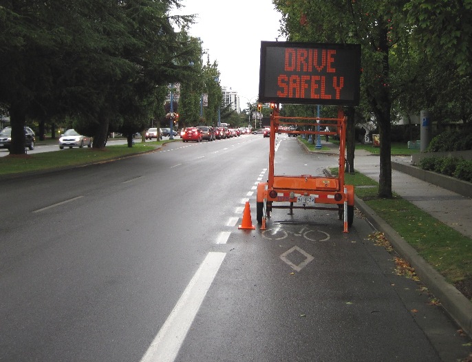
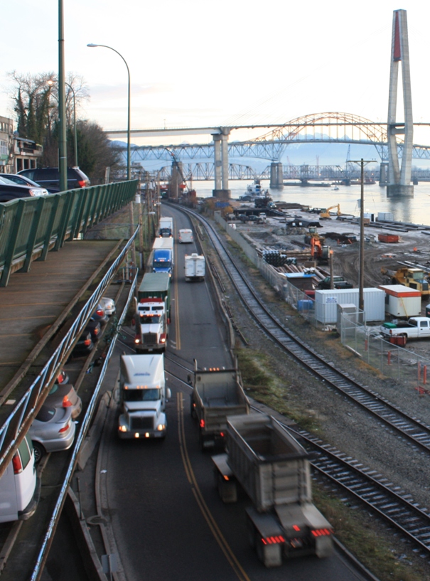
Lots going on right now, back to regular posting in a jiffy.
In the meantime, here is an image I collected while riding in a bike lane to work not too long ago, sure to elicit deep thought.
I submit for your consideration:
Lots going on right now, back to regular posting in a jiffy.
In the meantime, here is an image I collected while riding in a bike lane to work not too long ago, sure to elicit deep thought.
I submit for your consideration:
I have a real love-hate thing going on with the Planning Department in New Westminster. Well, “hate” is too strong a word; let’s call it love-like somewhat less.
During the recent election, I noted the incredible progress the City has made over the last decade. The Downtown, 12 Street, Sapperton, the waterfront trails in Queensborough: there is a lot of great stuff going on. During the election, I mostly gave the kudos to the politicians running the place, but equal (or greater?) credit has to go to the planners in the City who help bring the visions of multiple parties (developers, council, neighbourhoods, third party stakeholders, rabble-rousers) together into what will hopefully be the best possible compromise to move the City forward.
The revitalization of the Downtown is ongoing and already showing significant dividends. As I mentioned last year, the building of the MUCF at 8th and Columbia will be an important piece in this puzzle, as will the opening of the retail spaces at the New Westminster Station, the date of which was just announced. However, I remain highly critical of how the pedestrian experience of this keystone entrance to our new Downtown is being managed. Today, the City will officially decide to shut down the 8th Street crosswalk that is so heavily used (and would continue to be used as the preferable pedestrian route to the MUCF), its timing not exactly coincident with the building of alternative routes, but with the need to accommodate a staging area for the Santa Claus Parade. Alas.
What concerns me more, though, is that the City is finally making public announcements about what has been rumoured for the last year or two: they want someone to build a hotel on the Kyoto block, the recently-demolished set of buildings on the north-west corner of 8th and Columbia, immediately adjacent the entrance escalator to the New Westminster Station.
Potentially sticking another big pedestrian roadblock at the entrance to our downtown, and turning over what could be a precious piece of public open space – one that belongs to the City – into another high-rise development.
Back when I was winging about how the MUCF essentially turned it’s back on 8th Street and the Skytrain Station, my main complaint was one of potential lost opportunity. With Plaza 88 bringing people into New Westminster to go to the new theatres, there is a great opportunity to draw those people onto Columbia for the new eating, drinking and shopping opportunities that are being developed there. Tying these to the River Market via an upgraded pedestrian overpass behind Hyack square would be a bonus.
Now that 8th Street will be inevitably lost as pedestrian space, the question remains how we will draw people to Columbia Street. The answer seems to be down a shadowy narrow escalator, past a couple of loading bays in the shadow of big buildings. We can do better.
Imagine Kyoto Plaza (actually imagine a better name, but stay with me here…), an 6000-square foot open space across Columbia Street from similar-sized Hyack Square. To the west is the concrete wall of the Plaza 88 Theatres, adorned with green and/or water features, and cut by a curving, pedestrian ramp carrying people down from the New West Station concourse, giving them a grand view of the streetscape below and to the east. In the centre of the plaza sloping up to the ramp are planters, seating areas, maybe even a fountain, to compliment the architecture of Hyack Square across the street. The intersection of 8th and Columbia will be wide, and slightly elevated, perhaps in the “pedestrian scramble” design, to link together open spaces north and south, and to provide a visual entrance to Columbia Street for cars approaching from the east.
Let’s give people a reason to step out of Plaza 88, and at first look towards Columbia Street, then go down there and spend some money. Let’s give the office workers and visitors of the new MUCF an open space to sit, soak up sun, eat lunch. Let’s give people walking from other neighbourhoods, people arriving by car or by Skytrain a place to meet up before going for a drink, for dinner, or for a movie.
Let people’s first impression of the Royal City when they get off the SkyTrain be of an open, happening, safe and comfortable place with lots to offer, instead of a dark tunnel-like walking route past parking garage entrances and high-rises.
Come to think of it, we can even support the Downtown BIA’s never-satiated hunger for more parking by providing 3 floors of underground parking, similar to the MUCF, and add 150 spots to the downtown inventory (or maybe 200 if we link to the MUCF using the area under 8th Street), while still keeping the ground level as human, pedestrian space.
I have nothing against hotels, and recognize it is an asset the City could use more of. I doubt whether this is the best space for it. There are lots of 6500-square foot footprints in downtown where an interested business can stick a boutique hotel, there are very few open spaces that are in the possession of the City and serve as the entrance to our Downtown for visitors arriving by car and by transit, and as a link between our main shopping street, our eponymous Transit Centre, and our Waterfront Market. We have an opportunity to alleviate the unfortunate loss of pedestrian space around the MUCF with some visionary planning right now, and benefit the entire downtown retail area with some creative land use decisions here. Let’s not lose this second chance.
C’mon Planning Department, Make me love you again…
I don’t think anyone other than TransLink wasted more bits of information or wrote more column-inches of text on the UBE process than I did. For those with short memories, the issue to me was very clear: why waste >$150 million on an overpass to take traffic pressure off of Coquitlam at the expense of putting more traffic pressure on New Westminster and serious disruption of the lives of hundreds of Sapperton residents. Simply put: it just wasn’t on. The people spoke, the City and TransLink listened.
Now, for some bizarre reason, one of the candidates for Mayor wants to re-open the issue. I can’t believe I have to write this post.
During this election, there are many candidates complaining about traffic, even the current Chair of the Traffic Committee outlined a long list of traffic woes in the City, suggesting somebody has to do something (without acknowledging that for the last 3 years, that somebody was him). Lots of complaints, not too many ideas. The only thing worse than no ideas are really bad ideas.
So desperate for new ideas are we that the biggest cheer at the Queens Park Residents Association All-Candidates gaggle ‘ n’ weep went to outsider Mayoral Candidate Francois Nantel, for suggesting his first priority as Mayor would be to remove the offending sidewalk bulge at 6th and Royal so he can beat the queue when trying to turn up the hill. This was, unfortunately, an example of how common sense is usually wrong.
The prospective mayor apparently didn’t realize that bulge serves at least three purposes:
1) It makes the crossing of Royal Ave easier for pedestrians. It is a high-traffic street and it is very wide (4 travel lanes, 2 parking lanes, plus a significant island/boulevard). Pedestrians crossing that street, especially those with mobility issues, need a lot of time to cross that much space. By shortening their distance, we make it safer and more comfortable for pedestrians, and it allows us to shorten the amount of time the red light is lit for the crossing traffic, allowing more traffic to flow through the intersection.
2) It narrows the road with a safe obstacle, which serves to slow traffic so it runs closer to the speed limit. Wide, open roads equal fast speeds. By introducing highly visible narrowing of the road, the perception of speed increases, ,and traffic slows down. This is why you fell comfortable going 50kmh over the speed limit coming down the hill from Gaglardi Way (a road with a 60km/h speed limit built for 100km/h), yet rarely find yourself speeding through the Deas tunnel. Royal is wide and open and looks like it can accommodate 80km/h traffic, but has a speed limit of 50km/h. The bump helps keep the traffic down to 70km/h.
3) The bump stops rat runners. Those people who get off of arterial routes like Royal and bomb through Queens Park and the Brow of the hill and the west End, using our neighbourhood streets to commute through. When traffic is backed up on Royal, they are looking for any escape route. If they can pass a line of 8 cars and turn right up 6th, they will take the next opportunity to turn left: Queens, Third, Fourth, any street to get them back to Stewardson. If they have to wait until the line of cars in front of them has cleared the intersection, they are way more likely to just go straight through and remain on the arterial route.
So sorry you have to wait an extra 30 seconds to turn up 6th in rush hour, Francois, but rest assured, there are good reasons for it. Thanks for pointing out one of the difficulties of designing traffic systems: everyone hates when their access to open road space is fettered, and everyone hates when everyone else’s access to road space close to where they live is unfettered.
Even fraught with all of those details, this idea is pretty minor compared to the Grand Plan 4 McBride outlined by Mayoral Challenger James Crosty. According to an expansive profile in the Record today,
“he’s already working with some Burnaby councillors who want discussions about the Stormont connector reopened and wants to talk to Coquitlam about the United Boulevard extension.”
I remember James as an early proponent of the “T-option” for the UBE, one that the people of Sapperton would simply not accept, was more expensive that the other options, and was of questionable value for “getting traffic moving” as it included a set of lights and 90-degree turn on a major truck route. Mostly, TransLink could not convince the people of New Westminster that adding more lanes to our border without addressing the traffic needs of New Westminster was not something New Westminster was going to accept. Despite all of the boo-birds saying it was a done deal and that the current Council had signed secret deals, etc.; in the end, Council listened to the people, took a principled stand, and stood up against the pressure form the senior and neighbouring governments. The death of the UBE was a major success for this Council.
I cannot fathom why Crosty wants to bring the UBE back now. He was at some of the consultation meetings; according to his own selective memory, he led the charge against the UBE (a dubious claim; His role was once described to me by a Sapperton friend as “waiting around to see which way the crowd was going, then rushing to the front just when we arrived, to provide the illusion he was leading all the way”). However, suggesting we open that can of worms, and topping it with opening a bigger can of Stormont Connector worms, suggests to me he did not learn from the UBE consultation process at all.
??
?
 |
| reference: this is a copy and paste from Citizen Chat, Volume 1, Issue 1. Which may contian an unreferenced image from TransLink. |
? ?? Mr. Crosty’s campaign newspaper has, as the centre piece of his Transportation Policy, this statement:
“People will always seek the fastest way from Point A to Point B. I would resolve to focus on the replacement of the Patullo [sic] Bridge. This would connect with a proposed covered thoroughfare which is currently McBride Avenue [sic]. The newly enclosed highway will emerge at the new Stormont Connector, taking vehicles straight into Burnaby and access to Hhy. #1.”
OK, first off, I agree with the first statement; In fact that is what I have been saying all along. The problem is, people want to solve the infrastructure capacity and livability problem of 400,000 vehicles per day passing through New Westminster right now by making New West the fastest point between points A and B. How does that not just make more people use New West as a drive-thru?
The natural corollary is that people will avoid the slowest route between Points A and B. With the South Fraser Perimeter Road and the Highway 1 Expansion: doesn’t that mean we can avoid increasing to our traffic woes just by being the only route without a freeway?
I’ve heard Mr. Crosty suggest the Cut’n’Cover McBride Avenue Boulevard idea before, and he has never been able to answer several questions for me. Primarily, who is currently lining up to spend the > $1 Billion it would cost to build a 2-km long, 4- or 6-lane covered roadway through a fully built-up community? Cut ‘n’ Cover often sounds cheap ‘n’ easy, but it is very far from that. Engineering a 5-m-deep trench over 2km is a major feat, involving the moving a freaky amount of fill, managing significant groundwater flow, and moving 100 years worth of sewer, water, gas, and communication utility infrastructure. Remember, this will need to be at least three times as wide as the Canada Line project on Cambie, with much more significant safety and escape structures, allowing that there will be cars in it and not sealed trains. Just expropriating enough land to build a couple of interchanges at 6th and/or 10th would be horrendously expensive. The idea boggles the mind. And just like Cassiar and Deas Tunnels, no placarded trucks would be allowed, so it would be of dubious value as a Truck Route.
McBride is part of the Major Road Network so I guess it would be up to TransLink to build and operate it, except of course, TransLink couldn’t scrape together enough money to build the order-of-magnitude less expensive UBE. I think TransLink has bigger regional priorities than relieving traffic on McBride Blvd right now.
Then there is the question of what the problem is this tunnel is meant to solve. The Billion Dollar Tunnel will connect the non-existent Stormont Connector to an unknown, potentially tolled, Pattullo bridge. I’m glad Mr. Crosty is talking to Burnaby Council Candidates, because I just don’t see Mayor Corrigan ploughing down a hundred homes and a kilometre of forest, disrupting the lives of thousands of East Burnaby residents, just to relieve New Westminster of a little traffic. Corrigan went nuts over the Hwy 1 Expansion and voted against funding the Evergreen… I don’t imagine his is willing to spend the hundreds of millions of dollars required to make it easier for Surreyites to get to Highway 1. But hey, maybe I’m being negative.
If we accept that transportation (with it’s ugly little brother traffic) is the biggest issue in the Election. I think Jonathan Cote (who actually understands the municipal role in sustainable transportation planning) and Chuck Puchmayr (who provided the most logical answer to transportation questions at the recent all-candidates event) have made the strongest cases for election.
Just to prove I am an equal-opportunity critic, I want to relate a conversation I had with Bill Harper, Incumbent and Candidate for Council. Bill is from the other end of the political spectrum than James Crosty and John Ashdown, in that old-fashioned Labour/Left v. Business/Right way of looking at politics.
At the Queens Park Residents Association all-candidates slap ‘n’ giggle, Harper came out strongly against tolling any future the Pattullo bridge replacement. Although he only had 30 seconds to talk on the topic, the argument (if you afford me the right to paraphrase) is that tolls take us towards a regime where only the rich can use a bridge, and the poor are excluded from using it.
In the glad-handing session after the debate, I commented to Bill that we are going to have to agree to disagree on the tolls issue, and to his credit, he looked me right in the eye and said “Why?” In the ensuing discussion, Bill linked tolls on the bridge to the Smart Meter program and the introduction of water meters. His opposition stems from the ideological point that pay-as-you-go benefits the rich and is punitive to the poor: “That is BC Liberal Policy, and I don’t agree”.
I strongly disagree with Bill on this point.
One of the first principles of responsible resource management is that the user pays for the amount of that resource they use. A fisherman who removes 10 tonnes of salmon from the Fraser River cannot pay the same licensing fee for that resource extraction as a person catching a single salmon. A company logging 500 Hectares of forest cannot pay the same stumpage fee as a company logging a single hectare.
This goes the same for resources that we are delivered through our utility systems. Persons should be (and are) charged for electricity use per Kw/h. It is not only fundamentally fair, it encourages responsible use of the resource, provides economic incentive to taking measures to reduce use, it is the first step in managing the resource responsibly. The same goes for our water and garbage utilities: it angers me to no end that I pay the same to toss away my once-every-month-half-full garbage bin as the guy next door who overloads his bin every week: the City pays per tonne to pick up and get rid of the stuff, they should be charging us per tonne to remove it. I am subsidizing the guy who is being wasteful with a limited resource.
Municipal water may be the worst example of this. As a region, we spend more than $200 Million every year to collect, treat, and pump almost 400 Million cubic metres of water to customers who, in the summer months, use almost half of that water to keep their lawns green. There is no built-in incentive to reduce this usage unless the use is metered, and with our population expanding, the capital cost of expanding our system is going to push those costs up. The fundamental question of fairness is why are the poor living on small lots or in apartments subsidizing the expansive green lawns of the rich?
Now, in the old-school socialist mindset, everything I wrote above is bullocks, because the poor have the same right to water and electricity as the rich, and if we treat it like a commodity, they will have to go without. The problem is, the cost of providing that utility will mean they have to go without unless we get a handle on the cost of providing it!
If we are going to build a socially, economic, and environmentally sustainable community, the first step is to get a handle on our resource use. Fundamentally, that will need to rely on pay-as-you-go for utilities like water, electricity, and solid waste. I would throw transportation infrastructure into that pile.
If we are concerned about the cost of access being too high for the poorest in society, then we need to develop programs to see that they are provided reasonable access at affordable rates. Frankly, the street homeless don’t care how a utility charges landowners for their water. If there are working poor and pensioners who are finding themselves in a difficult position paying their water bill, we need programs to help with that (such as the City’s existing program to provide utility rate discounts to seniors living alone). What will not help these people is basing their annual water bill on their neighbour’s decision to keep their 1-acre of grass out front mossy green during the hottest summer drought.
The Tragedy of the Commons is not a solution to affordability.
Back to Bridges
One point of tolling the bridge is to bring the cost of using one piece of infrastructure into line with the cost using the alternatives. I pay a toll every time I get on a Skytrain. I pay an extra toll every time I take a bus over a bridge (as that represents a Zone Change, with the attached surcharge). If TransLink is going to be given the task of managing the region’s transportation system, bridges, major road networks, and transit, then the toll to use that service should be equal. I need to pay $3.75 to ride one station from Columbia Street to King George, I don’t see why drivers should pay less to go that distance because they can afford a car.
However, the more pressing reason to have this discussion in New Westminster is Transportation Demand Management. We learned from the Golden Ears Bridge that people will drive a long way to avoid a toll, even irrationally far, because we undervalue their time and the cost of the gas in our tanks (even as we complain about the price – the cognitive dissonance of the common driver is amazing – and I put myself in that same category when I am driving!). When the New Gordon Campbell Port Mann Bridge costs $4 to cross, and the Pattullo is free: a higher proportion of people are going to take the cheap route around, and New Westminster’s traffic will worsen, creating more incentive to erode our land base with more lanes choked with traffic, and keeping the unsustainable cycle going.
I’ll blog more about the #1 issue in New Westminster (according to most Council candidates) in a few days
I guess once James Crosty stepped up to run for Mayor, it was inevitable that a distraction like train noise would become a central talking point in this election.
 |
| Vital transportation link or loaded shotgun? Actually, both. |
Based on recent comments in the local media, trains are either the worst thing that ever happened to New Westminster, or they are completely benign and only bother a couple of Nimby whiners. Like most things, the reality is somewhere in between the two. And like most political hot-button topics, there are numerous interacting issues here, none of them being addressed by the overtly-partisan letter-writers to the local papers. Yes, I’m talking to you, Ted Eddy.
First off, and pointed out by Matt Laird in a letter that garnered no feedback a few weeks ago, the issue that the Quayside Board and the esteemed Mr. Crosty was fighting is a completely different issue than train whistles and the City’s new plan to address whistle cessation. Matt should know: he is named in the court case, Mr. Crosty is not. The City doesn’t really have a horse in the first fight, but has significant input on the second. I’m not sure if conflating the two issues is particularly helpful, as any success we will make in whistle cessation is going to require participation with the railways in question and collaboration, not court fights.
Scott Larsen’s very long letter to both papers last week was a treatise on the “who gives a shit?” side of the argument. The thesis, that being “trains are here, love them or leave” is kind of unsatisfying.
I don’t see trains as different than any other business or resident in the City. They have a right to use their land and to do business, and to not be unnecessarily fettered by unreasonable neighbours. Like any other part of the community, they also have some (ethical, if not legal) responsibility towards their neighbours, and need to consider what reasonable accommodation they can afford their neighbours. Since Rail companies are not beholden to City Bylaws and do not pay property tax, there is little that Cities can do but respectfully request these accommodations, and work with the Rail Companies in a partnership to manage them. For this to happen, both sides need to be honest brokers, and the Rail Company needs to be concerned about the needs of their neighbours.
I have worked with railways on “emissions” issues in the past (emissions being the catch-all term for air pollutants, vibrations, and noise), and from my limited personal experience: the small guys are great to deal with, the two big Canadian railways are harder to deal with, and BNSF are a bunch of jerks. My suspicion is that this reflects their corporate structures, as the larger and more pan-national the organizations, the less accountability the guy across the table has to the community and the more he has to the “shareholders”, wherever they are.
In the case of the Quayside, it seems that efforts to be honest brokering fell apart years ago, although none of us really know what happened, as the agreement was kept confidential, and no-one is talking about it. However, continued engagement is the best bet the Quayside has, and Mr. Crosty and company should get kudos for doing so much to keep the issue moving along. I’m not sure conflict through the courts is the best approach, but I am on the outside, am not party to the confidential agreement, nor to their strategy discussions with their legal counsel. Here is the point: neither are most of the people commenting so vociferously about this issue! Therefore, you are criticising Mr. Crosty and the Quayside about something you don’t know anything about!
The most idiotic and useless part of this public discourse is the “they were here first” trope. Residential development pre-dates rails in New Westminster by at least 20 years. Of course, the rails were here before James Crosty moved to the Quayside, but James Crosty and many of the Quayside condos were there before SRY Railway (the current keeper of the bridge through the Quayside) was created, and down the rabbit hole we go. All of this built the idea that whoever is here first can do whatever they want, and anyone who comes later has to lump it. That is anti-community, anti-democracy, anti-development, anti-progress, and a silly argument for an adult to make.
That said, Mr. Crosty’s argument that the First Nations were really here first is kind of bizarre: I don’t think the First Nations experience is a good image to evoke about how newcomers should treat long-time residents…
His long response to Mr. Larsen’s letter the New Leader makes it clear that Mr. Crosty wants this issue to stay in front of the election. Which is too bad, because I think that there are other issues in the City that need more attention this election than the Quayside’s ongoing battle with the Railways. Clearly that is one issue that will not be solved in this election or during the next council term. The role of the City in finding that solution is also hard to define, and in the end, Mr. Crosty and Mayor Wright are on the same side of this fight: they want the rails and the people of the Quayside to peacefully coexist.
Finally, does anyone else think it is a bizarre that there was a lot of news, much generated by Mr. Crosty himself when the Court of Appeal hearing was held, now that the decision has been returned, and the Quayside appears to have lost, there has been no mention of this setback in the local news or on Mr. Crosty’s website?
UPDATE: Mr. Crosty sent me a message, and addressed some of the issues above. here is his note:
What you state is a loss may not be. We are waiting for the CTA to determine the outcome. The Judgement’s first page states the following:
“The appeal is allowed, the decision of the Agency is set aside and the matter is returned for re-determination in accordance with the reasons of the Court with one set of costs payable by the Canadian Transportation Agency to the Appellants.”
In other words the second complaint was rejected and the original complaint has yet to be dealt with. The CTA ruled on the second complaint this was rejected by the court hence the CTA is required to pay costs on this successful appeal by the rail companies.
As per usual court decisions are complicated matters we will not know what happens until the CTA convenes with it’s legal council. Sorry you have to wait but this is not a simple court case. We prefer to wait for the CTA to render it’s findings. The QCB has been patient, these things move slowly thru the system when it is the first time – after all we been waiting 5 years whats another week, month, or year 🙂 I trust you understand.
Like I said, I’m not a lawyer, and I am not in the middle of this case, so I am obviously missing a lot of the subtlety. Mr. Crosty’s trust is misplaced, as I really don’t understand. But the QCB has a strategy, so let’s wait to see where it goes before we pass any judgement.
The City’s official jump onto the Let’s-Make-Front-Street-Livable bandwagon has received a little media play locally. It has also caused some rumbling in local blogosphere. Much like the UBE debate last year, there is a lot of miscommunication. There is one point I want to clarify when it comes to my vision for the waterfront.
As much as I support the City’s new vision for Front Street, there are aspects I am more reluctant to support. I think the entire Parkade has to go, not just the more decrepit half. I think we need to reassess how more 30-story buildings with 5-story pedestals fit on our waterfront. I think we need to connect our waterfront east to Quayside and west to Sapperton. Most significantly, I don’t think it is necessary, or even desirable, to force trucks off of Front Street.
This is not a new position, but something I have been saying all along. Some local comments have suggested I “hate trucks” and want to move everyone back to “horses and buggies”. Anyone who knows me well knows that I really, really hate horses. So that argument is spurious.
When considering a future for Front Street, we need to deal with what we have and make the best of it. We have three sets of rails that are not going anywhere soon, so this is never going to be a completely re-claimed area. The main impacts from trucks and trains are noise and soot, both of which will be significantly improved with the removal of the Parkade.* With the loss of the parkade pedestals, there will be lots of room for two lanes of through-traffic, and some combination of back-in angle or parallel parking with wide sidewalks, trees and greenery to provide a buffer from the exhaust stacks of trucks and trains. It will still have a bit of an “industrial” feel, much like the Warehouse District of Yaletown, but with the river as a view and a provider of breeze. It will be a livable, commercially viable space. It could even become a regional evening entertainment district if connected smartly to the Plaza 88 Theatre complex and Skytrain stations.
With a 30km/h speed limit, there is no reason trucks can’t continue to use Front Street, as long as we keep the pavement in good repair (to reduce noise) and integrate green buffers. New Westminster’s waterfront has historically been a working one, and the design of the new park reflects that. I suspect development of Front Street could continue that trend, and connect seamlessly. Anyone who has been to the Quays of Old Montreal knows what I am talking about. Rails, trucks, commercial property, and livable space; intelligently planned to work together.
The other way to look at the problem is what happens if we close Front Street to Traffic? Some have suggested pushing the trucks to Royal Avenue or 8th Ave. Evidently, these people do not live on Royal Avenue or 8th Ave. Royal already has difficulty with it’s truck traffic, especially around the big hill between 8th Street and Stewardson. The hill is steep, with a light-controlled intersection at the top, and half-way down. Between laden trucks grumbling to get started on a steep slope going up the hill to truckers using Jake Brakes to go down the hill and the inevitable rattle-and-crack of containers over the necessarily-uneven pavement at the mid-hill intersection, the large number of residents on Royal have enough truck problems of their own. 8th Ave also has it’s own traffic problems, and connects poorly at either end. It is worth noting both Royal Ave and 8th Ave are the locations of two major school-building projects. Generally, truck routes and school zones don’t mix.
So, no. Removing trucks from Front Street probably creates more problems than it solves. However, that doesn’t mean we need to build a 4-lane high-speed truck route to, as people euphemistically say, “keep traffic moving”. Nothing we do on Front Street will solve the problems of congestion at the Queensborough Bridge interchange, on Stewardson and Third Ave, Front and Columbia, Columbia and Brunette or the Brunette and Highway 1 interchange. The last 50 years or study on traffic demand management around the world has shown one thing: if you replace two congested lanes of traffic with four lanes, the only long-term result is four congested lanes.
Keep Front Street at two lanes, keep trucks on it, to reduce the load on other routes, but don’t let the presence of a few trucks take away from a larger vision for a useable and commercially viable Front Street.
* I note if Larco builds a 30-story development on a 5-story parking pedestal, a la Plaza 88 and Carnarvon Canyon, we are into a whole new level of negative impact traffic noise and pollution wise – but that’s another post for another day.
A second report to Council that came down last week was an outline on the Master Transportation Plan process. I have railed on about this in the past, and have spent much of the summer letting people know about the MTP during NWEP booth events. All along, we have been telling people it is coming, asking them questions about their transportation issues, and suggesting they get involved in the consultation process if they care about the future of the City.
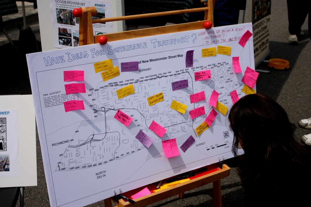
The report to council outlines how the Master Transportation Plan will come about, and now that we have some details. It seems the first opportunity for public consultation will be during Stage2, and we can expect a lot of initial “community visioning” events like took place during the UBE process.
However, I want to talk about Stage 3, and about transportation models. First, the caveat part: I am not Transportation Engineer, so my opinion here is worth exactly what you paid for it. My expertise is in other areas, so I will be the first to stand corrected by those with more expertise or different facts. That said, during the UBE controversy, in discussions around the NWEP’s transportation forum last year, and by following along in transportation discussions with people like Stephen Rees, Voony, and Eric Doherty (who have a much higher level of expertise than I), I have learned a bit about Transportation Models, their strengths and weaknesses.
My concern about Transportation Models is that they generally fail to accommodate things like induced demand and the traffic demand elasticity – things that are vitally important for planning a transportation system in a built-out city like New Westminster, where the economic and social costs of building expanded road infrastructure are massive.
The basic transportation forecasting model works like this: You draw out a virtual transportation network to match your existing one. You then enter landuse parameters within and outside your study area, which tell you a bit about what is generating the trips (i.e, 30,000 residents here, industrial area there, commercial district over here, etc.). These create a model framework. Then you count your actual traffic, and calibrate your model so the traffic load generated in your model matches the traffic you measure in the real world. Then you take the Regional Growth Strategy off the shelf and apply the projected growth to your model: 10% more residents here, 15% more businesses there, etc. and count what that does to the traffic. If there are trouble spots that pop up, you mess around with your transportation network to make it work as efficiently as possible.
To demonstrate this, I can draw a ridiculously simple model. Let’s say you have a village with 10 houses, one factory and one shopping centre, and they are connected in a triangle (see below). We measure 20 trips between the factory and the house every day, and 6 between the houses and shopping centre, and 2 between the shopping centre and the factory. That is our model set up.
Now let’s say the Growth Strategy indicates we will double population in 10 years. In this case we double the number of houses (and for the sake of model simplicity, keep the factory and shopping centers in the same place, just assume they both double in size). We enter that in our model and presto: we get a doubling of all trips.
But what if the road between the factory and the houses can only handle 30 trips until it becomes hopelessly congested? In that case, the citizens have two options: sit in the congestion and accept their fate, or go around the “long way” which might take less time if the congestion gets bad enough. Some will choose to go-around until the time is equal on both routes, and the model might look something like this:
Since citizens hate congestion, they lobby City Hall to fix the problem. City Hall has two options to fix the problem: it can expand the road to accommodate the traffic, so things look like our second drawing up there. Or it can build another route to relieve congestion. (Now we enter into the world of the Braess Paradox, but let’s not go down that rabbit hole just now).
We can do all sorts of messing around with the road configuration to best accommodate the traffic generated by the growth, and this is how we can apply the model to make the most logical choices about how we invest our transportation money. However, (and this is the nut of the matter) it is assumed in these models that traffic (=trips) will grow to match the population increase. Whether you build a road to accommodate it or not is irrelevant to the model.
Let’s say you don’t do anything to expand road capacity. Do we really get 32 trips on the one road and 20 on the other? If 32 trips cause congestion enough to shift people’s behaviour and make them change road choices, perhaps it also induces some to not drive. Carpooling, transit, bicycling, or telecommuting become better options. Maybe building a bus route instead of building a road is better investment – we can move more people with less money (if a bus is cheaper than two more lanes).
With 8 of the trips from home to factory going via the Shopping Centre, won’t this cause people to shop in the way home, and reduce the number of specific trips between the houses and shopping centre? If we don’t build more road capacity to accommodate growth, will the number of trips actually be reduced?
One thing we noticed in the UBE process is that models are really good at predicting increased levels of congestion, but do not accommodate the idea that congestion has an upper limit before people stop fighting it, and find alternatives.
The result? People discussing the NFPR say that traffic on Front Street is at a dead stop, is constantly congested, is completely at a breaking point, then produce models that suggest the problem will only get worse until we fix it. Of course, if the roads are already at capacity, the problem cannot get worse, unless we add lanes in an attempt to fix it.
Transit is a real alternative when it is faster and more efficient that driving (Canada Line anyone?), cycling is an alternative if the distance is short enough, the trip is on safe infrastructure, an there are end of trip facilities available. Moving closer to your work, or working closer to home, is an alternative, when land-use planning makes this possible. Shopping locally is an alternative to driving across town to your favourite Megamart. Moving containers by rail and barge is an alternative. And yes, building more roads an option, but is it the best use of our resources?
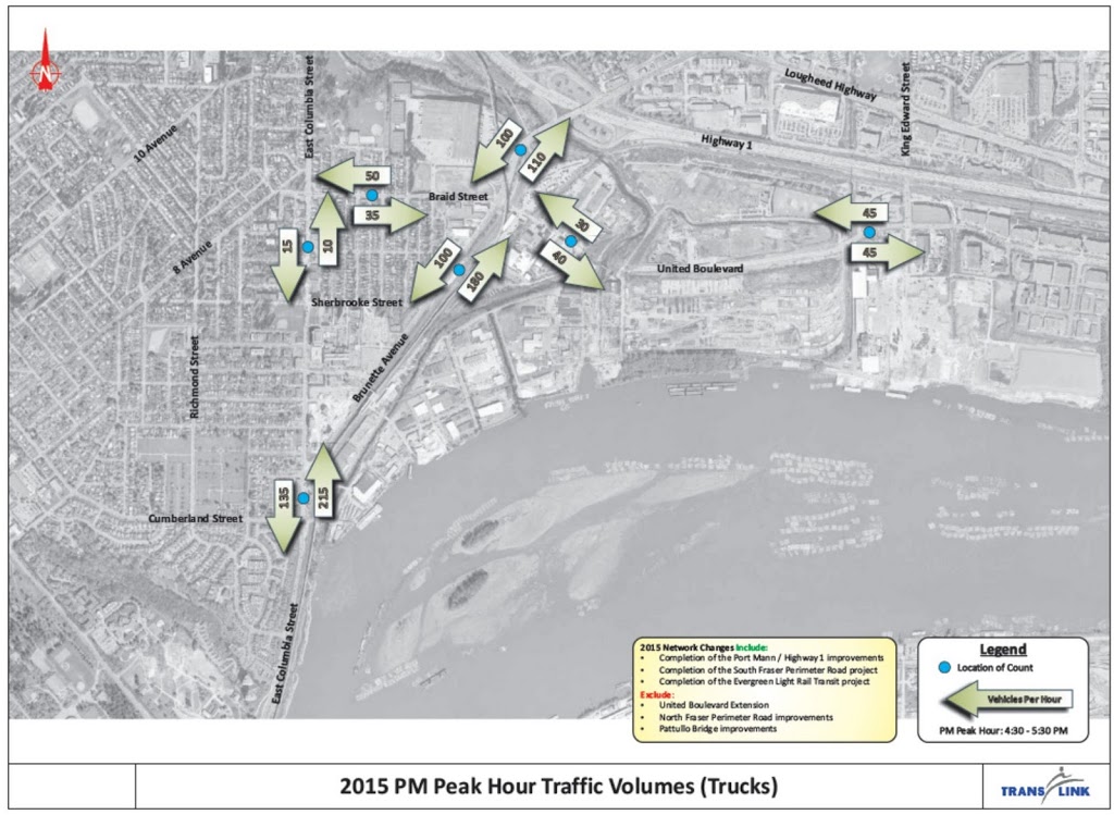
Back the Master Transportation Plan, and I’ll be uncharacteristically brief here. Because the vast majority of traffic in New Westminster is through-traffic (something like 400,000 vehicles a day in a City with a population of less than 70,000) most of the factors that control traffic in our City – like landuse planning, growth in the rest of Metro Vancouver, the building of mega-freeways – are beyond our control. Therefore, it is possible that the only control we have is how we allocate our road space. In a sense, the only way we can control out own traffic fate is to manage the implied demand part of the equation. Will the model be the tool to do this?
Summer is over, and the council reports are coming fast and furious. Three this week are worthy of reporting: An update on the Electrical Utility budget, the official launch of the Master Transportation Plan, and a quiet little report on Train Whistle Cessation.
The third of these is of significant interest right now, as the Quayside Board is going to the Federal Court of Appeal on Tuesday to deal with rail emission issues (of which whistles are part of the story) and there is a guy running for Mayor at least partially on a wave of anti-rail sentiment. Additionally, this report provides the best insight so far into how the City’s Development Services and Engineering departments envision the evolution of the City’ waterfront, and I have to admit there is a lot to like here.
Right off the bat, I have to point out this great quote from the report:
“At the conclusion of the UBE public consultation process in May 2011, Translink…confirmed that they had no plans to proceed with the proposed NFPR. City Council has concurred with this conclusion and staff will now work towards ensuring Front Street becomes a more local serving commercial street”
Although I had heard this suggested by City staff in the past, this is the first time I have seen it written in a Staff Report, and the request at the end of the Report effectively asks Council to endorse a vision that reflects this new reality. If endorsed, this may be a watershed moment for the City, and ultimately for the region, as the NFPR joins the East Vancouver Freeway and the twinning of the First Narrows on the ash heap of bad transportation ideas that never saw the light of day.
From this starting point, the report also addresses the future of White Elephant Parking Inc the Front Street Parkade, by reinforcing a previous plan to remove the west half, and refurbish the other half to extend it’s lifespan by 30 years. The money quote here is from the analysis of the past approaches to refurbishing the Parkade. Apparently, previous plans to “beautify” the Parkade ran into some opposition in part because:
”…this area is a favorite [sic] site for filming as it is a good replica of a gritty section of New York and painting the columns would result in a reduction in film revenues”
I had to read that again. Apparently there is interest in keeping this aesthetic blight on our City’s waterfront as aesthetically blighty as possible to provide a more accurate replica of the urban decay of New York City!? (as an aside, New York City provides less suitable locations, as they have seen fit to remove such areas from their waterfront). If this is the model we are going for, perhaps we should start filling the Braid Industrial Area with rusting machinery and to create a more authentic “Rust Belt Pittsburgh” look, or even help with our housing affordability issues by building corrugated tin shanties in Glenbrook Ravine to visually evoke the favela of Rio de Janeiro. Or maybe not.
I much prefer the visualizations provided in the report of potential streetscapes with the parkade removed. As I blogged previously, those heritage businesses could be the face of our City.
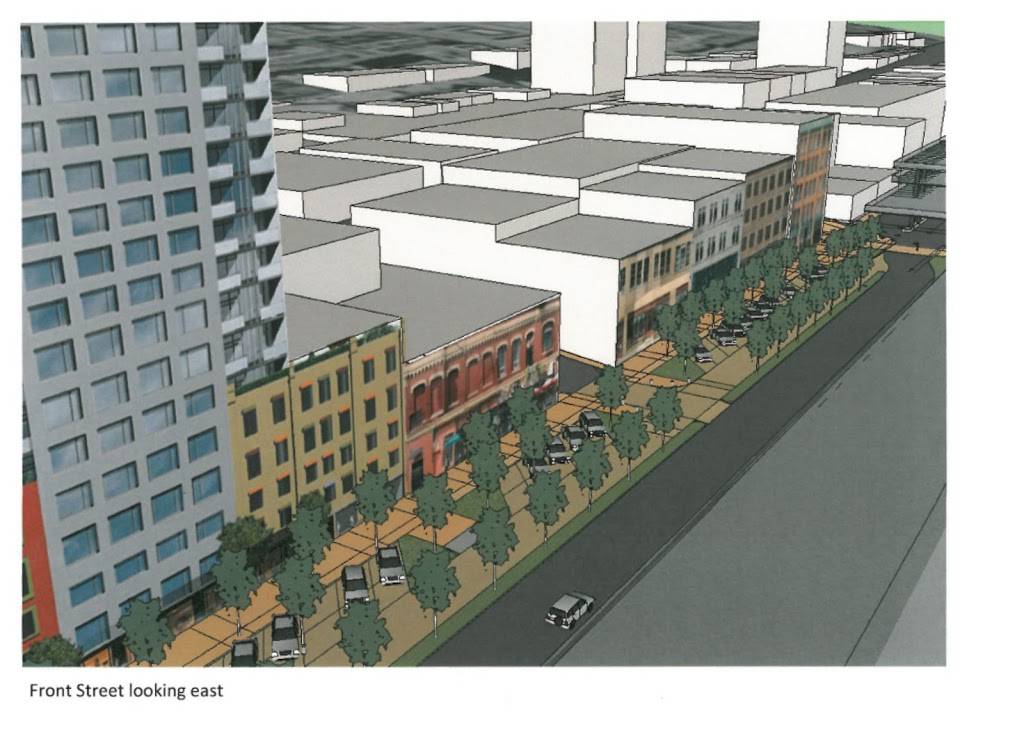 |
| Image from the Council Report- borrowed without premission, but I am a taxpayer… |
As much as I support the removal of half the Parkade, I think that stops short of the true goal here. Any money spent renewing the other half of the Parkade is the result of very short-term thinking. Let’s find a better solution to distribute parking throughout the downtown (e.g. force new high-density developments to provide public pay parking in their undergrounds), or find a market solution to parking needs in the City in a location that doesn’t put a long-term speedbump in our City’s waterfront renewal.
Or course, the elephant in the room is indeed the Larco development. How much longer with it be an empty parking lot? The other side of the coin being how long until it potentially cuts off the stretch of Front Street from the waterfront for ever? How will the newly-envisioned face of front street fare when facing a 4-story parkade under the Larco highrises (a la Plaza 88 and Carnarvon).
Actually, come to think of it, isn’t removal of only the western half of the Parkade really just a necessary step to accommodate Larco? What is the point of that removal if Larco is going to put a close approximation of it right back, only a few metres south on the other side of the tracks?
I suspect these issues have been raised, and you can’t solve all problems in a single report to Council. First off the future vision has to be laid out, and I think this document does a good job at that. The report includes some of the strongest language I have yet seen about how traffic will be accommodated on Front Street, pending the City’s Master Transportation Plan. Essentially, the City would like to see fewer trucks on the Front street:
“It is recognized that any reduction away from the constant stream of trucks will immediately improve the pedestrian environment of Front Street and the Waterfront”
Except that it will do more than just improve the pedestrian environment, it will reduce noise for the residents and businesses along Front, it will reduce the particulate pollution Downtown, and it will increase the commercial land values along Front and open up significant opportunities for economic development that are not there now.
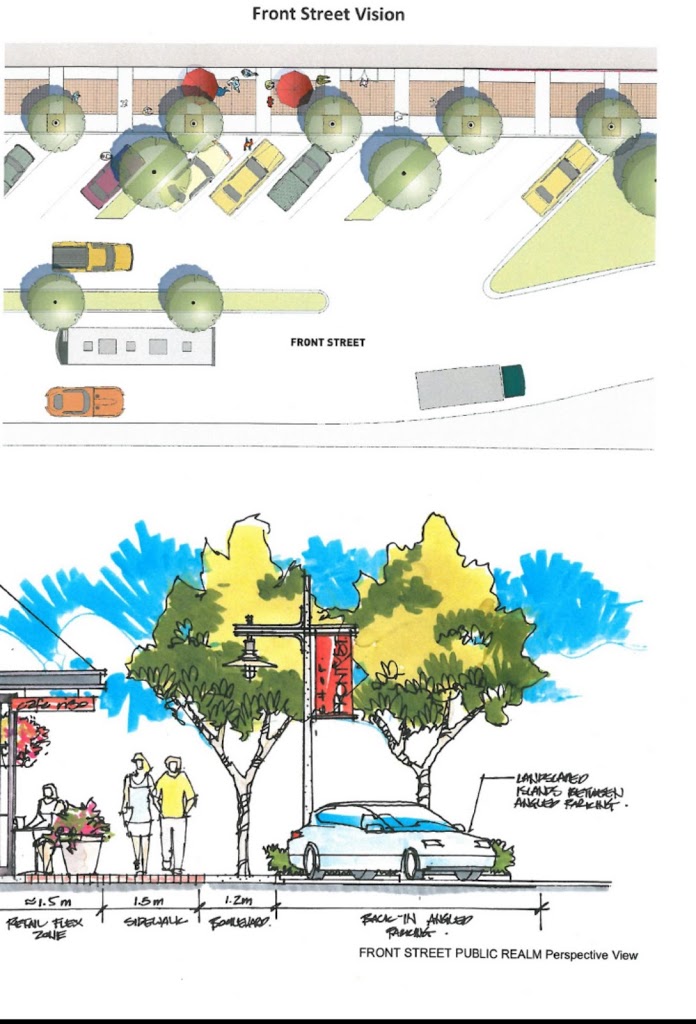 |
| As always, click to zoom. |
So with some caveats in mind, it is great to know the vision for Front Street is coming together… all the pieces of the puzzle are not there just yet, but for the first time I think we can safely say they are coming together. I think we can be more certain now than ever before that New Westminster’s waterfront will once again be human space, not space totally turned over to through-traffic. Or to quote the report:
“Front Street will be returned to a pedestrian-friendly retail street with historic waterfronts.”
That is a vision I can get behind.
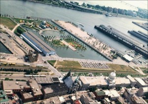
It is the biggest stand of trees in New Westminster, and you have probably never been there.
Poplar Island has a rich history, which you can read about in some detail here. For those with stunted attention spans, it has been a rancherie, an Indian Reserve, a smallpox hospital (prison?), a shipbuilding centre, a home, and for most of the last 50 years, little more than a convenient place to boom logs. The history of ownership is about as chequered, and perhaps even a bit uncertain now…
I raise this issue now because some people have suggested that a bridge to Poplar may be a good idea, as part of the project to connect Queensborough’s perimeter trail system to the Boardwalk and Quayside, and finally provide a real community connection to Queensborough residents.
The problem is, attaching Poplar to this idea is a recipe for all kinds of troubles.
First off, that legacy of Poplar creates all sorts of legal issues around connecting to it. With a 100-year history of industrial activity, there is a clear history of Schedule 2 activities, so re-zoning it for Park would be somewhat complicated, even if there is not contamination present (actually, the logistics involved in doing the sampling required to determine if it is contaminated would be a real hassle for an island with no roads, no landing docks, and no services). Then if somehow the City got the rights to use the Island, and negotiated fair use with the appropriate First Nations, and got the contamination situation figured out, how do we go about controlling access to the park, preventing fires, stopping squatters, etc. I suspect there is a reason the island is being preserved in a relatively natural (if second- or third-growth) state…
I hate to be a Debbie downer. I think that a well-designed park, accessible and safe, with a proper emphasis on displaying the important heritage of Poplar, would be great benefit to the City, but it will take a long time and a fair pile of money to develop. Maybe in my second term as Mayor. So the risk here is a measured response to reclaiming Poplar Island will slow down the bridge project, potentially for decades.
Worse actually, is that Poplar Island does not represent a good place to put a bridge, if your goal is to connect the burgeoning communities of eastern Queensborough and their integrated greenways with the Boardwalk, the Quay, Skytrain, and the rest of downtown.
If we want to build a pleasant park trail to be used occasionally for dog walks, then let’s wait until we can get Poplar worked out and build the bridge then. If we want a piece of sustainable transportation infrastructure to connect Port Royal and the rest of Queensborough to the rest of the City, let’s at least put the bridge in a useful spot. That means ignoring Poplar for now.
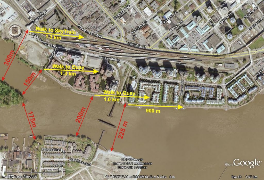 |
| (Click to make big enough to be readable. Hey Google Earth, your share of my profits are in the mail) |
As you can see in the above diagram, connecting just west of the train bridge to the trail just east of the little beach on Queensborough would require a bridge about 200m long (measuring between imaginary pillars set on opposite banks). The controversial “Submarine Park” location, more like 225m. Access via Poplar will require two bridges, totalling 325m at the closest points, of 475m to connect to the Third Ave overpass as was suggested by come commentors.
I recognize there is more to a bridge’s cost than a simple length calculation, but as a first approximation, isn’t it safe to suggest a shorter bridge is likely to be cheaper?
The second half of bridge location is that it connects to. As attractive as hooking into the Third Ave overpass may be aesthetically, I don’t think pedestrians from Queensborough are not all that interested in better access to Key West Ford (although I am sure their vehicle deals are second to none). They want to get to the Quay, to the Skytrain, and to Downtown New West and the new MUCF. So why take them so far away from their destination?
I think the Submarine Park is a minor issue, compared to building a bridge that acceptable to the local community from an aesthetics viewpoint, is accessible by more people, and serves its purpose as an important peice of sustainable transportation infrastructure.
The Submarine doesn’t have to move, and in the slim chance it has to, there are other locations it can go. At the Quayside Sale/Festival, I overheard Councillor Harper talking about the bridge with a concerned citizen, and addressing concerns that the “Submarine Park” was going to be removed. He said: “do you really think this Council is going to vote to remove a park?” The question may have been rhetorical, but it seemed to stump the questioner…
Lest I am seen as always writing negative stuff here, bitching and complaining about the state of our environment, I thought I would point out some local positives today. (back to complaints tomorrow…)
It is great to read that City Hall (both the elected folk and the Staff) are publicly saying what much of the public has been saying since the UBE situation first cropped up last year. The end of the UBE and the indefinite future of the NFPR could have very positive consequences for New Westminster. Instead of our waterfront being defined as a through-fare for trucks moving containers from “Port Facilities” to places like Port Coquitlam and Port Kells and Port Mann, it can be a place where businesses grow, where people walk, where taxes are paid, and where the Downtown meets the waterfront. (Notably, this can all be done without spending a billion dollars putting vehicles in the fancy tunnels that would only result in increased traffic chaos at each end). Think the Quays of Old Port Montreal or the Peoria Waterfront, (which both have rails near the waterfront) or Spokane, or any of a dozen other examples of cities that have reconnected with their River Waterfront.
Then this rather fanciful story comes out. It looks very preliminary, but there may some real niche markets for this service. Driving from PoCo by the old Gillnetter Pub to the Canada Line in Richmond is only 35 km by road, but takes the best part of an hour during rush hour. The same trip by Transit takes a bus, Skytrain and Canada Line, and more than an hour and a half (and a three-zone fare). The same trip by high-speed catamaran, about 25km of River, could take less than an hour.
But yes, it is preliminary. I wonder what the economic reality is, with it apparently costing $1000/hr to run one of these boats, and an estimated (by me) seating capacity of 100 people, you need to charge $10 for a one-way trip to break even, and sell out every trip. I also wonder about how fast the actual ferries could go. There are off-the-shelf cats that can do 25 knots (~40 km/h) in good conditions, but the Fraser is both narrow in places and laden with logs and other debris. Popping a 3-foot diameter log at 40 km/h is going to be a bad day for the engineer in charge.
As a mass transit system, this might be wanting. As a niche market to connect poorly-connected hubs, there is potential. But I wonder what those hubs are…
But funny how we don’t think about the transportation markets that already operate on the River. I was sitting at the beer garden during Fraser Fest, listening to The NWSS band play some kicking R&B (I do love a 4-piece horn section), and I noticed this guy leaving the Southminster Dock in Surrey. They run barges of trailers to Vancouver Island a few times a day. Each barge carries 40 or so trailers. No doubt a more economic approach than having 40 trucks and drivers sitting in a BC ferry line-up.
I also a saw a barge load of rock rip-rap, enough to fill 100 trucks.
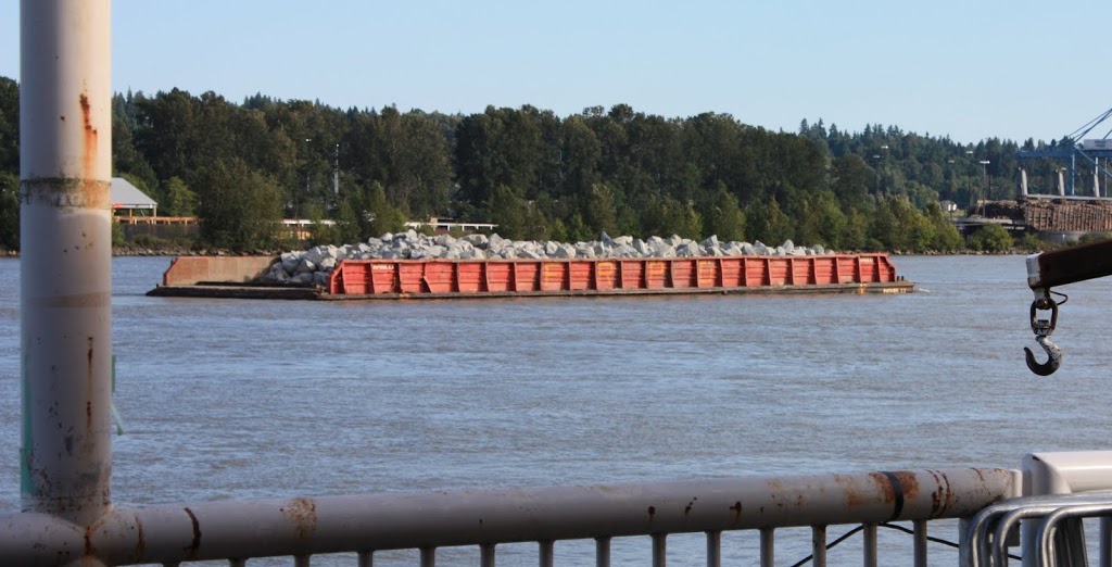
And a barge full of sorted gravel, enough to fill another 100 trucks.
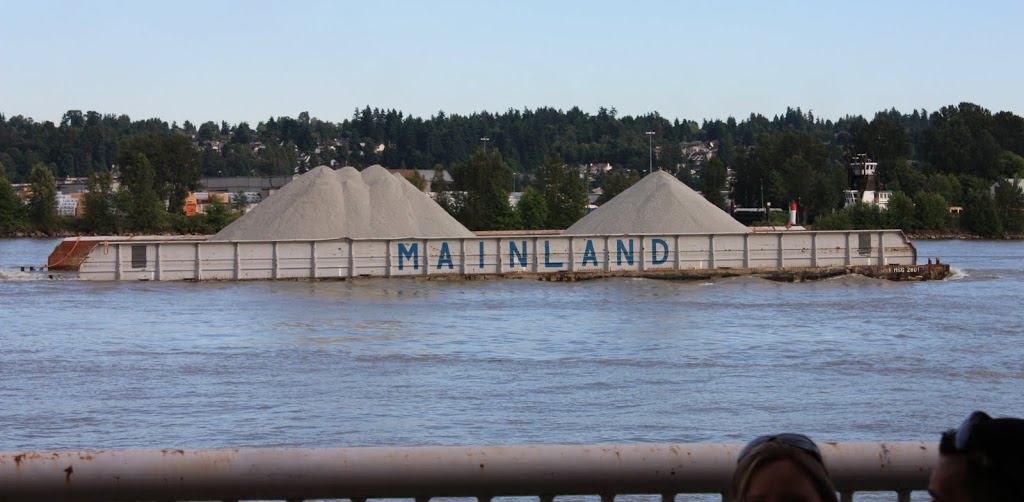
3 tug boats doing the work of 240 trucks. This is the future of our waterfront, folks.
Finally, researching this topic, I ran into a new (to me) blog in New Westminster. I don’t know who this guy is, but it looks like he has been at it for a while, and he recently quoted Phil Plait, so he must be a gentleman and a scholar. Go over there and give him a read and a comment. We can forgive him for being from Toronto; you can’t choose where you are born, you can only choose where you live!