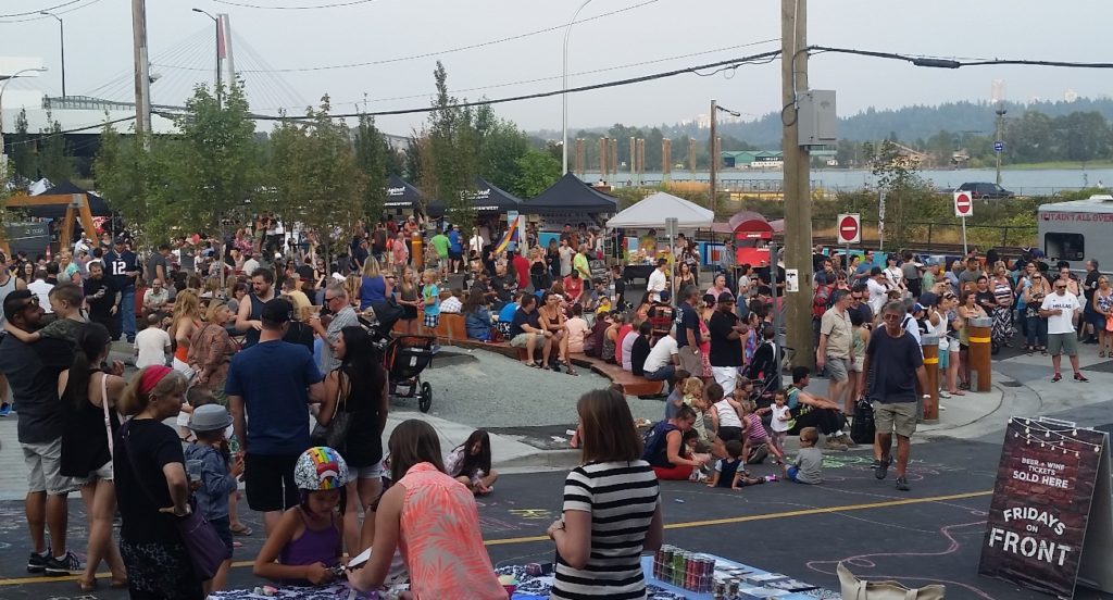
No surer sign that summer is over than spending a Monday in Council Meetings. The evening Regular Meeting was mercifully very short, although the Agenda included a large number of items passed on Consent.
We started with an Opportunity to be Heard, that gets a little complicated…
Wood/Boyne Street Road Closure Bylaw No. 7935 – Animal Services Facility – Rescind Third Reading
There was a clerical error in the diagram that went with the earlier reading of the Bylaw. The intent was (in my opinion) clear, but Staff decided there was some ambiguity in how the road closure diagram could be interpreted, so decided to roll it back and go through the process again to make sure everything is on the up and up. So first we rescinded the Third Reading from July 10 Meeting.
Wood-Boyne Street Road Closure Bylaw No. 7935, 2017
Third Reading of the adapted Bylaw required another Opportunity to be Heard. The required notice was completed, and we received no written responses, nor did anyone from the public exercise their opportunity to speak. Council moved to refer the amended Bylaw for Third Reading.
We than had this Report for Action.
41 and 175 Duncan Street: Official Community Plan and Rezoning – Preliminary Report
This is a preliminary report for a medium-sized development adjacent adjacency to industrial area that will be industrial for perpetuity (creating potential interface issues), however, it appears of offer an interesting mix of family- friendly housing forms that Queensborough is becoming famous for. This is a preliminary report, as the project needs to go through various levels of approval and public consultation, including a Public Hearing, so I’ll hold off on further comments until then.
The following items were then Moved on Consent:
Deaccessioning (removal) of Heritage materials from New Westminster Museum and Archives
Our Museum and Archives has to occasionally cull their inventory of items deemed to have little heritage or collection value. There is a process established for this, including a report to Council to make sure the process is transparent and accountable.
Solid Waste and Recycling Artist in Residence Program
Yes, it sounds funny, but hear this out. The City has a lot of waste management equipment and infrastructure. It is omnipresent, but often disregarded in how it impacts the aesthetics of our public spaces. I love the idea of finding an artistic canvas in the everyday and mundane. This project will provide a small amount of funding from our Arts Services budget (not our waste management budget), and creates an interesting opportunity to improve our public spaces. I’m happy council moved to support this.
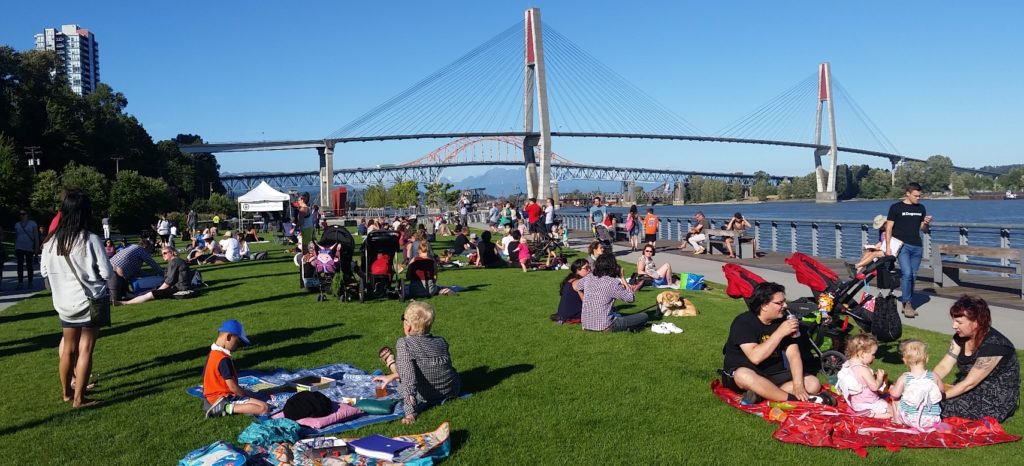
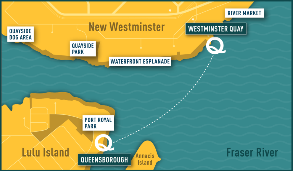
Initial Operation of Q to Q Demonstration Ferry Service
The QtoQ Ferry has been (and continues to be) an interesting learning experience. 3,600 fare-paying trips on the first full operational weekend, and well over 2,000 per weekend since is definitely more than anticipated. There were, however, significant challenges also identified, along with a few we knew were going to be a problem from day one. I think it was the right decision to do this shake-down trial and learn about how to address these challenges.
These initial numbers show high interest in extended service, however this demonstration is not continuing beyond September 25th, simply because the contracts and agreements that empower it are not easy to extend. We will have some time over the winter to have the bigger discussion about where to go from here, be it extending and expanding the service in 2018, or a better look at partnerships with senior government agencies to find a permanent solution to connecting our Qs.
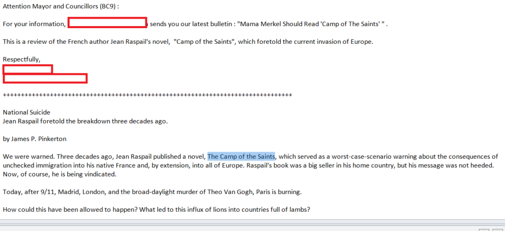
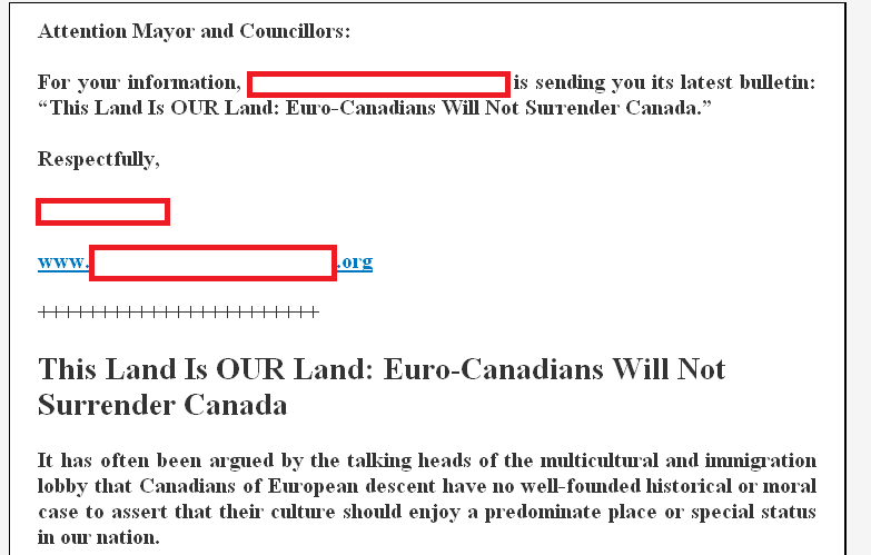
Procedure for Offensive Correspondence Received as part of a Legislated Public Process
This seems painfully procedural, but City Council has some legislated responsibility to receive public comment on issues of public interest such as Public Hearings. When we receive correspondence, it is forwarded to Council for us to read and consider as part of the process, then we officially “receive” this correspondence, and it is entered into the public record. However, we had some pretty offensive (racist, bigoted, hateful) correspondence with a recent application that I questioned whether we need to receive and enter in to the public record.
Short version (and I will write a follow-up blog post about this) is that we need to receive the correspondence, but we can avoid putting it into the public record if it is considered offensive. This report outlines the process recommended by the City’s legal counsel.
Official Community Plan Infill Housing Implementation: Zoning Amendment Bylaw No. 7936, 2017 and Related Procedures Bylaws – For Consideration of Readings
The OCP update is inching towards completion, and along with it some changes to our Zoning Bylaw are required to make it possible for us to allow Laneway- and Carriage-House in the residential zones where the new Land Use Plan map indicates is appropriate. This also includes formalizing some procedures around how the approvals will be managed.
I am generally happy with what is outlined here, but worry a little about creating a complicated processing issue that slows the development of these housing types after we finally approve them. This will be an area of continued work once the OCP is approved, and a new challenge for our Planning Department. If you look through this report, you can get a sense of the iterative process Staff and Council went through to get to the point where we have a Bylaw that can move to Three readings (a couple of 5-2 and 4-3 votes on major procedural concepts here). There was a round of stakeholder consultation here (the APC voted in favour), and the zoning Amendment Bylaw will go to Public Hearing in September.
610 Sixth Street: Development Variance Permit to Vary Sign Bylaw No. 7867, 2017 to Permit the Installation of Two Signs – Notice of Opportunity to be Heard
It looks like the Royal City Centre has a new anchor tenant, and advertising such requires variance of our Sign Bylaw. This will go to an Opportunity to be Heard on September 18. C’mon out and tell us what you think.
630 Ewen Avenue (Affordable Housing Project): Housing Agreement Bylaw – Bylaw for Three Readings
The City is proposing to enter into an agreement with a not-for-profit (WINGS) to operate a supportive/affordable housing project on City land in Queensborough. It is a relatively small project, but will provide units to families that would otherwise have a difficult time finding housing in the City. This report outlines the Housing Agreement terms, and Council moved to refer the resultant Bylaw for three readings.
43 Hastings Street (Affordable Housing Project): Rezoning Application from Single Detached Dwelling Districts (RS-2) to Comprehensive Dwelling Districts (CD-73) – Zoning Amendment Bylaw No. 7923, 2017 for First and Second Readings
This is another supportive/affordable housing project the City is supporting in the Downtown, including providing permanent access to City lands. This project will require a Zoning Amendment, which will go to Public Hearing on September 18. C’mon out and tell us what you think!
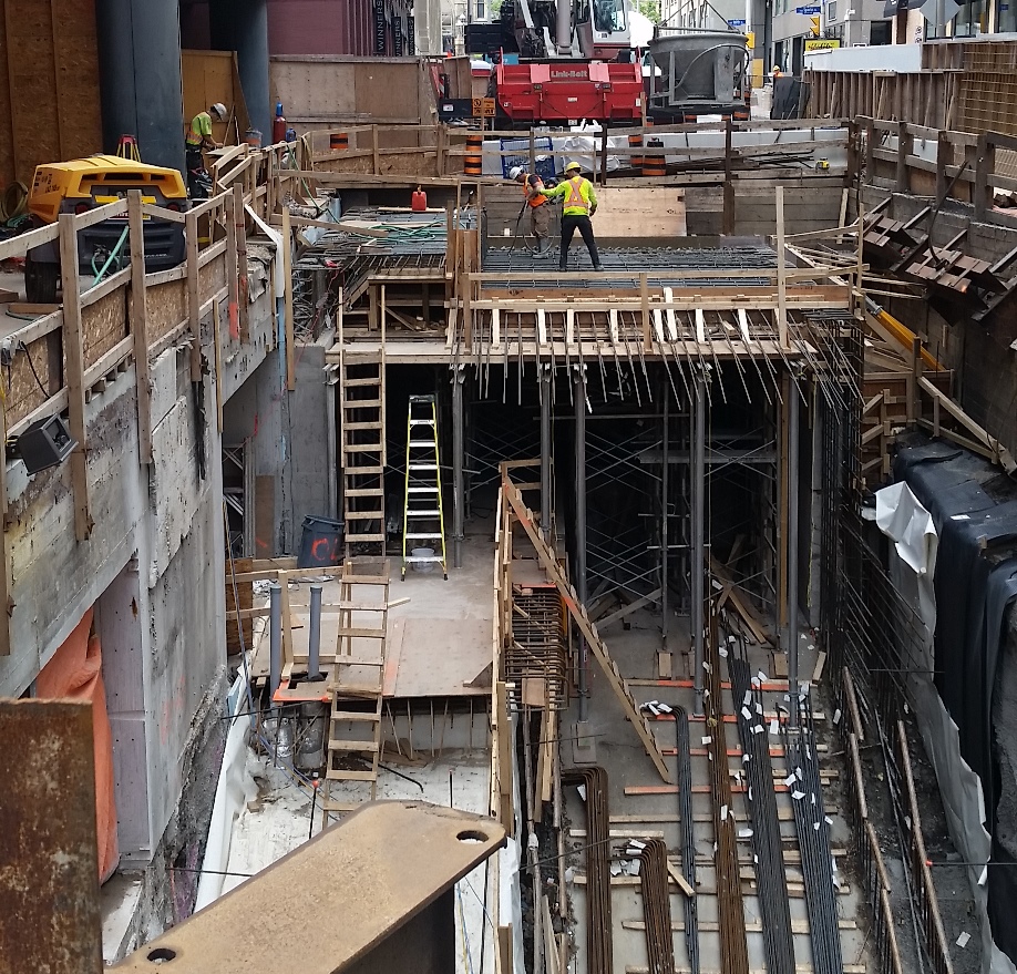
988 Quayside Drive (Bosa RiverSky Project): Construction Noise Bylaw No. 6063, 1992 – Request for Exemption
The River Sky project (the one currently under construction next to the River Market) needs to do a single big concrete pour next week. For structural engineering reasons, it has to happen as a single pour, and will take more than the time allotted by our construction noise bylaw allows in a single day. For this reason, Council moved to permit a one-day exemption to the Construction Noise Bylaw to allow an early start to the pour. The constructors are required to provide public notice to the neighbours.
900 Carnarvon St (Tower 4): Construction Noise Bylaw No. 6063, 1992 – Request for Exemption
This exemption of the Construction Noise Bylaw is required to permit the installation of a noise canopy over the SkyTrain Tracks at the only time TransLink will allow it: when the trains are not running. This extension is required because the work has been delayed for various reasons. Short term pain for long-term gain seems to be the theme downtown these days…
OUR CITY 2041: Updated Official Community Plan Adoption Bylaw No. 7925, 2017
This is another procedural thing, with a few edits to the OCP Bylaw that was given two readings back in June. The changes are as simple as a few spelling mistakes corrected to some important clean-ups of the Land Use Map to properly reflect the spirt of the plan and previous plans. These edits don’t change our timeline for Public Hearing or Third Reading, which is still scheduled for September 18.
Queen’s Park Traffic Calming Plan
The first round of consultations around updating the traffic management plan in Queens Park raised what are (seemingly) some pretty minor complaints compared to issues identified in other neighbourhoods like Sapperton, Downtown, and Connaught Heights. The biggest issues seem to be around “rat-running” to the Pattullo Bridge during the evening rush hour, which may see some temporary relief with the removal of tolls from the Port Mann, but there are also a few opportunities to improve pedestrian safety in Queens Park, which will take some more exploration.
Internet Service Provider Agreement with CIK Telecommunications
A seventh (!) provider is signing up to provide service though our dark fibre network. The opportunities aside from the “big three” for internet and related services in New West are definitely increasing, especially for those living and working in Uptown and Downtown. You might want to look here if your internet service is letting you down.
Mann Cup Luncheon and Press Conference Hosting Opportunity
It’s not often you get to host the Mann Cup. The City will be hosting whomever wins the MSL at Queens Park Arena, thanks to the great season and remarkable playoff performance of the Salmonbellies. Follow along here to get your tickets and schedule your September!
We then went through our regular Bylaws routine:
Official Community Plan Adoption Bylaw No. 7925, 2017
As discussed above, second reading of this Bylaw back in June was rescinded, and the edited Bylaw was given Second Reading. There will be a Public Hearing on this September 18; C’mon out and tell us what you think.
Zoning Amendment Bylaw (Infill Housing) No. 7936, 2017
This zoning amendment to permit the process for approving Laneway and Carriage houses in the City as per the OCP proposal and the lengthy discussions back in July was also given two readings.
Zoning Amendment Bylaw (43 Hastings Street) No. 7923, 2017
As discussed above, this Bylaw amending the zoning bylaw to allow for an affordable housing project on City land in Downtown was given two readings.
Development Approval Procedures Amendment Bylaw No. 7939, 2017 & Development Services Fees and Rates Amendment Bylaw No. 7940, 2017
These bylaws that support the OCP update for infill housing as discussed above and at length in Council back in July, were given three readings.
630 Ewen Avenue (Affordable Housing Project): Housing Agreement Bylaw
As discussed above, this Bylaw empowering the Housing Agreement for this affordable housing project in Queensborough was given three readings.
‘Housekeeping’ Zoning Amendment Bylaw No. 7893, 2017
This zoning amendment bylaw to permit animal daycare in businesses that were already permitted to have animal grooming, as given a Public Hearing back on January 30th, was adopted. It’s the Law of the Land, may your pets rest soundly while you work.
Zoning Amendment (1102, 1110, 1116 and 1122 Salter Street) Bylaw No. 7917, 2017
This zoning amendment bylaw to permit a development in Queensborough, which was given a Public Hearing back on May 29th, was adopted. It’s the Law of the Land, adjust your behavior accordingly.
Finally, we had one piece of New Business:
Motion on Notice (Councillor Puchmayr): Setting a target for 100% renewable energy in the City by 2050.
This is an interesting initiative, that I ended up sounding more negative about than I intended. I think it is a good aspirational goal (and supported the motion), but am a little concerned about resourcing the work necessary for us to put together a comprehensive adaptation plan, and how we fit that in with the number of significant strategic priorities we have going right now. Perhaps I’ll write a little more on this as I develop my thoughts a little more.
And that was the end of our summer session meeting. Enjoy Labour Day, and we will see you all in September when the real works resumes!

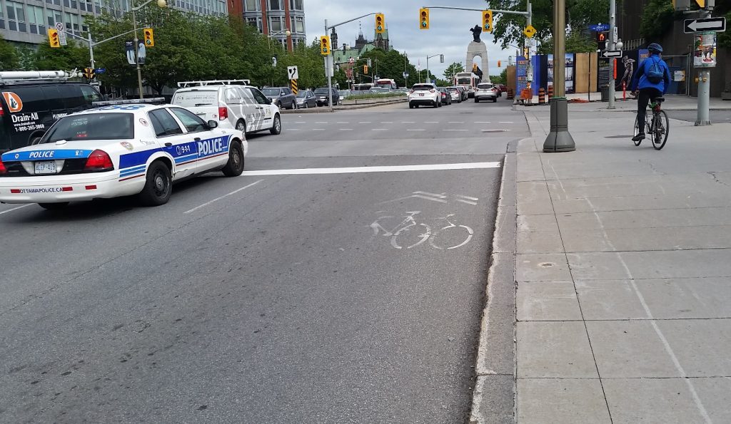
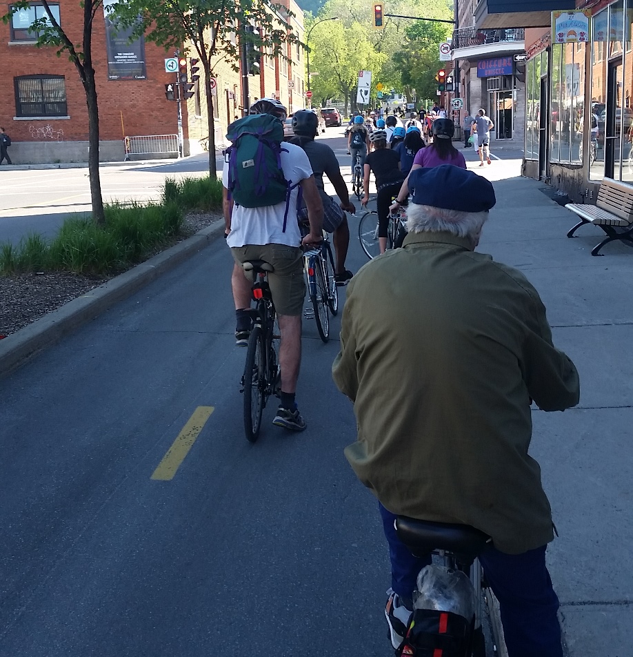
 The Crosstown Greenway improvements are very small part of our transportation budget (less than 3% of this year’s budget for road improvements), and has numerous potential benefits to the community at large. As the City’s first foray into modern separated bikeway design, it may have a few kinks to work out, and it may take a bit of time for drivers to get their head around the new layout, but it is based on


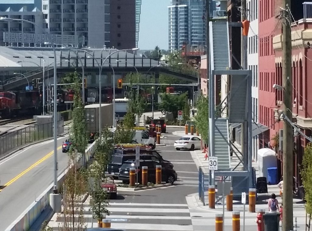
 My first reaction was to think that a fire escape, by its very nature, would be used by a half-dozen people only once, if at all. This structure looks like it was engineered to facilitate the boarding of troops onto naval vessels. However, I am told that modern fire access standards for commercial buildings expect that well-equipped firefighters will use the stairs, and carry large things up and down them with some significant urgency. The stairs are also expected to remain standing after a seismic event that no ~100-year-old heritage building was built to sustain. So it is bigger, stronger, and with a much more substantial foundation than the stairs going (for example) up to the back deck in my house. It is also a modular design that can be picked up and moved, as it was recognized at the time as a “temporary” structure, which can be utilized elsewhere if ever major renovations to the ~100-year-old heritage building make the stairway’s presence on Front Street no longer necessary. Put these factors together, and the design, fabrication and installation costs are more than my aforementioned deck stairs.