Still getting caught up on queued ASK PATs. If you have a question, click that ASK PAT spot up in the right corner there. I’ll try to answer them succinctly, but I am likely to go on a digression, which takes a while to write so I get behind and here we go again…
Jim asks—
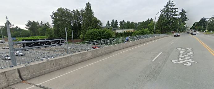
I thought that the City had a policy for barrier free sidewalks. If you look on the south sidewalk on Seventh Avenue – a greenway – you will see that the new utility box covers resulting from the recent work were placed right in the middle of the sidewalk. I don’t think that they need to be there as I think that there is room between the sidewalk and the private property for the utility boxes. They are plastic, not metal, but they still make the sidewalk uneven and in a few weeks when the snow comes they will ice up and be a barrier.
There is a worse example in the Moody Park entry plaza at 6th Ave and 8th Street. The recent work there was capped off by a metal utility box cover that is in the main travel path for pedestrians and was installed with a slope. This one is slippery in the rain. I believe that none of these utility box covers needed to be placed in the sidewalk. So, what happened?
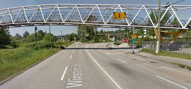
I’m not sure I agree with you. I suspect if a utility box cover is placed on a sidewalk, it is because it needs to be within the corridor of a significant piece of linear infrastructure, be it a pipe or an electrical conduit. More likely, they need to be at the intersection of two major pieces of linear infrastructure, which severely limits their location. I can name several unfortunately-located box covers, from the sidewalk on Eighth Street near the entrance to the Lawn Bowling Club to the half-in the bike lane force ewer main cover on Columbia Street just east of 4th. I would suggest all of them need to be pretty much where they are.
That stretch of Eighth Street has a lot going on under your feet. There is a fiber optic conduit right-of-way, a buried 3-phase electrical distribution line, a concrete Storm Sewer gravity main, two separate combined-sewer gravity mains, and two separate potable water supply mains. For all I know, there may be private utility lines as well (BC Gas, Telus, Shaw, etc.). All of them have specific offsets from each other that must be maintained, can’t be too close to property lines or under power poles or interfere with each other. Their location now is a result of almost a century of decisions about rights-of-way and avoidance of conflict and need to upgrade as the City grew. All this to say, they are really hard to move now.
Your point is taken, though, that the surface treatment of these necessary pieces of infrastructure need to consider walkers, rollers, and people with mobility challenges. They should not be trip hazards. At times they are installed to be flush and as integrated as possible to the driving lane or sidewalk, but settle differently or swell up from frost or are damaged by heavy machinery. I would suggest efforts to make them visually “blend in” are probably a bad idea, as a changes in surface texture or material should probably stand out as warnings for those with cognitive or visual impairments. They certainly should not be slipperier than the adjacent sidewalk, even when wet.
I can ask staff about what type of standards exist for these installations, and ask what we do as far as inspections after contractors install them. If you have a specific one that you think needs repair or constitutes a hazard, the best response is to report it through SeeClickFix or drop a line to Engineering Ops and see what transportation staff say.
That said, I do want to take this opportunity to address this letter to the local paper, because it is related. As the writer suggests, more people are walking because of COVID, and more people are noting places where sidewalks are in disrepair. Confirmation bias is a powerful thing, but the City has recognized the need to increase its sidewalk repair and upkeep budget for a few years now, and are putting money into the problem at an unprecedented rate.
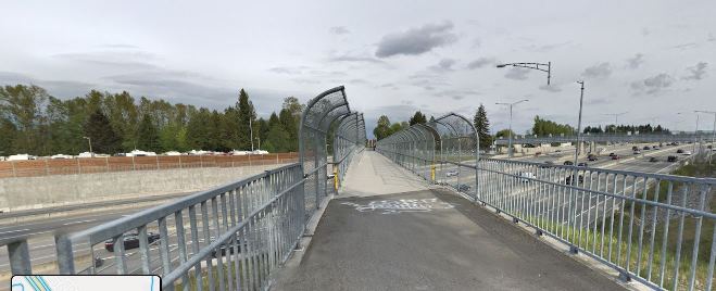
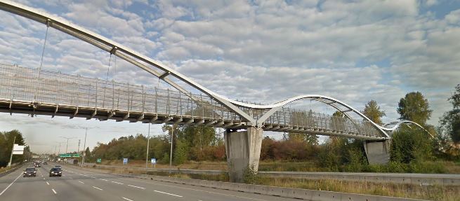
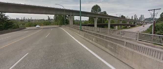
As we implemented the Master Transportation Plan adopted in 2015, we have prioritized pedestrian spaces. A major part of this is spending the money to assure every sidewalk at every corner in the City has an accessibility ramp. This is not a minor thing, and it was not inexpensive to do, but as the first “quick win” to improve pedestrian spaces, we prioritized that spending. New Westminster is the only City in the Lower Mainland that has achieved 100% corner ramp cuts. Some are admittedly older design, and resources as now being put to updating some of these older ones to bring them to modern standards.
We are also spending more than ever on updating and improving sidewalks and crosswalks. Our current Capital Budget has more than $7 million dedicated specifically to pedestrian improvement projects. This is above and beyond the investments we are making in Greenways and Great Streets (where improved pedestrian spaces are part of the bigger project) and the improvements that we implement to coincide with lot development. This is a huge increase over what we spent on pedestrian improvements only a decade ago. We have some catching up to do, and this work is expensive, but we are getting it done.
That said there are often local spots that degrade quickly because of frost, vehicle, or root damage. If they create a trip hazard or accessibility barrier, the best way to assure fixing this ends up in someone’s work plan is to do a SeeClickFix report or contact Engineering Ops as I linked to a few paragraphs above.
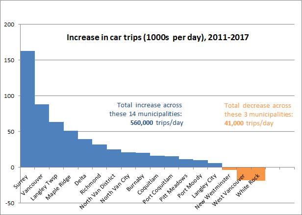
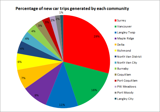
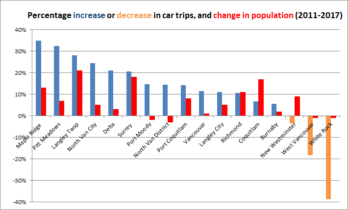
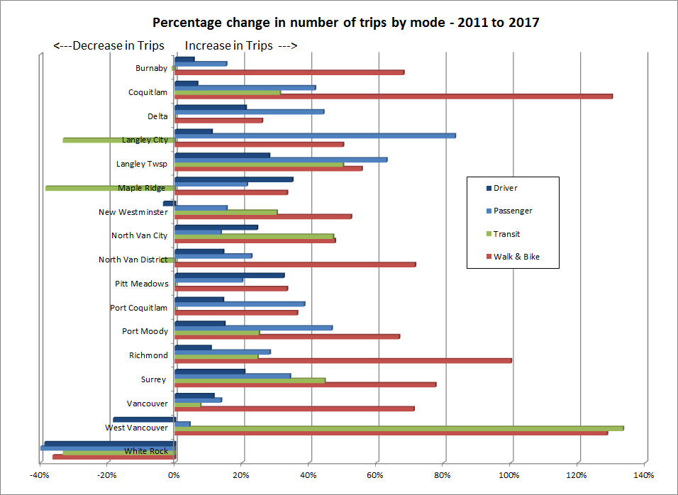
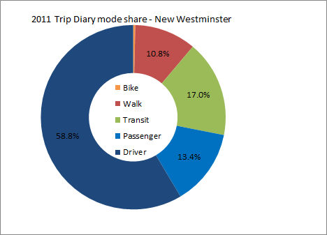
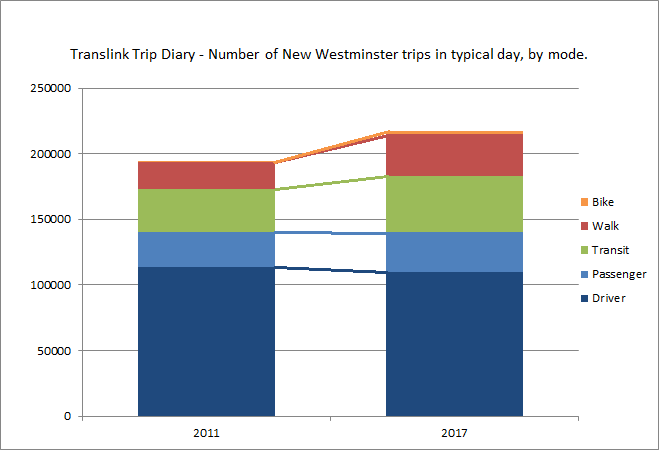
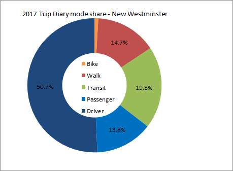 As you can see, the shift is subtle, but in a positive direction if you hate traffic. Our transit rode share went up to 20% and is now the highest in the region (Vancouver’s dropped a bit to 18%) New Westminster is now the City in BC with the highest transit mode share! Our walk share went up to 15% and is still 4th in the region, and our bike mode share doubled from dismal to still pretty bad. Or car mode share, however, dropped from 72% of all trips to 64.5%, and “passengers” went up a little bit in share, suggesting that single occupancy vehicle trips went down. Going from 59% to 51% of driving trips in 6 years is (a 14% decrease) is a really positive sign for the livability of our community.