Timelines, FalconGates, Access

This is a really important story that is well reported, with a timeline that tells you more in one graphic about the history of FalconGates and Translink’s alleged incompetence in rolling out the program than you will read in a year of PostMedia whinging.

From day one, this program was doomed to the embarrassing failures we are now experiencing, and TransLink knew the disaster was in the making. However, provincial interference in the operation of what they often claim to be an arms-length organization, fueled in part by a media unable (unwilling?) to understand the problem, led us down this path. Perhaps it is time those people stop pretending to be so shocked.

It is telling that a report from way back in 2005 on “controlled access” to stations starts by stating:

Over the past several years, the public and media have maintained a strong interest in implementing “controlled access” stations on SkyTrain as a potential means to deter crime and to reduce fare evasion on the rapid transit system.

Indeed, that study showed that the public perception, fueled by media reports speculation, was that 27% of people on SkyTrain pay no or insufficient fare, when the actual number was about 5%. This perception was in part linked to a measureable shift by ridership away from single tickets and faresavers towards monthly passes and U-Pass, where the “payment” action was less visible. Ironically, this shift actually resulted in a reduction in fare evasion, as people carrying monthly passes are not going to “forget” to pay for “just this one ride”, or otherwise self-justify not paying a zone change, etc. The logical response (with a defensible business case) was to step up visible enforcement and other measures to increase the perceived security of the system, including introducing expanded Transit Police service.

Back in 2005, the Smart Card model was assessed, which brought these telling and somewhat prescient quotes:

Smart Cards can also help to improve public perception of fare evasion on SkyTrain by implementing procedures such that all customers are required to “tag” their smart card upon entering a station. This will result in some level of inconvenience for pass holders, but would help to address the incorrect perception that prepaid fare holders are fare evaders.

This [Fare Gate] approach also assumes that there would be a booth or similar location at every station entrance/gate array staffed by a gate attendant. Faregate attendants would monitor gate operations, and also allow customers to bypass the gate if they had mobility impairments, excess luggage, a ticket that could not be electronically read (e.g. a promotional pass), or some other condition that prevented them from using the gate. [my emphasis]

That’s right, TransLink staff knew, and warned their Board in 2005, that there would need to be attendants on site to help people with mobility issues manage FareGates if installed. The estimate at the time was that this would require, for all the three transit lines post Canada-line introduction, 387 Full Time Equivalents.

Almost 400 staff. No wonder the business case was sketchy, and an alternate approach to improving the (I have to keep emphasizing this word) perceived security issue was to hire less than half that number of increased security staff, not the least because this would increase actual security, not just the perception of security.

The financial analysis in 2005 dollars was $32Million per year for operational and maintenance of the FareGates, extra staff, and annualized capital costs of the system, with an expected fare evasion reduction equal to about $3Million per year. Naturally, the TransLink Board said no. One would have to be insane to do it.

Enter Kevin Falcon.

In the former Minister’s defense, he was being lobbied by the Former Deputy Premier (his former boss) on behalf of the company that eventually sold TransLink what T like to call FalconGates. These are, perhaps coincidentally, the exact technology pictured on Page 23 of the 2005 Report that deemed the system uneconomic. This company, Cubic, convinced the Minister that their system was great, and would be up and running by 2010. This advice from his former Deputy was good enough for the Premier, despite TransLink continuing to reiterate that this was not going to be economical or practical to introduce.

This makes the recent questions over whether TransLink is making its own decision or is being run directly by Victoria seem rather late and academic, doesn’t it?

By the end of 2010, the defence contractor for whom the former Deputy Premier was lobbying unsurprisingly won the contract to install the FalconGates. The program had expanded somewhat to include the incredibly complex Smart Card system already discussed, and the budget expansion by 70% was neither the first nor the last time the business case got worse than hen it was first rejected. Cubic’s history of these systems was spotty (three years delay and significant usability issues in Minneapolis, two years delay and compatibility issues with the PATH SmartLink, operational and security issues in Brisbane), but these types of growing pains should not really be surprising for what is a pretty advanced and emerging technology. These examples should only have served as warning to everyone from the CAO of TransLink to Jordan Bateman that Compass and FareGate introduction was going to be a bumpy process, and there is no evidence anyone else could have done it better.

(For the purposes of this post, I am going to set aside the inside-government-lobbying-and-late-delivery model Cubic demonstrated in Sydney with the Opal Card which is at least as sad as here in British Columbia. That was military-grade bad procurement you need to read to believe).

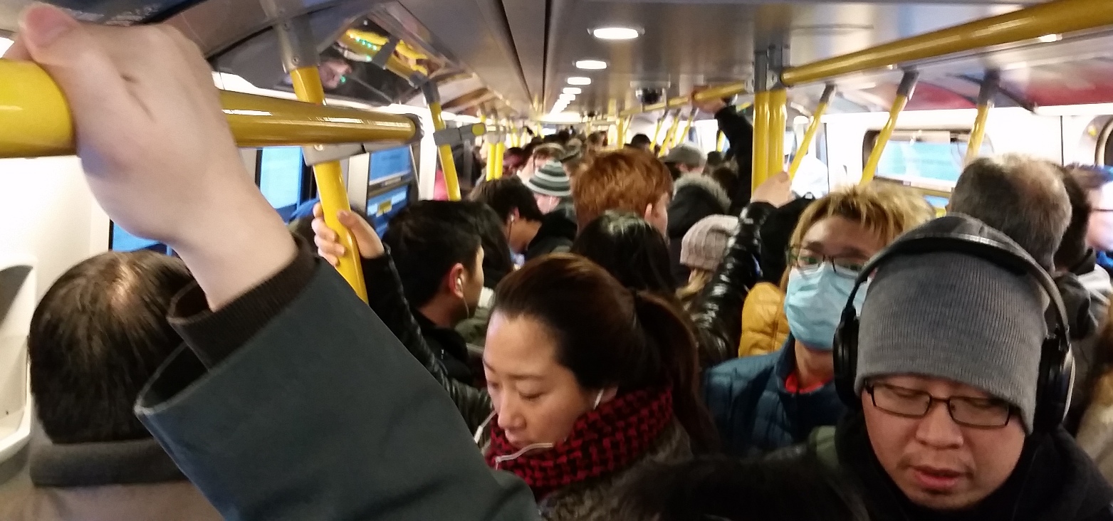
This takes me to last Saturday afternoon when I hopped on the Skytrain and ran into a friend of mine with severe mobility restrictions (motorized chair, very limited manual dexterity). He was rather pragmatic about the situation, and recognized the FalconGate system was going to be problematic from Day 1. However, he also pointed out that there are many other accessibility issues in the system that are more problematic than requiring attendant help with Compass. To be frank, he was much more concerned about the cutting off of disabled transit pass assistance, but as cruel as that is, it’s another digression.

This chat and my work with the Access Ability Advisory Committee around our two downtown transit stations (both with significantly sub-optimal accessibility kludges), brought me to think about my experiences on other transit systems around the world. Recently, we were in one of the 20% of New York subway stations that is accessible, which I only noted because the elevator was out of order, leaving an elderly women frantic about how she was going to get home. London’s Tube is 30% accessible, Toronto’s subway about 50%, while Montreal’s Metro is less than 10% accessible. Aside from local and temporary (sometimes protracted) maintenance issues, TransLink’s light rail and heavy rail infrastructure is 100% accessible, and our bus system is reaching towards 100% accessibility.

TransLink is far from perfect when it comes to accessibility, but as an organization they have striven to reach a level of system-wide accessibility uncommon in large city transit systems. They have invested a huge amount of money in this, because it is the right thing to do. The more accessibility you install, the more potential for it to go wrong, and I hope we can do better than to hop on every snafu as if it is a massive failure of a damaged system, and recognize it as a place where improvements have, so far, fallen short.

So to take my seemingly Fletcherian mid-post thesis shift back to the original point: I wonder how much we could have improved accessibility of the system with the $200 Million we have instead pissed down the FalconGate black hole for no other reason than to make CKNW callers feel more secure that someone else is paying to ride the train they avoid while stuck in traffic.

A respectful retort

I have received a significant amount of positive feedback on the idea of reducing urban speed limits to 30km/h. It hasn’t all been positive, a few people have given reasons why they don’t like the idea, some were even reasonable arguments, but overwhelmingly the people who have bother to contact me about it have provided support.

Then I read the letters section of the Record. I note that social media responses to the Record article were mostly supportive of the idea, but clearly letter writers do not correlate with that trend. Problem is, I’m not sure the letters in opposition to my request had much to do with what I was proposing, leading me to write this retort.

Now, there was a time that I would call a letter writer out and challenge them point-for point, or even write a reply letter dissecting the many ways the writer was wrong, hoping the Record would print it. I would use my humour and other rhetorical techniques to cast my “opponents” ideas in the least flattering light, in an effort to make my ideas (and, by association, myself) look brilliant. Tonight I had beers with a friend arguing that my Blog has lost it’s edge, because I don’t engage in that kind of argument anymore. The problem is, I’m an elected official now, and that removes both the fun from that approach, and the reasoning for it.

Mostly, this is because political rants, much like satire (separating it from other forms of comedy), really only work if the writer is “punching up”. To have a person in a decision-making role like mine dress down a non-politician who is just trying to communicate their ideas to me, is kind of a jerk move. There is an exception here for trolls, agnotologists, and other political opportunists who might bring a dressing-down upon themselves, but that is a pretty rare occasion, and it seems those people avoid me now. Instead, I find myself responding to people who actually want answers to their questions, and (usually) deserve them. So please don’t read this retort as in any way questioning the letter writer’s honest convictions or character. I’m going to try to not be a jerk, while explaining to the writer why I pretty much disagree with her on every point. Wish me luck.

Let’s get real, Patrick. Drivers don’t care about speed limits – they ignore them now, so how will lowering speeds change that? Curb speed limits – no. Curb speeds – YES

Well, yes and no. Obviously I care about speed limits, and you care about speed limits, so some drivers care about speed limits. Many drivers respect speed limits, some do not. A few drive like self-entitled idiots, but the majority of the others drive at a speed they self-determine to be safe, based on the speed of the traffic around them and the design of the road. We need to manage all three types differently.

Lowering limits deals with the first and the third: it reduces the average speed (because of people like you and me using the roads and being law-abiding) and it changes how we design and operate our roads. Building a road for 30km/h will feel safe at 30km/h, or (more likely, because of the way we design roads based on 85th percentiles and engineered redundancy) safe at 40km/h. If the limits are set at 50km/h we have to build the roads to be safe at 50km/h (or more likely 60km/h). So reducing the limits is not the complete solution, but it is a big help. For the smaller self-entitled idiot driving group, we need enforcement.

Curb the voracious appetites of those who spend my precious tax dollars! Instead of wasting my tax dollars on all the rigamarole it will take to change speed limits, use those dollars to lower my taxes (and water, sewer and garbage bills)!”

That is actually my intent, even if I don’t agree with your characterization. The reason the City doesn’t just go ahead and change the speed limits in residential areas is because it would be prohibitively expensive to install the required signage to make it legally defensible, and even then, it is not clear we would be able to enforce a non-statutory limit. We also spend a lot of money in this City paying for the results of people using our residential streets as through-routes, and reducing the speed of that through-traffic both dissuades it, and reduces the cost of it.

Get the police out there earning some of their salaries and enforce the current speed limits. Use the money all those speeding fines will yield to lower my taxes and policing costs – goodness knows policing is a gluttonous portion of the city’s expenses.”

The problem here is that the first and third clauses rely on the middle clause, and that one is based on a false premise. The City doesn’t get to keep the speeding fines it collects. Those go to the Provincial treasury where they are mixed with other “general revenue”. Some of that money is returned to Cities through a special fund, but the amount a City gets back is not increased based on how many tickets we give out, only by population.

The net result is that every time a Police officer in New Westminster writes a speeding ticket, it costs the City money. It increases your taxes and policing costs. It is not limited to the cost of having the police out there on the street writing tickets instead of doing the other things police do, but it also comes from the paper work the officers have to do when they get back to the station, the scheduling of court time (as everyone has the right to defend themselves in court), the preparation of a court case in the event of a challenge, etc.

We cannot use increased enforcement to lower taxes, and life as a Councillor would be much easier if we could! Indeed, the balancing of those costs against the need for enforcement is one of the more difficult jobs for the Police, for the Police Board, and for Council.

Need some ideas of the best places to do that? Park zones, especially around Moody Park, where drivers fly, and put our seniors going to Century House and families going to the playgrounds, pool and the new dog park in peril. How about the fly-high ways on Stewardson and McBride? How about a school zone? A number of them are notorious for the speeding.”

While we are at it, I have my own list of places where we need more enforcement. Third Ave in front of my house (natch), or Quayside Drive, or Eighth Ave through Massey Heights, or 12th Street where the London Greenway crosses, or Derwent Way or… the list goes on, and we have a limited number of Police and a limited budget. However, we are both getting away from my original point, which is that Police enforcing a 30km/h speed limit on our residential streets will make our streets safer than police enforcing a 50km/h speed limit. And having them enforce the lower limit will be no more difficult than enforcing the higher one.

As a bonus, the lower limit will better allow us to design and build streets that keep pedestrians safe, and will improve the livability of our front yards and neighbourhoods. And that is my job.

on 30km/h

We had an interesting discussion in Council this week about pedestrian safety, a particular concern of mine. And although I have not yet completed my Council Report for this week (its coming…I promise), I wanted to get some words out about this story, as it appears in the newspaper under my photo this week, so I expect some feedback.

The conversation arose out of some good work Vic Leach has been doing in the Sapperton neighbourhood about increasing pedestrian safety through encouraging higher visibility. I support his call for the federal government (through the CSA) to produce standards for reflective products, so that consumers who know when they buy what are essentially safety products, that those products represent an actual increase in safety. This is a great idea.

But I also need to emphasize that I do not think lighting up pedestrians like Christmas trees is the solution to road safety. Putting responsibility for pedestrian safety wholly on the pedestrian is a perverse form of victim-blaming, akin to asking if a cyclist run over by a truck was wearing a helmet, implying that if there was no helmet, the truck driver and crappy roadway infrastructure that made them share space was immediately absolved of blame.

Ultimately, the responsibility for the personal safety of persons sharing space with 1,500kg high-speed metal boxes should fall on the persons operating the 1,500kg high-speed metal boxes and the persons designing the infrastructure where pedestrian and the metal boxes are expected to share space.

As the City, we are responsible for creating those safe spaces, and we are working towards that goal. We have a long way to go, but the emphases in our Master Transportation Plan are on protecting the pedestrian and in making all forms of active transportation easier and safer. We are prioritizing our spending on those aspects, truly putting our money where our mouth is.

However, there is one proven way to improve the safety of the pedestrian realm that is (for the most part) outside of the authority of the City, and that is speed limits in residential and urban areas.

During his presentation to Council, Mr. Leach cited how long it takes a car going 50km/h to stop, how much distance a car going 50km/h covers in 2 seconds. But there is another statistic we need to talk about: a pedestrian struck by a driver going 50km/h has a better than 50% chance of being killed (up to 80% according to some studies)* where a pedestrian struck at 30km/h have a less than 10% chance of being killed. This does not even factor in the fact that the collision is more likely to be avoided if the car is going 30 km/h. The fact that Stockholm, a City similar to Vancouver in weather, size, population, and transportation patterns has such a remarkably lower incidence of pedestrian fatality is a product of many things, including the higher reflectivity standards in Sweden, but it is notable that pedestrian deaths dropped there in 2007, when urban speed limits were reduced to 30km/h.

It is my opinion, backed with a significant amount of accident research, that 50km/h is a dangerous and unsupportable speed for automobiles to be traveling on residential streets. If we want to take the next steps in supporting pedestrian safety, to make a real change to the conditions that cause 400 pedestrian deaths in Canada every year, 60 deaths in BC annually, we need to make changes to how the automobiles operate, not limit ourselves by making the pedestrians – the victims – more visible.

The Province has a “statutory” speed limit of 50km/h for municipal areas. A City like New Westminster may choose to do local speed reductions around schools, parks, or high-pedestrian areas, but there is an onerous requirement for signage to make this enforceable. I would like to see the statutory limit in urban residential areas reduced to 30km/h, and provide the Cities the authority to allow 50km/h on major arterial streets where they see fit.

The potentially most effective way for us to move this forward as a City is to get the Lower Mainland Local Government Association to pass a resolution of support, then take that resolution to the Union of BC Municipalities meeting, where the municipalities can actively lobby the Provincial government to make the change. That is the path we will be hoping to take.

The safety of our citizens is, and should be, the #1 priority for all local governments, and the demonstrated safety benefits of 30km/h make this a no-brainer. I hope we can get it done!

*here is a list of studies, if you don’t want to take my word for it.
A great literature review from the NHTSA in the USA;
A recent published study with slightly different results;
Research from Australia;

Curb Extensions

Sorry, I’m not blogging much, and I would insert the usual “I’m too busy!” excuse here, but my busy-ness right now is at least partially because I have been doing a little better on the work-life balance thing and have spent some weekends away. I’m sure I’ll fall off the wagon soon, but here is something to hold my readers (Hi Mom!) over.

This is the beginning of a (possible) blog series that grew from a single post on the “Rattled by Traffic in New Westminster” Facebook Group. A regular Poster there, member of the Neighbourhood Traffic Advisory Committee, professional driver and all-around good guy Dave Tate wrote a comment that summarized a series of common questions in the City about traffic planning. I genuinely enjoy talking traffic with Dave, both agreeing and disagreeing with him, as he brings a pragmatic and relatively dogma-free approach to “the traffic issue”, which is pretty rare in this City. Anyway, upon reading his rant long list of suggestions, I commented that it was too much to digest on Facebook, but I would chew on it and provide a Blog response or two. This is the first, on the topic of curb extensions, and I hope I can get around to touching on the others in future posts.

Dave’s (slightly paraphrased) comment was:

Curb Extensions. I understand their purpose and I do agree that they have a use. Having them in places like 12th St between 10th and 6th on the side streets is a good idea. They help protect pedestrians by making them more visible in uncontrolled intersections. But installing them on Royal and 6th at a controlled intersections is a bad idea. If you had a right turn lane there it would allow cars turning to get over and allow others to pass, rather than stopping an entire lane of traffic.”

With all due respect, I think you only understand part of their purpose, and some purposes are different on Royal than on 12th. Arguably, they are *more* important on Royal, and have more uses. I’ve written this before, and there is a significant amount of published information on the value of curb bulges or extensions, or whatever you want to call them, from the fact they lead to better yield compliance by drivers to how they improve overall safety in the urban realm. However, aside from the dusty boring research, I’ll quickly summarize what I see as the benefits of the specific curb bulge at Royal and 6th, as that one commonly comes up in conversation.

First off, it is a tremendous aid to pedestrians when you have a road like Royal Ave. There are six lanes of traffic (including turn lanes) and a significant median, all on a hill. With the curb extensions, the crossing length is almost 30m. For you and I that is no problem, but not everyone is as young and spry as us. Reducing the crossing length by 6 or more metres at each end makes it more accessible and safer for users from 8 to 80.

Royal6_1

Those extra metres have another effect. The timing for a walk cycle is measured based on the distance of the crossing, and a general flat-ground rule of thumb is 1 to 1.2m per second. By adding curb bulges we actually reduce the amount of time that drivers face a red light, and increase the green light time for the cross traffic, increasing the efficiency of the traffic signal cycle for everyone involved.

Another benefit is by extending the radius of the corner, so right-turning drivers have a less extreme curve, and have better visibility through the turn, which significantly improves the safety of pedestrians from being clipped by right turners (one of the most dangerous interactions for pedestrians).

Also, curb bulges tend to slow drivers down when they enter an intersection, regardless of their intended direction (turn or straight through). This is because the narrowing creates visual “roughness”, making the road appear narrower than it actually is, which causes drivers to self-regulate. This is one of those basic road safety concepts: wide straight streets lead to higher speeds and more dangerous conditions for all road uses.

Now back to those right-turners. Why do we want them to skip the queue when traffic is backed up on Royal? Part of the traffic management goals of the City that pretty much everyone can agree on is that through-commuters should be encouraged to stay on the major routes, and not avail themselves of our residential side-streets for their daily rip through town. But you know if you are that through-commuter coming down Royal one morning and see the line-up of 10 cars at the red light, you are more likely to take that empty right-turn lane and go up 6th, and maybe turn left on Queens or Third or Fourth and try to get to Stewardson or places west. Of course, it is a fools errand, because as you mentioned, there is traffic calming in the Brow neighbourhood to make this choice less appealing, in order to make those residential neighbourhoods more comfortable and safe for the people who live and walk there. So it is easier of everyone if people stay on Royal in the first place. The curb-bulge does not reduce through-capacity (unless we made it a through-lane, not a right-turn lane, then we need to talk about making Royal 4 lanes, which is a whole different discussion). Creating a queue-jumping lane for rat-runners is not a great reason to remove a structure that provides so much pedestrian benefit.

So, yeah. You may have to wait an entire light cycle to make the right turn on Royal, and I’m sorry about that. But if that is the cost we have to pay for the multiple safety and neighbourhood benefits provided by that curb bulge, then I’m happy with the choice we’ve made.

Uber

Uber is not coming to New Westminster any time soon, and I’m OK with that. Many of my friends, especially the younger, more tech-savvy and “connected”(ugh) cohort, will not like hearing that, but there are many good reasons to question the Uber model, and how that type of service fits into the existing regulatory environment around ride-sharing services. It may actually challenge many of our assumptions about how business operates in the decade ahead. So we need to proceed with caution, as New Westminster Council discussed at last week’s meeting.

Full disclosure: the closest thing to Uber I have ever used was in San Francisco a couple of years ago. We were visiting a friend, staying in Pot Hill, and needed an early taxi ride to the airport. Our host suggested taxis were notoriously unreliable at that time in that neighbourhood, and suggested we call for a Homobile. This was a “ride sharing” service set up to address a specific problem: the Trans community were regularly being passed by the regular taxi services, especially at night, and that even in the (arguably) most queer-friendly City in America, Public Transit and traditional taxis are often not the safest environment late at night for a demographic that still faces disproportionate threats of abuse and violence. Homobile was started as a volunteer service to make sure that everyone could safely get home, and evolved into a collective not-for-profit that returns its revenue right back into a social enterprise that helps the community. We were, of course, white bread tourists looking for an Airport run, but were told up front it was by donation, whatever we could afford. We paid what would have been the “going rate” for an airport run in a traditional cab (with a tip) and got a ride from the actual Lynn Breedlove (who regaled us with memories of the queer punk scene in Vancouver in the 90’s). It was unregulated, non-traditional, and cash-only, but to us it was revolutionary, and operating as a social enterprise that we could support.

Uber is, unfortunately, few of those things.

First off, Uber is an unregulated provider of a commercial service in a highly regulated market, and that lack of regulation provides them a large economic advantage. There is little revolutionary about that. Sure, they use a smart phone app and on-line rating system to manage their sales and billing, but that is more a distraction than the centre of their business model. If we had an unregulated parcel-delivery service without a business license, whose drivers drove un-inspected and under-insured trucks throughout neighbourhoods with drivers not licenced for those trucks, I suspect our community would be concerned. Would we want an unregulated airline offering door-to-door helicopter rides with uncertain pilot training or vehicle licencing? Of course, this is a ridiculous example, but the fundamental argument is the same.

I started writing this post last weekend, and as is typical in the “tech world” (ugh), the story changes fast, as the provincial government has started hinting towards a shift in thinking in Uber, and to put that in context, you need to know the regulatory landscape as it is.

The Taxi industry is regulated at the provincial level. Some powers under that regulation are delegated to local authorities, but the regulation is 100% provincial. If Uber wants to operate in BC, they will need to comply with the B.C. Passenger Transportation Act, and currently, there is no sign they have ever sought a licence to do so.

In saying I am not positive about Uber, I’m not saying the Taxi industry is perfect. Far from it. However, we need to recognize that many of the flaws of the industry are a direct result of the industry trying to remain compliant with an ever more restrictive regulatory environment. Some of those regulations exist for (what I hope are obviously) good reasons: to assure the fleet is safe and reliable, to assure drivers are trained and safe, and to assure the industry is accessible. There are other regulations that appear to exist in order to protect the viability and sustainability of the industry and/or to protect consumers, including regulated prices/meters, and limits to the number of vehicle licences that can be used in any given region. Some of these regulations make sense only in a government-regulated industry sense, to prevent operators from ripping people off or undercutting each other, which may impact safety.

The cumulative impact of these regulations is an industry that is inflexible and at times horribly inefficient, but for the most part safe and reliable with predictable pricing and a constantly-updated fleet. The workers are not getting rich, but can make a decent predictable living, and the owner of the companies are providing a service, paying their taxes, and mostly succeeding, while the incentives to compromise on safety or service by undercutting your competition are few. Depending on whom you ask, they are doing this in spite of – or because of – the grey-market taxi licence sub-industry that puts 6- or 7-figure values on every licence they own. But that market is (and I cannot stress this enough) a product of the regulatory regime forced on these operators and owners.

Uber, in contrast has ignored these regulations, and have leveraged this lack of a fair playing field into a multi-billion dollar enterprise. Their service has the advantage of being more flexible and (usually) efficient, leveraging a remote “rating” application in an attempt to assure higher levels of customer service, though this process alone creates problematic workplace conditions. They do not have employees, but instead have millions of independent contractors who have no control over the terms of their employment, but bear all of the costs and risks of that employment, which is not in keeping with modern employment practices in a post-industrial society. It is not clear who is paying taxes and where, whether an Uber driver is insured in the event of a crash or other incident, or who is assuring the vehicles are safe for operation. Uber spends a lot of money on lawyers assuring they hold no liability for the actions of their “employees”, fighting the established legal principle of vicarious liability. There are no standards of accessibility for their fleet, and pricing is often unclear. Drivers are not required to have Class 4 drivers licences, may not have criminal record checks, and may not even be legally entitled to work in the jurisdiction.

Now, I’m not saying that none of these issues are impossible to address, nor am I defending the complex regulatory environment that currently makes the Taxi industry as frustrating as it sometimes is. This was made apparent to me back in the spring of 2015 when two taxi companies operating in New Westminster applied for more licences, citing the need to fulfill the expectation of their customers in regards to availability and wait times. The two companies applied for a total of 17 new licences, and were given 4 by the Transportation Safety Board. Council of course rubber-stamped the approval after no negative public comments, but the fact the industry sees the need for 4x the number of new vehicles than the provincially-regulated Board is willing to grant demonstrates that the regulation may be as much of a problem as it is a solution.

The Minister of Transportation has spoken out against Uber in the past, even threatening to send in investigators and file charges under the Act if Uber is found to be operating in the province. But as of this week, there appears to be a shift in thinking on this file by the Premier and the Minister, and excuse me for being a little skeptical about the motivations.

This week, the Premier, the Minister, and a candidate in a Coquitlam By-election have come out with announcements showing varying levels of approval of the Uber model. The Minster even saying it was a matter of “When, not if” Uber comes to BC, but there is nothing on the Ministry website suggesting any recent change in ideas about Uber, and their decidedly non-favourable Factsheet on the topic has not been updated in 6 months. So if a conversation in the Ministry is being started about this, it isn’t a public one.

Where the conversation is more “public” is over at the BC Liberal Party, where on-line ads and data-mining pages have already started asking you what flavour of Uber you would like (note the survey includes “yes” and “not sure”, with “no” not an option?):

capture2
Link to Source

You need to submit your name and contact info to take part, and as this is a Liberal Party ad, not a government document, it is simply a method to collect contacts for targeted Get-Out-The-Vote action in May 2017. There is nothing unusual or illegal about this, but it is telling that the Government is (in their official role) telegraphing movement on this at the same time they are (in their political role) collecting the names of people who like the idea of the change.

This tells me that the Liberals anticipate Uber being a wedge issue during the 2017 election, and are assembling their resources for that fight. No doubt the Premier’s former campaign coordinator, who is now paid to lobby the government on behalf of Uber, is part of this planning process, and will know how to leverage the needs of his employer(s) to the utmost political advantage of all.Capture

It already appears that the paid comment-section spammers “digital influencers” of the Liberal Party have been  characterizing the NDP as dinosaurs, old fashioned and “proponents of videos stores” if ever they call on the Government to show some actual leadership on this file with revised regulations,  so that should be fun to watch.

Which makes me suspect that the regulation of “the sharing economy”(ugh) will end up much like the gradual and ultimately irrelevant shifts in liquor laws over the last few years. There will be little useful policy developed and little real change, but a lot of press releases to sell small populist victories at times when the Government needs some good news. And if Uber never arrives in the Lower Mainland, somehow the blame will be shifted to “lefty” cities like Vancouver and New Westminster, despite our lack of regulatory jurisdiction.

But to prove I am skeptical, not cynical, I hope this does not occur. I hope that this forces the Government to take a serious review of the taxi industry and employment standards in the “ride sharing” industry, so that workers and consumers in both industries are protected, and can make clear, informed, choices about their options. And also hope the Government put as much effort into planning and developing those regulatory changes as they clearly are in marketing the political battle to come.

Middle Aged Westminster

I am just back from Vacation, and I am still trying to understand where the Royal City New West Record newspaper is coming from when they emphasize an alleged clash between the “New” and “Old” communities in New Westminster as their Story of the Year. Perhaps I am being obtuse, but it seems to evoke the divisiveness of the Old Stock Canadians dog-whistle message quoted in the article’s lead, and I simply disagree with the premise.

To suggest that “younger folks and families” filling new condos are somehow different than families living in houses is not only a false dichotomy, it creates an impression that one is better or more important than the other, and that somehow people (especially, as continually suggested in the story, the City’s government) are picking sides. It belies the reality of how mixed and diverse our City is, and how much blending there is in those two alleged camps.

I’m a resident of Brow of the Hill, not born in New West, but feeling very connected to this community I live in a house across the street from numerous apartments built in the 60s and 70s, predominantly full of renters, some more connected to the community as I, some less. On one side of my house is a family of “younger folks” who moved in at the end of 2015 after a decade of living in Vancouver, although one of them grew up in Queens Park and graduated from NWSS – are they “Old” or “New” New West? What about the retired couple across from me, one of whom was born in the BC Interior (like me) but had a career working for the City of New Westminster? I have friends who live in a condo on the Quay that has a demographic not far from your typical retirement village, I know young families filing more-affordable single-family homes in Queesnborough, some second-generation Canadians who first learned English at Queen Elizabeth Elementary, others the children of families that built Queensborough generations ago. Who has the hubris to draw the line between “New” and “Old” New West within this mix? Why would we want to?

Because between “New” and “Old” New West is a huge and growing number of “Middle Age” New West, those who have been here for a few years, or a few decades, and despite having not been born here, they have put down roots and are making New Westminster home. And they are raising a new generation of New West. At the the suggestion of conflict, most would say we are all New Westminster, whether our grandfather was born here, or we arrived as a refugee last week.

Our success as a community will be found in supporting each other, and embracing the diversity of our community. As the great Jane Jacobs reminds us in her treatise on vibrant neighbourhoods and cities, a diversity of people, families, buildings and activities are what create an economically viable and culturally sustainable community. Only that will make us strong enough to withstand threats external or internal, and avoid the stagnation that too often follows on the heels of urbanization. Just as we cannot stop innovating, we cannot throw away what is established, we need to make them work together.

So if building a great community means accepting all types of people sharing and working together, and if the line between “New” and “Old” is so fuzzy, what is to be served by trying to insert arbitrary lines, creating arbitrary categories, and watching for reasons for them to fight?

This ambiguity extends to the idea that there is some sort of fundamental transition happening in New Westminster today, or that suddenly the town that time forgot is being trust into a new era. The reality is that (for lack of a better word) “change” has always defined New Westminster as much as stability. Over 150 years we have gone from a Quayqayt (“Resting Place”) on a pristine river to a Capital City on the edge of the colony. We were at times largest port on the west coast, the home of the pacific fishing fleet and a regional commercial centre. We were eventually outshone by an upstart western suburb, then gradually enveloped by its growing metropolis. Over time our commercial dominance waned, then our waterfront industry declined. Soon the Quayside led a new residential focus based on waterfront location and condo living, while our transportation spine went from streetcar to automobile to Skytrain. There were good times and bad, and most of the time there was a little of both. These changes were most often gradual, shifts were generational, as were the waves of new immigrants putting their cultural stamp on our community – English, Chinese, Punjabi, Filipino, Honduran, Somali, Syrian…

Through all those times, transitions, and shifts, which should we stamp as the optimum, the one we must not move away from? I know I can’t make that call, and it would suggest it is silly to try. Because over that time all of our strongly-held traditions have adapted – including the oft-cited example of May Day. A couple of years ago I wrote a blog post about a study that outlined many of these “transitions”, including the way May Day and the festivals around it have changed, sometimes back and forth, based on the economics and attitudes of the day. Most interesting to me was the part that talked about a new upstart group of young business leaders who came in 40 years ago and re-drew a bunch of traditions to modernize the City’s May festivals – the group that came to be known as the Hyack Festival Association.

I only use this as an example, and don’t want to dwell on it, for fear I am playing into the narrative that I don’t believe.

Far from suddenly transitioning to a New New Westminster, we are continuing to evolve. I love some of New Westminster’s “Old” traditions (the Anvil Battery Salute? Who can’t love that?) and am completely uninterested in some others. I also love some (not all!) of the “New” traditions being developed (PechaKucha Nights!) and hope they survive to the next generation. Of course, in between there have been many Traditions that have come and gone, and some in that intermediate stage between “Old” and “New”. Some people like the RC Musical Theatre, some like the Symphony, some like comedy at the Columbia and live music at the Heritage. I think the Royal City Curling Club is a 50-year cultural and sporting tradition in the City that not enough people appreciate, but to love it doesn’t take away from the legacy of the Salmonbellies. Why do we have to choose and put ourselves in camps?

We are all New Westminster. So let’s keep embracing the things we love, and not be afraid to try new flavours. Because it is the combination of “New” and “Old” that makes us special, not an alleged conflict between them.

Q2Q Compromises

The Q2Q bridge is an important project for New Westminster, and one I support. It is, however, a project with major challenges, and I am glad we are at a stage where the next phase of public consultation is taking place, so we can talk about some of those challenges, and what they mean to the City.

First off, I need to put my comments on the Q2Q into context, in relation to my position on Council.

The Q2Q concept was developed long before I was elected, even before I started to rabble-rouse in the community on transportation topics. However, I have expressed strong support for the project for years, even piping up to challenge some of the past opponents of the concept. I have always believed, and continue to believe, that the Queensborough community needs to have a reliable, safe, and accessible connection to the “mainland” of New Westminster, and that connecting the beautiful waterfront greenways of Queensborough to the Quayside boardwalk will have huge benefits for both communities. When the topic came up during the election, I was quick to say I supported the project and wanted to see it built as soon as possible.

Now that I am on Council, and am (in part) responsible for getting this project done, the brutal reality of the project has set in. The bridge some of us may dream of may not be possible in this location, and the development of palatable compromises is daunting and frustrating at times. It is becoming a lesson for me about the reality of planning for community infrastructure when a local government’s power is so limited.

If someone were to ask me what I wanted to see in a Q2Q bridge, it would look something like this:

Click
(typical, ask an urbanist geek about a design, he takes you to Copenhagen)

The bridge would be approximately the elevation of the boardwalks on either side, fully accessible, would be at least 3m wide, and would have an interesting design aesthetic that creates some regional buzz when it is built. As marine traffic would need to cross, it would have an innovative swing style that was integrated in to the design, and was an eye-catcher such that the 5-minute wait for the boat to cross was not something that irritated you, but intrigued you. It would even have areas over the water where you could sit, have a picnic, drop a fish line in the water, or take photos of crossing trains, passing boats, or overhead eagles. It would also represent an easy connection for people commuting by bikes, people out for a stroll, people pushing kids in a stroller – a seamless connection across the river.

But that ain’t going to happen, because the City doesn’t own the river. Although the North Arm of the Fraser at that location is a significant industrial transportation corridor regulated by the Navigation Protection Act and Port Metro Vancouver. I cannot emphasize enough that the people who make a living moving things up and down the river would much prefer no bridge there at all, and due to the nature of the regulations, the people working the river get the say about what goes in, on, or over the river. If they don’t agree, nothing gets built.

The “they” in the case of the North Arm of the Fraser River are the Council of Marine Carriers. They use the North Arm of the Fraser to move barges, boats, booms, and all sorts of floating things. There are no alternate routes, and their business relies on it, so they are pretty motivated to keep the North Arm accessible.

If you haven’t noticed, the train bridge connecting the Quayside to Queensborough is open most of the time to marine transport, and only swings closed when a train needs to cross the river. This would not be a great situation for the Q2Q bridge if we want it to be a reliable transportation connection that pedestrians and cyclists can rely upon. We need a bridge where the default position is closed (to boats), that only swings open when the boats go by, with a cycle quick enough that it won’t cause major inconvenience for either user group.

For the bridge to operate like this, the Marine Carriers have determined a clearance of 14.5m over the water is required. This would permit enough boats to pass under without opening the bridge that a default-closed position is acceptable to the folks who work on the river. This 14.5m makes for a pretty challenging crossing for cyclists or pedestrians with mobility problems. Hence, we can’t have the bridge we want.

q2qdrawThe question then becomes – how do we get people up to 14.5m? A ramp that meets typical mobility-access standards (i.e. no more than 5% grade – and yes, I am aware and frightened that 8% grades are shown on the rendering) would need to be about 250m long, even longer if we add standard landings at set distances. This would be expensive, and create a long visual intrusion for the Quayside residents next to the bridge. Stairs wrapped around an elevator column would have a much smaller visual impact, and if we can avoid the design mistake that led to a completely unacceptable delay on the Pier Park elevator (yes, we can), the size and scale of that structure is a good estimate of what the bridge landings would look like.

This image is *very* conceptual

I would love to see some creative alternate approaches, and we may see some coming from the engineers we hire to build the bridge. The corkscrew ramps at the southern foot of the Golden Ears Bridge seem very effective to me, and are of the same scale vertically, although I’m not sure we have the footprint area to take the same approach:

geb
…and I have my doubts whether Port Metro Vancouver would allow us to build such a structure over top of the water. It has already been suggested that the structure as proposed would require the highest level of environmental review (“Type D”) which makes it sound like a pedestrian and cyclist bridge will somehow have a bigger environmental risk than a coal terminal or LNG export facility.

You may also have noticed the plans for the bridge shifted from being slightly upstream of the train bridge to slightly below. The upstream side as a little better for the City, as both landings work better, but the downstream was deemed safer for boat traffic. Unfortunately, this means the landing on the Queensborough side is going to be much more complicated (read: expensive) to build.

Alas, we are stuck with what we have. I can complain about an industry group having more power than an elected local government about how our river is used, but as we learned in the Fraser Surrey Docks coal terminal discussions, the Port does not answer to local governments, but to their own mandate, and Sunny Ways are not likely to shift their business model any time soon.

So we will do what we can to build the most accessible, most convenient, and most user friendly bridge within the constraints given us, even if it isn’t as elegant as one we might see in a place like Copenhagen.

(non)-SimCity

The City is having this on-going conversation about housing types. It is part of the consultation process for a new Official Community Plan. If you read this blog you probably care a bit about the future of the City, so you should take part. You can now do that without leaving the comforting warm blue glow of the computer you are looking at right now.

The OCP is a legally-required planning document the City produces, and it is usually updated every decade or so. The City is operating on a 1998 OCP that, despite regular updates and edits over the last 17 years, is getting very long in tooth. The process to update it has been going on for more than a year, and there have been several phases of public consultation, as open houses, as stakeholder meetings, and as special events.

Staff have gone out of their way to try to engage more people in this process so that resultant plan can better reflect the desires of the entire community, not just the easy-to-engage groups that are usually over represented in your regular City Open House. Now they have developed a new engagement tool, so you can sit at home on your computer or tablet and provide some useful insight to the process.

It comes at a time when the OCP is looking at housing types, and addresses what some have identified as a significant problem in New Westminster: we have a lot of apartments and an adequate supply of single family detached (SFD) homes; we have very little of the in-between housing types. Townhomes, row homes, du-, tri- and quad-riplex designs, and carriage/laneway housing. With the average SFD in New West selling over $800,000, young and growing families are running out of affordable options in our City, and it is the young, growing families that we need to sustain our community, our livability, and our community in the coming decades. If they leave (or are forced out by lack of flexible housing options), then our city will change in a way that few will like.

So the question to be asked right now is: How do those housing types fit in our community? Are there places this type of “infill density” makes sense, and places where it doesn’t? you can help answer this question by taking this on-line survey. But before you do, maybe I can explain a little more about how the survey works, and what you are being asked. So click this link, open a second window, and I’ll walk you through it.

When you open the survey, you can see there are 5 “pages”, and you are on Page 1, marked by a checkmark. As you go through each page, its page number will become a checkmark, so you can follow your progress.1

Page 1 is just an intro with some factoids on it, and if you hit the “begin” button, it throws you to Page 2:2Here is where various housing forms are shown, divided up into three categories: Low, Moderate, and High Infill. In each of those three categories, there are examples of housing types, (4,3,and 2, respectively). For each of those 9 types, you can select what you think about it (from strongly dislike to strongly like, with “neutral” in the middle). You can also provide some comments for each by hitting the “optional comment” section at the bottom. You might have a specific concern about the function of any one type, or talk about the measures that would need to be in place to make that form work for you.

Not sure what these housing types really look like? The City has provided a couple of walking tour maps, one of Queensborough, another of North Vancouver, where some of these housing types are already built. You can print them off and go take a look, or just go into Google Maps and Google Streetview and have a look around. We live in the future.   

If you provide at least “like” levels for 50% or more of the housing types, you get your check mark and can move on to Part 3:3This page gives you a map of the 1998 OCP (which you can zoom into and look around), and provides you three “Scenarios” for a new OCP. None of these scenarios are necessarily part of a final OCP, but they are models used to gauge opinion and each address different neighbourhoods differently. At the roughest form, Scenario 1 would provide little more growth than we have today, Scenario 2 would provide more opportunities around transportation corridors especially, and Scenario 3 would provide the most opportunity to diversify our housing types, spreading the potential growth around a little more.

You can zoom in and scan around the Three Scenarios, provide a simple 1-5 star rating, and provide optional comments on what you like or don’t like about each Scenario. If you open the Legend, you will see the shades of beige reflect the “Low-Moderate-High” infill that was discussed on the earlier page, and that is where the detail really hits the ground here.

It is important looking at this to remember, if a neighbourhood or street are zoned for “medium infill”, that in no way means every house on that street is going to be knocked down and replaced with a triplex or row homes. Development simply doesn’t happen like that. Houses belong to individual homeowners, the City cannot tell them to knock their house down and replace it. Looking at the existing OCP from 1998 (The “current scenario” map), there are many areas where higher density is permitted than currently exists. For example, the extensive “RL/RM” medium-density area around the 22nd Street SkyTrain station is still single family homes 18 years after that OCP was adopted. Changes permitted on a lot-by-lot basis on an OCP ware not changes required by an OCP on a neighbourhood basis, and with growth occurring at between1-5% annually, these changes are very gradual. This is why we need to look decades ahead in these plans.

So poke around those three scenarios, see what you like or don’t, add your opinions, and give them some “stars”. This earns you a check mark, and lets you move onto Page 4:4Here, you can provide your own plan for how the City should grow. Starting with a blank map of the City (if you use the little pull-down menu that says “City Wide”, it will zoom to specific neighbourhoods). You can drag-and-drop any of the square tabs from the top row, from “Status Quo” up through density to “High Rise”, and drop in on a block in your map. Kind of like SimCity but less immediate feedback. You can also add comments on any block if you wish:4b

You can be creative about what you think the shape of New Westminster should be, recognizing that you are not looking at tomorrow, but 20-30 years in the future. Once you have dropped a few pieces, you earn your checkmark and move on:5

Here, the survey collects a bit of demographic data. It is simple, and anonymous, but helps with understanding what groups are being reached with this tool, and which ones are not. You can provide an e-mail to receive updates (if you want), and add any extra comments. And you are done.

So this Christmas time, you are sitting around with the family, tryped out on tryptophan, presents are unwrapped, log in the fireplace, and it is a few days before the New Years College Football black hole opens up and consumes you whole, spend a half hour playing working on the computer and providing the City the data it needs to make the OCP vision fit your vision.

Merry Christmas! See you in 2016.

Bugs in my compass

I had a slightly different commute schedule last Wednesday, in that I had a morning meeting in one of New Westminster’s western suburbs, and had one of those multi-leg trips to work. Instead of riding my bike or joining my carpool partners, I took the SkyTrain on all three legs.

My transit commuting is irregular enough that FareSavers have been the most logical and economical way to pay. Since the FareSavers have become about as rare as white rhinos, I have been buying tickets at the kiosk, pretty much because that is the pattern I have fallen into. On the first leg of my Wednesday journey, I reflexively bought a 2-zone ticket and although I noticed a few weeks ago that the new tickets are essentially disposable Compass cards, it took me one of those overstuffed train moments of self-realization to ask: why the hell haven’t I bought a Compass Card?

My thinking place
My thinking place

So on the second leg of my journey, after my meeting in that distant western suburb (I like what they’ve done with the place, not sure why anyone would want to live there), I popped for the $6 deposit and a nice float of $60. The number seemed to me prudent: large enough that it will keep me for a little while as I try out these new-fangled ideas, but not so large that I will hate the world when I inevitably lose it. Tap In at Waterfront; all good.

My first problem was at Brighouse. Like many of my cohort, I was riding with earphones, listening to a Skeptic’s Guide to the Universe podcast, and as I left the station and performed my first Tap Out, I was uncertain if I heard a beep. Actually, I heard multiple beeps, as people were tapping in and out all around me, but did MY kiosk beep? I think so, and with people behind me rushing out of the station to the busses, I didn’t want to break momentum to make sure. Even if I did, would Tapping Out twice somehow mess the system up, and count as re-entry? When did I become so old that new technology confuses me? Was it before or after I completely lost touch with popular music? Is Beyonce still a thing?

Fortunately, I can go on-line to see the status of my Compass Card. To do this, you need to set up an account, and aside from the frustratingly archaic, patriarchal and gender-normative mandatory “Mr/Mrs/Ms” data field (really, TransLink? It’s 2015), the interface was easy enough for gramps like me to navigate. I was able to confirm that, sure enough, the Tap Out didn’t take. My card balance showed $55.80, meaning I was charged the FareSaver Rate of $4.20 for a three-zone ride, instead of the $3.15 FareSaver Rate for a 2-zone ride. To fix my Tap Out mistake, I needed to call the 1-800 phone number, which launched me on yet another metaphysical debate about whether that hassle was worth $1.05 of my time.

I go through life like this, folks. It is harrowing.

Being interested in taking the ride to see where it goes, I did nothing. After work I once again hopped on transit, this time Tapping In at Brighouse Station at 5:10pm (90% sure it beeped for me), Tapping Out at waterfront at about 5:45 (70% sure, as the exit from Canada Line at Waterfront is a serious traffic pinch point that I am still certain will be the failure of the entire FalconGate Fiasco), Tapping In again across the lobby at Waterfront (100% sure, as the FalconGate was operating), and Tapping Out again at Columbia Station at about 6:15 (lets put this one at 95%). I made it to my 6:30 meeting at City Hall just in time. Thanks TransLink!

Curious to see how all of this activity showed up on my card, I logged on (after resetting my password, because who remembers those things?) and this is what I get:

Capture

Clearly, Compass is confused, or I really need to work on my tapping skills. My 5:10 Tap In was apparently registered, as it appears to have made the system aware I didn’t tap out, but none of the subsequent taps was registered. Fred Astaire I am not. As far as tracking my movements, we have a 2 for 6 on Taps. I suppose the two Waterfront taps cancel each other out, I’m surprised it didn’t catch me leaving Columbia Station. The good news is:

Capture2

The confusion of my movements has resulted in TransLink charging me for one three-zone trip, and not for the two 2-zone trips I made, so I guess I am $2.10 up on the deal.

I hasten to note this problem is very likely to go away once the FalconGates are fully operational, as it will be pretty much impossible for you to miss a tap-out. The current bugs in the system should probably be expected, and at least there is a method for you to receive a refund in the case you get overcharged.

As an interesting aside, I have two travel options on transit getting from my work to New West. I can take the Canada Line to Waterfront, then SkyTrain to New West, or I can hop on the 410 bus to 22nd Street station then one stop on SkyTrain. Both take almost exactly the same time, one hour station-to-station. I have always chosen the SkyTrain because it is more comfortable than the 410 bus and (traditionally) more reliable as it doesn’t get stuck in the east-west-connector single-occupant-vehicle Stockholm-syndrome traffic-radio-reality-program plebiscite-free fustercluck that our regional transportation system is becoming.

However, now that we are in the Compass world there is another difference:

Capture3

The ride on the bus will cost me $2.10 with my loaded Compass Card, the Train ride $3.15. If I was a daily commuter, that would be a difference of more than $500 a year. This makes me wonder if people will actually engage in this type of “toll avoidance”, trading convenience and comfort for a few dollars a day.

Transit Service changes

In case you haven’t heard, TransLink is making some changes to bus routes in New West, and have been doing public consultation, You have until tomorrow(!) to go to this website and fill out the survey if you have any concerns or questions.

My quick notes (which I based on the info provided in our Council Report from staff on Monday):

These changes need to be approached carefully. Last time we had service “optimization” in New Westminster, an apparently reasonable re-orientation of the east-west routes across the north part of the City resulted in a serious erosion of service to one very specific demographic. The large population if seniors that live in higher-density housing near 8th Ave and McBride suddenly found themselves disconnected from the Royal City Centre at 6th and 6th, which was a major social hub for them – it was a significant disruption to a social network to a very transit-dependent community. So I tried to dig through these route changes to see if I could find similar breaks in social connections that may impact our community.

The change to the 106 is probably a good thing. It will make one of the primary connections between Downtown and Uptown New West more reliable, as Kingsway traffic will no longer delay the return route. There will still be the same connection to the Highgate/Edmonds Pool areas, but if you want to go further up Kingsway, you will need to switch buses.

106

Combining the C8 and a portion of the C3 route into the new “J” route will probably adress one of the biggest capacity concerns – the high number of pass-ups on the C3. This 24-passenger shuttle commonly has 40 people lining up at New West Station to board. with it’s destinations split between the new “J” route and “H” route, some of that capacity headed for Victoria Hill should be better served.

Current Route (see below for changes)

Similarly, re-routing the C4 into the “H” route should make the service more reliable, with the bonus of returning that direct connection between McBride and 8th and the 6th & 6th area that was undone in the last changes. The “H” route shuttle is fully accessible, which is really important for the population using that route.

Proposed new routes
Proposed new routes

The modified C9 route causes me a couple of concerns. The side-route on Jamieson Court that the current C9 takes will, apparently be eliminated, and this is a bad idea. There are two important destinations to seniors on Jamieson Court- the Glenbrook Amenities Centre and Royal City Manor. To make people bound for either of these go up to Richmond Street is quite a steep hoof for people with mobility issues. If they with to catch the bus northbound, the crossing of Richmond is not the safest spot in the City – with a steep, curvy hill and problematic sightlines. The Jamieson Court stop makes sense for all sorts of reasons, and should be preserved.

The other problem I have with this route is the plan to have the C9 go down Cumberland and turn left on East Columbia. This is already a tough little intersection, as it is where there is already a challenging crossing for cyclists and pedestrians for the Central Valley Greenway. the intersection is right turn only, so re-routing the bus will require some sort of activated signal to allow a left turn, which will completely change Cumberland. The only thing keeping this from already being a significant rat-running alternative-route-commuter corridor is the unlikeliness of pulling off a left turn onto East Columbia during rush hour. It is the lack of a signal, not the little “no left turn” sign, that keeps Cumberland from becoming a through-route. I cannot support any changes here that will make Cumberland a rat-running alternative-route-commuter route, as that will have effects all the way up Glenbrook to the Canada Games Pool area. This streets and neighbourhoods cannot handle that traffic increase.

That is my condensed take on the good and the bad – hopefully you can take 10 minutes to look at the routes and provide some feedback to TransLink by on-line form or mail before the end of day on November 6th.