In your Backyard

There was perplexing opinion piece in the Vancouver Sun on Monday that referenced the City of New Westminster’s efforts to perform public outreach as part of its Official Community Plan process. Unfortunately, the writer (a New Westminster resident) seemed to take the position that the City was trying to sneak a bunch of changes through in defiance of our residents, and that any evidence of consultation is either “dilly dallying” with “fairy tale jargon” or evidence that planning is sprinkled in “pixie dust”.

It started with the complaint that a Dog Park had been added to Moody Park without her consultation. After two years of public calls for a dog park at that location and more than a year of open houses, council meetings, postings in the local paper, attendance by paid City staff at several Residents Association meetings, on-line call for input on the City web page, poster advertising at key park locations, stories in the local paper, draft models of various layouts, letters to the editor for and against, and a public survey that received more than 450 responses, apparently the City had not done enough to warn her that a pretty common amenity was being added to a park near her home. That sort of sets the stage for the 900 word whinge to follow.

At first, the writer seems concerned that the City is bent on destroying everything she holds dear. Part of it is a complaint, it seems, that either the City doesn’t engage, or people don’t get engaged. Fair enough. However, both underdeveloped theses are undermined by her closing paragraph, which demonstrates her contempt for the very ideas of planning and outreach:

“Because change will happen with or without us, as consultants, developers and urban planners rush to ‘transform’ the region’s long-established neighbourhoods, as if the word transform has been dipped in pixie dust, as if hasty artificial evolution somehow trumps organic natural evolution, which is the way neighbourhoods came together before Metro Vancouver real estate turned into a shell game.”

I cannot even understand what she is saying here, but it seems to suggest that, previous to this OCP, there was no previous OCP, or even zoning. It seems the writer imagines no previous city regulation or planning process shaped our community, and that somehow planning for any change will not only hasten it, but make it “artificial”. Perhaps it is a call to freeze all change in the region, because she has her “leafy enclave” and somehow those thousands of (current and future) New Westminster families who cannot afford adequate housing should just move into a lean-to by the river… you know, keep things “organic” like they used to be. It’s nonsensical.

For the record, the City is required by Provincial legislation to have an Official Community Plan, and to update it on a regular basis. Our current one was first developed on 1998, and has seen a significant amount of (ahem) organic evolution over the last 18 years. It is time for an update, because things have changed since 1998, not the least being a significant shift in the Metro Vancouver real estate market, and in the demographics of our community.

Do you want to know what bugs me enough about this article that I am writing an lengthy retort? Is it the laziness inherent in the lack of fact checking? Is it the failure of a person whose job it is to inform people to provide any useful information? Is it the condescending language and entitled whingy spirit of the piece?

No. What pisses me off is that the writer is somehow both ignorant and contemptuous of the incredible job that our City staff have done over the last two years making something as dull and arcane as an Official Community Plan update into something that people from across the City have found engaging, interesting and rewarding to take part in. Our staff have developed a comprehensive outreach plan unprecedented in the City, have created hard copy and on-line resources, have found a huge variety of inspired ways to take these materials out to the places where people are, and have begged and pleaded for people from across the City, from different walks of life, from different family and housing stages, to provide input. And the citizens of this city have responded in an equally unprecedented way, showing up and taking part in big numbers.

The City has gone out of its way over the last 2 years to make this OCP review process open, transparent, and accountable. It has not just received public comment, it has gone out for more than 16 months actively seeking public comment. Have we done enough? Let me provide a quick summary:

  • Staff have provided information and feedback materials while attending at least one meeting of every one of the 10 Residents’ Associations and the Quayside Community Board;
  • Staff have presented reports to 11 Council advisory committees and commissions, all made up of residents of the City, including the transportation, heritage, environment, planning, youth, seniors, multicultural, and economic development committees;
  • There have been no less than eight (8) public reports to Council on the process and preliminary feedback;
  • Over the last two summers, staff have set up “Pop up Planning” booths at numerous community events, including Uptown Live, 12th Street Music Festival, the Pride Street Festival, the Royal City Farmers Market, Sapperton Day, the Summer Sizzle, Pecha Kucha, Canada Day in the Park, etc.;
  • Staff put together a stakeholder group of a couple of dozen volunteer residents and business people from across the City, representing different neighbourhoods and demographics, specifically to advise staff on better ways to reach out to their neighbourhoods and cohorts, and improve how the public engagement operates;
  • Staff held an inspiring workshop entitled “Love Our City” where more than 170 people sat down for a full day with maps and pens and talked about the things they loved and didn’t love about their neighbourhoods. They identified key features, “community hearts”, and challenges that residents wanted to see addressed on the next 20 years;
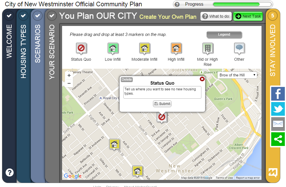
  • More recently, a similar multi-hour open workshop was held to discuss different housing forms, the opportunities and challenges, and to discuss how or where different forms may fit, on a neighbourhood-by-neighbourhood basis. More than 150 people attended this day-long event.
  • There have been more than dozen “travelling workshops” at places like Century House, the Sapperton Pensioners Hall, the River Market, and Connaught Heights School, organized on different days of the week and at varying times, sometimes mid-day, sometimes in the morning, sometimes in the evening, to make it as flexible as possible to fit everyone’s schedule. There are three more scheduled in the month ahead (see below);
  • There are current and ongoing efforts to connect better to underrepresented groups such as lower income residents, people with specific housing or transportation needs, and single parents, through organizations like the New West Family Place, Elizabeth Fry Society, Spirit of the Children Society, Immigrant Services Society, and the Interagency Council;
  • Feedback has been sought (and for the most part received) from Fraser Health, the Development Community (including UDI), Metro Vancouver, Adjacent municipalities, the Ministry of Transportation, the Ministry of Environment, Port Metro Vancouver, School District #40, TransLink, and the Qayqayt first nation;
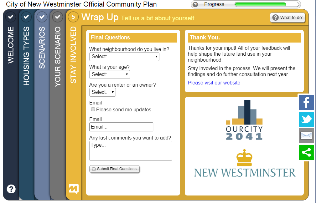
  • The ongoing on-line surveys have generated (at last count) more than 700 individual responses, and those responses keep coming in;
  • Besides the native advertising of just being in your face at every community event over the last two years, staff have advertised on the City website and the City Page in the local newspapers, have purchased other newspaper ads, have put up posters at all City buildings (City Hall, Community Centres, the Library, etc.), have performed mail drops across the City, have even hand-delivered in some neighbourhoods where the mail drops were less effective, have used the illuminated billboards at every entrance/exit to the City, Facebook Ads and newsletters. They even arranged to have the School Board provide notices for every student in the district take home to their parents.

Personally (and I am not alone on Council here), I have tried to spread the word in any way I could. I helped organize an open house that brought together 50 young professionals – engineers, architects, chefs, software developers, marketing gurus, people with young families worried about their future housing needs and affordability, most who don’t traditionally take part in “City open houses” about planning issues. We got together at the River Market for a 2-hour workshop on housing types and density, and they provided incredibly varied, intelligent, and valuable input. I have written several blog posts, including one with step-by-step instructions on how to complete the City’s on-line engagement portal. I have attended dozens of workshops, open houses, and community meetings – not to do the job of staff in explaining the process, but just to hear what people are saying in response, and to encourage people to provide feedback directly to the City in any way they can. With the exception of the one meeting Christopher Bell kicked me out of because he felt he couldn’t have a “frank discussion” with me in the room, I heard valuable and sometimes surprising input, and have learned a great deal about the diversity of opinion in the City.

So if the author’s complaint is a lack of public engagement, my question is – what would she have us do? Because we are ready and willing to do whatever we need to in order to get a better sampling of the community. And the job is not done, as there is a bunch more public consultation to come.

If Ms. Fralic (as some have suggested) was just trying to goad people into getting more engaged, there are opportunities for you to take up her charge, which I whole-heartedly encourage you to do. Here are a few of the ways you can do so:

There are three more open workshops, January 30, February 6 and February 13, one of them only steps from the Dog Park of Concern. They are open to everyone – but it is way helpful if you register ahead of time so we know how many chairs to have and how much materials to prepare (you can even review the materials ahead of time). These are in the middle of a weekend day when most are available, and there will be both free childminding to make it easier for families to participate, and foodtrucks on site in case you get peckish during the three-hour event. We really want to remove any barrier to you attending.

There is still the on-line survey, and if you take a bit of time to fill it out, it is actually quite fun and interactive. If you want a step-by-step guide on how to complete it, I tried to throw one together here. Let me know if you need more help with it.

If the on-line thing isn’t for you, and you want paper copies of the materials to mark up and send in with your suggestions, or if you have a group of people who would like a little more guidance to help go through the materials so you can provide feedback, you can Contact the City Planning Department (email ourcity@newwestcity.ca or phone 604-527-4532) and they will do that for you. Or contact me (see contacts below) and I’ll arrange it for you.

And of course, any comments you have, good, bad, or otherwise can be sent to the Planning Department above, or to Mayor and Council.

If, somehow, you have missed all of these opportunities to provide input, and still want to comment on the OCP, there will be another entire round once the framework of a new OCP is developed. Which is another point Ms. Fralic could have fact-checked: Up to now, we have been collecting people’s input into what they want to see, and we have (as part of that) put a few very draft concepts together, but we have not yet created a new comprehensive plan. Everything you have seen so far (and this was made explicit by staff at every event where they were presenting) is pure speculation used to provide media to gauge public opinion. It is not the actual plan for a new OCP. Because we are too deep into public engagement for staff to have developed that yet.

The draft land use plan for a new OCP will be developed by staff this spring, and if it passes a first trip past Council, it will again go out for more public consultation. You will, at that time, again have the opportunity to come to public meeting, read materials on-line, provide feedback by computer, by mail, by phone or in person.

Don’t let this be you. 

Middle Aged Westminster

I am just back from Vacation, and I am still trying to understand where the Royal City New West Record newspaper is coming from when they emphasize an alleged clash between the “New” and “Old” communities in New Westminster as their Story of the Year. Perhaps I am being obtuse, but it seems to evoke the divisiveness of the Old Stock Canadians dog-whistle message quoted in the article’s lead, and I simply disagree with the premise.

To suggest that “younger folks and families” filling new condos are somehow different than families living in houses is not only a false dichotomy, it creates an impression that one is better or more important than the other, and that somehow people (especially, as continually suggested in the story, the City’s government) are picking sides. It belies the reality of how mixed and diverse our City is, and how much blending there is in those two alleged camps.

I’m a resident of Brow of the Hill, not born in New West, but feeling very connected to this community I live in a house across the street from numerous apartments built in the 60s and 70s, predominantly full of renters, some more connected to the community as I, some less. On one side of my house is a family of “younger folks” who moved in at the end of 2015 after a decade of living in Vancouver, although one of them grew up in Queens Park and graduated from NWSS – are they “Old” or “New” New West? What about the retired couple across from me, one of whom was born in the BC Interior (like me) but had a career working for the City of New Westminster? I have friends who live in a condo on the Quay that has a demographic not far from your typical retirement village, I know young families filing more-affordable single-family homes in Queesnborough, some second-generation Canadians who first learned English at Queen Elizabeth Elementary, others the children of families that built Queensborough generations ago. Who has the hubris to draw the line between “New” and “Old” New West within this mix? Why would we want to?

Because between “New” and “Old” New West is a huge and growing number of “Middle Age” New West, those who have been here for a few years, or a few decades, and despite having not been born here, they have put down roots and are making New Westminster home. And they are raising a new generation of New West. At the the suggestion of conflict, most would say we are all New Westminster, whether our grandfather was born here, or we arrived as a refugee last week.

Our success as a community will be found in supporting each other, and embracing the diversity of our community. As the great Jane Jacobs reminds us in her treatise on vibrant neighbourhoods and cities, a diversity of people, families, buildings and activities are what create an economically viable and culturally sustainable community. Only that will make us strong enough to withstand threats external or internal, and avoid the stagnation that too often follows on the heels of urbanization. Just as we cannot stop innovating, we cannot throw away what is established, we need to make them work together.

So if building a great community means accepting all types of people sharing and working together, and if the line between “New” and “Old” is so fuzzy, what is to be served by trying to insert arbitrary lines, creating arbitrary categories, and watching for reasons for them to fight?

This ambiguity extends to the idea that there is some sort of fundamental transition happening in New Westminster today, or that suddenly the town that time forgot is being trust into a new era. The reality is that (for lack of a better word) “change” has always defined New Westminster as much as stability. Over 150 years we have gone from a Quayqayt (“Resting Place”) on a pristine river to a Capital City on the edge of the colony. We were at times largest port on the west coast, the home of the pacific fishing fleet and a regional commercial centre. We were eventually outshone by an upstart western suburb, then gradually enveloped by its growing metropolis. Over time our commercial dominance waned, then our waterfront industry declined. Soon the Quayside led a new residential focus based on waterfront location and condo living, while our transportation spine went from streetcar to automobile to Skytrain. There were good times and bad, and most of the time there was a little of both. These changes were most often gradual, shifts were generational, as were the waves of new immigrants putting their cultural stamp on our community – English, Chinese, Punjabi, Filipino, Honduran, Somali, Syrian…

Through all those times, transitions, and shifts, which should we stamp as the optimum, the one we must not move away from? I know I can’t make that call, and it would suggest it is silly to try. Because over that time all of our strongly-held traditions have adapted – including the oft-cited example of May Day. A couple of years ago I wrote a blog post about a study that outlined many of these “transitions”, including the way May Day and the festivals around it have changed, sometimes back and forth, based on the economics and attitudes of the day. Most interesting to me was the part that talked about a new upstart group of young business leaders who came in 40 years ago and re-drew a bunch of traditions to modernize the City’s May festivals – the group that came to be known as the Hyack Festival Association.

I only use this as an example, and don’t want to dwell on it, for fear I am playing into the narrative that I don’t believe.

Far from suddenly transitioning to a New New Westminster, we are continuing to evolve. I love some of New Westminster’s “Old” traditions (the Anvil Battery Salute? Who can’t love that?) and am completely uninterested in some others. I also love some (not all!) of the “New” traditions being developed (PechaKucha Nights!) and hope they survive to the next generation. Of course, in between there have been many Traditions that have come and gone, and some in that intermediate stage between “Old” and “New”. Some people like the RC Musical Theatre, some like the Symphony, some like comedy at the Columbia and live music at the Heritage. I think the Royal City Curling Club is a 50-year cultural and sporting tradition in the City that not enough people appreciate, but to love it doesn’t take away from the legacy of the Salmonbellies. Why do we have to choose and put ourselves in camps?

We are all New Westminster. So let’s keep embracing the things we love, and not be afraid to try new flavours. Because it is the combination of “New” and “Old” that makes us special, not an alleged conflict between them.

Vacation

I took a vacation. After a busy but very rewarding year with too much work, a too-stuffed schedule, and too little recreation time, it was good to get away for a couple of weeks and chill.

Of course, I read some books about urban planning (reviews soon, if I get time) and spent a lot of time looking at the urban realm while tracing the career path of Peter Stuyvesant. Here are three thoughts.

1.City Bikes are cool.

This is New York’s bike-sharing program, and while spending an unseasonably warm Christmas in Brooklyn, we had an opportunity to spin around on the almost-ubiquitous blue bikes.

vac3

The bikes themselves are sturdy Dutch-style upright bikes with full fenders, enclosed chains (no grease to worry about), simple but effective three-speed internal hubs, drum(!) brakes, and hub-generator powered lights. Tough? The bikes are (to paraphrase Neal Stephenson) “built as if the senseless dynamiting of [Citybikes] had been a serious problem at some time in the past”. They are pretty much a perfect balance between bulletproof and efficient.

There are many options to pay, from paying for a single ride to buying an annual pass. We bought a couple of 24-hour passes for $10 each. This gave us unlimited access for 30-minute rides. We were able to ride from our apartment in Bedford-Stuy to Barclay Centre, then from Braclay to downtown Brooklyn. Dropping bikes at a convenient station (you are never more than a 5-minute ride from a station within the service area), we walked across the Brooklyn Bridge, wandered around a bit in Manhattan, picked up a couple of bikes in Little Italy, rode across the Williamsburg Bridge, dropped bikes and visited a microbrewery, etc., etc.

Actually, bulletproof and efficient pretty accurately describes the entire system. The kiosks and payment process is simple to use, and features a little digital map you can scroll around to navigate your neighbourhood, the on-line app will guide you to the nearest station (if your 30 minutes are running out), and there are very few surprises.

vac2

Is the system successful? 10 Million individual rides in 2015, and ongoing expansion plans to reach 12,000 bikes and 700 stations by 2017. Before anyone talks to me about my helmetless pictures above (Hi Karon!), there is no helmet law in New York, and with literally tens of millions of rides since its inception 2013, there has never been a fatality or a serious injury on a City Bike. Looking at NYC’s pedestrian and traffic fatality stats, CityBike may be the safest way to travel in the Big Apple.

Yet, globally, no jurisdiction with a helmet law has successfully launched a bike-share program like Citybikes. Every one has failed, or failed to launch. And I predict Vancouver’s will fail for this very reason.

2. Even in New York, pedestrians are serfs.

Walking Fifth Avenue from Central Park to the Empire State Building is an incredible experience. From the Plaza, past the Library and Rockefeller Center and St. Patrick’s Cathedral, through the (unofficial) centre of world shopping, it is a spectacular combination of sights and sounds and people and shopping and urban buzz. A couple of days after Christmas, I got to share it with tens of thousands of other people.

It got rather more intimate than most would probably like, because all of those people were crowded behind barriers on too-narrow sidewalks as hundreds of police spent their holidays keeping the vast expanses of asphalt between the sidewalks free for the movement of – a couple of dozen cabs and towncars.

vac7

Just look at this photo and look at how the public realm is divided up. 4m sidewalks, 20m of road, and look at where the people are. Overall, New York City is one of the most walkable places on earth, and between the incredibly convenient subway system (although, I noted only about 10% of station were accessible for people with disabilities!), short distances to get any kind of shopping you might want, and a huge reliance on walking as the primary form of transportation – the guy in the town car somehow gets priority to an opulent amount of the public space. It’s bizarre.

3. Aruba may be the Netherlands, but it ain’t Dutch.

We picked Aruba for our vacation because we didn’t want adventure this year, we just wanted to chill on a beach, and according to legend, Aruba’s beaches are amongst the best. A legend I will whole-heartedly confirm.

However, we were also intrigued by Aruba’s Dutch heritage (it is still part of the Kingdom of the Netherlands), and hoped to see a little of the Dutch personality of the island. Unfortunately, aside from ubiquitous Heineken and plenty of young Dutch nationals working the tourist bars and restaurants, there was not a lot of Amsterdam to be found in Aruba. For a small island with incredibly pleasant weather, It was a depressingly car-oriented community. We used the local bus service (inexpensive, predictable, convenient, almost empty) and walked most of the time, where most people used cars, truck, atvs, and motorcycles. The only cyclists we saw were of the lycra-clad sporting type. The pedestrian realm ranged from non-existent up on Malmok where we were staying to downright hostile once you got a block off of the tourist strip in the resort areas.

vac5

Maybe we should try Curacao

4. Vacation notwithstanding, it’s good to be home.

And I am realizing that New Westminster has pretty much all of the assets that Jane Jacobs mentions when talking about vibrant communities, which is a hopeful sign…

Q2Q, again.

This Post is actually an extended response to the comment by Ken, a Quayside resident and community builder, to my previous post about the Q2Q bridge. I thought his comments raised enough issues that I couldn’t do it justice just replying in a comment field!

Thanks Ken,

I will try to address your questions, but recognize that much of what you talk about occurred before my time on Council (so I was not involved in the discussions) and I respect that you have a much more intimate knowledge of the conversation on the Quayside over the last decade than I do.

The project has indeed gone through various iterations in its history, and the initial plans ( here is a link to a report from the time) were to reach 22m of clearance to develop a fixed link that would get adequate clearance that we would not need Navigable Waters permission (read- not specifically need Marine Carriers permission) which required essentially the same height as the Queensborough Bridge. Conceptual drawings were developed based on the site conditions and some baseline engineering, and very preliminary cost estimates prepared. That concept was indeed reviewed by the Port (at that time, the Vancouver Fraser Port Authority) and note they even at the time preferred an upstream (east of the train bridge) location (see page 12 of that report I just linked to). Note also: that report suggests elevators at each end to improve accessibility. This is the concept that first went to public consultation, and concerns were heard about the need for long ramps that would have nonetheless been very steep, the overall height, the fate of the Submarine Park, etc.

The only alternative to all of that height was a swing/bascule bridge. To explore this option, the City asked some engineers to sketch and (very preliminarily) price some alternative concepts, including a bascule and a sidewalk attached to the rail bridge. The City again took these preliminary concepts to public consultation, and the bascule design clearly came up as the preferred approach, even recognizing it was potentially more expensive.

Now that a preferred concept was (hopefully) found, and the Q2Q crossing once again received endorsement from the new Council, it was time to actually pay a little more money to engineers to further develop the preferred concept to a level of detail that would allow screening for Port review. Not enough development for a full review, mind you (that will likely take several hundred thousand more dollars in engineering and environmental consultant fees and will no doubt also result in adjustments of the concept), but enough that it is worth the Port’s time to look at our concept and provide a detailed regulatory screening and provide us a pathway to approval.

That is pretty much where we are right now, and for the third time, this concept is coming to the public for review. The only thing I can guarantee you at this point is that if (and it is still an “if”, despite general Council and public support) this project is completed, it will not look exactly like the drawings you see on the page today. There is much engineering to do, environmental review to perform, and more public discussion to be had. Satisfying the Port’s environmental review will be months once we get to that point, and we can guarantee it will require some design adjustments.

There are also other adjustments I think we need to see based on public feedback this time around. Although I have held my cards close to my chest because I don’t want to prejudice the public consultation, I will admit up front that there are two things in particular I cannot tolerate in the plans as presented at the open house: the 8% ramps simply do not meet modern standards of accessibility; and the closing of the bridge at night is not an acceptable way to treat a piece of public active transportation infrastructure. I’m prepared to accept that we cannot have the Copenhagen-style transportation amenity I would prefer, but I am still hopeful we can find a compromise that provides an accessible, reliable, and attractive transportation connection. We are not there yet. (And please remember, I am only one member of a Council of seven, and I cannot speak for them).

To answer what seems to be your main concern, I don’t know when the Marine Carriers were first consulted on this project, but the Port (who provides the Marine Carriers their authority) were clearly involved from day 1. They preferred an upstream location (now prefer a downstream one) and created the 22m by 100m “window” that led to the original 22m-high bridge concept, and have now led to evaluation of several swing/bascule concepts. Clearly, the City and our engineers have been searching for a creative solution to make what the politicians and public want mesh with the rather strict requirements of those who regulate the river and transportation. But serving those two/three masters is why the City is taking this iterative, slow approach, and why “plans that keep changing” are a sign of progress, not failure.

One thing to think about is that every step of this process costs more than the previous step, and moving backwards costs most of all. As engineering analysis and design gets more detailed, it gets more expensive, so we don’t want to do the detailed work twice. We could have asked for a ready-to-build concept a decade ago, and done enough detailed design that we just needed to pull the trigger and we could have it built within a year, and then taken it to public consultation. But if things are found that don’t work (i.e. the initial 22m height), we have spent a lot on a concept we now need to spend more on to change. Instead, we do feasibility studies, take it to stakeholders, the public, the regulators, and are given feedback. We then develop the concept to get more engineering done, and again have a look at the result and either move forward or change track depending on feedback.

This is a responsible way to plan, design, and pay for a public amenity. It is an iterative process, because as a government, we need to do our best to meet the needs of residents, of taxpayers who are footing the bill, of the regulations at 4 levels of government that have a thousand ways to limit our excesses, and of people who may be impacted by every decision we make.

If a government claims to do three years of stakeholder and public engagement, detailed engineering analysis and business case development, then turn around and deliver to you the exact same proposal they managed to render in a 3D model three years ago when the analysis started, then you know their consultation was bunk.

And I guarantee you, for every person who complains “this project has changed since the public consultation”, there are two who will say “public consultation never changes anything, they are going to ram their idea through regardless of what we say”. Actually, the same person will often say both, completely unaware of the irony. And that is why I appreciate your honest comments Ken, it sounds to me like you are trying to understand, not just complaining. So please provide your comments to the Engineering department and to Mayor and Council, and you will be heard!

Q2Q Compromises

The Q2Q bridge is an important project for New Westminster, and one I support. It is, however, a project with major challenges, and I am glad we are at a stage where the next phase of public consultation is taking place, so we can talk about some of those challenges, and what they mean to the City.

First off, I need to put my comments on the Q2Q into context, in relation to my position on Council.

The Q2Q concept was developed long before I was elected, even before I started to rabble-rouse in the community on transportation topics. However, I have expressed strong support for the project for years, even piping up to challenge some of the past opponents of the concept. I have always believed, and continue to believe, that the Queensborough community needs to have a reliable, safe, and accessible connection to the “mainland” of New Westminster, and that connecting the beautiful waterfront greenways of Queensborough to the Quayside boardwalk will have huge benefits for both communities. When the topic came up during the election, I was quick to say I supported the project and wanted to see it built as soon as possible.

Now that I am on Council, and am (in part) responsible for getting this project done, the brutal reality of the project has set in. The bridge some of us may dream of may not be possible in this location, and the development of palatable compromises is daunting and frustrating at times. It is becoming a lesson for me about the reality of planning for community infrastructure when a local government’s power is so limited.

If someone were to ask me what I wanted to see in a Q2Q bridge, it would look something like this:

Click
(typical, ask an urbanist geek about a design, he takes you to Copenhagen)

The bridge would be approximately the elevation of the boardwalks on either side, fully accessible, would be at least 3m wide, and would have an interesting design aesthetic that creates some regional buzz when it is built. As marine traffic would need to cross, it would have an innovative swing style that was integrated in to the design, and was an eye-catcher such that the 5-minute wait for the boat to cross was not something that irritated you, but intrigued you. It would even have areas over the water where you could sit, have a picnic, drop a fish line in the water, or take photos of crossing trains, passing boats, or overhead eagles. It would also represent an easy connection for people commuting by bikes, people out for a stroll, people pushing kids in a stroller – a seamless connection across the river.

But that ain’t going to happen, because the City doesn’t own the river. Although the North Arm of the Fraser at that location is a significant industrial transportation corridor regulated by the Navigation Protection Act and Port Metro Vancouver. I cannot emphasize enough that the people who make a living moving things up and down the river would much prefer no bridge there at all, and due to the nature of the regulations, the people working the river get the say about what goes in, on, or over the river. If they don’t agree, nothing gets built.

The “they” in the case of the North Arm of the Fraser River are the Council of Marine Carriers. They use the North Arm of the Fraser to move barges, boats, booms, and all sorts of floating things. There are no alternate routes, and their business relies on it, so they are pretty motivated to keep the North Arm accessible.

If you haven’t noticed, the train bridge connecting the Quayside to Queensborough is open most of the time to marine transport, and only swings closed when a train needs to cross the river. This would not be a great situation for the Q2Q bridge if we want it to be a reliable transportation connection that pedestrians and cyclists can rely upon. We need a bridge where the default position is closed (to boats), that only swings open when the boats go by, with a cycle quick enough that it won’t cause major inconvenience for either user group.

For the bridge to operate like this, the Marine Carriers have determined a clearance of 14.5m over the water is required. This would permit enough boats to pass under without opening the bridge that a default-closed position is acceptable to the folks who work on the river. This 14.5m makes for a pretty challenging crossing for cyclists or pedestrians with mobility problems. Hence, we can’t have the bridge we want.

q2qdrawThe question then becomes – how do we get people up to 14.5m? A ramp that meets typical mobility-access standards (i.e. no more than 5% grade – and yes, I am aware and frightened that 8% grades are shown on the rendering) would need to be about 250m long, even longer if we add standard landings at set distances. This would be expensive, and create a long visual intrusion for the Quayside residents next to the bridge. Stairs wrapped around an elevator column would have a much smaller visual impact, and if we can avoid the design mistake that led to a completely unacceptable delay on the Pier Park elevator (yes, we can), the size and scale of that structure is a good estimate of what the bridge landings would look like.

This image is *very* conceptual

I would love to see some creative alternate approaches, and we may see some coming from the engineers we hire to build the bridge. The corkscrew ramps at the southern foot of the Golden Ears Bridge seem very effective to me, and are of the same scale vertically, although I’m not sure we have the footprint area to take the same approach:

geb
…and I have my doubts whether Port Metro Vancouver would allow us to build such a structure over top of the water. It has already been suggested that the structure as proposed would require the highest level of environmental review (“Type D”) which makes it sound like a pedestrian and cyclist bridge will somehow have a bigger environmental risk than a coal terminal or LNG export facility.

You may also have noticed the plans for the bridge shifted from being slightly upstream of the train bridge to slightly below. The upstream side as a little better for the City, as both landings work better, but the downstream was deemed safer for boat traffic. Unfortunately, this means the landing on the Queensborough side is going to be much more complicated (read: expensive) to build.

Alas, we are stuck with what we have. I can complain about an industry group having more power than an elected local government about how our river is used, but as we learned in the Fraser Surrey Docks coal terminal discussions, the Port does not answer to local governments, but to their own mandate, and Sunny Ways are not likely to shift their business model any time soon.

So we will do what we can to build the most accessible, most convenient, and most user friendly bridge within the constraints given us, even if it isn’t as elegant as one we might see in a place like Copenhagen.

(non)-SimCity

The City is having this on-going conversation about housing types. It is part of the consultation process for a new Official Community Plan. If you read this blog you probably care a bit about the future of the City, so you should take part. You can now do that without leaving the comforting warm blue glow of the computer you are looking at right now.

The OCP is a legally-required planning document the City produces, and it is usually updated every decade or so. The City is operating on a 1998 OCP that, despite regular updates and edits over the last 17 years, is getting very long in tooth. The process to update it has been going on for more than a year, and there have been several phases of public consultation, as open houses, as stakeholder meetings, and as special events.

Staff have gone out of their way to try to engage more people in this process so that resultant plan can better reflect the desires of the entire community, not just the easy-to-engage groups that are usually over represented in your regular City Open House. Now they have developed a new engagement tool, so you can sit at home on your computer or tablet and provide some useful insight to the process.

It comes at a time when the OCP is looking at housing types, and addresses what some have identified as a significant problem in New Westminster: we have a lot of apartments and an adequate supply of single family detached (SFD) homes; we have very little of the in-between housing types. Townhomes, row homes, du-, tri- and quad-riplex designs, and carriage/laneway housing. With the average SFD in New West selling over $800,000, young and growing families are running out of affordable options in our City, and it is the young, growing families that we need to sustain our community, our livability, and our community in the coming decades. If they leave (or are forced out by lack of flexible housing options), then our city will change in a way that few will like.

So the question to be asked right now is: How do those housing types fit in our community? Are there places this type of “infill density” makes sense, and places where it doesn’t? you can help answer this question by taking this on-line survey. But before you do, maybe I can explain a little more about how the survey works, and what you are being asked. So click this link, open a second window, and I’ll walk you through it.

When you open the survey, you can see there are 5 “pages”, and you are on Page 1, marked by a checkmark. As you go through each page, its page number will become a checkmark, so you can follow your progress.1

Page 1 is just an intro with some factoids on it, and if you hit the “begin” button, it throws you to Page 2:2Here is where various housing forms are shown, divided up into three categories: Low, Moderate, and High Infill. In each of those three categories, there are examples of housing types, (4,3,and 2, respectively). For each of those 9 types, you can select what you think about it (from strongly dislike to strongly like, with “neutral” in the middle). You can also provide some comments for each by hitting the “optional comment” section at the bottom. You might have a specific concern about the function of any one type, or talk about the measures that would need to be in place to make that form work for you.

Not sure what these housing types really look like? The City has provided a couple of walking tour maps, one of Queensborough, another of North Vancouver, where some of these housing types are already built. You can print them off and go take a look, or just go into Google Maps and Google Streetview and have a look around. We live in the future.   

If you provide at least “like” levels for 50% or more of the housing types, you get your check mark and can move on to Part 3:3This page gives you a map of the 1998 OCP (which you can zoom into and look around), and provides you three “Scenarios” for a new OCP. None of these scenarios are necessarily part of a final OCP, but they are models used to gauge opinion and each address different neighbourhoods differently. At the roughest form, Scenario 1 would provide little more growth than we have today, Scenario 2 would provide more opportunities around transportation corridors especially, and Scenario 3 would provide the most opportunity to diversify our housing types, spreading the potential growth around a little more.

You can zoom in and scan around the Three Scenarios, provide a simple 1-5 star rating, and provide optional comments on what you like or don’t like about each Scenario. If you open the Legend, you will see the shades of beige reflect the “Low-Moderate-High” infill that was discussed on the earlier page, and that is where the detail really hits the ground here.

It is important looking at this to remember, if a neighbourhood or street are zoned for “medium infill”, that in no way means every house on that street is going to be knocked down and replaced with a triplex or row homes. Development simply doesn’t happen like that. Houses belong to individual homeowners, the City cannot tell them to knock their house down and replace it. Looking at the existing OCP from 1998 (The “current scenario” map), there are many areas where higher density is permitted than currently exists. For example, the extensive “RL/RM” medium-density area around the 22nd Street SkyTrain station is still single family homes 18 years after that OCP was adopted. Changes permitted on a lot-by-lot basis on an OCP ware not changes required by an OCP on a neighbourhood basis, and with growth occurring at between1-5% annually, these changes are very gradual. This is why we need to look decades ahead in these plans.

So poke around those three scenarios, see what you like or don’t, add your opinions, and give them some “stars”. This earns you a check mark, and lets you move onto Page 4:4Here, you can provide your own plan for how the City should grow. Starting with a blank map of the City (if you use the little pull-down menu that says “City Wide”, it will zoom to specific neighbourhoods). You can drag-and-drop any of the square tabs from the top row, from “Status Quo” up through density to “High Rise”, and drop in on a block in your map. Kind of like SimCity but less immediate feedback. You can also add comments on any block if you wish:4b

You can be creative about what you think the shape of New Westminster should be, recognizing that you are not looking at tomorrow, but 20-30 years in the future. Once you have dropped a few pieces, you earn your checkmark and move on:5

Here, the survey collects a bit of demographic data. It is simple, and anonymous, but helps with understanding what groups are being reached with this tool, and which ones are not. You can provide an e-mail to receive updates (if you want), and add any extra comments. And you are done.

So this Christmas time, you are sitting around with the family, tryped out on tryptophan, presents are unwrapped, log in the fireplace, and it is a few days before the New Years College Football black hole opens up and consumes you whole, spend a half hour playing working on the computer and providing the City the data it needs to make the OCP vision fit your vision.

Merry Christmas! See you in 2016.

Ask Pat: New Westminster College

Randy asks—

Have you read the article at the Globe and Mail about a fake college set up called New Westminster College? As per the article, there are no students, no courses, no employees. It seems like a total sham. Is there anything the city can do to prevent this kind of thing from occurring?

No, I hadn’t read this, but I encourage people to. It is a pretty good piece of investigative reporting that gives me hope for the continued existence of journalism.

It is pretty strange to see how far some people will go to run a scam potential non-existent business, and it is unclear exactly what the scam business model is here (although my skeptic senses are tingling). The “General” doesn’t appear to be asking anyone for money from their website, and as far as I can tell, putting up a webpage of you shaking hands with famous people isn’t against the law, even if you call yourself “Professor” to do it. Neither is handing our fake fellowships, even when dressing up in uniform and pretending to be a soldier. The world (even New Westminster) is full of “Kentucky Colonels” and “Nebraska Admirals” and the such, and having never been a soldier myself, it isn’t up to me to call them out. If he calls himself a geologist, I’ll get involved.

According to the Globe story, the “College” has a business licence in New Westminster (I have not looked into this), but without an address here other than a post office box, it would be hard to argue they are violating any business license requirements or zoning. Perhaps not surprisingly, our Business Licence Bylaw says you need a license to run a business, but not that you need to run a business in order to be able to buy a licence.

As far as trading in the good name of New Westminster, there is probably not much we can do about that either. From New Westminster Centre to the Shops at New Westminster Station, businesses can attach a place name to their business without the City being able to command intellectual property. I’m not sure we have the legal authority to determine who is “too scammy” to use our good name.

But hey, who am I to say? This may be some sort of immigration scam, or he may just be an innocent general contractor with access to the former Prime Minister trying to open a Hospital on Morocco. Could be he is just a guy with a dream. To quote the illustrious General himself: “It’s not my fault if people do not do their research.”

Long Span

A short post on what could soon be the longest bridge span in Canada.

There is much to say on this boondoggle (there, I put it out there right up front so you know how I feel about this plan) and the pretend “business case” presented to defend it. I am sure I will be writing something more lengthy and detailed in the coming weeks, but I need to end one line of discussion immediately, so this short note.

In discussing this project, the strongest proponents and the more flaccid skeptics (unfortunately, I don’t know in which of those camps to include the Province’s official opposition), are quick to say “well, something has to be done about the traffic there!” which to most seems like justification enough to spend $3.5 Billion on a solution right out of 1950. The Minister of Speeding even invoked his 1950s predecessor Phil “Air pollution is the smell of money” Gaglardi, calling anyone who doubted a 1950’s solution to a 2015 problem a “naysayer”, like that is the natural antonym to his self-description as a capital-V “Visionary”.

So if we all agree that “something has to be done about the traffic there” (and if we choose to ignore that “the traffic there” has been steadily decreasing for a decade), perhaps we should have a meaningful discussion about what the options are to address that traffic problem. Right off the bat, however, the most ignored point is that we don’t need to get rid of all of the traffic to fix the traffic problem. We only need to get rid of a little bit of the traffic.

Let me explain. But first, we need to ignore this graphic in the Project Definition Report:

ignore

…because it comes without proper citation to its source, and appears to reflect some imaginary projection of what the actual traffic counts in the tunnel are. I say this, because the Ministry helpfully provides actual traffic counts in this document, and as Station P-16-4NS is the counter that measures the number of vehicles going through the tunnel, here is the most recent data:

p164ns

Congestion occurs somewhere around 1,500 – 1,600 vehicles per hour per lane. That’s just one of those numbers transportation geeks keep in the back of their mind when reviewing this stuff. Note that the tunnel has a counter-flow lane, so peak travel is carried on three lanes. The two big peaks flatline just over 1,500 x 3 for about two hours every morning and two hours every evening. At the same time, the single-lane against-peak flow flatlines at about the carrying capacity of the reduced lane count, also causing congestion until the counter-flows can re-open to give a little relief. The tunnel is at capacity during the rush, which is why traffic is reducing on this route, not going up.

Those peaks and flatlines are important, because those are the natural limits of the system, stay a few hundred cars below that, and you have the carrying capacity of the bridge, and (barring accidents and the such, but let’s not go there now) you have a system working at optimum. Looking at the data, that optimum for the system only requires removing about 10-15% of the traffic.

These pie charts from the same report demonstrate how easy it would be to do that:

type1

type2

type3

type4

SOV? Single Occupant Vehicle. A car with one person in it. Anywhere between 65% and 84% of the vehicles driving through the bridge. Add the 2OV (Two Occupant Vehicle), and you realize that the problem at the tunnel is not “goods movement”, as trucks are only on average about 5% of the traffic. Also notice transit vehicles are 1% of the traffic on the tunnel. Despite that 1%, we also learn from the consultation documents that up to a quarter of the people travelling through the tunnel are in that 1% of the traffic:

transittunnel

So how can we reduce the traffic in the tunnel by the required 15%? Get a few of the people in those SOVs into transit. Not all of them (and that is the false dichotomy argument we must avoid), but just a few of them. I’m not even suggesting that tunnel traffic see a radical mode shift, just one in line with transportation patterns north of the Fraser. To do this you need to provide more and better transit service, because to get people out of their cars, you need to give people viable and reliable alternatives. Even the incredibly sub-par overcrowded, under-scheduled, and poorly-connected transit service through the current tunnel moves up to a quarter of the people who go through the tube. Imagine what would happen if it was rapid bus, or light rail…

Alternately, if funding is a problem, you could also do the only thing ever proven to reduce traffic congestion in urban areas: put a price on the road. No need to build a new bridge if you put a small toll on the existing tunnel. That very effectively reduced traffic on the Port Mann Bridge corridor. Then you could use that toll to fix the safety issues at each end and upgrade the 5o-year-old mechanical systems, which by all accounts is an order of magnitude less money than the new bridge would cost.

Of course, to “solve the problem”, any rational transportation planner would suggest the Government do both. This is why the Mayors of the region, who have been grappling with a failing transportation system (and the provincial government’s reluctance to fix it) for a decade now, recognize that the Massey Replacement is not solving any problems. They rightly point out that it will both create larger problems, and take billions of dollars away from the alternative solutions that *can* fix the problem.

Wow. This short note sure got long, what with the graphs and such. Sorry, I will sum up.

Yeah, maybe somebody has to do something about the traffic here, but the solution being offered is far from “Visionary”. Instead, it is an expensive kludge being offered by people who lack the imagination and courage (two characteristics that define true Visionaries) to address a problem in a creative new way, instead relying on the ghost of a 1950s ideology.

These people

thesetwo

Look at those two on my right. They aren’t just one of the cutest couples known to history, they are a big part of the recent history of New Westminster. I’m celebrating them here today because they just got on a plane, headed for Montreal and a new home, a new adventure, and a new community.

Will Tomkinson was born and raised in New West, in a heritage home on 1st street across from Queens Park. He is variously third- or fourth-generation or something the other, which makes him “Old New West”, and he has the sartorial style, baritone singing voice, and respect for traditions to fit the stereotype. Briana is a transplant to New West, with new-fangled ideas about creating local connections through social media and social justice, rarely hearing a new idea she didn’t want to throw up a flag pole, just to see who salutes. They met in Douglas College and eventually fell in enough love to start building a homestead in the West End of New Westminster. They started raising a gaggle of free-range kids, and started blogging about being a young family in New Westminster.

It was only a few years ago, but I cannot remember for certain when I first met them, or when I became aware of Tenth to the Fraser, or which came first. However, it must have been around the 2008 Municipal Elections when the Tomkinsons’ hyper-local Blog became part of my usual web surfing routine. I vaguely remember helping run an all-candidates event at Douglas College in what must have been the May 2009 Provincial election with Will and Briana (I seem to remember pulling audience-member’s questions out of Will’s fedora, but my memory is more photogenic than photographic), so we must have been friends by then.

What Briana and Will (and Will’s sister Jocelyn, and later Jen Arbo) did with 10ttF was create a social media nexus in New Westminster. It was a general-purpose Blog back when Blogs were the cool new thing. Instead of just being about them, they covered events in the city, politics, business reviews, and general interest stories about being a young family in a growing and changing community. And as with all really effective social media, it created digital connections that soon became human connections. They introduced us to, and induced us to support, new local businesses like Re-Up BBQ and new social enterprises like the Royal City Farmers Market. 10ttF was a glue that brought people together without the commitment of a club or the constraints of common interest, and their comments section was often where conversation took place amongst that in-between generation of young professionals and young families who found Letters to the Editor a little too quaint, and those who were too profane or silly to be committed to newsprint.

Through 10ttF, I was encouraged to start my own Blog, first on environmental issues as GreenNewWest (I was the President of the New Westminster Environmental Partners and an Environmental Scientist- “write what you know”, they say), then as NWimby, as my interests expanded. It was through 10ttF that I first met Jen Arbo, who once told me I had to do this Twitter thing (much to James Crosty’s chagrin), and who eventually became a huge supporter during my campaign for City Councillor. It was through 10ttF that I was encouraged to get involved on City advisory committees and other volunteer work around town, which was one part of what led to my Citizen of the Year nomination. I have a lot for which to personally thank Will and Briana.

So now the Tomkinsons are pulling up stakes and relocating to la belle province. A great job opportunity, and a chance to escape a bit from the frenetic property-value-defined lifestyle of the West Coast, they are going to raise that gaggle of kids in a wooded semi-rural area with actual seasons and where half the people speak an entire other language. Can’t say I’m not a little jealous for the adventure those kids are going to have. But even as they have been recently pulling back from their central-organizer roles in New West due to work commitments, an expanding family, and some other pressures, we will now truly feel their absence at the next New Westminster Scotch Appreciation Society meeting, at the next NEXT-NW soirée, at the next Brew Westminster kettle boil, when we need a line on a sweet artisanal axe.

The legacy they have created, however, will go on. Tenth to the Fraser has a new owner (the ubiquitous and omniscient Jen Arbo), and pieces are being put into place to create a new look and a new vibe to appeal to that larger group of digitally-connected people who are increasingly making New Westminster their home. The many connections Briana and Will made remain strong: on line, at Beer Friday, or just down at the River Market at a Saturday where we somehow find there is always someone to talk to, someone who is so familiar around New West as you consider them part of the furniture, but you can’t quite remember when you first met them.

Thank you Will and Briana. You are good friends, and great citizens, and you made New Westminster a better place for those you are leaving behind. We’ll see you again soon.

Ask Pat: bike lockers?

Pamela asks—

Are there bylaws requiring bike lockers in new developments?

Yes. Kind of. But they may not be as useful as you might like.

The City has the weighty tome called the Zoning Bylaw that regulates pretty much every aspect of new development. If you want to build an apartment building, row of townhouses, office tower, curling rink or shopping mall, there are all sorts of regulations in there to dash your architect’s dreams. Included in those requirements are requirements for bicycle parking (Section 155, to be precise).

Before we get too deep into it, we need to define our terms, because I often park my bicycle leaned up against a parking meter, so all “bicycle parking” is not created equal. The Bylaw differentiates between Long-Term Bicycle Parking (“means a space designed for the parking of one bicycle by permanent users of a building, such as employees and residents”) and Short-Term Bicycle Parking (“a freely accessible space designated for the parking of one bicycle, available for public use during the business hours of premises in the building”). It also differentiates between a Bicycle Locker (“for the storage of one bicycle and accessible only to the operator of the bicycle“) and Bicycle Storage (“an area providing two or more long term bicycle parking spaces“).

Let’s put the short-term parking aside, because installing a couple of racks on the sidewalk is pretty straight-forward. The number of designated long-term bicycle parking spots depends on the type of development. New multi-family buildings require 1.25 bicycle spots per unit (regardless of whether that unit is a studio or a three-bedroom), and office buildings require 1 long-term bicycle space per 8,000 sqft of office space. For comparison, the City requires between 1 and 1.5 vehicle parking spaces per residential unit (depending on the number of bedrooms) and 1 parking spot per 31-50 sqft of office space.

Long-term bicycle storage must be at least 20% in the form of bicycle lockers, which must be solid-walled (not metal cages) and secure. The rest can be in a bike storage room, which must by law be painted white(!), include space for no more than 40 bicycles per room, and have secured access by key for fob.

The Bylaw is silent, however, on how those bicycle parking facilities are distributed among the residents of the building, so those decisions are made by the Developer, the Marketer, and (eventually) the Strata Board. I can find no rule that makes it mandatory to provide access to one or more secured bicycle parking spots to any specific suite, nor is there anything limiting a developer from charging for access to those secured spots. It is possible that, once built, the “bicycle storage” area could be converted to general storage, and I suspect that is what happens in many buildings.

Do you have storage lockers in the basement of your high-rise? Nothing in the Zoning Bylaw that I could find mandates their existence, and it is possible those are converted bicycle storage, if your building is a recent build. People who bought suites may have paid for access, or may have been guaranteed access, but it is, unfortunately, a buyer-beware market. Of course, the same is true for automobile parking spaces. The City designates there must be, say 1.4 per suite, but we do not dictate which suites get one spot and which suite gets two, or how much residents are required to pay for buying/leasing/using them.

As for Office buildings, we simply do not require enough in our zoning bylaw. One spot for 8,000 sqft of office is ridiculous. However, we also do not have any rules around end-of-trip facilities in commercial buildings, and this will limit uptake of cycling more than the threat of having to lock your bike up outside. If you work for a large organization like TransLink with a 150,000 sqft office (18 bike spots required!), it is easy to justify end-of-trip change rooms and showers for your several-hundred staff – actually, they are likely to demand it if your staff includes professionals under the age of 40. But if you are a smaller office tenant, leasing 2,000 square feet for your 5 employees in the same strata building, it is not viable for you to build those same amenities, and you can only hope the Owner and/or Strata see the benefit of these as a “common area” amenity.

So to answer your question, Yes, we require bicycle storage. However, we don’t do enough to make sure that storage is useful for people who want to use it.