When the media start talking about bridges and roads and transit and referenda and all the stuff that is rolled into the Lower Mainland and BC’s plan to move people about, there is a common theme that arises. Go to any recent on-line story about these subjects, and someone will inevitably comment that the “solution” is to toll all of the bridges equally, the number usually proffered is $1 per bridge. This is suggested as being more “fair” than just putting these more expensive tolls ($3-$4) on the newer bridges.
That usually gets shouted down in the comments when someone else comes along and says any toll at all is a “cash grab” and there is no way a piece of infrastructure should be paid for by the people who use it, and the comment thread goes from there.
Example, Example, Example.
There is rarely any deeper analysis of that first idea. What happens if we toll all the major bridges at $1 a crossing? What problem does this “fair” solution solve?
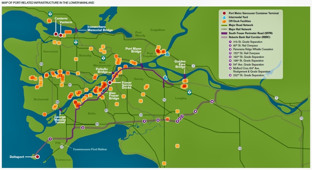
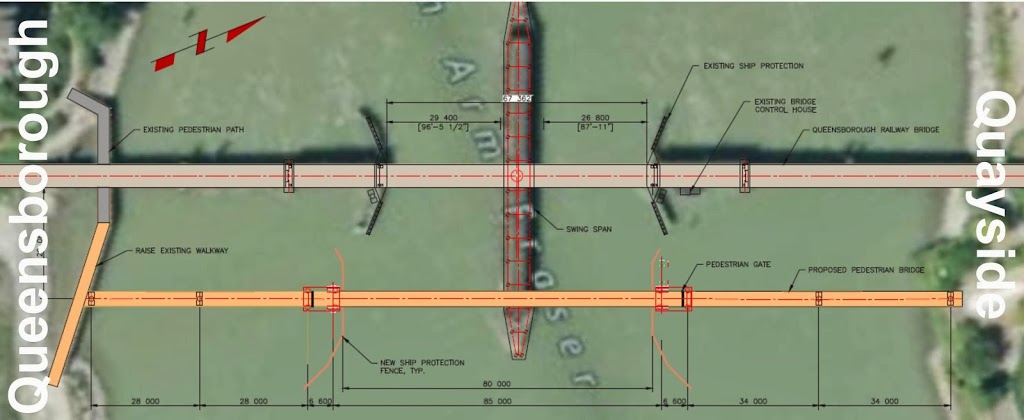
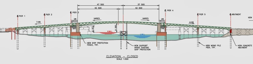
First we need to define our terms. When people talk about tolling “all the bridges”, they surely don’t mean the bridge on Gaglardi Way that spans the Brunette River or the King Edward Overpass, but they likely would include the two North Shore crossings and the major crossings of the Fraser (Golden Ears, Port Mann, Pattullo, Alex Fraser, and Massey). Ambitious tollers might include the Pitt River and the Knight, and really, you couldn’t do the Knight without doing the Oak and Laing as well (lets assume the Queensborough is spared, as it is really an access to the Alex Fraser or one of the other crossings)
Seeing as how the False Creek bridges (Cambie, Granville, and Burrard) belong to the City of Vancouver, and the Middle Arm bridges (Moray, No. 2 Road, Dinsmore, and Sea Island) to the City of Richmond, it is pretty unlikely they could be included in any regional tolling scheme.
This raises an interesting jurisdictional issue, especially around Richmond. Most of the bridges belong to the BC Ministry of Transportation, so tolling could be accomplished with a wave of a Minister’s hand, but three (Golden Ears, Pattullo, and Knight) belong to TransLink, and the Laing belongs to YVR, so some interesting revenue-sharing complications would ensue.
But let’s put those complications aside for a moment, and look purely at the revenue side. Traffic counts for most of those bridges are available from the MoTI website, and it took only a bit of digging to find the numbers for the rest. Let’s use 2012 traffic numbers, as they are the most recent available and complete. Here is the average daily vehicle count on the bridges:
Bridge Operator Daily Vehicles
Golden Ears TransLink 30,000
Port Mann TI Group 110,047
Pattullo TransLink 65,000
Alex Fraser MoTI 105,108
Massey MoTI 81,729
Lions Gate MoTI 60,285
Ironworkers MoTI 115,331
Pitt River MoTI 80,000
Laing YVR 70,000
Oak MoTI 68,150
Knight TransLink 90,000
Total: 875,650
So if you slapped a $1 toll on all 8 “major” bridges (including the Pitt River), you are looking at $650,000 per day in revenue, 365 days a year. Add the jurisdictionally-problematic North Arm bridges between Richmond and Vancouver and that number boosts to $876,000. Annually, this works out to just under $240 Million and $320 Million per year.
Wow, that’s a lot of money. Except two of those bridges already collect tolls ranging from $2.50 to $9.00, depending on the vehicle type. Although neither bridge is yet reaching its “revenue goal”, the amount of toll revenue promised the contractor at Port Mann is about $184 Million, and for the Golden Ears, $38 Million. Assuming that TransLink and the Ministry could somehow break these long-term contracts, we would need to remove this $222 Million from our net increase in revenue, bringing it down to less than $100 Million. Let’s ignore, for the benefit of the argument, the cost of setting up and running all of these tolling locations.
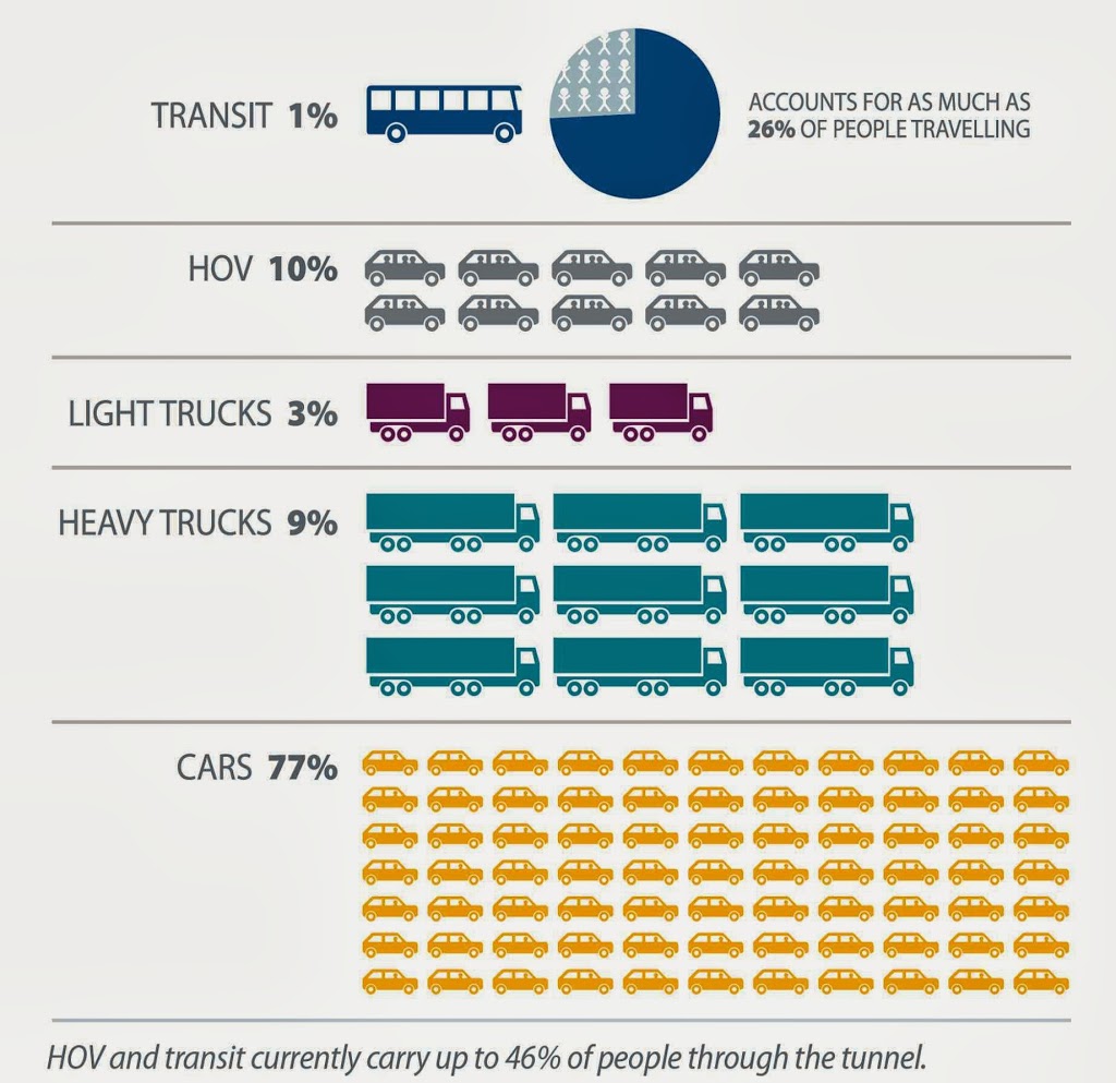
To put that $100 Million into perspective, TransLink collects $450 Million in fare revenue every year from people riding public transit, which is about a third of its annual $1,400 Million operational budget. The tolling revenue at $1 per car only represents about 7% of the TransLink operational budget: hardly enough to fund even the most modest growth of the transit system.
The fairness or palatability of $1 tolls on all bridges seems less relevant when you realize it will hardly make a dent in the money we need in this region to build a reliable transit system, never mind building more bridges and lanes of highways (upwards towards 3,700km of new roads!) that will be required to support the region’s growth if we don’t build a more robust transit system.
This is why municipalities with region-wide bridge-tolling policies, like San Francisco or New York, are charging $5- $15 to use the bridges. If we are going to talk about a “fair toll on all bridges”, it most certainly won’t be $1. The numbers don’t work.
The $1 Toll – Updated!
Update:
Despite the positive response I got for doing a little bit of basic math with publicly-available data, I was not surprised to hear the “$1 Toll Everywhere” suggested again as the panacea to TransLink funding on the CBC “Early Edition” this morning. This was only shocking because it was being put out by Colin Hansen (the man who brought us the HST debacle, and should know a little about referenda), only to be immediately supported by Moe Sihota. Neither stopped to think if a “toll under a dollar” was going to actually generate any meaningful revenue.
Alas, that is the state of political journalism in 2014. A series of he-said she-said talking point arguments, no-one doing basic fact-checking.
Regional Transportation rabble-rouser Eric Doherty on another forum asked an important question in relation to the “$1 Toll Everywhere” Plan: What does it cost to set up a toll collection system? Installing toll collection infrastructure on 11 bridges, and the bureaucracy to run it, would surely cost hundreds of millions of dollars, and would cost tens of millions a year to operate. If it takes three years to pay off the toll collection system, and another 20% of our $1 Toll is lost to overhead- the net revenue numbers get even worse.