On Friday evening, more that 75 people showed up at Douglas College to talk about land use, sustainability, and the future or our public space in New Westminster. The event was the product of the remarkable young mind of New Westminster native Colin O’Neil and sponsored by the Rivershead Society of BC. I was honoured to be invited to provide one of the short talks that were intended to get the people in the room thinking about sustainable spaces.
I had 20 minutes, and wanted to talk about how New Westminster relates to the river (it being an event of the Rivershead Society) and about land use. These topics, during my research, kept pointing back at the history of the Port of New Westminster, and how its modern corollary Port Metro Vancouver impacts every part of our waterfront and the planning of our community.
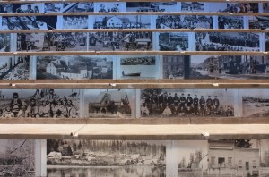
As working on this talk took up much of my normal “blogging time” over the last little while, I figured I would repurpose my speaking notes into a blog post. So below are the notes I made, along with the photos that were projected during my talk. Note I tend to rift off on my notes during talks, but the framework is here. This is, more or less, what I meant to say, as opposed to what I actually said.

I want to talk about the pressures on land use on the riverfront, historically, and at present, and how that relates to sustainability of our community
The history of our City is tied to how we have used our waterfront, the geography of the waterfront, and the value we put on that place. In New Westminster, we are emerging from a long-term stagnation as the City waited for some form of renewal. That renewal only began with a re-imagining of how our waterfront is used. To understand how we address the Fraser River now, we need to look at some history.
The City is here because of the River. The Fraser has provided the City many things: water, food, transportation, a place to put our wastes. But mostly it gave us a reason to be here and a place to form our community.
I became a geologist after studying geography, so when I look at land, I think about the physical forces that formed it, then about the human forces that shaped it. It was only 10,000 years ago that this place where we are today emerged from several millennia of ice cover, and the shoreline here was oceanfront. The Fraser River was choked with glacial sediments unlocked from melting ice, and the Fraser Delta grew westward from here. It was probably immediately after the ice left that the first people arrived here, no doubt using these shores for fishing, to hunt game, to gather food, to rest and gather. We don’t know who these first visitors were, but we know after several thousand years, their direct descendents, the Qayqayt had established villages here by the time that Europeans arrived by sea and down the river a mere 200 years ago.
The European reasons for locating here was a simple military decision bred of ambitions of empire. Fort Langley was located in a swamp on the wrong side of the River, and when the inevitable American invasion came, the Brits would be overrun and driven in to the river. New Westminster had a steep shoreline on the correct side of the River to face down the invading hoards. It must have been a formidable position, as the hoards never actually arrived, and the invasion ended with the unfortunate death of one pig San Juan Island, but that is another story altogether.
The first boom for New Westminster came with the Fraser River, then Cariboo, gold rushes. Despite losing the status of Capital to politics a decade later, and the western terminus of the CPR two decades after that to more politics, New Westminster put some serious industrial roots down in those first decades… and it was all about the River.
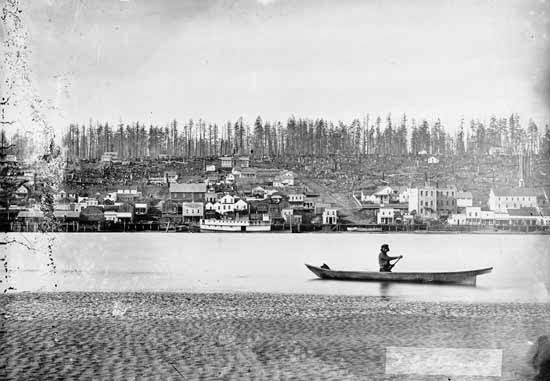
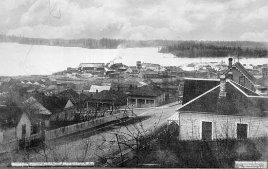
By 1887, Vancouver became the railhead, but New Westminster was home to Canada’s Pacific fishing fleet. There were already more than a dozen canneries on the Fraser River. There were also four sawmills, and ironworks and machine shops to support these primary resource industries. As the surrounding areas of Lulu Island and Southwestminster were cleared of trees and ploughed into farms, New Westminster became the centre for all agricultural trade in the new Province.
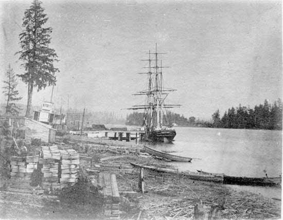
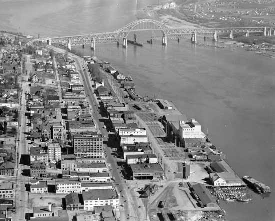
By the turn of the century (last one) a rail spur and the first bridge across the river were built – the same bridge that carries trains across the river today. The waterfront was remarkably diverse in its industrial function. As dredging increased and larger ships were permitted upriver, New Westminster became the most important Port on the west coast.
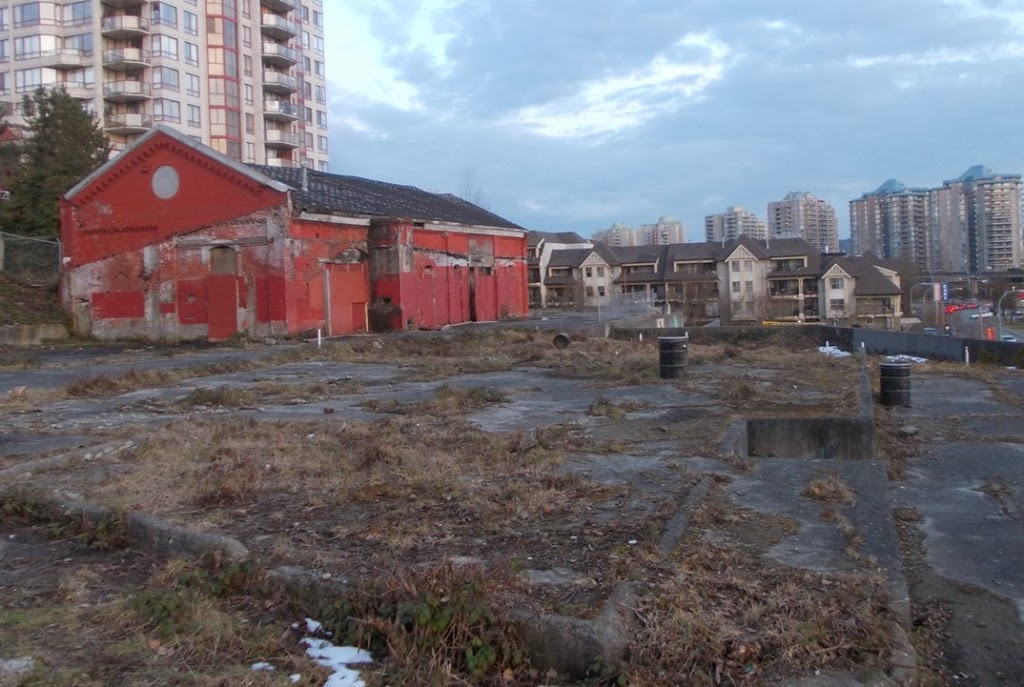
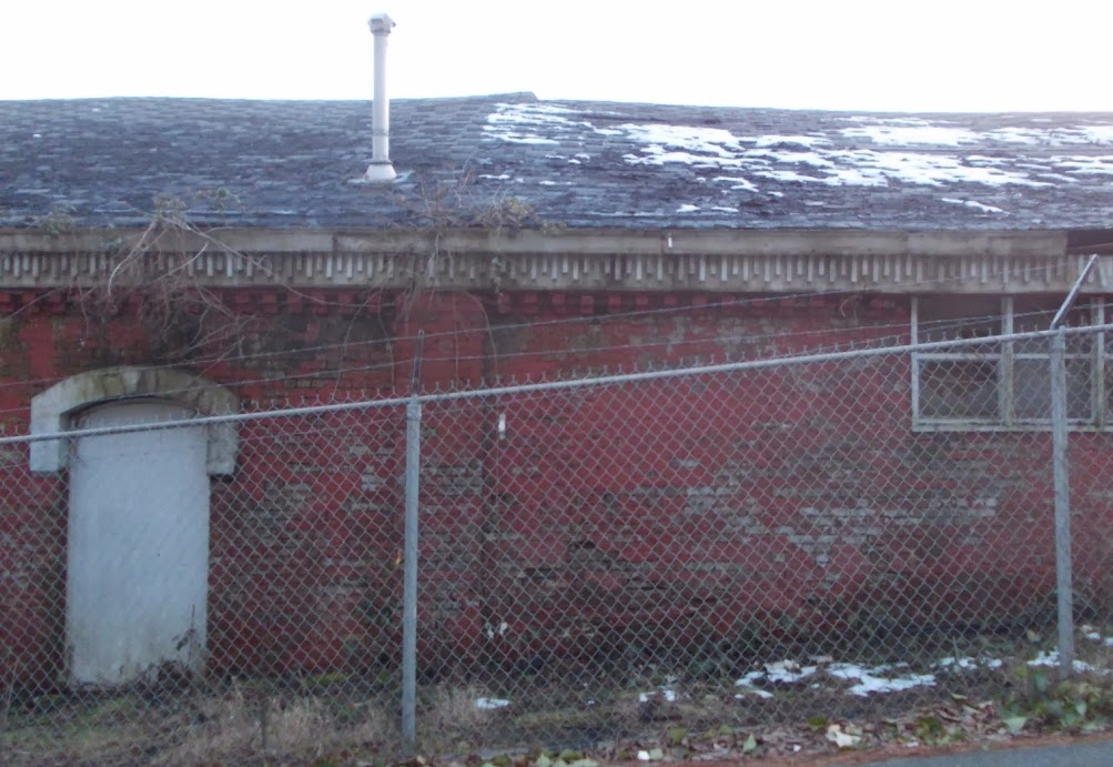
It is hard for us younger folk here to envision how industrial New Westminster was around the time of World War 2. There were 15 lumber mills, a dozen fish canneries and places to can produce, a paper mill, a distillery, a brewery, meat packing, cold storage, fertilizer manufacturing, wood treatment, aircraft manufacturing and shipbuilding, and a huge machine shop, metalworking and woodworking industry to support it all. Almost the entire waterfront was taken up by one of the 120 or so manufacturing plants. And they used the River, for transport, water, raw materials, and a place to put their waste.
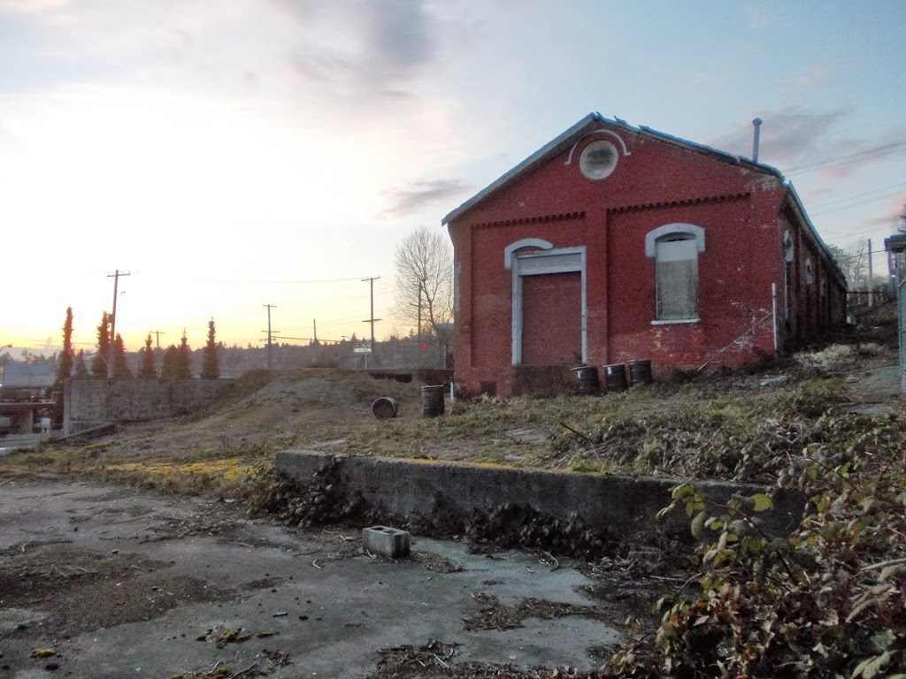
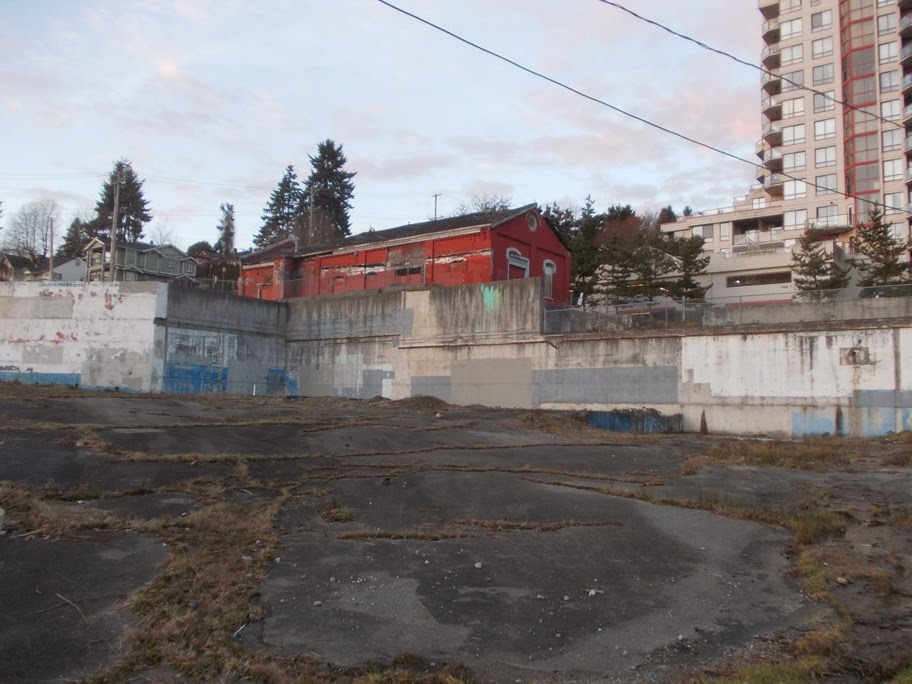
At the time of the cleanup-up to the Pier Park, they discovered large piles of metal shavings full of cutting fluids in the shore sediments. Apparently these old machine shops would cut a hole in the floor of the pier to dispose of their shavings, and when the pile built up to the base of the pier, they simply nailed down some planks to cover the hole, and cut another one 20 feet over. The River was a great place to put your waste!
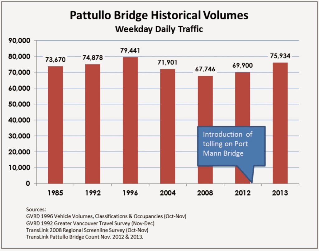
Shipping from the Port of New West peaked in 1956, and along with this peak came the peak of retail commercial business- the “Golden Mile” era of Columbia Street. Then things changed.
How many manufacturing plants do we have now?
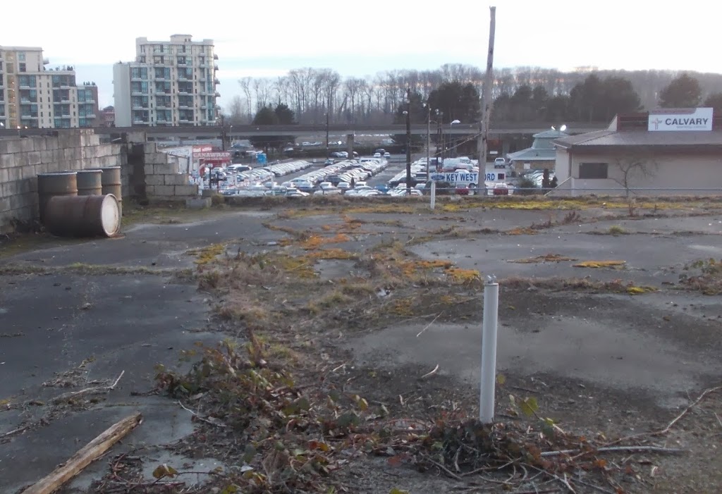
The Port declined in the early 70s, and closed shop completely in 1980.
Why? Where did they go?
A large part of the answer is globalization. International competition and the emergence of Asian manufacturing made it cheaper to import the important service equipment these primary manufacturers required. The primary manufacturing industries (and the waterfront was dominated by sawmilling) were seeing consolidation, and a movement from local control to external control. When economic stresses of volatile global markets hit the single-resource industries, the old technology in these New West facilities was easy to shut down first in favour of newer or less labour intensive plants elsewhere.
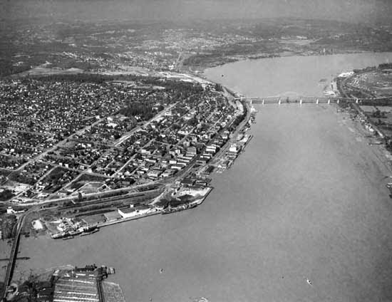
At the same time, the Port declined as its original fortuitous location became untenable for the new ways of moving freight. The ships started to get too large for the Fraser River, but more importantly, those steep defensible slopes did not allow enough room on the shore side of the dock for roll-on-roll-off and containerization methods. The old warehouses of the New Westminster waterfront were decrepit, and no-one was interested in investing in their renewal.
Part of the story of our City’s interaction with the River is told in the history of our Port Authority. The Port of New Westminster – the piers and buildings where the freight was stored and moved during the peak – belonged to the City. The New Westminster Harbour Commission was formed in 1913, and worked with City and the Board of Trade to promote the Port and fought off competition from Port of Vancouver. The Port had a global reach, trading to the USA, through the Panama Canal to Europe, and to the emerging Asian markets. The NWHC promoted connections to all of these places, advertised globally in a competitive market to get the most of the ongoing growth. And for a little while, that worked.
Eventually, the geographic constraints and change of technology through the 50s and 60s led to expansion of port facilities to Fraser Surrey Docks and Annacis Island, and the NWHC became the Fraser River Harbour Commission in 1965, covering the entire area upriver from Steveston to the Pitt River and Kanaka Creek in Maple Ridge.
The FRPC eventually became the Fraser River Port Authority, and that latter entity ceased to exist in 2008, when the Federal Government decided to amalgamate all Port operations between Horseshoe Bay and the US border into one authority – ”Port Metro Vancouver”.
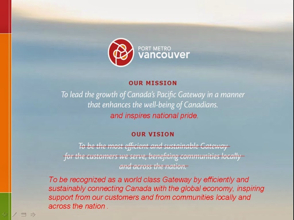
I’m not going to get too deep into the reasons for this, but the impact obvious: a further reduction in local control of the waterfront. Especially as we look at the “mandate” and “vision” of this new regional authority:
Note the word “Gateway” always appears with a capital “G”, like most deities.
This is the part of the talk where I delve into subjectivity and opinion, but you need to get subjective here, because this speaks directly to how we value our river, our waterfront, and our community. What do we want our river to be? How do we want to use our waterfront? Do we want a say in how our community develops?
These statements don’t speak much to accountability to the local community, although the Port does seem interested in local benefits. But things actually get worse, because these statements changed in 2014 (which I write here over the old ones, to put the contrast in high relief):
Where they used to benefit us, they now wish to inspire us and fill us with national pride.
Maybe this is just a bit of Winter Olympic year hubris, we did, after all win a lot of gold metals this year, and everyone wants a piece of that…. but I’m having my doubts.
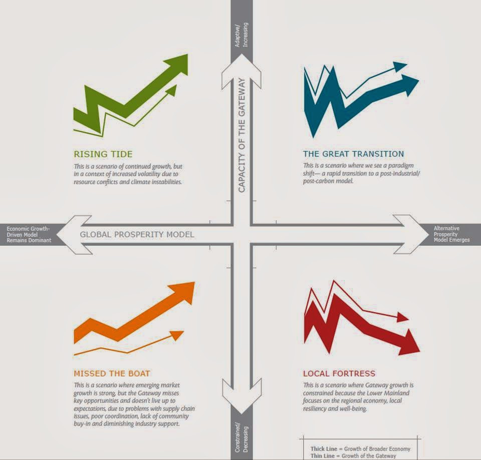
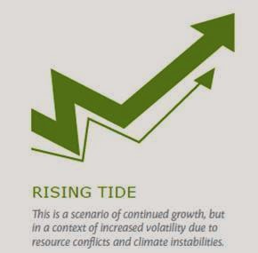
Here is visioning document put out by the Port a couple of years ago. This is meant to help the Port set plans for the coming decades – to envision the future they will need to plan towards. In this document, they set out 4 possible futures, and aside from the phallic symbolism, the colour scheme (green is good, red is bad) makes it clear what future the Port wants, and what it does not:
But look closely at how the Port, in their visioning, describes success:
Which in these uncertain times seems reasonable, I guess. The future is uncertain, the globe is headed to shit, but damn the torpedoes, full speed ahead!
Contrast this to the vision of failure, the fate we must avoid:
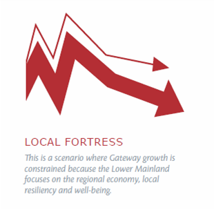
Local resiliency? Well being? The horror…
Again I ask, what do you want your port to provide to your community?
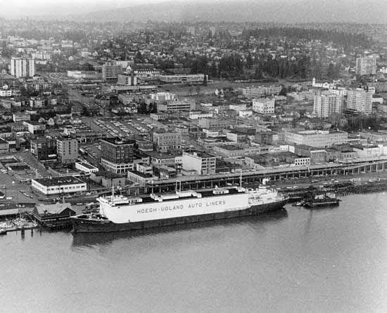
Maybe we don’t want to go back to having heavy industry on our waterfront, maybe we value the space differently. We now provide different values to the River: we want to look at it, be cooled by it, be provided ecosystem services from it. We still rely on it for work, we still want it to provide us fish, and these uses are ultimately compatible with using it for transportation.
This is not to say the Port doesn’t use our waterfront for industry. However, it uses it in very different ways, mostly to store things and move things on and off of trucks. Today, the Port wants to take more of our farmland to convert it into industrial space, not for moving goods on and off of boats, or even for adding value to goods or undertaking manufacturing – but to put things on and off of trucks.
Don’t worry about the ALR, they say, we need an “Industrial Land Reserve”, and we can just truck in all of our food.
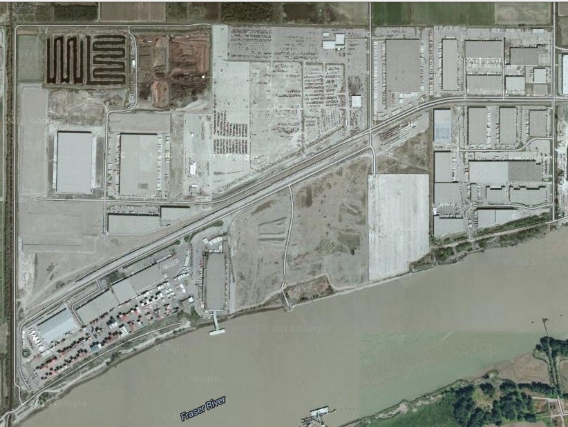
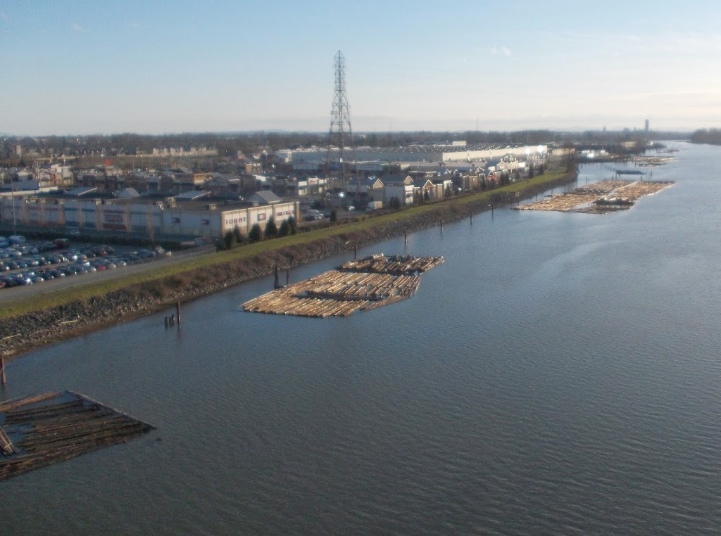
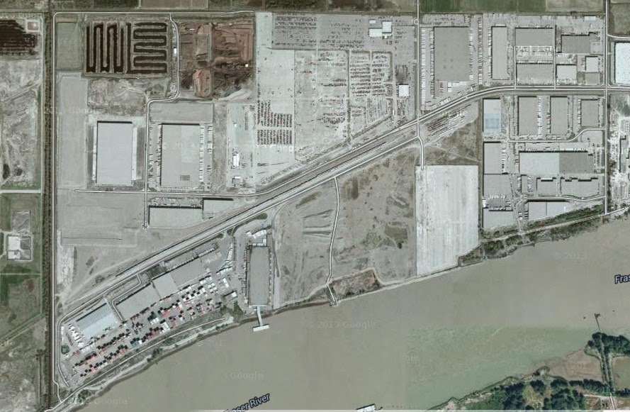
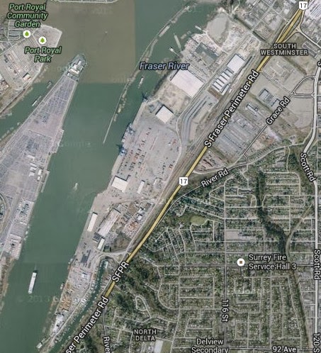
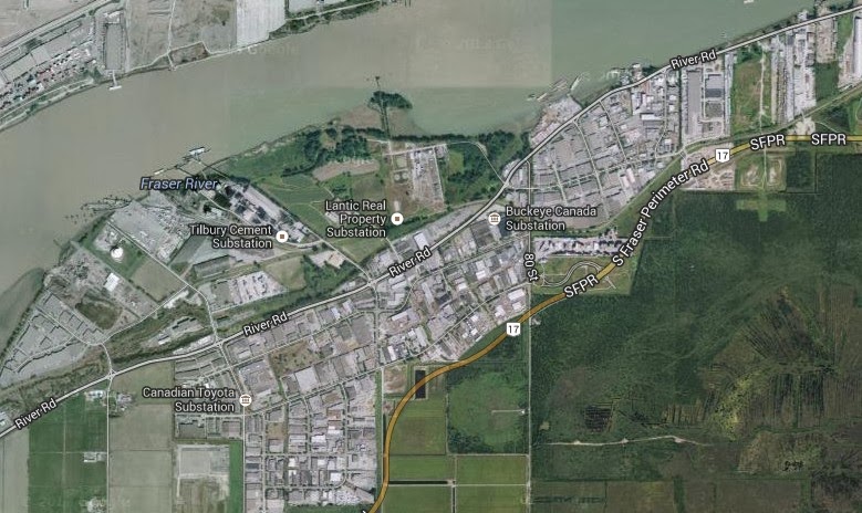
Look at this piece of Port land, almost 40 hectares of industrial land belonging to the Port, rapidly being filled with warehouses. What’s missing?
The piers. There is no-where for a boat to tie up. How will they move things on and off of boats? There is one old one, rarely used for moving wood pulp onto boats as break bulk. Instead of building piers to move all of those containers you can see, or all the good in all of those massive warehouses, the Port is investing in building an overpass to connect this access road to the East-west Connector, and to expanding road access to the area, to more rapidly get the trucks to your neighbourhood streets.
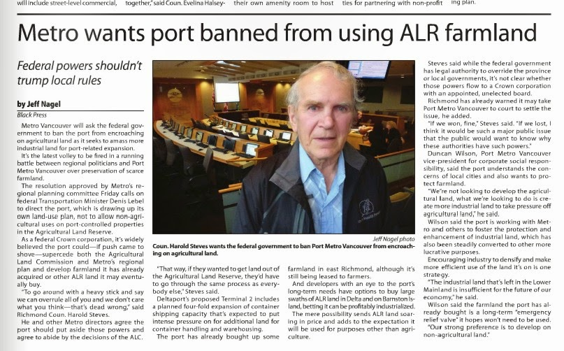
This is the Captial-G “Gateway” in those mission statements. No wonder Councillor Harold Steves in Richmond gets all ornery about the Port buying the 10 hectares of active farm land just to the north of this picture.
Now, why am I hitting the Port so hard? Any why doesn’t councillor Steeves do something about it?
Because the Port is making these decisions that will decide what our waterfront (and our river, and our community) will look like over the coming decades, whether you like it or not. They are completely unaccountable to local concerns.
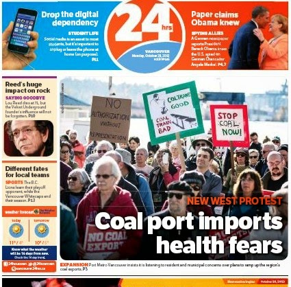
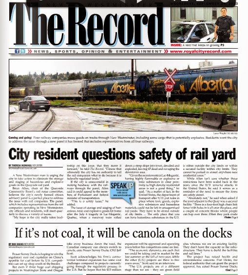
Will our waterfront become a larger export site for thermal coal, eking small profits from the exacerbation of the largest man-made global catastrophe of all time? The Port approves, despite community concerns.
Will we allow the Port to buy up more ALR land, convert it to industrial land by fiat, and lease it out for profit to trucking companies? At the same time they don’t pay living wages to those truckers? The Port argues this is important, and we cannot allow “local well-being” to slow their growth.
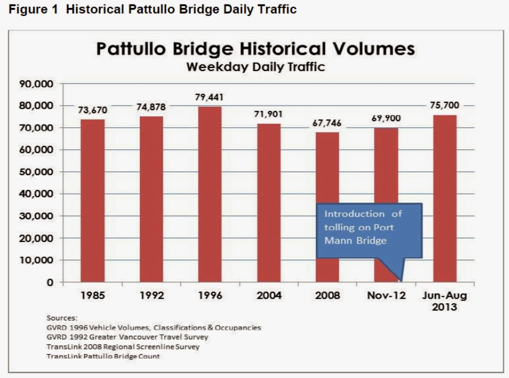
We live in New Westminster where the #1 livability issue is traffic: trucks and through-commuters. The region has spent $5 Billion building freeways for trucks, that Capital-G “Gateway Program”, the support of which the Port has made their mandate and vision. And they are not done. Another $3 or $4 Billion of your money will be spent replacing the Pattullo and the Deas Tunnel – the Gateway marches on. Meanwhile our livability suffers as we need to cut bus routes in our community for lack of investment. If we dream of expanding public transit, we will need to hold some sort of referendum at some point off in the future.
All of these issues and more have one thing at the core – the Port.
Remember how the industry of New Westminster changed, the forces that restructured out waterfront and caused decades of decline in our City: lack of local ownership, multinationals taking over the businesses, reliance on volatile foreign markets for resource goods instead of concentration on building local resiliency and well being.
I’m not saying I want to go back to cutting metal shavings into the river, but we have to recognize that the river can still be our connection to a bigger world and at the same time provide us a better community.
It is still why we are here. But now, more than ever, we have very little say about what happens to it. Remember those vision statements: Who does the Port answer to?
I, for one, don’t think local resiliency, sustainability, and livability should be feared.